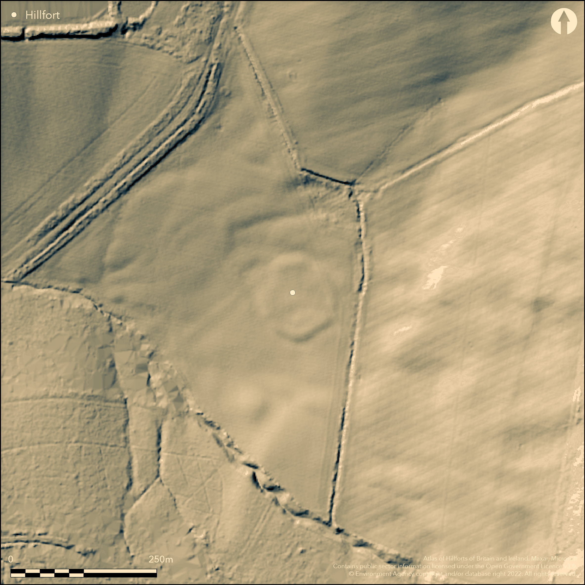
LiDAR 1m DTM Hillshade
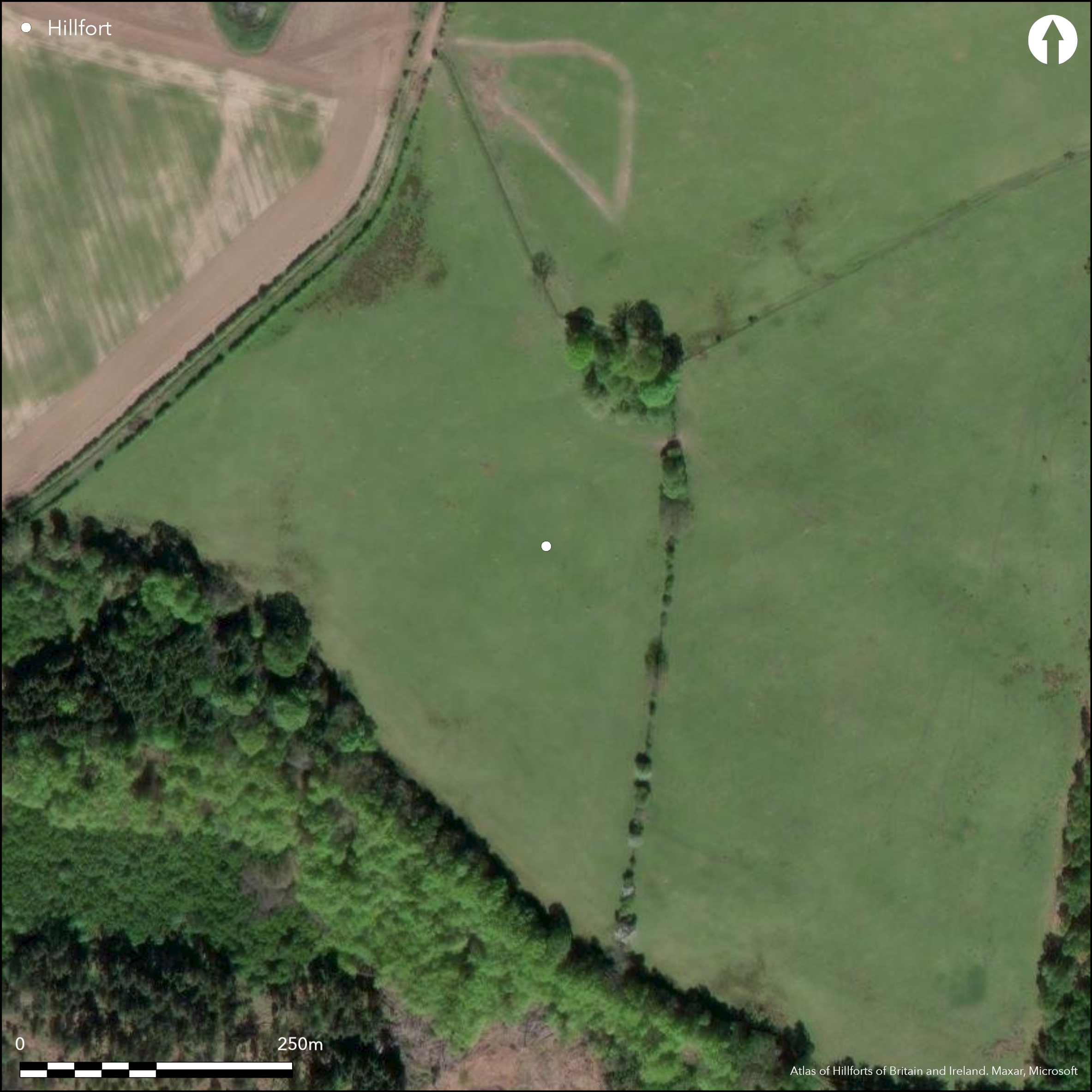
Satellite Imagery
LiDAR 1m DTM Hillshade
Satellite Imagery
Scroll left/right to view further images.
HER: Northumberland 3409 (None)
NMR: NU 02 NE 21 (5505)
SM: None
NGR: NU 0701 2699
X: 407010 Y: 626990 (OSGB36)
To the E of Oak Wood at 130m OD and overlooked by the steep slopes of Kay Hill, an enclosure or univallate hlllfort now surviving as slight earthwork and cropmarks. The enclosure is circular with an approximate diameter of 52m enclosing an internal area of 0.23ha. It lies on ground that slopes away to the W but is surrounded by higher ground on all other sides. It comprises two narrow ditches with a wide bank between. The bank, which has an average width of 10m and height of 1m, has been spread by ploughing. A possible further bank lies in the SE. A break in the ditches in the E, possibly out-turned, could be an original entrance. No internal habitation has been observed and a well described by Maclauchlan (1858) could not be traced during a field investigation in 1955. Maclauchlan also records querns and a possible mortar from the site. A further stone object, possibly a mortar or quernstone was found on a spoilheap in 1969 during the construction of a field drain which cut across the enclosure ditch in the N. The site was considered ploughed-out during a field investigation in 1974. It is now under pasture and is said to survive only as a cropmark but slight banks can be seen on satellite imagery. The site is shown as 'Camp site of'' on 1885-1900 OS mapping. Minimal investigations, undated.
Citizen Science: ✗
Reliability of Data: Confirmed
Reliability of Interpretation: Unconfirmed
X: -210447 Y: 7466717 (EPSG: 3857)
Longitude: -1.8904782585721047 Latitude: 55.53661844175461 (EPSG:4326)
Country: England; None
Current County or Unitary Authority: Northumberland
Historic County: Northumberland
Current Parish/Community/Council/Townland: Chatton; Chillingham
Slight earthworks
| Extant | ✓ |
| Cropmark | ✓ |
| Likely Destroyed | ✗ |
None
| Woodland | ✗ |
| Commercial Forestry Plantation | ✗ |
| Parkland | ✗ |
| Pasture (Grazing) | ✓ |
| Arable | ✗ |
| Scrub/Bracken | ✗ |
| Bare Outcrop | ✗ |
| Heather/Moorland | ✗ |
| Heath | ✗ |
| Built-up | ✗ |
| Coastal Grassland | ✗ |
| Other | ✗ |
A possible hillslope fort lying at 130m OD on a western-facing slope.
| Contour Fort | ✗ |
| Partial Contour Fort | ✗ |
| Promontory Fort | ✗ |
| Hillslope Fort | ✓ |
| Level Terrain Fort | ✗ |
| Marsh Fort | ✗ |
| Multiple Enclosure Fort | ✗ |
| Hilltop | ✗ |
| Coastal Promontory | ✗ |
| Inland Promontory | ✗ |
| Valley Bottom | ✗ |
| Knoll/Hillock/Outcrop | ✗ |
| Ridge | ✗ |
| Cliff/Plateau-edge/Scarp | ✗ |
| Hillslope | ✓ |
| Lowland | ✗ |
| Spur | ✗ |
Dominant Topographic Feature: Gentle slope to the W
| North | ✗ |
| Northeast | ✗ |
| East | ✗ |
| Southeast | ✗ |
| South | ✗ |
| Southwest | ✗ |
| West | ✓ |
| Northwest | ✗ |
| Level | ✗ |
Altitude: 130.0m
The parish boundaries between Catton and Chillingham lies approximately 80m to the SW
Boundary Type: Parish/Townland
Undated. A possible quernstone discovered in 1969 is the only find
Reliability: D - None
| Pre 1200BC | ✗ |
| 1200BC - 800BC | ✗ |
| 800BC - 400BC | ✗ |
| 400BC - AD50 | ✗ |
| AD50 - AD400 | ✗ |
| AD400 - AD 800 | ✗ |
| Post AD800 | ✗ |
| Unknown | ✓ |
| Pre Hillfort: | None |
| Post Hillfort: | None |
| Artefactual: | Quernstone, not described or closely dated |
Visited by Maclauchlan 1852-54 and shown on 1885-1900 OS mapping. Field investigations in 1955, 1969, 1974
| 1st Identified Written Reference (1852): | None |
| Other (1955): | Field investigation |
| Other (1969): | Field investigation |
| Other (1974): | Field investigation |
| 1st Identified Map Depiction (None): | None |
Internal features and a well identified my Maclauchlan (1858) could not be traced. A stream to the E provides a nearby water supply.
None
| None | ✓ |
| Spring | ✗ |
| Stream | ✗ |
| Pool | ✗ |
| Flush | ✗ |
| Well | ✓ |
| Other | ✗ |
None
| No Known Features | ✓ |
| Round Stone Structures | ✗ |
| Rectangular Stone Structures | ✗ |
| Curvilinear Platforms | ✗ |
| Other Roundhouse Evidence | ✗ |
| Pits | ✗ |
| Quarry Hollows | ✗ |
| Other | ✗ |
None
| No Known Excavation | ✓ |
| Pits | ✗ |
| Postholes | ✗ |
| Roundhouses | ✗ |
| Rectangular Structures | ✗ |
| Roads/Tracks | ✗ |
| Quarry Hollows | ✗ |
| Other | ✗ |
| Nothing Found | ✗ |
None
| No Known Geophysics | ✓ |
| Pits | ✗ |
| Roundhouses | ✗ |
| Rectangular Structures | ✗ |
| Roads/Tracks | ✗ |
| Quarry Hollows | ✗ |
| Other | ✗ |
| Nothing Found | ✗ |
Possible quernstone or mortar
| No Known Finds | ✗ |
| Pottery | ✗ |
| Metal | ✗ |
| Metalworking | ✗ |
| Human Bones | ✗ |
| Animal Bones | ✗ |
| Lithics | ✗ |
| Environmental | ✗ |
| Other | ✓ |
Nothing on satellite imagery
| APs Not Checked | ✗ |
| None | ✓ |
| Roundhouses | ✗ |
| Rectangular Structures | ✗ |
| Pits | ✗ |
| Postholes | ✗ |
| Roads/Tracks | ✗ |
| Other | ✗ |
A break in the ditches in the E, possibly out-turned, could be an original entrance.
| 1: | None |
| 2: | None |
Guard Chambers: ✗
Chevaux de Frise: ✗
| 1. Out-turned (East): | None |
Two narrow ditches with a wide bank between. The bank, which has an average width of 10m and height of 1m, has been spread by ploughing. A possible further bank lies in the SE.
| Area 1: | 0.23ha. |
| Total: | 0.23ha. |
Total Footprint Area: Noneha.
None
| ✗ | None |
| ✓ | Possible further bank in the SE |
| NE Quadrant: | 1 |
| SE Quadrant: | 2 |
| SW Quadrant: | 1 |
| NW Quadrant: | 1 |
| Total: | 2 |
| Partial Univallate | ✓ |
| Univallate | ✗ |
| Partial Bivallate | ✓ |
| Bivallate | ✗ |
| Partial Multivallate | ✗ |
| Multivallate | ✗ |
| Unknown | ✗ |
| Partial Univallate | ✗ |
| Univallate | ✗ |
| Partial Bivallate | ✗ |
| Bivallate | ✗ |
| Partial Multivallate | ✗ |
| Multivallate | ✗ |
None
| None | ✗ |
| Earthen Bank | ✓ |
| Stone Wall | ✗ |
| Rubble | ✗ |
| Wall-walk | ✗ |
| Evidence of Timber | ✗ |
| Vitrification | ✗ |
| Other Burning | ✗ |
| Palisade | ✗ |
| Counter Scarp Bank | ✗ |
| Berm | ✗ |
| Unfinished | ✗ |
| Other | ✗ |
None
| None | ✗ |
| Earthen Bank | ✗ |
| Stone Wall | ✗ |
| Murus Duplex | ✗ |
| Timber-framed | ✗ |
| Timber-laced | ✗ |
| Vitrification | ✗ |
| Other Burning | ✗ |
| Palisade | ✗ |
| Counter Scarp Bank | ✗ |
| Berm | ✗ |
| Unfinished | ✗ |
| No Known Excavation | ✓ |
| Other | ✗ |
| ✗ | None |
| ✓ | None |
Number of Ditches: 2
| ✗ | None |
Gates, T. and Deegan, A. 2009. Monuments in the Landscape in Passmore, D.G. and Waddington, C. (eds). Managing Archaeological Landscapes in Northumberland. Till-Tweed Studies, Vol 1. Oxbow, 125-71.
Hogg A.H.A. 1951. Proc Society Antiq Newcastle upon Tyne, 11, 158
Jobey, G .1965. Hillforts and Settlements in Northumberland. Archaeol Aeliana. No. 132, 43, 64
MacLauchlan, H. 1858. Memoir written during a survey of the Roman wall, through the counties of Northumberland and Cumberland, in the years 1852-1854. Made by direction of His Grace the Duke of Northumberland. 34
Atlas of Hillforts:
Wikidata:
This work is licensed under CC BY-SA 4.0

 and should be cited as:
Lock, Gary and Ralston, Ian. 2024. Atlas of Hillforts of Britain and Ireland. Available at: https://hillforts.arch.ox.ac.uk
Document Version 1.1