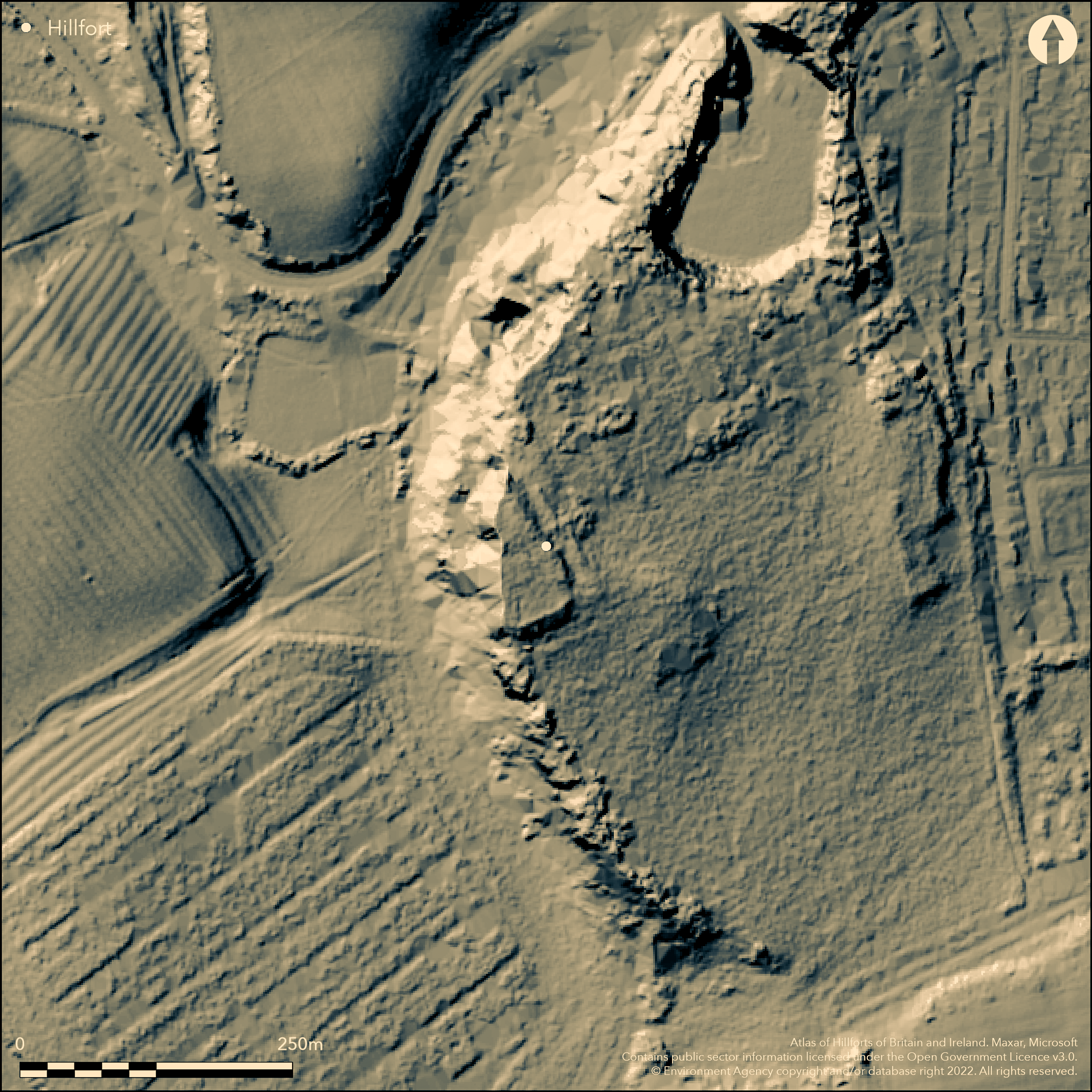
LiDAR 1m DTM Hillshade
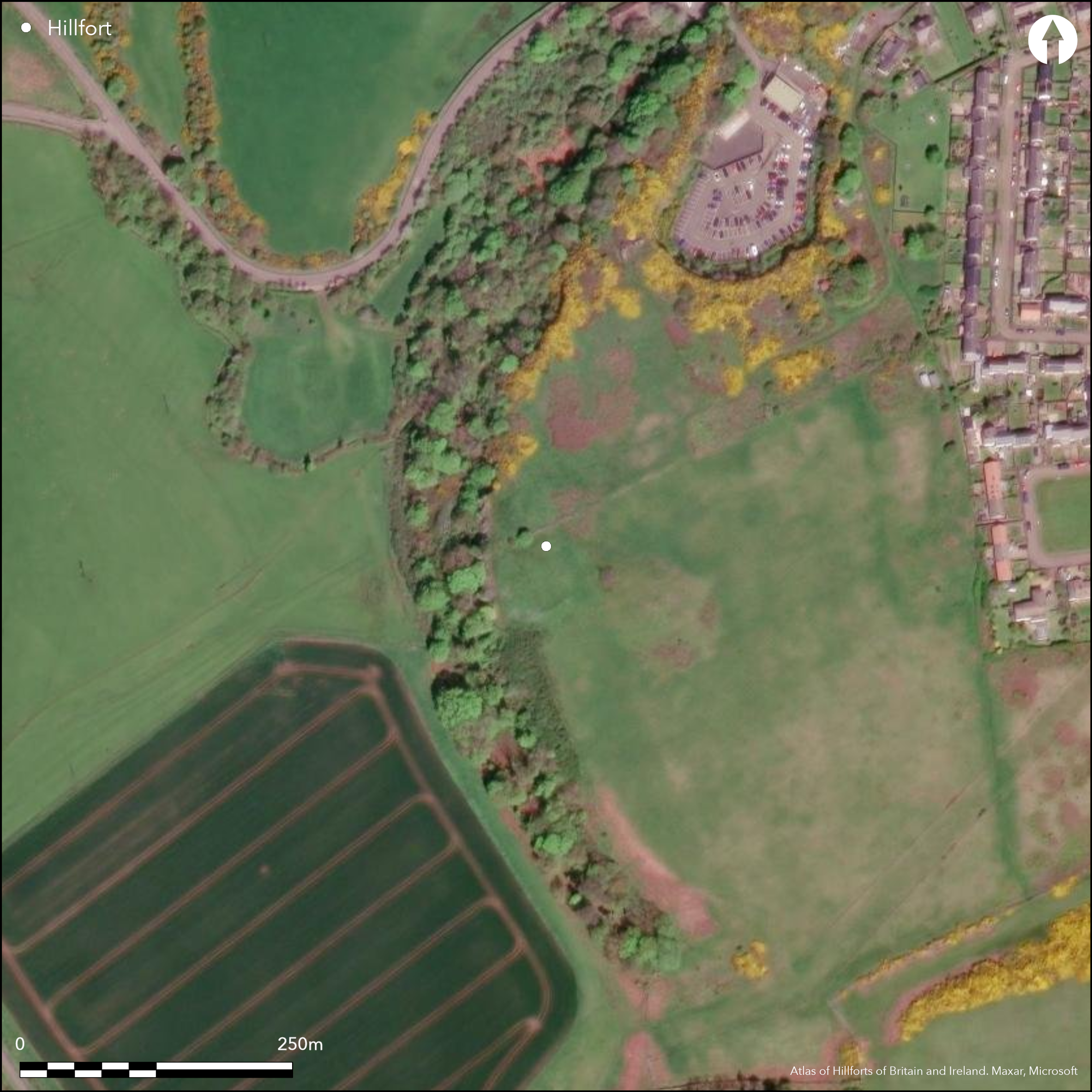
Satellite Imagery
LiDAR 1m DTM Hillshade
Satellite Imagery
Scroll left/right to view further images.
HER: Northumberland 5667 (None)
NMR: NU 21 NE 1 (8084)
SM: 1014506
NGR: NU 2554 1955
X: 425540 Y: 619550 (OSGB36)
Sited at 29m OD above the wooded, rocky crags of Craster Heugh, a possible hillfort or defended settlement. The site is irregular in form measuring approximately 20m E-W by 100m N-S. It holds a dominant position, taking advantage of the steep natural crags of Craster Heugh for additional defence. A field boundary running SW-NE crosses the enclosure and the earthworks survive better to the N. The site has up to three earth and stone ramparts and a single ditch. In the E the inner and best preserved of the ramparts stands 1.84m high and 10.8m wide including the ditch. The rampart is now turf-covered but large stones can be seen within the structure. The middle rampart measures 5.8m wide and 0.87m high. There is no evidence for an associated ditch. The outer rampart which is now plough-damaged in the SE measures 0.35m high by 10.8m wide. Damage to this side was observed by Bateson (1895). A further bank measuring 6m wide and 0.6, high has been added to the defences on the NE side which sits between the middle and outer ramparts. A single bank lies in the N and W where it is protected by the crags of the Heugh. Only one rampart survives in the S. It is uncertain if a break in the rampart in the SE corner is an original entrance. There is no evidence for internal features and the site is unexcavated and undated. The enclosure is shown on 1975 OS mapping and was scheduled as a defended settlement in 1996. It was included in the The North East Rapid Coastal Zone Assessment Survey (RCZAS) in 2008 as part of the National Mapping Programme.
Citizen Science: ✗
Reliability of Data: Confirmed
Reliability of Interpretation: Confirmed
X: -177840 Y: 7453457 (EPSG: 3857)
Longitude: -1.5975632562877744 Latitude: 55.4691531260071 (EPSG:4326)
Country: England
Current County or Unitary Authority: Northumberland
Historic County: Northumberland
Current Parish/Community/Council/Townland: Craster
The site survives in good condition in part, but is now cut by a field boundary running SW-NE with plough damage occurring to the S of the boundary.
| Extant | ✓ |
| Cropmark | ✗ |
| Likely Destroyed | ✗ |
Appears on satellite imagery to be rough grassland
| Woodland | ✗ |
| Commercial Forestry Plantation | ✗ |
| Parkland | ✗ |
| Pasture (Grazing) | ✗ |
| Arable | ✗ |
| Scrub/Bracken | ✗ |
| Bare Outcrop | ✗ |
| Heather/Moorland | ✗ |
| Heath | ✗ |
| Built-up | ✗ |
| Coastal Grassland | ✗ |
| Other | ✓ |
At 29m OD, a possible partial contour fort trending SW with the crags of Craster Heugh forming a a natural defence in the W and NW.
| Contour Fort | ✗ |
| Partial Contour Fort | ✓ |
| Promontory Fort | ✗ |
| Hillslope Fort | ✗ |
| Level Terrain Fort | ✗ |
| Marsh Fort | ✗ |
| Multiple Enclosure Fort | ✗ |
| Hilltop | ✗ |
| Coastal Promontory | ✗ |
| Inland Promontory | ✗ |
| Valley Bottom | ✗ |
| Knoll/Hillock/Outcrop | ✗ |
| Ridge | ✗ |
| Cliff/Plateau-edge/Scarp | ✓ |
| Hillslope | ✓ |
| Lowland | ✓ |
| Spur | ✗ |
Dominant Topographic Feature: Craster Heugh (crags)
| North | ✗ |
| Northeast | ✗ |
| East | ✗ |
| Southeast | ✗ |
| South | ✗ |
| Southwest | ✓ |
| West | ✗ |
| Northwest | ✗ |
| Level | ✗ |
Altitude: 29.0m
N/A
Undated, presumed Iron Age
Reliability: D - None
| Pre 1200BC | ✗ |
| 1200BC - 800BC | ✗ |
| 800BC - 400BC | ✗ |
| 400BC - AD50 | ✗ |
| AD50 - AD400 | ✗ |
| AD400 - AD 800 | ✗ |
| Post AD800 | ✗ |
| Unknown | ✓ |
| Pre Hillfort: | None |
| Post Hillfort: | None |
| Morphology/Earthwork/Typology: | None |
The site was discussed by Bateson in 1895, but did not appear on OS mapping until 1975. Field investigations in 1955 and 1969. Scheduled.
| 1st Identified Written Reference (1895): | None |
| Other (1955): | Field investigation |
| Other (1969): | Field investigation |
| 1st Identified Map Depiction (1975): | OS |
| Other (1996): | Scheduled |
| Other (2008): | North East Rapid Coastal Zone Assessment Survey |
No internal features contemporary with the hillfort are known
None
| None | ✓ |
| Spring | ✗ |
| Stream | ✗ |
| Pool | ✗ |
| Flush | ✗ |
| Well | ✗ |
| Other | ✗ |
None
| No Known Features | ✓ |
| Round Stone Structures | ✗ |
| Rectangular Stone Structures | ✗ |
| Curvilinear Platforms | ✗ |
| Other Roundhouse Evidence | ✗ |
| Pits | ✗ |
| Quarry Hollows | ✗ |
| Other | ✗ |
None
| No Known Excavation | ✓ |
| Pits | ✗ |
| Postholes | ✗ |
| Roundhouses | ✗ |
| Rectangular Structures | ✗ |
| Roads/Tracks | ✗ |
| Quarry Hollows | ✗ |
| Other | ✗ |
| Nothing Found | ✗ |
None
| No Known Geophysics | ✓ |
| Pits | ✗ |
| Roundhouses | ✗ |
| Rectangular Structures | ✗ |
| Roads/Tracks | ✗ |
| Quarry Hollows | ✗ |
| Other | ✗ |
| Nothing Found | ✗ |
None
| No Known Finds | ✓ |
| Pottery | ✗ |
| Metal | ✗ |
| Metalworking | ✗ |
| Human Bones | ✗ |
| Animal Bones | ✗ |
| Lithics | ✗ |
| Environmental | ✗ |
| Other | ✗ |
The site is still visible on satellite imagery but no internal features can be seen.
| APs Not Checked | ✗ |
| None | ✓ |
| Roundhouses | ✗ |
| Rectangular Structures | ✗ |
| Pits | ✗ |
| Postholes | ✗ |
| Roads/Tracks | ✗ |
| Other | ✗ |
A simple break in the ramparts lies in the SE. It is uncertain if this was the original entrance
| 1: | None |
| 2: | Possible entrance |
Guard Chambers: ✗
Chevaux de Frise: ✗
| 1. Simple Gap (South east): | None |
Up to three earth and stone ramparts and a single ditch. In the E the inner and best preserved of the ramparts stands 1.84m high and 10.8m wide including the ditch. The rampart is now turf-covered but large stones can be seen within the structure. The middle rampart measures 5.8m wide and 0.87m high. There is no evidence for an associated ditch. The outer rampart which is now plough-damaged in the SE measures 0.35m high by 10.8m wide. A further bank measuring 6m wide and 0.6, high has been added to the defences on the NE side which sits between the middle and outer ramparts. A single bank lies in the N and W where it is protected by the crags of the Heugh. Only one rampart survives in the S.
| Area 1: | 0.18ha. |
| Total: | 0.18ha. |
Total Footprint Area: Noneha.
None
| ✗ | None |
| ✗ | None |
| NE Quadrant: | 3 |
| SE Quadrant: | 3 |
| SW Quadrant: | 1 |
| NW Quadrant: | 1 |
| Total: | 3 |
| Partial Univallate | ✓ |
| Univallate | ✗ |
| Partial Bivallate | ✗ |
| Bivallate | ✗ |
| Partial Multivallate | ✓ |
| Multivallate | ✗ |
| Unknown | ✗ |
| Partial Univallate | ✗ |
| Univallate | ✗ |
| Partial Bivallate | ✗ |
| Bivallate | ✗ |
| Partial Multivallate | ✗ |
| Multivallate | ✗ |
None
| None | ✗ |
| Earthen Bank | ✓ |
| Stone Wall | ✗ |
| Rubble | ✓ |
| Wall-walk | ✗ |
| Evidence of Timber | ✗ |
| Vitrification | ✗ |
| Other Burning | ✗ |
| Palisade | ✗ |
| Counter Scarp Bank | ✗ |
| Berm | ✗ |
| Unfinished | ✗ |
| Other | ✗ |
None
| None | ✗ |
| Earthen Bank | ✗ |
| Stone Wall | ✗ |
| Murus Duplex | ✗ |
| Timber-framed | ✗ |
| Timber-laced | ✗ |
| Vitrification | ✗ |
| Other Burning | ✗ |
| Palisade | ✗ |
| Counter Scarp Bank | ✗ |
| Berm | ✗ |
| Unfinished | ✗ |
| No Known Excavation | ✓ |
| Other | ✗ |
| ✗ | None |
| ✓ | Single ditch in the E |
Number of Ditches: 1
| ✗ | None |
Bateson, E. 1895. A History of Northumberland, Vol. 2 (Newcastle upon Tyne), 166-7.
MacLauchlan, H. 1867. Notes not included in the memoirs already published on Roman roads in Northumberland (London), 7
Tolan-Smith C. 2008. North East Rapid Coastal Zone Assessment. Report ref. 2008/81. Archaeological Research Services. Unpublished
Atlas of Hillforts:
Wikidata:
This work is licensed under CC BY-SA 4.0

 and should be cited as:
Lock, Gary and Ralston, Ian. 2024. Atlas of Hillforts of Britain and Ireland. Available at: https://hillforts.arch.ox.ac.uk
Document Version 1.1