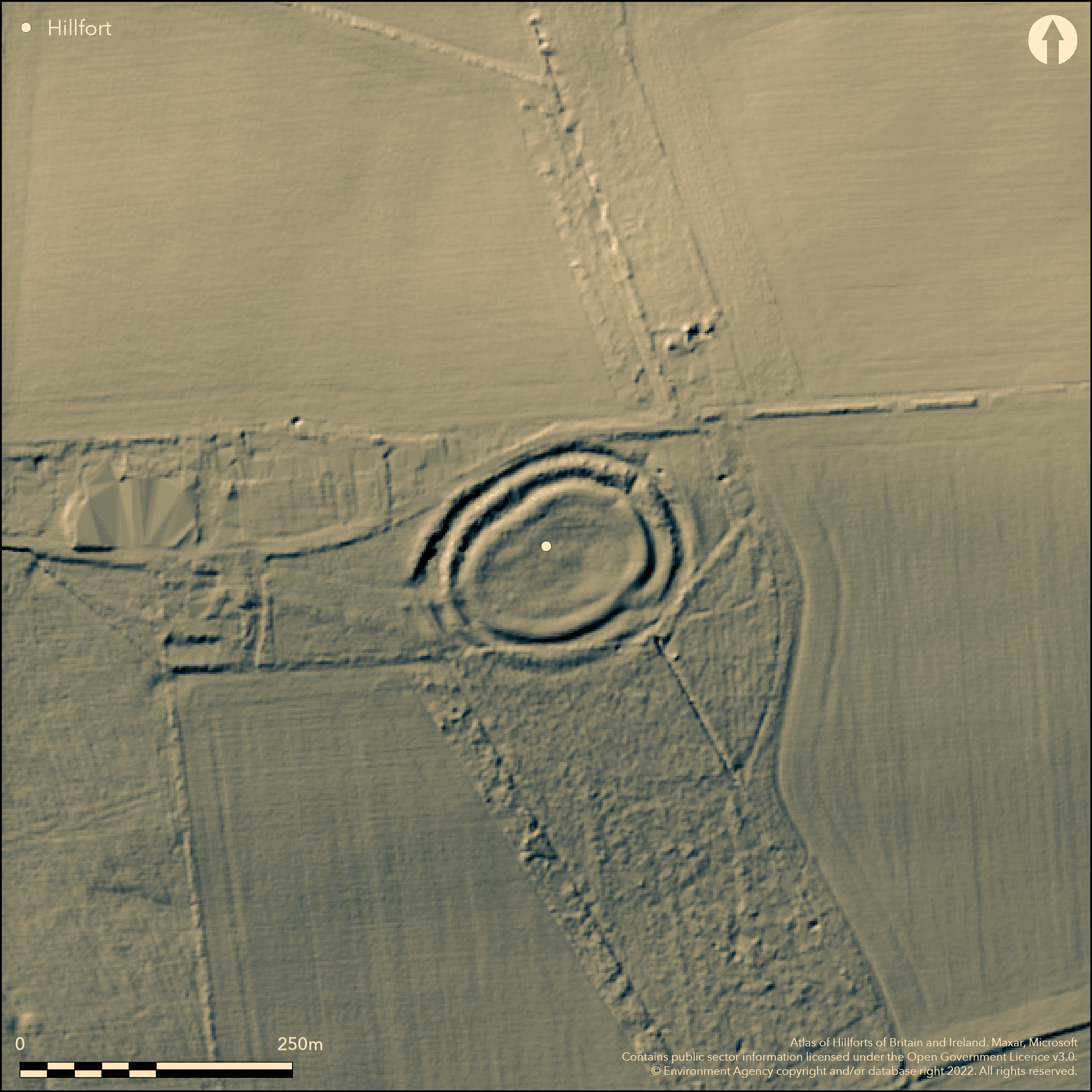
LiDAR 1m DTM Hillshade
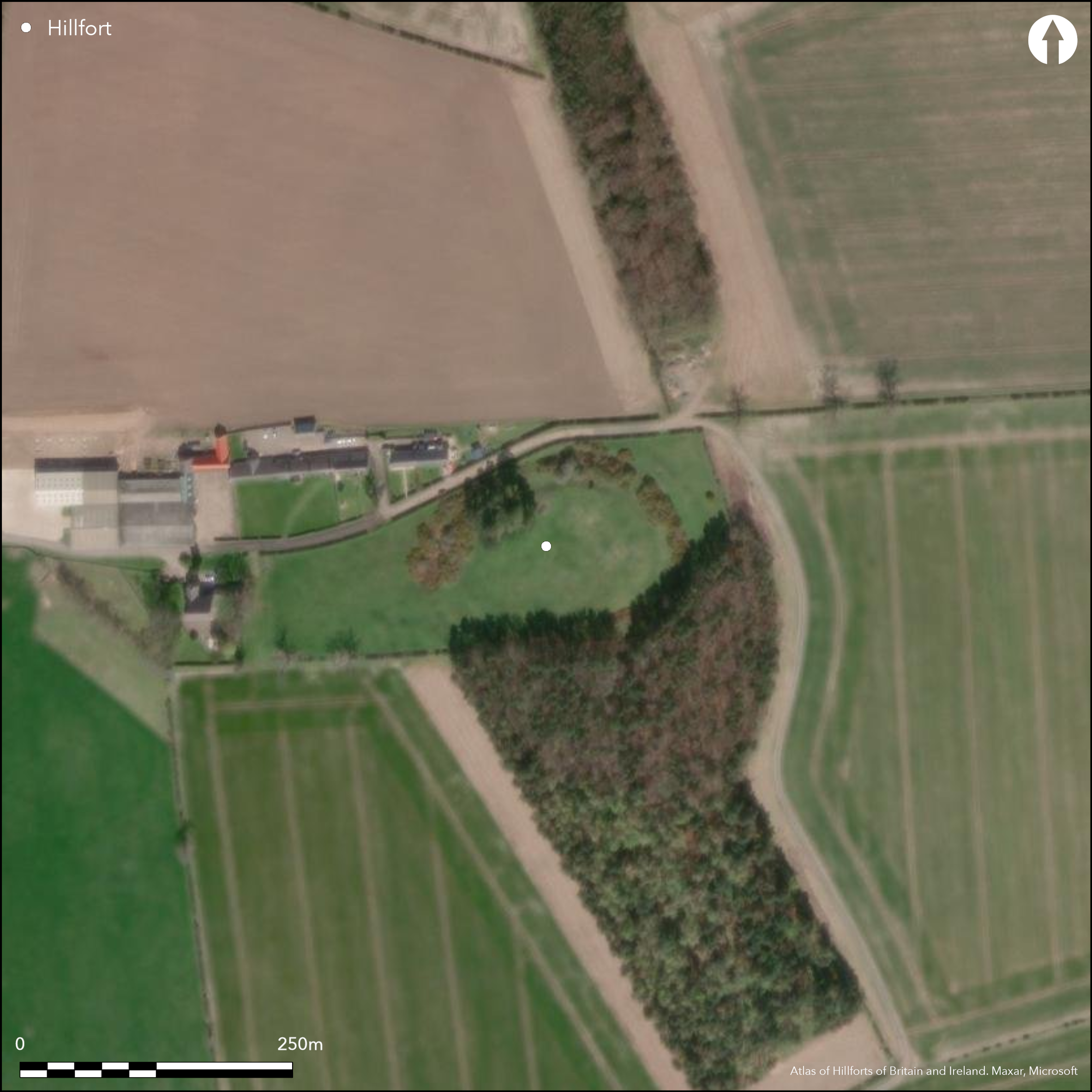
Satellite Imagery
LiDAR 1m DTM Hillshade
Satellite Imagery
Scroll left/right to view further images.
HER: Northumberland 1953 (None)
NMR: NT 93 NE 11 (3594)
SM: 1006536
NGR: NT 97940 35415
X: 397940 Y: 635415 (OSGB36)
A multiperiod, bivallate hillfort lying at 92m OD on the crest of a ridge on Fenton Hill overlooking the Till Valley. The final form of the hillfort is oval in plan measuring 100m E-W by 70m N-S and enclosing 0.5ha. Enclosure on the hill began as two successive phases of palisaded enclosure (late Bronze Age to early Iron Age) with a smaller internal area than that of the later enclosure. This was succeeded by a single timber-revetted rampart of earth and stone and a ditch. Evidence of quarry ditches were found behind the rampart. The was replaced by an enclosure of similar construction with a slightly larger footprint. This rampart itself was replaced on the same line by the inner of possibly two earth and stone dump ramparts and ditches (middle and outer rampart). The middle rampart was revetted with timber set in a continuous stone-packed trench rather than individual postholes. The outer rampart is possibly a counterscarp bank. A simple 4-m wide causeway lies in the W with a timber-lined entrance passage which carried a finely cobbled roadway. No evidence for a gateway was found during the excavation. A number of hut circles have been recorded within the interior. Two, constructed of timber walls set in irregular stone-filled trenches 9m and 10m in diameter were excavated by Burgess (1984). An extensive sunken cobbled surface near the centre of the enclosure edged by postholes 1.5m apart along its curved margin, was also recorded. Finds recovered during the excavations included sherds of coarse handmade and decorated pottery and a flint blade. Radiocarbon dates obtained from the hillfort, although sample and context unspecified, gave a date of 800-200 cal BC and 390-40 cal BC. An unspecified sample from ard marks from beneath the second box ramparts 410 cal BC-cal AD 60 (Burgess 1984). The hillfort survives in good condition other than in the N where the ramparts are cut by a modern road and in the S where they have been levelled for afforestation. The site is shown on 1856-65 OS mapping and excavated in 1971-2 and scheduled in 1994.
Citizen Science: ✗
Reliability of Data: Confirmed
Reliability of Interpretation: Confirmed
X: -226452 Y: 7481632 (EPSG: 3857)
Longitude: -2.034255685920592 Latitude: 55.61236535418104 (EPSG:4326)
Country: England
Current County or Unitary Authority: Northumberland
Historic County: Northumberland
Current Parish/Community/Council/Townland: Doddington
None
| Extant | ✓ |
| Cropmark | ✗ |
| Likely Destroyed | ✗ |
Grassland, with evidence of ploughing in the past. Some tree cover on ramparts in the N. Ramparts in the S now destroyed for woodland
| Woodland | ✓ |
| Commercial Forestry Plantation | ✗ |
| Parkland | ✗ |
| Pasture (Grazing) | ✓ |
| Arable | ✗ |
| Scrub/Bracken | ✓ |
| Bare Outcrop | ✗ |
| Heather/Moorland | ✗ |
| Heath | ✗ |
| Built-up | ✗ |
| Coastal Grassland | ✗ |
| Other | ✗ |
A level terrain fort lying at 93m OD on level ground on the crest of a ridge
| Contour Fort | ✗ |
| Partial Contour Fort | ✓ |
| Promontory Fort | ✗ |
| Hillslope Fort | ✗ |
| Level Terrain Fort | ✓ |
| Marsh Fort | ✗ |
| Multiple Enclosure Fort | ✗ |
| Hilltop | ✗ |
| Coastal Promontory | ✗ |
| Inland Promontory | ✗ |
| Valley Bottom | ✗ |
| Knoll/Hillock/Outcrop | ✗ |
| Ridge | ✓ |
| Cliff/Plateau-edge/Scarp | ✗ |
| Hillslope | ✗ |
| Lowland | ✓ |
| Spur | ✗ |
Dominant Topographic Feature: Crest of a ridge
| North | ✗ |
| Northeast | ✗ |
| East | ✗ |
| Southeast | ✗ |
| South | ✓ |
| Southwest | ✗ |
| West | ✗ |
| Northwest | ✗ |
| Level | ✗ |
Altitude: 93.0m
N/A
Radiocarbon dates obtained from hillfort, sample and context unspecified, gave dates of 800-200 cal BC and 390-40 cal BC. An unspecified sample from ard marks from beneath the second box ramparts 410 cal BC-cal AD 60. First phase palisade 690+/- 100BC (Burgess 1984).
Reliability: B - Medium
| Pre 1200BC | ✗ |
| 1200BC - 800BC | ✗ |
| 800BC - 400BC | ✓ |
| 400BC - AD50 | ✓ |
| AD50 - AD400 | ✓ |
| AD400 - AD 800 | ✗ |
| Post AD800 | ✗ |
| Unknown | ✗ |
| Pre Hillfort: | None |
| Post Hillfort: | None |
| C14: | 2400+/-100 BP |
Shown on 1856-65 OS mapping, general reference in MacLauchlan (1919-22). The site was excavated in 1971-72 (Burgess 1984). Scheduled
| Other (1935): | Scheduled |
| Other (1964): | Field investigation |
| Other (1967): | Field investigation |
| 1st Identified Map Depiction (None): | None |
| 1st Identified Written Reference (None): | None |
| Excavation (None): | None |
A number of hut circles have been recorded within the interior. Two constructed of timber walls set in irregular stone-filled trenches 9m and 10m in diameter, were excavated by Burgess (1984). An extensive sunken cobbled surface near the centre of the enclosure edged by postholes 1.5m apart along its curved margin, was also recorded. Finds recovered during the excavations included sherds of coarse handmade and decorated pottery and a flint blade.
None
| None | ✓ |
| Spring | ✗ |
| Stream | ✗ |
| Pool | ✗ |
| Flush | ✗ |
| Well | ✗ |
| Other | ✗ |
None
| No Known Features | ✗ |
| Round Stone Structures | ✗ |
| Rectangular Stone Structures | ✗ |
| Curvilinear Platforms | ✓ |
| Other Roundhouse Evidence | ✗ |
| Pits | ✗ |
| Quarry Hollows | ✗ |
| Other | ✗ |
Cobbled surface
| No Known Excavation | ✗ |
| Pits | ✗ |
| Postholes | ✓ |
| Roundhouses | ✓ |
| Rectangular Structures | ✗ |
| Roads/Tracks | ✓ |
| Quarry Hollows | ✓ |
| Other | ✓ |
| Nothing Found | ✗ |
None
| No Known Geophysics | ✓ |
| Pits | ✗ |
| Roundhouses | ✗ |
| Rectangular Structures | ✗ |
| Roads/Tracks | ✗ |
| Quarry Hollows | ✗ |
| Other | ✗ |
| Nothing Found | ✗ |
None
| No Known Finds | ✗ |
| Pottery | ✓ |
| Metal | ✓ |
| Metalworking | ✗ |
| Human Bones | ✗ |
| Animal Bones | ✗ |
| Lithics | ✓ |
| Environmental | ✗ |
| Other | ✗ |
None
| APs Not Checked | ✓ |
| None | ✗ |
| Roundhouses | ✗ |
| Rectangular Structures | ✗ |
| Pits | ✗ |
| Postholes | ✗ |
| Roads/Tracks | ✗ |
| Other | ✗ |
A simple 4-m wide causeway in the W with a timber-lined entrance passage which carried a cobbled roadway.
| 1: | None |
| 2: | None |
Guard Chambers: ✗
Chevaux de Frise: ✗
| 1. Passage-way/Corridor (West): | None |
The final form is oval in plan measuring 100m E-W by 70m N-S enclosing 0.5ha. Enclosure on the hill began as two successive phases of palisaded enclosure (late Bronze Age to early Iron Age) with a smaller internal area than that of the later enclosure. This was succeeded by a single timber-revetted rampart of earth and stone and a ditch, later replaced by larger enclosure of a timber-revetted rampart and ditch. This rampart itself was replaced on the same line by the inner of possibly two earth and stone dump ramparts and ditches (middle and outer rampart). The middle rampart was revetted with timber set in a continuous stone-packed trench rather than individual postholes. The outer rampart is possibly a counterscarp bank.
| Area 1: | 0.36ha. |
| Total: | 0.36ha. |
Total Footprint Area: 1.05ha.
None
| ✓ | Whole site footprint estimated from satellite imagery |
| ✓ | None |
| NE Quadrant: | 2 |
| SE Quadrant: | 2 |
| SW Quadrant: | 2 |
| NW Quadrant: | 2 |
| Total: | 2 |
| Partial Univallate | ✗ |
| Univallate | ✗ |
| Partial Bivallate | ✗ |
| Bivallate | ✓ |
| Partial Multivallate | ✗ |
| Multivallate | ✗ |
| Unknown | ✗ |
| Partial Univallate | ✗ |
| Univallate | ✓ |
| Partial Bivallate | ✗ |
| Bivallate | ✗ |
| Partial Multivallate | ✗ |
| Multivallate | ✗ |
None
| None | ✗ |
| Earthen Bank | ✓ |
| Stone Wall | ✗ |
| Rubble | ✓ |
| Wall-walk | ✗ |
| Evidence of Timber | ✗ |
| Vitrification | ✗ |
| Other Burning | ✗ |
| Palisade | ✗ |
| Counter Scarp Bank | ✓ |
| Berm | ✗ |
| Unfinished | ✗ |
| Other | ✗ |
None
| None | ✗ |
| Earthen Bank | ✓ |
| Stone Wall | ✓ |
| Murus Duplex | ✗ |
| Timber-framed | ✓ |
| Timber-laced | ✗ |
| Vitrification | ✗ |
| Other Burning | ✗ |
| Palisade | ✓ |
| Counter Scarp Bank | ✗ |
| Berm | ✗ |
| Unfinished | ✗ |
| No Known Excavation | ✗ |
| Other | ✗ |
| ✗ | None |
| ✓ | None |
Number of Ditches: 2
| ✗ | None |
Burgess C. 1972, Fenton Hill Camp, Northumberland, Arch News Bull Northum Cumb & Westm., No.13, 4-5
Burgess C. 1973, Fenton Hill Camp, Northumberland, CBA Grp III Bull No.4 (May 1973) pp 1-2
Burgess, C. B. 1984. The Prehistoric Settlement of Northumberland: a speculative survey. In R. Miket and C. Burgess (eds). Between and Beyond the walls: Essays on the Prehistory and History of North Britain in Honour of George Jobey. Edinburgh, John Donald. 126-175
Jobey, G. 1965. Hillforts and Settlements in Northumberland. Archaeol Aeliana (4th Series) 43
MacLauchlan, H. 1919-22. Notes on camps in the parishes of Branxton, Carham, Ford, Kirknewton and Wooler in Northumberland. Hist Berwickshire Natur Club, 470
Atlas of Hillforts:
Wikidata:
This work is licensed under CC BY-SA 4.0

 and should be cited as:
Lock, Gary and Ralston, Ian. 2024. Atlas of Hillforts of Britain and Ireland. Available at: https://hillforts.arch.ox.ac.uk
Document Version 1.1