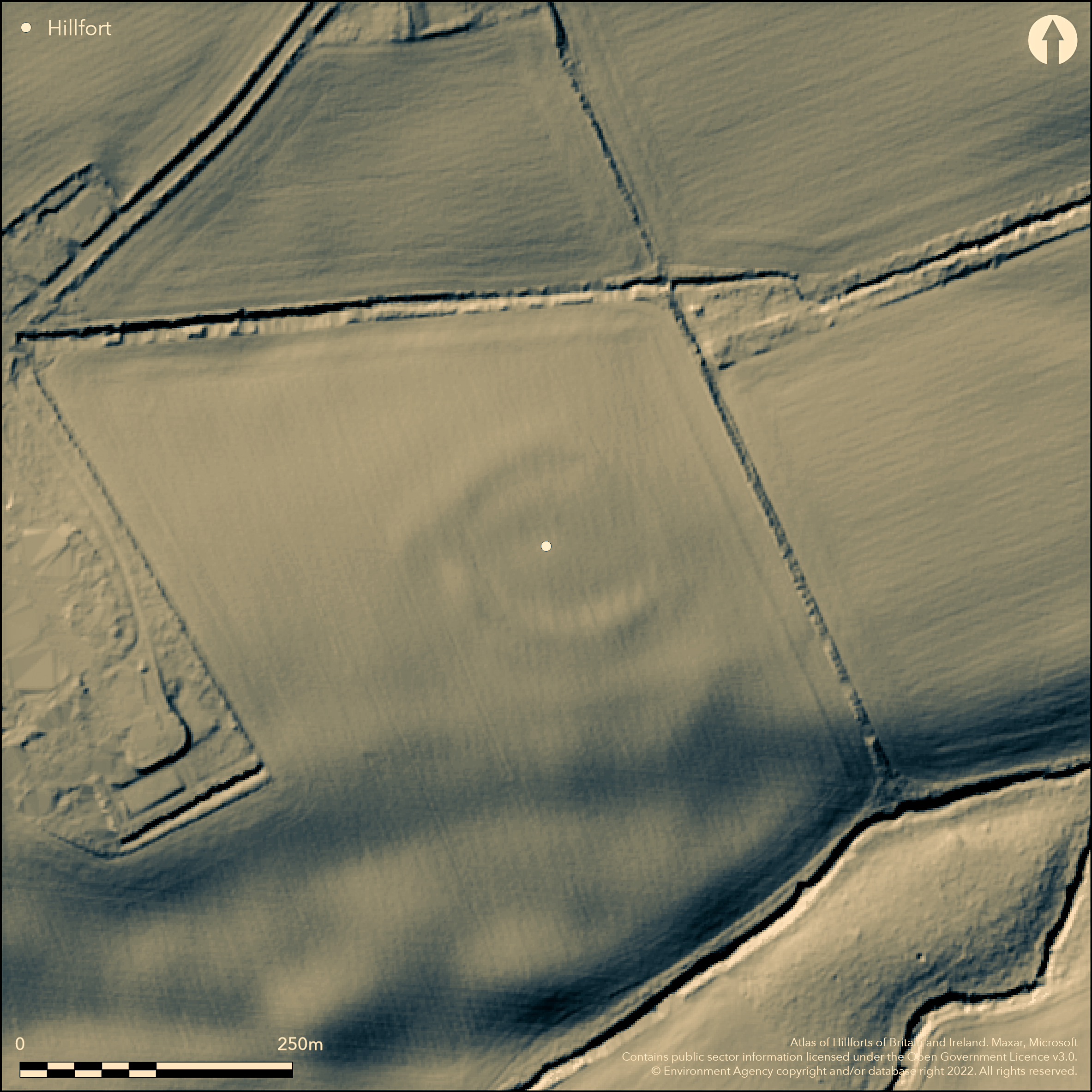
LiDAR 1m DTM Hillshade
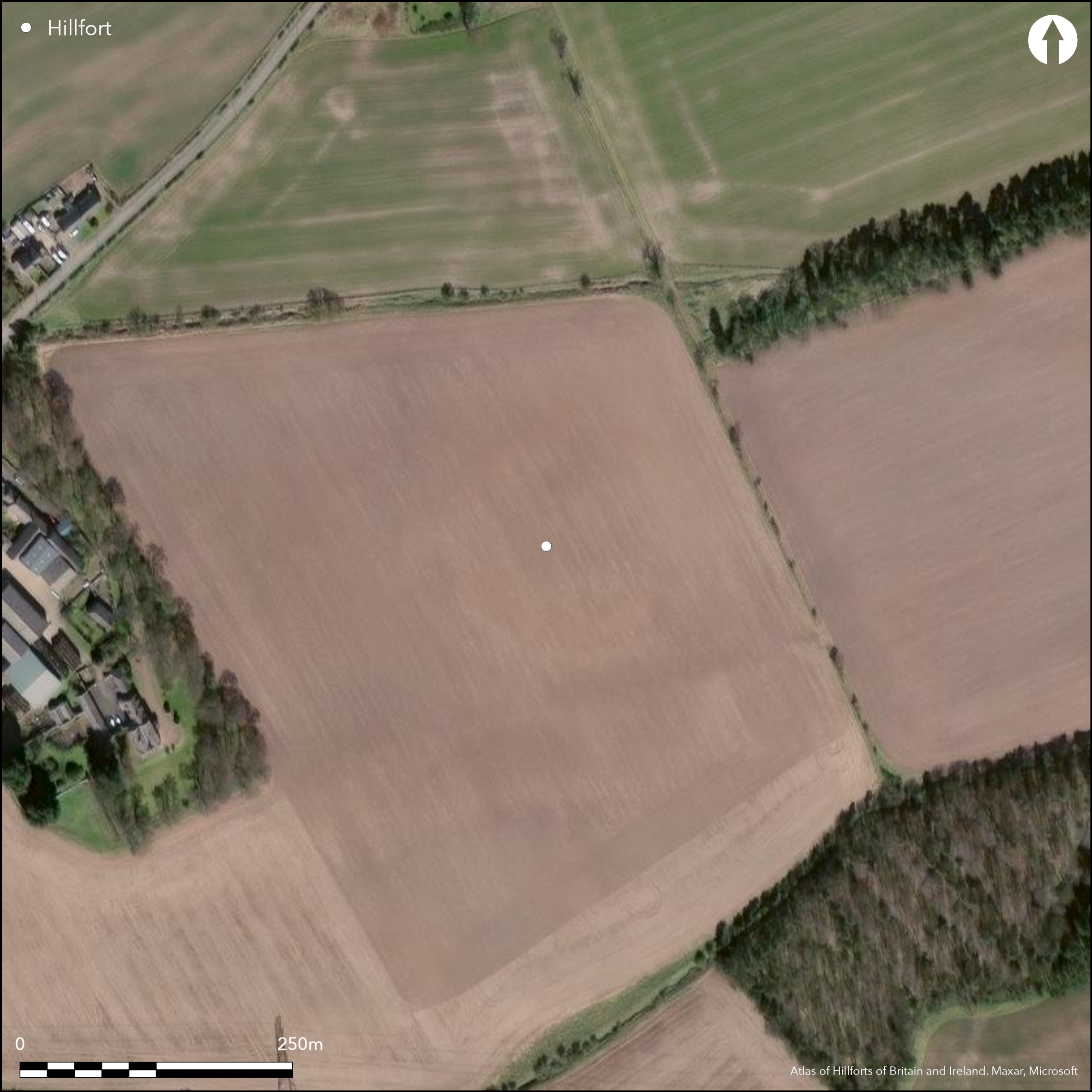
Satellite Imagery
LiDAR 1m DTM Hillshade
Satellite Imagery
Scroll left/right to view further images.
HER: Northumberland 1829 (None)
NMR: NT 93 NW 22 (3693)
SM: 1006481
NGR: NT 9237 3510
X: 392370 Y: 635100 (OSGB36)
Cropmarks of an enclosure, probably a hillfort lying 160m to the E of Flodden. The site is sub-oval in form measuring 140m N-S by 170 E-W with a whole site footprint of approximately 1.4-1.6ha. The site lies at c.70m OD on land that slopes gently to the E. It comprises two to three concentric ditches spaced approximately 8-10m apart, the innermost ditch being wider than the other two and possibly representing an earlier univallate phase. The area enclosed by the inner ditch is approximately 0.5ha. Lying almost centrally within this enclosure is a further sub-circular narrow ditched enclosure of 0.2ha, considered by Harding (1987) to be a causewayed enclosure around which the larger defensive enclosure was constructed. However its interpretation is uncertain. Staggered opposing entrances lie in the E and W through all the ditches with the ones in the W being slightly everted. Both are flanked by outward projecting ditches or 'hornworks'. There is no evidence for internal features. The site is shown as 'Camp' on 1856-65 OS mapping and was probably extant at that time but only traces of the outer rampart remained when inspected by the OS in 1964 and 1967. It now appears to survive only as cropmarks. The site is scheduled but undated, Minimal investigations.
Citizen Science: ✗
Reliability of Data: Confirmed
Reliability of Interpretation: Confirmed
X: -236295 Y: 7481063 (EPSG: 3857)
Longitude: -2.122671784753406 Latitude: 55.60947838404171 (EPSG:4326)
Country: England
Current County or Unitary Authority: Northumberland
Historic County: Northumberland
Current Parish/Community/Council/Townland: Ford
Vulnerable to ploughing
| Extant | ✗ |
| Cropmark | ✓ |
| Likely Destroyed | ✗ |
Gravel terrace of the River Till
| Woodland | ✗ |
| Commercial Forestry Plantation | ✗ |
| Parkland | ✗ |
| Pasture (Grazing) | ✗ |
| Arable | ✓ |
| Scrub/Bracken | ✗ |
| Bare Outcrop | ✗ |
| Heather/Moorland | ✗ |
| Heath | ✗ |
| Built-up | ✗ |
| Coastal Grassland | ✗ |
| Other | ✗ |
A lowland fort lying on an E-facing hillslope at 70m OD.
| Contour Fort | ✗ |
| Partial Contour Fort | ✗ |
| Promontory Fort | ✗ |
| Hillslope Fort | ✓ |
| Level Terrain Fort | ✗ |
| Marsh Fort | ✗ |
| Multiple Enclosure Fort | ✗ |
| Hilltop | ✗ |
| Coastal Promontory | ✗ |
| Inland Promontory | ✗ |
| Valley Bottom | ✗ |
| Knoll/Hillock/Outcrop | ✗ |
| Ridge | ✗ |
| Cliff/Plateau-edge/Scarp | ✗ |
| Hillslope | ✓ |
| Lowland | ✓ |
| Spur | ✗ |
Dominant Topographic Feature: E-facing slope
| North | ✗ |
| Northeast | ✗ |
| East | ✓ |
| Southeast | ✗ |
| South | ✗ |
| Southwest | ✗ |
| West | ✗ |
| Northwest | ✗ |
| Level | ✗ |
Altitude: 70.0m
N/A
Undated, presumed Iron Age in later phase(s). Possible henge in centre.
Reliability: D - None
| Pre 1200BC | ✗ |
| 1200BC - 800BC | ✗ |
| 800BC - 400BC | ✗ |
| 400BC - AD50 | ✗ |
| AD50 - AD400 | ✗ |
| AD400 - AD 800 | ✗ |
| Post AD800 | ✗ |
| Unknown | ✓ |
| Pre Hillfort: | Possible henge |
| Post Hillfort: | None |
| Morphology/Earthwork/Typology: | None |
The site is recorded on 1856-65 OS mapping and included in McLauchlan (1919-22). Field investigations in 1964 and 1967. Included in Passmore and Waddington (2012, 72). Scheduled.
| Other (1964): | Field investigation |
| Other (1967): | Field investigation |
| 1st Identified Map Depiction (None): | None |
| 1st Identified Written Reference (None): | McLauchlan |
| Other (None): | Scheduled |
No evidence for internal features
A spring lies to the S
| None | ✓ |
| Spring | ✗ |
| Stream | ✗ |
| Pool | ✗ |
| Flush | ✗ |
| Well | ✗ |
| Other | ✗ |
None
| No Known Features | ✓ |
| Round Stone Structures | ✗ |
| Rectangular Stone Structures | ✗ |
| Curvilinear Platforms | ✗ |
| Other Roundhouse Evidence | ✗ |
| Pits | ✗ |
| Quarry Hollows | ✗ |
| Other | ✗ |
None
| No Known Excavation | ✓ |
| Pits | ✗ |
| Postholes | ✗ |
| Roundhouses | ✗ |
| Rectangular Structures | ✗ |
| Roads/Tracks | ✗ |
| Quarry Hollows | ✗ |
| Other | ✗ |
| Nothing Found | ✗ |
None
| No Known Geophysics | ✓ |
| Pits | ✗ |
| Roundhouses | ✗ |
| Rectangular Structures | ✗ |
| Roads/Tracks | ✗ |
| Quarry Hollows | ✗ |
| Other | ✗ |
| Nothing Found | ✗ |
None
| No Known Finds | ✓ |
| Pottery | ✗ |
| Metal | ✗ |
| Metalworking | ✗ |
| Human Bones | ✗ |
| Animal Bones | ✗ |
| Lithics | ✗ |
| Environmental | ✗ |
| Other | ✗ |
None
| APs Not Checked | ✗ |
| None | ✓ |
| Roundhouses | ✗ |
| Rectangular Structures | ✗ |
| Pits | ✗ |
| Postholes | ✗ |
| Roads/Tracks | ✗ |
| Other | ✗ |
Staggered opposed entrances lie in the E and W through all the ditches with the ones in the W being slightly out-turned. Both are flanked by outward projecting ditches or 'hornworks'.
| 6: | None |
| 2: | Difficult to discern in the E from satellite imagery but staggered breaks are reported in E and W, therefore six breaks assumed |
Guard Chambers: ✗
Chevaux de Frise: ✗
| 1. Oblique (East): | Inner ditch |
| 1. Oblique (East): | Middle ditch |
| 1. Oblique (East): | Outer ditch |
| 2. Oblique (West): | Inner ditch |
| 2. Oblique (West): | Middle ditch |
| 2. Oblique (West): | Outer ditch |
Sub-oval in form measuring 140m N-S by 170 E-W with a whole footprint of approximately 1.4-1.6ha. Two to three concentric ditches spaced approximately 8-10m apart, the innermost ditch being wider than the other two and possibly representing an earlier univallate phase. The area enclosed by the inner ditch is approximately 0.5ha.
| Area 1: | 0.5ha. |
| Area 2: | 0.2ha. |
| Total: | 0.5ha. |
Total Footprint Area: 1.4ha.
None
| ✓ | Possible henge enclosure (unverified). Earlier univallate phase suggested by wider internal ditch. |
| ✓ | Four including 'henge'. Ramparts in the E impossible to discern from satellite imagery |
| NE Quadrant: | None |
| SE Quadrant: | 3 |
| SW Quadrant: | 4 |
| NW Quadrant: | 4 |
| Total: | 4 |
| Partial Univallate | ✗ |
| Univallate | ✗ |
| Partial Bivallate | ✗ |
| Bivallate | ✗ |
| Partial Multivallate | ✓ |
| Multivallate | ✗ |
| Unknown | ✗ |
| Partial Univallate | ✗ |
| Univallate | ✓ |
| Partial Bivallate | ✗ |
| Bivallate | ✗ |
| Partial Multivallate | ✗ |
| Multivallate | ✗ |
Only ditches visible on satellite imagery
| None | ✓ |
| Earthen Bank | ✗ |
| Stone Wall | ✗ |
| Rubble | ✗ |
| Wall-walk | ✗ |
| Evidence of Timber | ✗ |
| Vitrification | ✗ |
| Other Burning | ✗ |
| Palisade | ✗ |
| Counter Scarp Bank | ✗ |
| Berm | ✗ |
| Unfinished | ✗ |
| Other | ✗ |
None
| None | ✗ |
| Earthen Bank | ✗ |
| Stone Wall | ✗ |
| Murus Duplex | ✗ |
| Timber-framed | ✗ |
| Timber-laced | ✗ |
| Vitrification | ✗ |
| Other Burning | ✗ |
| Palisade | ✗ |
| Counter Scarp Bank | ✗ |
| Berm | ✗ |
| Unfinished | ✗ |
| No Known Excavation | ✓ |
| Other | ✗ |
| ✗ | None |
| ✓ | None |
Number of Ditches: 4
| ✗ | None |
Harding A.F. 1987, Henge monuments and related sites of Great Britain, B.A.R. Brit. Ser. No.175. 210-11
Hogg, A.H.A.1979. British Hill-Forts. An Index. British Archaeological Reports, British Series 62. 122
MacLauchlan, H. 1919-22. Notes on camps in the parishes of Branxton, Carham, Ford, Kirknewton and Wooler in Northumberland. Hist Berwickshire Natur Club, 460.
Passmore, D.G. and Waddington, C. 2012. Archaeology and Environment in Northumberland. Till-Tweed studies, Vol 2. Oxbow
Atlas of Hillforts:
Wikidata:
This work is licensed under CC BY-SA 4.0

 and should be cited as:
Lock, Gary and Ralston, Ian. 2024. Atlas of Hillforts of Britain and Ireland. Available at: https://hillforts.arch.ox.ac.uk
Document Version 1.1