LiDAR 1m DTM Hillshade
Satellite Imagery
LiDAR 1m DTM Hillshade
Satellite Imagery
Scroll left/right to view further images.
HER: Northumberland 1152 (None)
NMR: NT 90 SW 10 (1890)
SM: 1011394
NGR: NT 94783 02515
X: 394783 Y: 602515 (OSGB36)
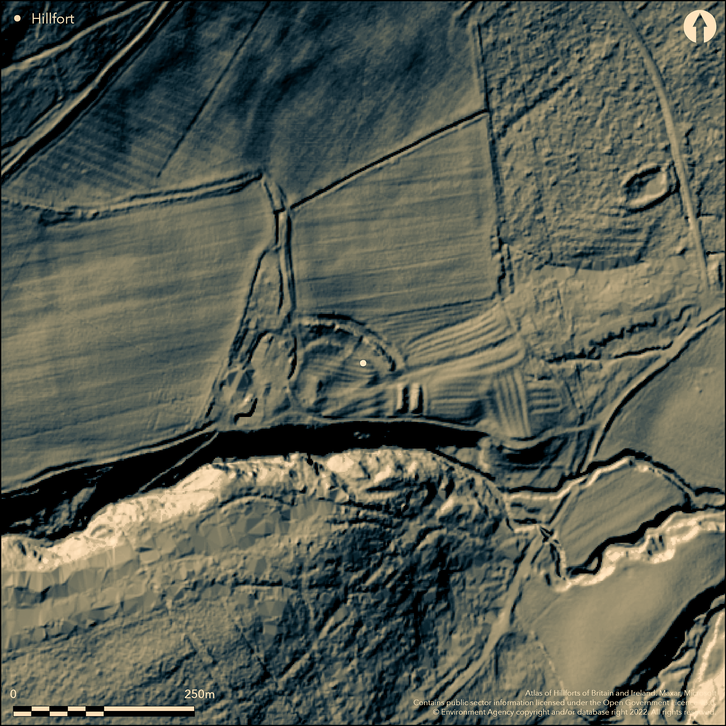
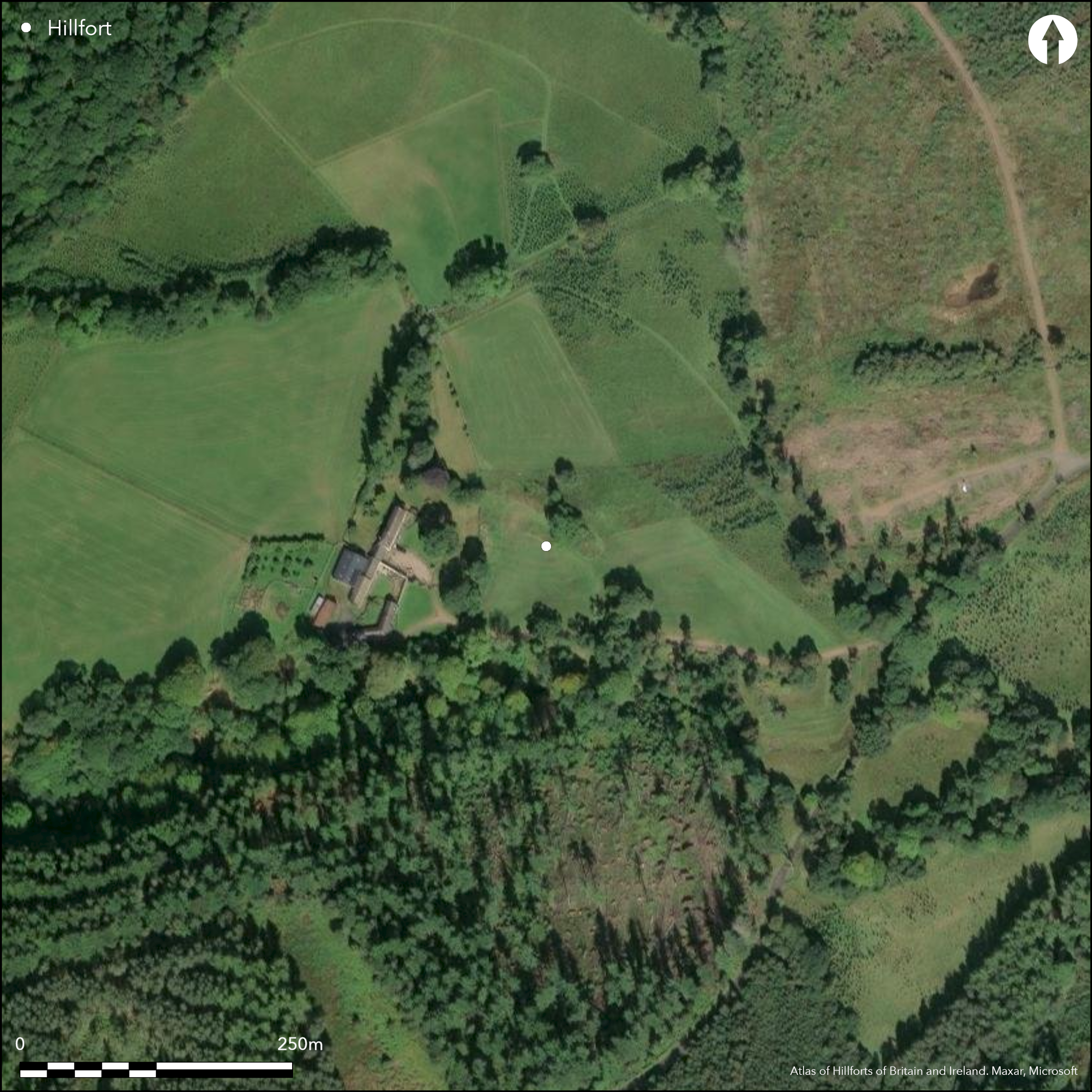
The remains of a multivallate promontory hillfort situated on sloping ground 70m to the E of Campville. The hillfort has been damaged by medieval agriculture and partially destroyed in the W by the settlement at Campville. Approximately 65m in breadth, it was estimated by Hogg (1979) as enclosing 0.32ha and comprises three ramparts and two medial ditches with traces of a third outer ditch in the SE. The enclosure was probably originally semi-circular, utilising the the steep escarpment above the Dovecrag Burn where the ramparts terminate. It is best preserved in the E where the inner bank is 6.5m wide and 1.3m high. The outer bank is 7.5m wide and lies 3m above the 2m wide internal ditch. At the N end there is a third, more denuded rampart separated from the inner rampart by a narrow ditch. An unusually wide entrance lies in the E, possibly widened by medieval ploughing. There is no evidence for internal occupation. A survey for the Hillforts in the Northumberland National Park project suggests the outer rampart might have been rebuilt at some unspecified time. It is shown on 1856-65 OS mapping. Minimal investigations and undated.
Citizen Science: ✗
Reliability of Data: Confirmed
Reliability of Interpretation: Confirmed
X: -231961 Y: 7423578 (EPSG: 3857)
Longitude: -2.0837449043920433 Latitude: 55.31671347412415 (EPSG:4326)
Country: England
Current County or Unitary Authority: Northumberland
Historic County: Northumberland
Current Parish/Community/Council/Townland: Harbottle
Levelled in the W and built over
| Extant | ✓ |
| Cropmark | ✗ |
| Likely Destroyed | ✓ |
None
| Woodland | ✗ |
| Commercial Forestry Plantation | ✗ |
| Parkland | ✓ |
| Pasture (Grazing) | ✗ |
| Arable | ✗ |
| Scrub/Bracken | ✗ |
| Bare Outcrop | ✗ |
| Heather/Moorland | ✗ |
| Heath | ✗ |
| Built-up | ✓ |
| Coastal Grassland | ✗ |
| Other | ✗ |
Lying at 169m OD on sloping ground on steep escarpment of the valley of the Dovecrag Burn
| Contour Fort | ✗ |
| Partial Contour Fort | ✗ |
| Promontory Fort | ✗ |
| Hillslope Fort | ✓ |
| Level Terrain Fort | ✗ |
| Marsh Fort | ✗ |
| Multiple Enclosure Fort | ✗ |
| Hilltop | ✗ |
| Coastal Promontory | ✗ |
| Inland Promontory | ✗ |
| Valley Bottom | ✗ |
| Knoll/Hillock/Outcrop | ✗ |
| Ridge | ✗ |
| Cliff/Plateau-edge/Scarp | ✓ |
| Hillslope | ✓ |
| Lowland | ✗ |
| Spur | ✓ |
Dominant Topographic Feature: Steep escarpment of the valley of the Dovecrag Burn
| North | ✗ |
| Northeast | ✗ |
| East | ✓ |
| Southeast | ✗ |
| South | ✗ |
| Southwest | ✗ |
| West | ✗ |
| Northwest | ✗ |
| Level | ✗ |
Altitude: 169.0m
N/A
Undated
Reliability: D - None
| Pre 1200BC | ✗ |
| 1200BC - 800BC | ✗ |
| 800BC - 400BC | ✗ |
| 400BC - AD50 | ✗ |
| AD50 - AD400 | ✗ |
| AD400 - AD 800 | ✗ |
| Post AD800 | ✗ |
| Unknown | ✓ |
| Pre Hillfort: | None |
| Post Hillfort: | None |
Shown on 1856-65 OS mapping. General reference in MacLauchlan's memoirs (1869). Field investigations in 1957, 1970 and 1976. Scheduled
| 1st Identified Written Reference (1869): | None |
| Other (1957): | Field investigation |
| Other (1963): | Scheduled |
| Other (1970): | Field investigation |
| Other (1976): | Field investigation |
| 1st Identified Map Depiction (None): | None |
| Other (None): | Scheduled |
No evidence for internal occupation. Cultivated with broad rigs
Dovecrag burn lies to the S
| None | ✓ |
| Spring | ✗ |
| Stream | ✗ |
| Pool | ✗ |
| Flush | ✗ |
| Well | ✗ |
| Other | ✗ |
None
| No Known Features | ✓ |
| Round Stone Structures | ✗ |
| Rectangular Stone Structures | ✗ |
| Curvilinear Platforms | ✗ |
| Other Roundhouse Evidence | ✗ |
| Pits | ✗ |
| Quarry Hollows | ✗ |
| Other | ✗ |
None
| No Known Excavation | ✓ |
| Pits | ✗ |
| Postholes | ✗ |
| Roundhouses | ✗ |
| Rectangular Structures | ✗ |
| Roads/Tracks | ✗ |
| Quarry Hollows | ✗ |
| Other | ✗ |
| Nothing Found | ✗ |
None
| No Known Geophysics | ✓ |
| Pits | ✗ |
| Roundhouses | ✗ |
| Rectangular Structures | ✗ |
| Roads/Tracks | ✗ |
| Quarry Hollows | ✗ |
| Other | ✗ |
| Nothing Found | ✗ |
None
| No Known Finds | ✓ |
| Pottery | ✗ |
| Metal | ✗ |
| Metalworking | ✗ |
| Human Bones | ✗ |
| Animal Bones | ✗ |
| Lithics | ✗ |
| Environmental | ✗ |
| Other | ✗ |
None
| APs Not Checked | ✓ |
| None | ✗ |
| Roundhouses | ✗ |
| Rectangular Structures | ✗ |
| Pits | ✗ |
| Postholes | ✗ |
| Roads/Tracks | ✗ |
| Other | ✗ |
Unusually wide entrance lies in the E, possibly widened by medieval ploughing
| None: | None |
| 2: | None |
Guard Chambers: ✗
Chevaux de Frise: ✗
| 1. Simple Gap (East): | None |
Approximately 65m in breadth. Comprises three ramparts and two medial ditches with traces of a third outer ditch in the SE. The enclosure was probably originally semi-circular, utilising the steep escarpment above the Dovecrag Burn where the ramparts terminate to form its defences. It is best preserved in the E where the inner bank is 6.5m wide and 1.3m high. The outer bank is 7.5m wide and lies 3m above the 2m wide internal ditch. At the N end there is a third, more denuded rampart separated from the inner rampart by a narrow ditch.
| Area 1: | 0.32ha. |
| Total: | 0.32ha. |
Total Footprint Area: Noneha.
None
| ✗ | None |
| ✗ | None |
| NE Quadrant: | 3 |
| SE Quadrant: | None |
| SW Quadrant: | None |
| NW Quadrant: | 3 |
| Total: | 3 |
| Partial Univallate | ✗ |
| Univallate | ✗ |
| Partial Bivallate | ✗ |
| Bivallate | ✗ |
| Partial Multivallate | ✓ |
| Multivallate | ✗ |
| Unknown | ✗ |
| Partial Univallate | ✗ |
| Univallate | ✗ |
| Partial Bivallate | ✗ |
| Bivallate | ✗ |
| Partial Multivallate | ✗ |
| Multivallate | ✗ |
The construction of the ramparts is not recorded and is assumed to be earthen banks.
| None | ✗ |
| Earthen Bank | ✓ |
| Stone Wall | ✗ |
| Rubble | ✗ |
| Wall-walk | ✗ |
| Evidence of Timber | ✗ |
| Vitrification | ✗ |
| Other Burning | ✗ |
| Palisade | ✗ |
| Counter Scarp Bank | ✗ |
| Berm | ✗ |
| Unfinished | ✗ |
| Other | ✗ |
None
| None | ✗ |
| Earthen Bank | ✗ |
| Stone Wall | ✗ |
| Murus Duplex | ✗ |
| Timber-framed | ✗ |
| Timber-laced | ✗ |
| Vitrification | ✗ |
| Other Burning | ✗ |
| Palisade | ✗ |
| Counter Scarp Bank | ✗ |
| Berm | ✗ |
| Unfinished | ✗ |
| No Known Excavation | ✓ |
| Other | ✗ |
| ✗ | None |
| ✓ | None |
Number of Ditches: 3
| ✗ | None |
Hogg, A.H.A.1979. British Hill-Forts. An Index. British Archaeological Reports, British Series 62. 121
MacLauchlan, H. 1869. Memoir written during a survey of the eastern branch of the Watling Street (London), 50
Atlas of Hillforts:
Wikidata:
This work is licensed under CC BY-SA 4.0![]()
![]()
![]() and should be cited as:
and should be cited as:
Lock, Gary and Ralston, Ian. 2024. Atlas of Hillforts of Britain and Ireland. Available at: https://hillforts.arch.ox.ac.uk
Document Version 1.1