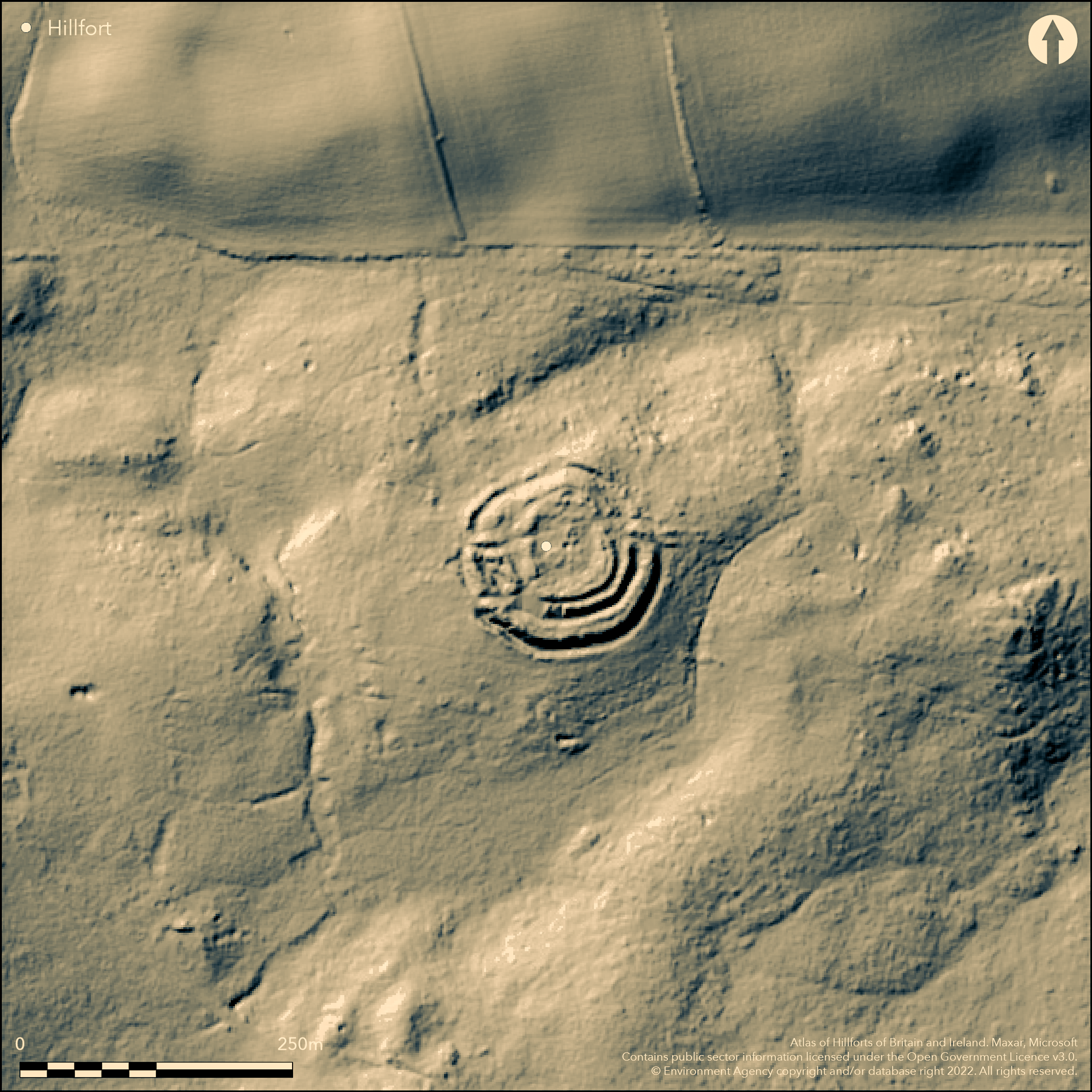
LiDAR 1m DTM Hillshade
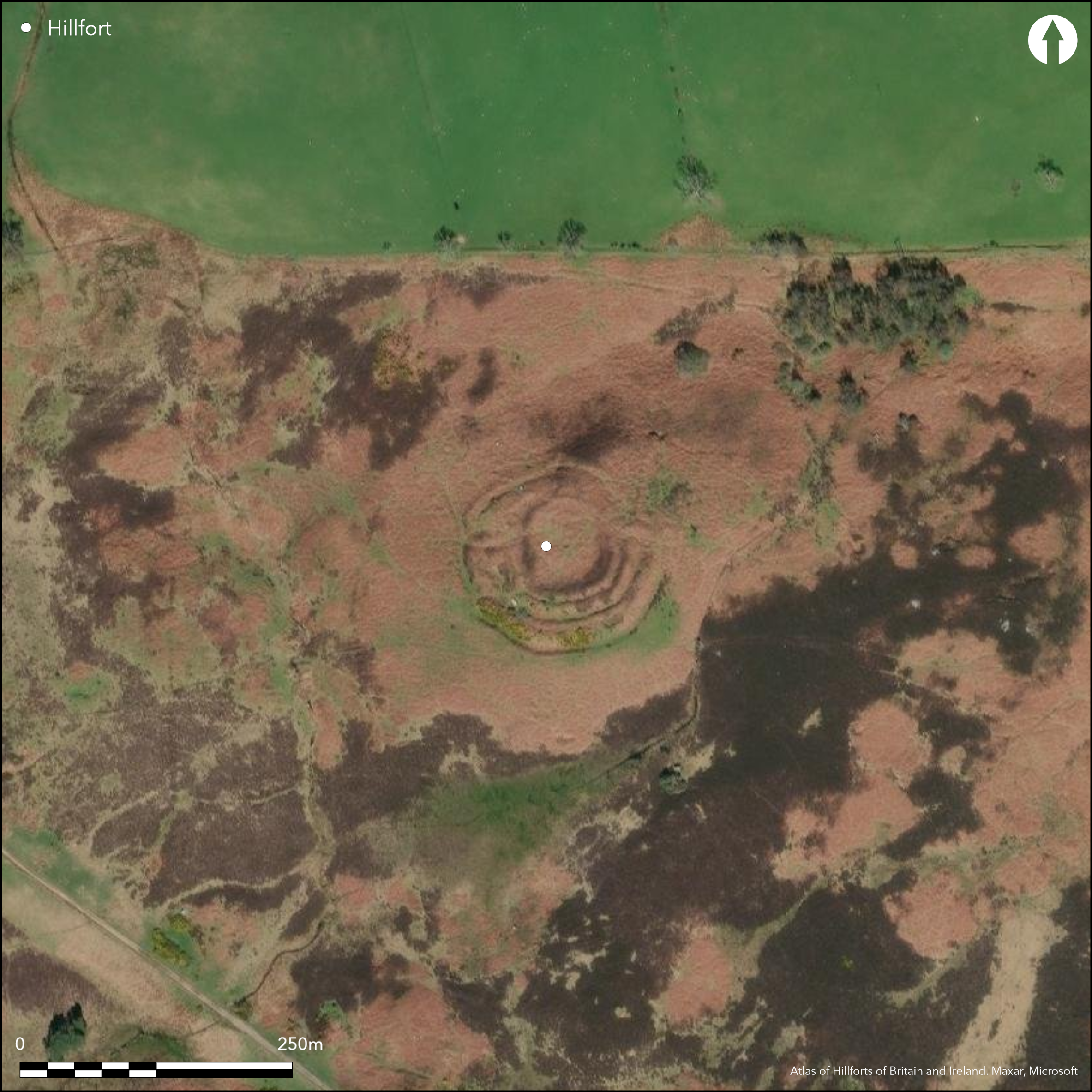
Satellite Imagery
LiDAR 1m DTM Hillshade
Satellite Imagery
Scroll left/right to view further images.
HER: Northumberland 3145 (None)
NMR: NU 01 NE 7 (4833)
SM: 1006594
NGR: NU 0999 1860
X: 409990 Y: 618600 (OSGB36)
Lying 1km to the SW of Eglingham at 142m OD, a multivallate hillfort reused in the Roman period. It occupies a non-defensive position on a gentle northerly slope on Beanley Moor. Circular with three earth and stone banks and three ditches it measures 102m in diameter with an overall area of 0.82ha. The ramparts increase in height and width outwards. The inner rampart averages 0.5m in height and 4m wide, and the outer rampart 8m in height and 8m wide. A further bank lies externally in the S. Entrances lie in the E and W, although the eastern entrance is now mutilated. Breaks in the western defences have transverse banks in the N and S between the middle and outer rampart, described as 'guard chambers' in the scheduling description. An E-W footpath crosses the enclosure utilising the breaks in the rampart. There are slight traces of two hut circles within the interior and four hut circles with an average diameter of 9m outside the hillfort in the NW. A further Romano-British hut circle lies within the inner ditch. These are stone founded with scooped interiors and are probably Romano-British. The site is shown on 1856-65 OS mapping. A number of cup and ring marked stones and Bronze Age cairns or burial mounds lie in the vicinity. Minimal investigations, undated.
Citizen Science: ✗
Reliability of Data: Confirmed
Reliability of Interpretation: Confirmed
X: -205224 Y: 7451891 (EPSG: 3857)
Longitude: -1.843560305006371 Latitude: 55.46117822823465 (EPSG:4326)
Country: England; None
Current County or Unitary Authority: Northumberland
Historic County: Northumberland
Current Parish/Community/Council/Townland: Hedgeley; Eglingham
Well preserved in the S and E but eroded on the N and W
| Extant | ✓ |
| Cropmark | ✗ |
| Likely Destroyed | ✗ |
Lies on open moorland, bracken covered in summer
| Woodland | ✗ |
| Commercial Forestry Plantation | ✗ |
| Parkland | ✗ |
| Pasture (Grazing) | ✗ |
| Arable | ✗ |
| Scrub/Bracken | ✓ |
| Bare Outcrop | ✗ |
| Heather/Moorland | ✓ |
| Heath | ✗ |
| Built-up | ✗ |
| Coastal Grassland | ✗ |
| Other | ✗ |
A contour fort lying at 142m OD on a gentle northerly-slope on open moorland
| Contour Fort | ✓ |
| Partial Contour Fort | ✗ |
| Promontory Fort | ✗ |
| Hillslope Fort | ✗ |
| Level Terrain Fort | ✗ |
| Marsh Fort | ✗ |
| Multiple Enclosure Fort | ✗ |
| Hilltop | ✗ |
| Coastal Promontory | ✗ |
| Inland Promontory | ✗ |
| Valley Bottom | ✗ |
| Knoll/Hillock/Outcrop | ✗ |
| Ridge | ✗ |
| Cliff/Plateau-edge/Scarp | ✗ |
| Hillslope | ✓ |
| Lowland | ✗ |
| Spur | ✗ |
Dominant Topographic Feature: Gentle northerly slope
| North | ✓ |
| Northeast | ✗ |
| East | ✗ |
| Southeast | ✗ |
| South | ✗ |
| Southwest | ✗ |
| West | ✗ |
| Northwest | ✗ |
| Level | ✗ |
Altitude: 142.0m
The parish boundary between Hedgeley and Eglingham lies approximately 95m to the N
Boundary Type: Parish/Townland
Undated, presumed Iron Age
Reliability: D - None
| Pre 1200BC | ✗ |
| 1200BC - 800BC | ✗ |
| 800BC - 400BC | ✗ |
| 400BC - AD50 | ✗ |
| AD50 - AD400 | ✗ |
| AD400 - AD 800 | ✗ |
| Post AD800 | ✗ |
| Unknown | ✓ |
| Pre Hillfort: | None |
| Post Hillfort: | Romano-British settlement |
| Morphology/Earthwork/Typology: | None |
Shown on 1856-65 OS mapping. General reference in Hardy (1890-1). Field investigations 1955, 1970. 1994 Field survey by Newcastle City Archaeological Unit. Scheduled
| Other (1932): | Scheduled (Amended May 2016) |
| Other (1955): | Field investigation |
| Other (1977): | Field investigation |
| Other (1994): | Field survey |
| 1st Identified Map Depiction (None): | None |
| 1st Identified Written Reference (None): | None |
Slight traces of two hut circles within the interior
None
| None | ✓ |
| Spring | ✗ |
| Stream | ✗ |
| Pool | ✗ |
| Flush | ✗ |
| Well | ✗ |
| Other | ✗ |
None
| No Known Features | ✗ |
| Round Stone Structures | ✓ |
| Rectangular Stone Structures | ✗ |
| Curvilinear Platforms | ✗ |
| Other Roundhouse Evidence | ✗ |
| Pits | ✗ |
| Quarry Hollows | ✗ |
| Other | ✗ |
None
| No Known Excavation | ✓ |
| Pits | ✗ |
| Postholes | ✗ |
| Roundhouses | ✗ |
| Rectangular Structures | ✗ |
| Roads/Tracks | ✗ |
| Quarry Hollows | ✗ |
| Other | ✗ |
| Nothing Found | ✗ |
None
| No Known Geophysics | ✓ |
| Pits | ✗ |
| Roundhouses | ✗ |
| Rectangular Structures | ✗ |
| Roads/Tracks | ✗ |
| Quarry Hollows | ✗ |
| Other | ✗ |
| Nothing Found | ✗ |
None
| No Known Finds | ✓ |
| Pottery | ✗ |
| Metal | ✗ |
| Metalworking | ✗ |
| Human Bones | ✗ |
| Animal Bones | ✗ |
| Lithics | ✗ |
| Environmental | ✗ |
| Other | ✗ |
None
| APs Not Checked | ✓ |
| None | ✗ |
| Roundhouses | ✗ |
| Rectangular Structures | ✗ |
| Pits | ✗ |
| Postholes | ✗ |
| Roads/Tracks | ✗ |
| Other | ✗ |
Entrances lie in the E and W, although the eastern entrance is now mutilated. The western entrance has transverse banks along the N and S sides between the middle and outer rampart described as 'guard chambers' in the scheduling description. An E-W footpath crosses the enclosure utilising the breaks in the rampart.
| 6: | Single breaks through each rampart in E and W |
| 2: | None |
Guard Chambers: ✓
Chevaux de Frise: ✗
| 1. Simple Gap (East): | Inner rampart |
| 1. Simple Gap (East): | Middle rampart |
| 1. Simple Gap (East): | Outer rampart |
| 2. Simple Gap (West): | Inner rampart |
| 2. Recesses/Guard Chambers (West): | Middle rampart |
| 2. Recesses/Guard Chambers (West): | Outer rampart |
Circular with three earth and stone banks and three ditches. It measures 102m in diameter with a whole site footprint of 0.82ha. The ramparts increase in size outwards. The inner rampart averages 0.5m in height and 4m wide, and the outer rampart 8m in height and 8m wide. A further bank lies externally in the S.
| Area 1: | 0.15ha. |
| Total: | 0.15ha. |
Total Footprint Area: 0.82ha.
None
| ✗ | Area estimated from satellite imagery |
| ✓ | None |
| NE Quadrant: | 3 |
| SE Quadrant: | 3 |
| SW Quadrant: | 3 |
| NW Quadrant: | 4 |
| Total: | 4 |
| Partial Univallate | ✗ |
| Univallate | ✗ |
| Partial Bivallate | ✗ |
| Bivallate | ✗ |
| Partial Multivallate | ✗ |
| Multivallate | ✓ |
| Unknown | ✗ |
| Partial Univallate | ✗ |
| Univallate | ✗ |
| Partial Bivallate | ✗ |
| Bivallate | ✗ |
| Partial Multivallate | ✗ |
| Multivallate | ✗ |
None
| None | ✗ |
| Earthen Bank | ✓ |
| Stone Wall | ✗ |
| Rubble | ✓ |
| Wall-walk | ✗ |
| Evidence of Timber | ✗ |
| Vitrification | ✗ |
| Other Burning | ✗ |
| Palisade | ✗ |
| Counter Scarp Bank | ✗ |
| Berm | ✗ |
| Unfinished | ✗ |
| Other | ✗ |
None
| None | ✗ |
| Earthen Bank | ✗ |
| Stone Wall | ✗ |
| Murus Duplex | ✗ |
| Timber-framed | ✗ |
| Timber-laced | ✗ |
| Vitrification | ✗ |
| Other Burning | ✗ |
| Palisade | ✗ |
| Counter Scarp Bank | ✗ |
| Berm | ✗ |
| Unfinished | ✗ |
| No Known Excavation | ✓ |
| Other | ✗ |
| ✗ | None |
| ✓ | None |
Number of Ditches: 3
| ✗ | None |
Gates, T. and Deegan, A. 2009. Monuments in the Landscape in Passmore, D.G. and Waddington, C. (eds). Managing Archaeological Landscapes in Northumberland. Till-Tweed Studies, Vol 1. Oxbow, 125-71.
Hardy, J. 1890. Report of meeting for 1890. Hist Berwickshire Natur Club. Vol. 14, 32
Jobey, G.1965. Hillforts and Settlements in Northumberland. Archaeol Aeliana (4th Series) 43, 71
Atlas of Hillforts:
Wikidata:
This work is licensed under CC BY-SA 4.0

 and should be cited as:
Lock, Gary and Ralston, Ian. 2024. Atlas of Hillforts of Britain and Ireland. Available at: https://hillforts.arch.ox.ac.uk
Document Version 1.1