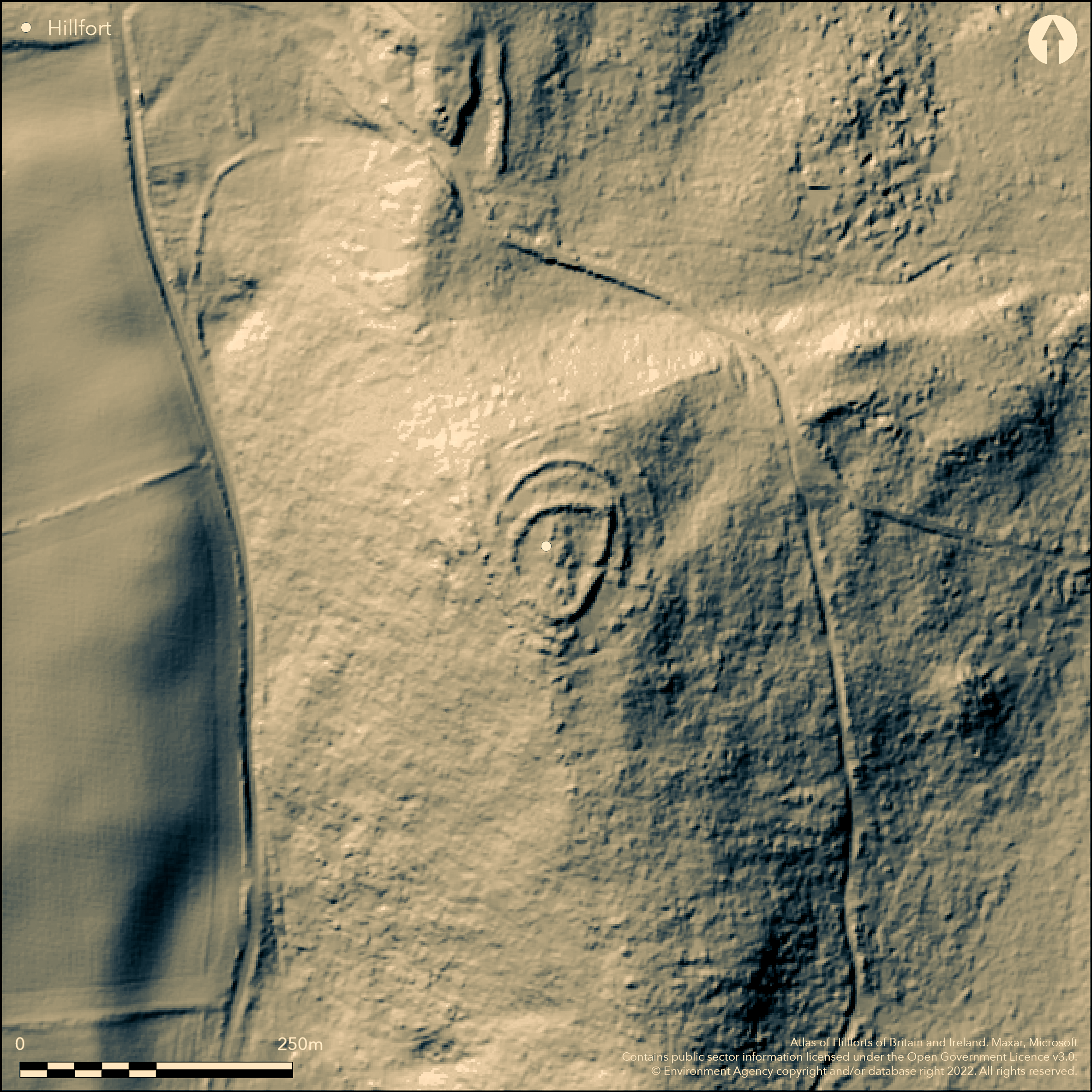
LiDAR 1m DTM Hillshade
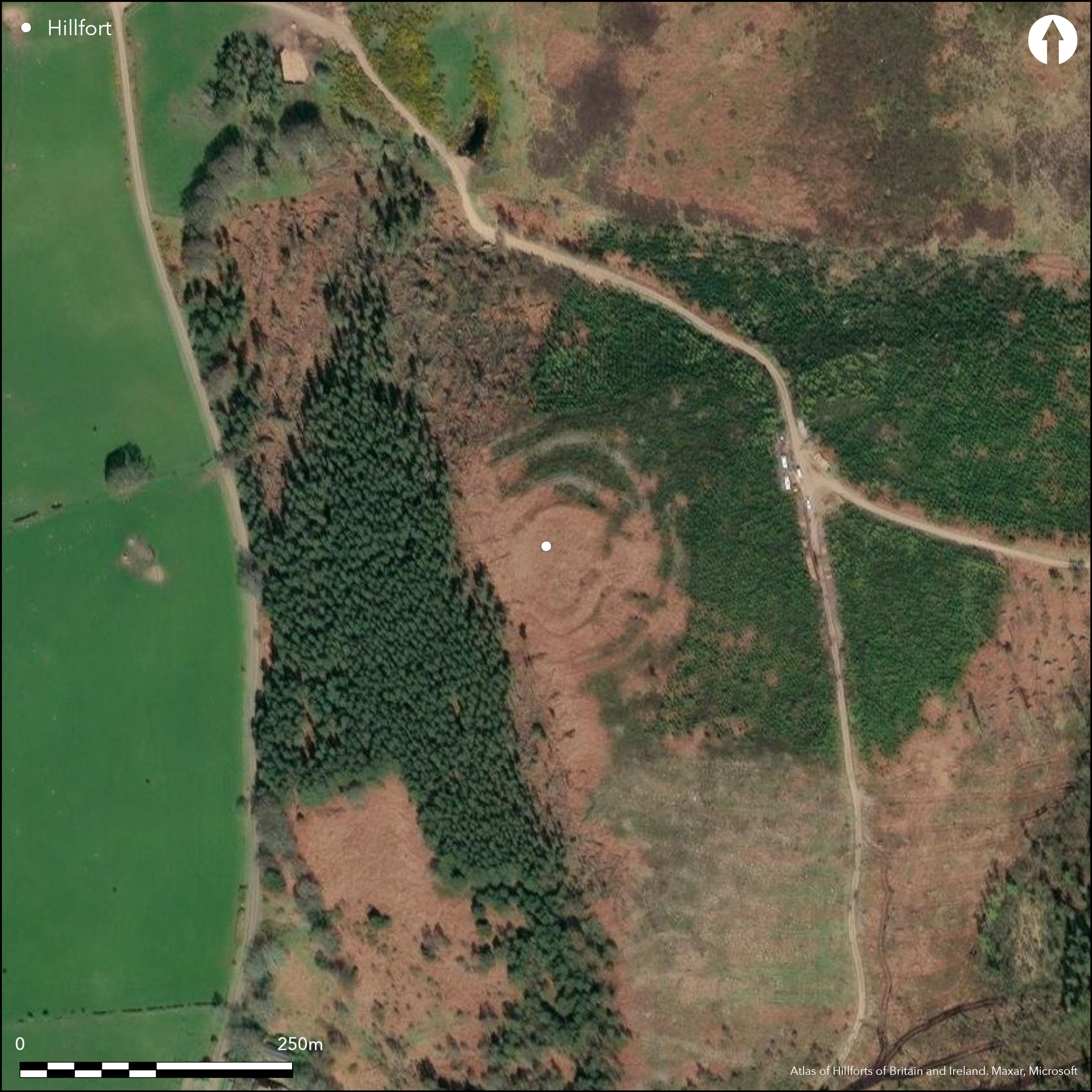
Satellite Imagery
LiDAR 1m DTM Hillshade
Satellite Imagery
Scroll left/right to view further images.
HER: Northumberland 3146 (None)
NMR: NU 01 NE 8 (4838)
SM: 1007453
NGR: NU 0929 1781
X: 409290 Y: 617810 (OSGB36)
A multivallate hillfort lying 350 NE of Wood House on undulating moorland within a clearing in Beanley Plantation. It is approximately oval in form with three earth and stone ramparts. The enclosure occupies the summit of a ridge at 213m OD, with a precipitous drop in the W and the ground falling away less steeply elsewhere. The inner and strongest of the ramparts is 4-10m wide and 2m high measuring 96m by 56m and enclosing 0.18ha. The 4m wide middle rampart measures 94.8m by 65m and encloses 0.3ha. Both are D-shaped and probably formed an earlier bivallate enclosure. The outer rampart which lies at the highest part of the hill is rectilinear in plan oriented SW-NE measuring 184m by 109m with a 2.5m wide bank. It is interpreted as a later feature which with the medial bank provides two annexes, envisaged as possible stock enclosures. A well-defined holloway 5m wide bisects the outer enclosure the NE but this might be a later feature. There is no record of ditches. The two inner ramparts have possible entrances in the NW and NE which are continuous through both ramparts. At the NE and NW angles of the outer rampart, upright stones create barriers. This is particularly well defined in the NW where it lies in close relation to the entrance through the inner and middle ramparts. At the outer side of the inner rampart a large stone demarcates the NW entrance. The outer enclosure has an entrance in the NW. The foundations of a single stone founded roundhouse 8m in diameter has been recorded within the inner enclosure. Others might be masked by vegetation. Although deforestation and reforestation occurred in the early to mid 20th century, the earthworks survive in good condition. In 1998 the hillfort underwent a walkover survey to establish its full extent and to demarcate an area around the hillfort prior for proposed tree felling. A management plan was also created at this time ahead of possible development of the hillfort as an educational resource. The site is recorded on 1856-65 OS mapping. Scheduled as a defended settlement.
Citizen Science: ✗
Reliability of Data: Confirmed
Reliability of Interpretation: Confirmed
X: -206459 Y: 7450500 (EPSG: 3857)
Longitude: -1.8546564903302118 Latitude: 55.45409322385969 (EPSG:4326)
Country: England
Current County or Unitary Authority: Northumberland
Historic County: Northumberland
Current Parish/Community/Council/Townland: Hedgeley
Said to survive in good condition
| Extant | ✓ |
| Cropmark | ✗ |
| Likely Destroyed | ✗ |
Occupies a clearing in woodland. Ramparts are bracken covered
| Woodland | ✗ |
| Commercial Forestry Plantation | ✓ |
| Parkland | ✗ |
| Pasture (Grazing) | ✗ |
| Arable | ✗ |
| Scrub/Bracken | ✓ |
| Bare Outcrop | ✗ |
| Heather/Moorland | ✓ |
| Heath | ✗ |
| Built-up | ✗ |
| Coastal Grassland | ✗ |
| Other | ✗ |
A contour fort, possibly multiple enclosure, lying on level ground on the summit of a ridge at 213m OD. If contemporary it would have overlooked Ringses hillfort, Atlas No EN0541, 1km to the SW
| Contour Fort | ✓ |
| Partial Contour Fort | ✗ |
| Promontory Fort | ✗ |
| Hillslope Fort | ✗ |
| Level Terrain Fort | ✗ |
| Marsh Fort | ✗ |
| Multiple Enclosure Fort | ✓ |
| Hilltop | ✓ |
| Coastal Promontory | ✗ |
| Inland Promontory | ✗ |
| Valley Bottom | ✗ |
| Knoll/Hillock/Outcrop | ✗ |
| Ridge | ✓ |
| Cliff/Plateau-edge/Scarp | ✗ |
| Hillslope | ✗ |
| Lowland | ✗ |
| Spur | ✗ |
Dominant Topographic Feature: Summit of a ridge
| North | ✗ |
| Northeast | ✗ |
| East | ✗ |
| Southeast | ✗ |
| South | ✗ |
| Southwest | ✗ |
| West | ✗ |
| Northwest | ✗ |
| Level | ✓ |
Altitude: 213.0m
N/A
Undated, presumed Iron Age, possibly multi-phased
Reliability: D - None
| Pre 1200BC | ✗ |
| 1200BC - 800BC | ✗ |
| 800BC - 400BC | ✗ |
| 400BC - AD50 | ✗ |
| AD50 - AD400 | ✗ |
| AD400 - AD 800 | ✗ |
| Post AD800 | ✗ |
| Unknown | ✓ |
| Pre Hillfort: | None |
| Post Hillfort: | Trig point shown on historic OS mapping |
| Morphology/Earthwork/Typology: | None |
General reference by Hodgson (1922), Recorded on 1856-65 OS mapping. OS Field investigations in 1955, 1958, 1970 and 1970. Archaeological walkover survey in 1997, carried out in advance of use of the hillfort for educational purposes. Scheduled as a multivallate defended enclosure
| 1st Identified Written Reference (1922): | None |
| Other (1949): | Scheduled |
| Other (1955): | Field investigation |
| Other (1958): | Field investigation |
| Other (1970): | Field investigation |
| Other (1997): | Field investigation, Northumberland FWAG |
| Other (1998): | Walkover survey by The Archaeological Practice |
| 1st Identified Map Depiction (None): | None |
Single stone foundation 8m in diameter. Possibly others but masked by vegetation
None
| None | ✓ |
| Spring | ✗ |
| Stream | ✗ |
| Pool | ✗ |
| Flush | ✗ |
| Well | ✗ |
| Other | ✗ |
None
| No Known Features | ✗ |
| Round Stone Structures | ✓ |
| Rectangular Stone Structures | ✗ |
| Curvilinear Platforms | ✗ |
| Other Roundhouse Evidence | ✗ |
| Pits | ✗ |
| Quarry Hollows | ✗ |
| Other | ✗ |
None
| No Known Excavation | ✓ |
| Pits | ✗ |
| Postholes | ✗ |
| Roundhouses | ✗ |
| Rectangular Structures | ✗ |
| Roads/Tracks | ✗ |
| Quarry Hollows | ✗ |
| Other | ✗ |
| Nothing Found | ✗ |
None
| No Known Geophysics | ✓ |
| Pits | ✗ |
| Roundhouses | ✗ |
| Rectangular Structures | ✗ |
| Roads/Tracks | ✗ |
| Quarry Hollows | ✗ |
| Other | ✗ |
| Nothing Found | ✗ |
None
| No Known Finds | ✓ |
| Pottery | ✗ |
| Metal | ✗ |
| Metalworking | ✗ |
| Human Bones | ✗ |
| Animal Bones | ✗ |
| Lithics | ✗ |
| Environmental | ✗ |
| Other | ✗ |
None
| APs Not Checked | ✓ |
| None | ✗ |
| Roundhouses | ✗ |
| Rectangular Structures | ✗ |
| Pits | ✗ |
| Postholes | ✗ |
| Roads/Tracks | ✗ |
| Other | ✗ |
Entrances lie in the NW and NE continuous through both ramparts. At the NE and NW angles of the outer rampart upright stones create barriers. This is particularly well defined in the NW where it lies in close relation to the entrance through the inner and intermediate ramparts. At the outer side of the inner rampart a large stone demarcates the NW entrance. An entrance in the SE side is also lined by large stones.
| 6: | None |
| 2: | None |
Guard Chambers: ✗
Chevaux de Frise: ✗
| 1. Simple Gap (North west): | Inner rampart bivallate enclosure Large stone demarcates outer side of rampart |
| 1. Simple Gap (North west): | Outer rampart bivallate enclosure |
| 2. Simple Gap (North east): | Inner rampart bivallate enclosure |
| 2. Simple Gap (North east): | Outer rampart bivallate enclosure |
| 3. Simple Gap (North west): | Later, outer enclosure |
Three earth and stone ramparts. The inner and strongest of the ramparts is 4-10m wide and 2m high, measuring 96m by 56m enclosing 0.18ha. The middle rampart is 4m wide and measures 94.8m by 65m enclosing 0.3ha. Both are D-shaped and probably form part of an earlier bivallate enclosure. The outermost, and possibly later rampart is rectilinear in plan measuring 184m by 109m with a 2.5m wide bank and oriented SW-NE. It is interpreted as a later feature which with the medial bank provides two annexes, possibly stock enclosures. No ditches are recorded
| Area 1: | 0.18ha. |
| Area 2: | 0.3ha. |
| Total: | 0.3ha. |
Total Footprint Area: 0.3ha.
None
| ✓ | The outer bank is possibly a later feature |
| ✓ | East side not completely visible |
| NE Quadrant: | 3 |
| SE Quadrant: | 3 |
| SW Quadrant: | 3 |
| NW Quadrant: | 3 |
| Total: | 3 |
| Partial Univallate | ✗ |
| Univallate | ✗ |
| Partial Bivallate | ✗ |
| Bivallate | ✗ |
| Partial Multivallate | ✗ |
| Multivallate | ✓ |
| Unknown | ✗ |
| Partial Univallate | ✗ |
| Univallate | ✗ |
| Partial Bivallate | ✗ |
| Bivallate | ✓ |
| Partial Multivallate | ✗ |
| Multivallate | ✗ |
None
| None | ✗ |
| Earthen Bank | ✓ |
| Stone Wall | ✗ |
| Rubble | ✓ |
| Wall-walk | ✗ |
| Evidence of Timber | ✗ |
| Vitrification | ✗ |
| Other Burning | ✗ |
| Palisade | ✗ |
| Counter Scarp Bank | ✗ |
| Berm | ✗ |
| Unfinished | ✗ |
| Other | ✗ |
None
| None | ✗ |
| Earthen Bank | ✗ |
| Stone Wall | ✗ |
| Murus Duplex | ✗ |
| Timber-framed | ✗ |
| Timber-laced | ✗ |
| Vitrification | ✗ |
| Other Burning | ✗ |
| Palisade | ✗ |
| Counter Scarp Bank | ✗ |
| Berm | ✗ |
| Unfinished | ✗ |
| No Known Excavation | ✓ |
| Other | ✗ |
| ✗ | None |
| ✗ | None |
Number of Ditches: None
| ✓ | The outer and middle ramparts are described as annexes, possibly for stock |
Anon. 1998. Beanley Hillfort, Beanley, Northumberland: archaeological walkover survey. The Archaeological Practice Unpublished assessment & evaluation reports.
Gates, T. and Deegan, A. 2009. Monuments in the Landscape in Passmore, D.G. and Waddington, C. (eds). Managing Archaeological Landscapes in Northumberland. Till-Tweed Studies, Vol 1. Oxbow, 125-71.
Hogg, A.H.A.1979. British Hill-Forts. An Index. British Archaeological Reports, British Series 62. 124
Hodgson, J.C. 1922. The Lordship, the Manor and the Township of Beanley. Archaeol Aeliana (3rd Series) XIX, 59-60
Jobey, G.1965 Hillforts and Settlements. Archaeol Aeliana, 4th Series, 43, 61
Atlas of Hillforts:
Wikidata:
This work is licensed under CC BY-SA 4.0

 and should be cited as:
Lock, Gary and Ralston, Ian. 2024. Atlas of Hillforts of Britain and Ireland. Available at: https://hillforts.arch.ox.ac.uk
Document Version 1.1