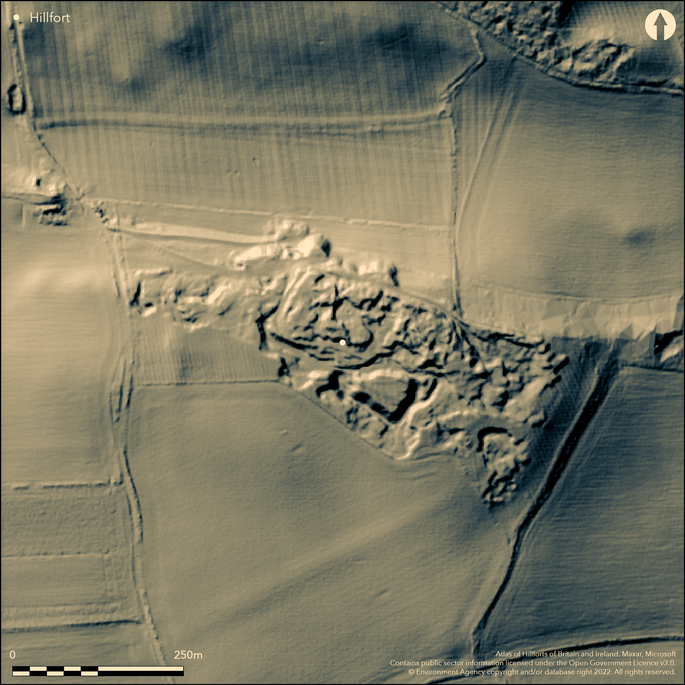
LiDAR 1m DTM Hillshade
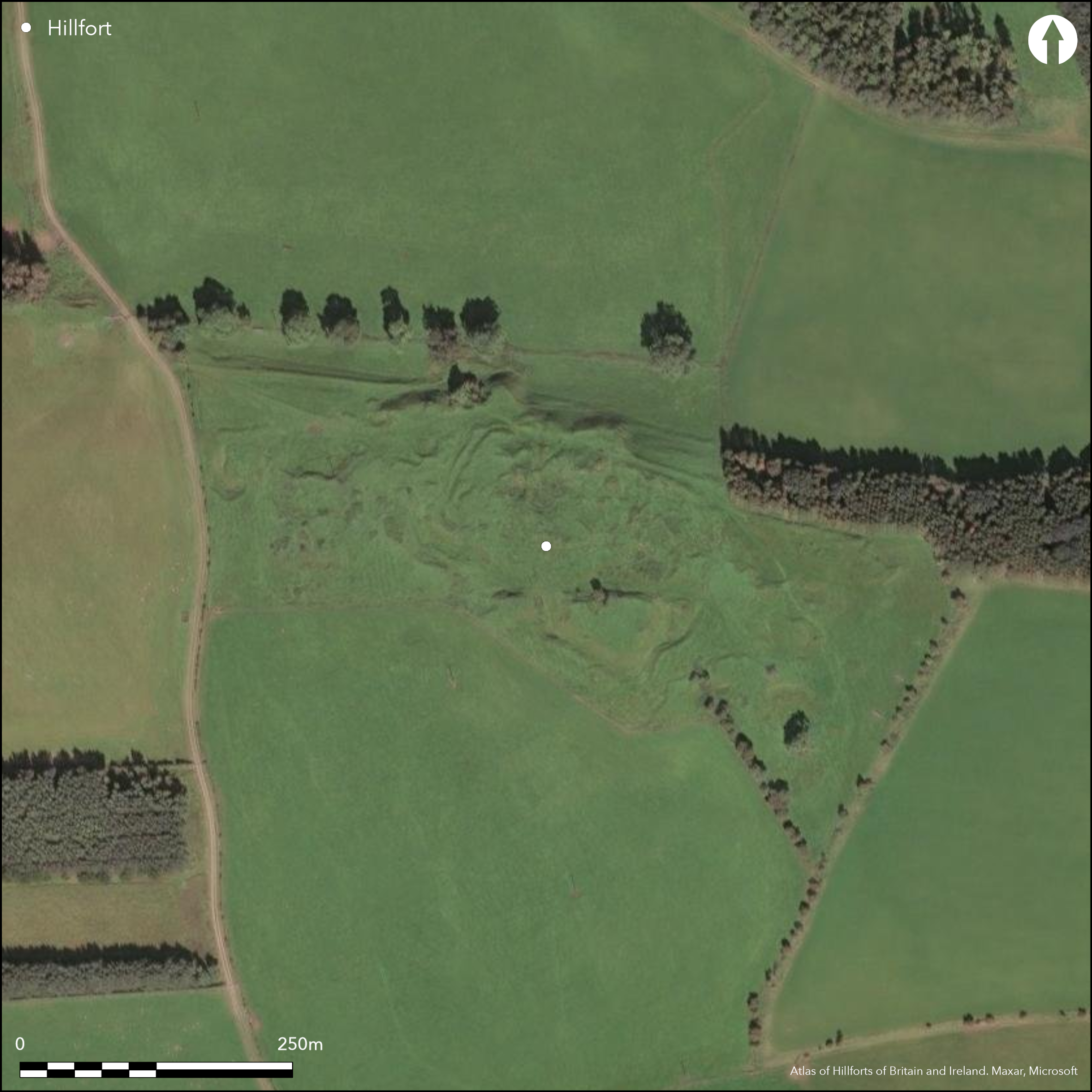
Satellite Imagery
LiDAR 1m DTM Hillshade
Satellite Imagery
Scroll left/right to view further images.
HER: Northumberland 1222 (None)
NMR: NT 90 SE 32 (1805)
SM: None
NGR: NT 9813 0147
X: 398130 Y: 601470 (OSGB36)
Lying 800m to the N of Hepple, at 183m OD on the summit of Wreigh Hill, the site of a possible multivallate contour fort, now destroyed. The hill falls away gently to the S and W to the valley of the River Coquet. The site was described by Mackenzie (1825) as being oval, measuring 128m by 82m internally. The included plan suggests multiple ramparts and ditches which MacLauchlan (1867) clarifies as three ramparts. The inner ditch is given as 5.5m wide and the external ditch 4.6m wide, the ramparts 4.6m high and 1.8m wide where they survived. Only two ditches were recorded on the steepest side in the NW. The location of entrances is not given. The foundations of buildings were recorded within the interior. Several querns, defaced Roman coins and large quantities of antlers of red deer were found by quarrymen (Dixon 1903). The site was quarried on all sides for limestone for lime production and grass covered quarry pits and spoil heaps are all that remain. A field inspectors visit in 1957 confirmed no trace of the enclosing works could be seen. This site is shown as 'Hetchester site of' on 1856-65 OS mapping. Undated but the described morphology of the earthworks suggests Iron Age, the finds lpossibly representing later re-use.
Citizen Science: ✗
Reliability of Data: Unconfirmed
Reliability of Interpretation: Irreconciled issues
X: -226090 Y: 7421746 (EPSG: 3857)
Longitude: -2.030999227438637 Latitude: 55.307347999010055 (EPSG:4326)
Country: England
Current County or Unitary Authority: Northumberland
Historic County: Northumberland
Current Parish/Community/Council/Townland: Hepple
Quarried
| Extant | ✗ |
| Cropmark | ✗ |
| Likely Destroyed | ✓ |
None
| Woodland | ✗ |
| Commercial Forestry Plantation | ✗ |
| Parkland | ✗ |
| Pasture (Grazing) | ✓ |
| Arable | ✗ |
| Scrub/Bracken | ✗ |
| Bare Outcrop | ✗ |
| Heather/Moorland | ✗ |
| Heath | ✗ |
| Built-up | ✗ |
| Coastal Grassland | ✗ |
| Other | ✗ |
A former contour fort lying at 183m OD on the summit of Wreigh Hill
| Contour Fort | ✓ |
| Partial Contour Fort | ✗ |
| Promontory Fort | ✗ |
| Hillslope Fort | ✗ |
| Level Terrain Fort | ✗ |
| Marsh Fort | ✗ |
| Multiple Enclosure Fort | ✗ |
| Hilltop | ✓ |
| Coastal Promontory | ✗ |
| Inland Promontory | ✗ |
| Valley Bottom | ✗ |
| Knoll/Hillock/Outcrop | ✗ |
| Ridge | ✗ |
| Cliff/Plateau-edge/Scarp | ✗ |
| Hillslope | ✗ |
| Lowland | ✗ |
| Spur | ✗ |
Dominant Topographic Feature: Summit of Wreigh Hill
| North | ✗ |
| Northeast | ✗ |
| East | ✗ |
| Southeast | ✗ |
| South | ✗ |
| Southwest | ✗ |
| West | ✗ |
| Northwest | ✗ |
| Level | ✓ |
Altitude: 183.0m
N/A
The described morphology of the earthworks suggests Iron Age. Several querns, defaced Roman coins and large quantities of antlers of red deer were found by workmen, these and the stone-founded buildings suggests later activity.
Reliability: D - None
| Pre 1200BC | ✗ |
| 1200BC - 800BC | ✗ |
| 800BC - 400BC | ✗ |
| 400BC - AD50 | ✗ |
| AD50 - AD400 | ✗ |
| AD400 - AD 800 | ✗ |
| Post AD800 | ✗ |
| Unknown | ✓ |
| Pre Hillfort: | None |
| Post Hillfort: | Roman activity; quarrying and limekilns. |
| Artefactual: | None |
| Morphology/Earthwork/Typology: | None |
The site has been described by a number of authors, possibly paraphrasing MacKenzie (1825). It is shown on 1856-65 OS mapping as 'Hetchester site of'. Field investigation 1957
| 1st Identified Written Reference (1825): | None |
| Other (1957): | Field investigation |
| 1st Identified Map Depiction (None): | None |
The 'foundations of ancient buildings' were recorded within the enclosure but their form is not given
None
| None | ✓ |
| Spring | ✗ |
| Stream | ✗ |
| Pool | ✗ |
| Flush | ✗ |
| Well | ✗ |
| Other | ✗ |
Buidling foundations recorded but morphology is unknown
| No Known Features | ✗ |
| Round Stone Structures | ✗ |
| Rectangular Stone Structures | ✗ |
| Curvilinear Platforms | ✗ |
| Other Roundhouse Evidence | ✗ |
| Pits | ✗ |
| Quarry Hollows | ✗ |
| Other | ✓ |
None
| No Known Excavation | ✓ |
| Pits | ✗ |
| Postholes | ✗ |
| Roundhouses | ✗ |
| Rectangular Structures | ✗ |
| Roads/Tracks | ✗ |
| Quarry Hollows | ✗ |
| Other | ✗ |
| Nothing Found | ✗ |
None
| No Known Geophysics | ✓ |
| Pits | ✗ |
| Roundhouses | ✗ |
| Rectangular Structures | ✗ |
| Roads/Tracks | ✗ |
| Quarry Hollows | ✗ |
| Other | ✗ |
| Nothing Found | ✗ |
None
| No Known Finds | ✓ |
| Pottery | ✗ |
| Metal | ✗ |
| Metalworking | ✗ |
| Human Bones | ✗ |
| Animal Bones | ✗ |
| Lithics | ✗ |
| Environmental | ✗ |
| Other | ✗ |
None
| APs Not Checked | ✓ |
| None | ✗ |
| Roundhouses | ✗ |
| Rectangular Structures | ✗ |
| Pits | ✗ |
| Postholes | ✗ |
| Roads/Tracks | ✗ |
| Other | ✗ |
The location of entrances is unrecorded
| None: | None |
| 2: | None |
Guard Chambers: ✗
Chevaux de Frise: ✗
Oval in form 128m by 82m internally. Three ramparts are reported by MacLauchlan (1867). Mackenzie (1825) records '..the fort has had but two ditches....' in the NW, indicating further ditches were present elsewhere. Inner ditch is given as 5.5m wide and the external ditch 4.6m wide, the ramparts 4.6m high and 1.8m wide where they survived.
| Area 1: | 0.7ha. |
| Total: | 0.7ha. |
Total Footprint Area: Noneha.
None
| ✗ | Enclosed area estimated from measurements |
| ✓ | Conjecture - taken from the plan by Mackenzie (1825) |
| NE Quadrant: | 3 |
| SE Quadrant: | 3 |
| SW Quadrant: | 3 |
| NW Quadrant: | 3 |
| Total: | 3 |
| Partial Univallate | ✗ |
| Univallate | ✗ |
| Partial Bivallate | ✗ |
| Bivallate | ✗ |
| Partial Multivallate | ✗ |
| Multivallate | ✓ |
| Unknown | ✗ |
| Partial Univallate | ✗ |
| Univallate | ✗ |
| Partial Bivallate | ✗ |
| Bivallate | ✗ |
| Partial Multivallate | ✗ |
| Multivallate | ✗ |
Destroyed
| None | ✓ |
| Earthen Bank | ✗ |
| Stone Wall | ✗ |
| Rubble | ✗ |
| Wall-walk | ✗ |
| Evidence of Timber | ✗ |
| Vitrification | ✗ |
| Other Burning | ✗ |
| Palisade | ✗ |
| Counter Scarp Bank | ✗ |
| Berm | ✗ |
| Unfinished | ✗ |
| Other | ✗ |
None
| None | ✗ |
| Earthen Bank | ✗ |
| Stone Wall | ✗ |
| Murus Duplex | ✗ |
| Timber-framed | ✗ |
| Timber-laced | ✗ |
| Vitrification | ✗ |
| Other Burning | ✗ |
| Palisade | ✗ |
| Counter Scarp Bank | ✗ |
| Berm | ✗ |
| Unfinished | ✗ |
| No Known Excavation | ✓ |
| Other | ✗ |
| ✗ | None |
| ✓ | At least two ditches are recorded, further might have existed. |
Number of Ditches: 2
| ✗ | None |
Dixon, D.D. 1903 Upper Coquetdale, Northumberland: its history, traditions, and folk lore. R. Redpath, Newcastle-upon-Tyne.125-6
Mackenzie, E. (ed) 1825. An historical, topographical and descriptive view of the county of Northumberland. 2nd Ed. Vol II. Mackenzie and Dent
MacLauchlan,H. 1867. Notes not included in the memoirs already published on Roman roads in Northumberland (Alnwick) 84
Atlas of Hillforts:
Wikidata:
This work is licensed under CC BY-SA 4.0

 and should be cited as:
Lock, Gary and Ralston, Ian. 2024. Atlas of Hillforts of Britain and Ireland. Available at: https://hillforts.arch.ox.ac.uk
Document Version 1.1