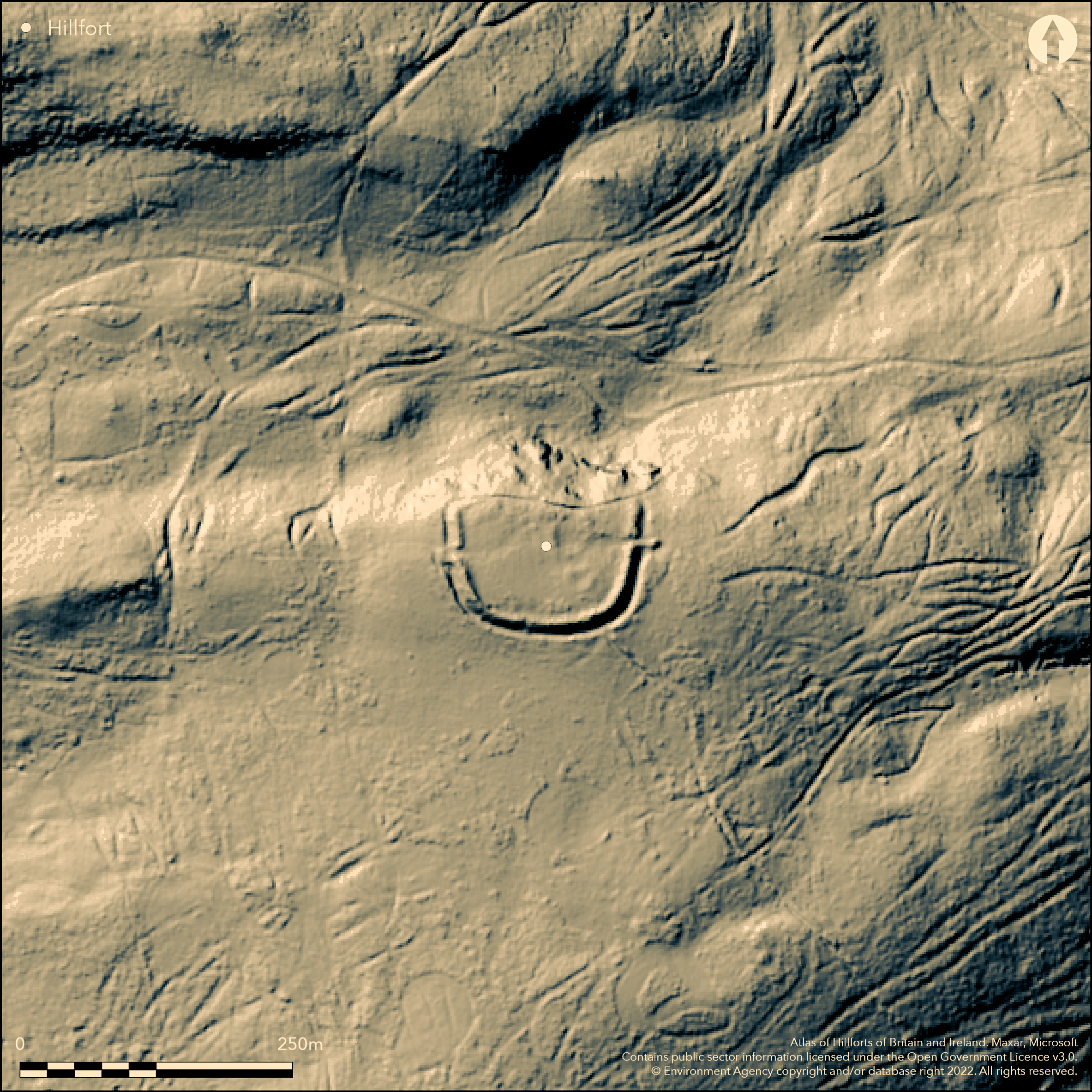
LiDAR 1m DTM Hillshade
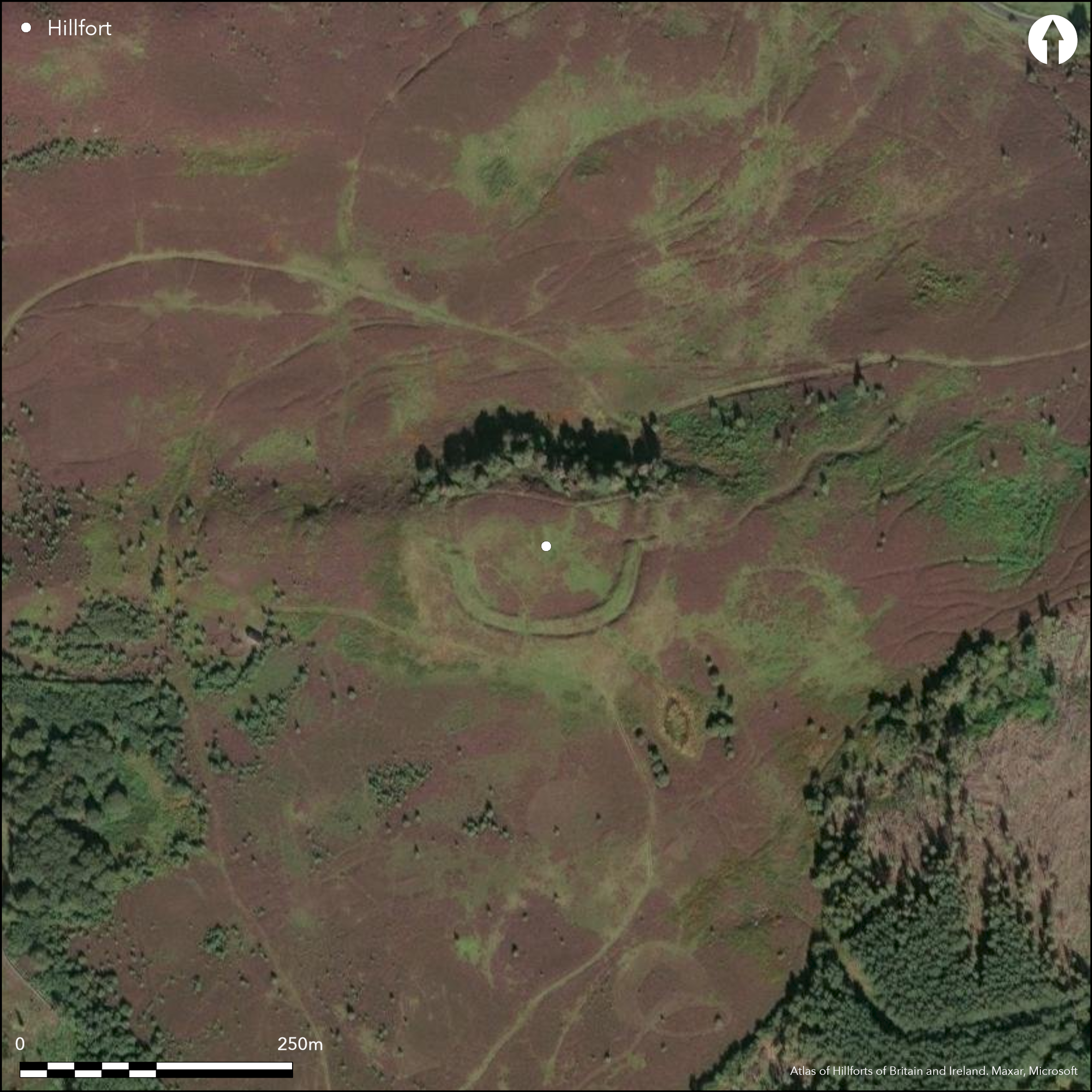
Satellite Imagery
LiDAR 1m DTM Hillshade
Satellite Imagery
Scroll left/right to view further images.
HER: Northumberland 9692 (None)
NMR: NY 99 NE 4 (19515)
SM: 1008873
NGR: NY 9816 9934
X: 398164 Y: 599343 (OSGB36)
Witchy Neuk, a univallate hillfort sited on a natural sandstone crag at 180m OD above the village of Hepple. The earthworks are D-shaped in plan utilising the end of the crag to provide the defences in the N. Elsewhere the enclosure comprises a single rampart and ditch measuring 90m E-W by 45m N-S. The rampart stands at between 1.4 to 2.6m high with a drystone wall revetment visible in some places. The external ditch is 1.8m deep and 6.5m wide. Entrances lie in the E and W. Both display the remains of defensive mounds, or clavicula, projecting outwards, with the one at the western entrance being curved. The ditch is stone-filled in the W to give access to the interior. Excavation suggests the entrance in the E was a later break (Wake 1936). Internally two wooden roundhouses in the SE have been confirmed through excavation. Iron slag was found in the vicinity of the roundhouse. Excavation also revealed stone flags 9m by 6m and a hearth from which two cooking pots were recovered. A saddle quern and glass from a Roman jug indicate use of the hillfort in the Roman period. Externally, a linear earthwork 0.8m high and 3.5m wide with a V-shaped ditch on the western side, 1.2m deep and 2.3m wide, runs SSE for 365m from the enclosure in the SE. Wake's excavation showed this to be a later feature. A rectangular stone structure in the SW is visible within the interior on 2002 and 2003 Google Earth imagery. The site is recorded on 1856-65 OS mapping.
Citizen Science: ✗
Reliability of Data: Confirmed
Reliability of Interpretation: Confirmed
X: -226029 Y: 7418009 (EPSG: 3857)
Longitude: -2.0304489796827094 Latitude: 55.28823513022421 (EPSG:4326)
Country: England
Current County or Unitary Authority: Northumberland
Historic County: Northumberland
Current Parish/Community/Council/Townland: Hepple
None
| Extant | ✓ |
| Cropmark | ✗ |
| Likely Destroyed | ✗ |
Rough grassland and heather
| Woodland | ✗ |
| Commercial Forestry Plantation | ✗ |
| Parkland | ✗ |
| Pasture (Grazing) | ✓ |
| Arable | ✗ |
| Scrub/Bracken | ✓ |
| Bare Outcrop | ✗ |
| Heather/Moorland | ✓ |
| Heath | ✗ |
| Built-up | ✗ |
| Coastal Grassland | ✗ |
| Other | ✗ |
A hillslope fort sited on a N-facing rocky spur at 180m OD
| Contour Fort | ✗ |
| Partial Contour Fort | ✗ |
| Promontory Fort | ✗ |
| Hillslope Fort | ✓ |
| Level Terrain Fort | ✗ |
| Marsh Fort | ✗ |
| Multiple Enclosure Fort | ✗ |
| Hilltop | ✗ |
| Coastal Promontory | ✗ |
| Inland Promontory | ✗ |
| Valley Bottom | ✗ |
| Knoll/Hillock/Outcrop | ✗ |
| Ridge | ✗ |
| Cliff/Plateau-edge/Scarp | ✗ |
| Hillslope | ✓ |
| Lowland | ✗ |
| Spur | ✓ |
Dominant Topographic Feature: N-facing rocky spur
| North | ✓ |
| Northeast | ✗ |
| East | ✗ |
| Southeast | ✗ |
| South | ✗ |
| Southwest | ✗ |
| West | ✗ |
| Northwest | ✗ |
| Level | ✗ |
Altitude: 180.0m
N/A
The morphology of the enclosure suggests later prehistoric origins but dateable finds recovered during excavation were Roman.
Reliability: C - Low
| Pre 1200BC | ✗ |
| 1200BC - 800BC | ✗ |
| 800BC - 400BC | ✓ |
| 400BC - AD50 | ✓ |
| AD50 - AD400 | ✓ |
| AD400 - AD 800 | ✗ |
| Post AD800 | ✗ |
| Unknown | ✗ |
| Pre Hillfort: | None |
| Post Hillfort: | None |
| Morphology/Earthwork/Typology: | None |
The site is recorded on 1856-65 OS mapping. Field inspections 1957 and 1971. Excavated by the Northumberland County History Committee under the direction of Thomas Wake in June 1936. Scheduled.
| Other (1932): | Scheduled |
| Excavation (1936): | None |
| Other (1957): | Field investigation |
| Other (1971): | Field investigation |
| 1st Identified Map Depiction (None): | None |
Internally two wooden roundhouses in the SE have been confirmed through excavation. Stone flags 9m by 6m and a hearth from which two cooking pots were recovered, also a saddle quern and iron slag.
None
| None | ✓ |
| Spring | ✗ |
| Stream | ✗ |
| Pool | ✗ |
| Flush | ✗ |
| Well | ✗ |
| Other | ✗ |
Rectangular stone structure, possibly later feature
| No Known Features | ✗ |
| Round Stone Structures | ✗ |
| Rectangular Stone Structures | ✓ |
| Curvilinear Platforms | ✓ |
| Other Roundhouse Evidence | ✗ |
| Pits | ✗ |
| Quarry Hollows | ✗ |
| Other | ✗ |
Stone flags and a hearth.
| No Known Excavation | ✗ |
| Pits | ✗ |
| Postholes | ✗ |
| Roundhouses | ✓ |
| Rectangular Structures | ✗ |
| Roads/Tracks | ✗ |
| Quarry Hollows | ✗ |
| Other | ✓ |
| Nothing Found | ✗ |
None
| No Known Geophysics | ✓ |
| Pits | ✗ |
| Roundhouses | ✗ |
| Rectangular Structures | ✗ |
| Roads/Tracks | ✗ |
| Quarry Hollows | ✗ |
| Other | ✗ |
| Nothing Found | ✗ |
Cooking pots, glass, saddle quern, iron slag
| No Known Finds | ✗ |
| Pottery | ✓ |
| Metal | ✗ |
| Metalworking | ✓ |
| Human Bones | ✗ |
| Animal Bones | ✗ |
| Lithics | ✗ |
| Environmental | ✗ |
| Other | ✓ |
None
| APs Not Checked | ✓ |
| None | ✗ |
| Roundhouses | ✗ |
| Rectangular Structures | ✗ |
| Pits | ✗ |
| Postholes | ✗ |
| Roads/Tracks | ✗ |
| Other | ✗ |
Entrances lie in the E and W. Both display the remains of defensive mounds, or clavicula, projecting outwards, with the one at the western entrance being curved. The ditch is stone-filled in the W to give access to the interior. Excavation suggests the entrance in the E was a later break (Wake 1936). A lowering of the bank in the S which carries a track is visible on satellite imagery. Possibly a sheep track
| 3: | Lowering of the bank in the S is probably later |
| 2: | None |
Guard Chambers: ✗
Chevaux de Frise: ✗
| 1. Out-turned (East): | Mound externally in the S |
| 2. Out-turned (West): | Mound externally in the S |
D-shaped in plan utilising the end of the crag to provide the defences in the N. Elsewhere the enclosure comprises a single rampart and ditch measuring 90m E-W by 45m N-S. The rampart stands at between 1.4-2.6m high with a drystone wall revetment visible in some places. The external ditch is 1.8m deep and 6.5m wide.
| Area 1: | 0.5ha. |
| Total: | 0.5ha. |
Total Footprint Area: 0.7ha.
None
| ✗ | Measurement approximate, taken from satellite imagery |
| ✗ | No ramparts in the N |
| NE Quadrant: | None |
| SE Quadrant: | 1 |
| SW Quadrant: | 1 |
| NW Quadrant: | None |
| Total: | 1 |
| Partial Univallate | ✓ |
| Univallate | ✗ |
| Partial Bivallate | ✗ |
| Bivallate | ✗ |
| Partial Multivallate | ✗ |
| Multivallate | ✗ |
| Unknown | ✗ |
| Partial Univallate | ✗ |
| Univallate | ✗ |
| Partial Bivallate | ✗ |
| Bivallate | ✗ |
| Partial Multivallate | ✗ |
| Multivallate | ✗ |
None
| None | ✗ |
| Earthen Bank | ✓ |
| Stone Wall | ✗ |
| Rubble | ✗ |
| Wall-walk | ✗ |
| Evidence of Timber | ✗ |
| Vitrification | ✗ |
| Other Burning | ✗ |
| Palisade | ✗ |
| Counter Scarp Bank | ✗ |
| Berm | ✗ |
| Unfinished | ✗ |
| Other | ✗ |
None
| None | ✗ |
| Earthen Bank | ✗ |
| Stone Wall | ✓ |
| Murus Duplex | ✗ |
| Timber-framed | ✗ |
| Timber-laced | ✗ |
| Vitrification | ✗ |
| Other Burning | ✗ |
| Palisade | ✗ |
| Counter Scarp Bank | ✗ |
| Berm | ✗ |
| Unfinished | ✗ |
| No Known Excavation | ✗ |
| Other | ✗ |
| ✗ | None |
| ✓ | None |
Number of Ditches: 1
| ✗ | None |
Jobey, G.1965. Hillforts and Settlements in Northumberland. Archaeol Aeliana (4th Series) 43
Wake, T. 1939. Excavations at Witchy Neuk, Hepple. Archaeol Aeliana 4 ser 16. 129-139
Atlas of Hillforts:
Wikidata:
This work is licensed under CC BY-SA 4.0

 and should be cited as:
Lock, Gary and Ralston, Ian. 2024. Atlas of Hillforts of Britain and Ireland. Available at: https://hillforts.arch.ox.ac.uk
Document Version 1.1