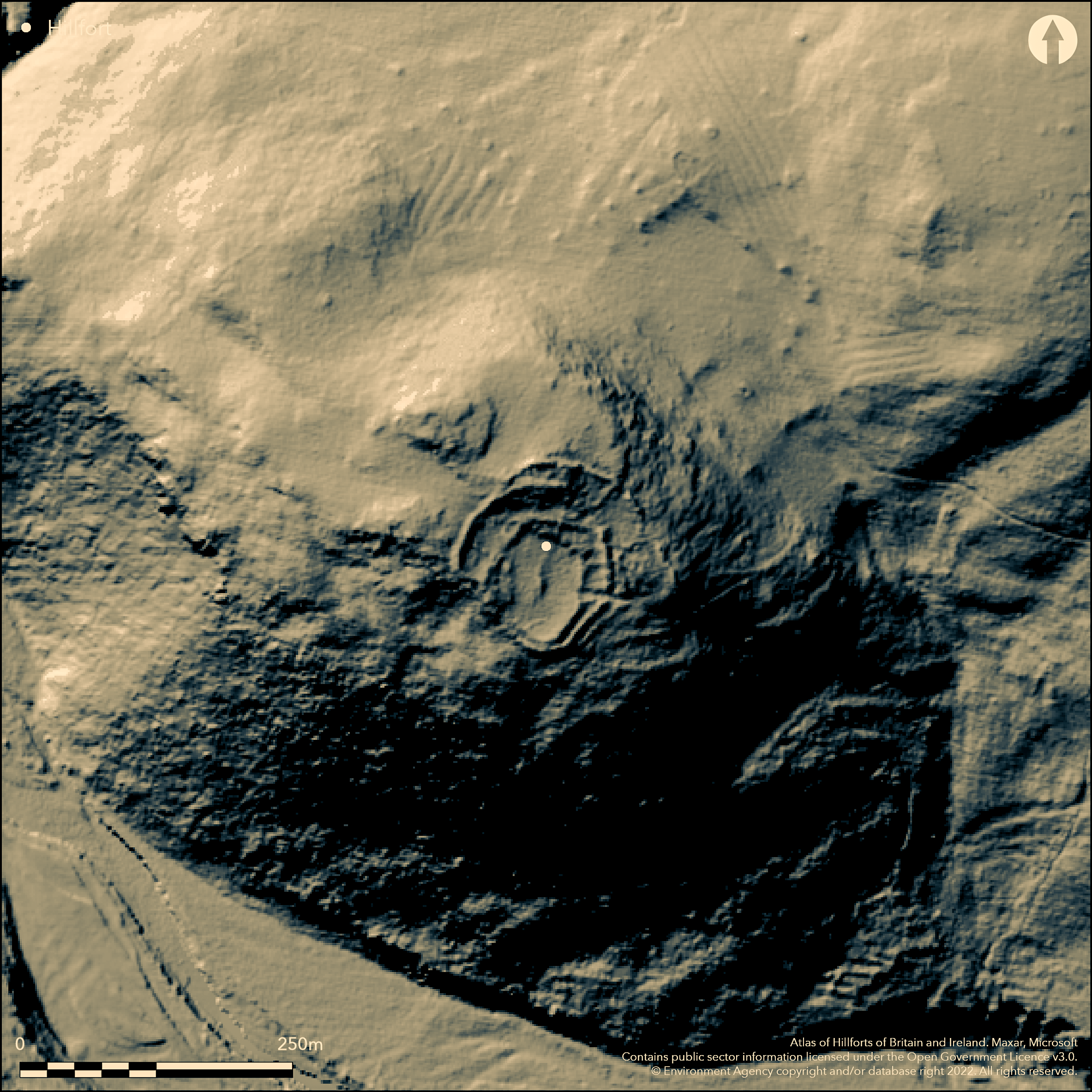
LiDAR 1m DTM Hillshade
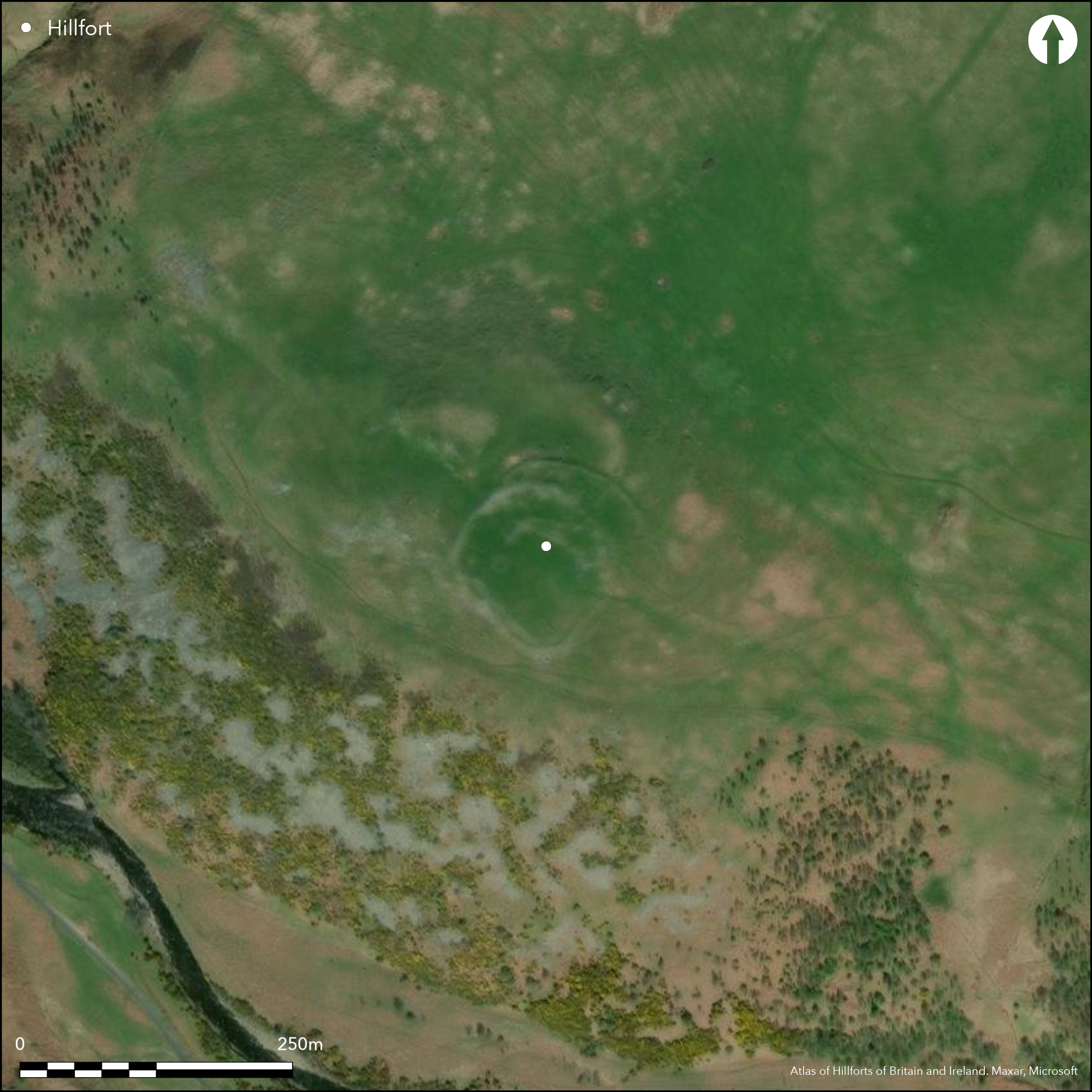
Satellite Imagery
LiDAR 1m DTM Hillshade
Satellite Imagery
Scroll left/right to view further images.
HER: Northumberland 3077 (None)
NMR: NU 01 NW 27 (5050)
SM: 1006544
NGR: NU 0042 1682
X: 400420 Y: 616820 (OSGB36)
A stone-built fort lying approximately 800m to the NW of Ingram. Believed to have been constructed in multiple phases, it lies at approximately 225m OD in a prominent position on the S side of the summit of Ewe Hill with commanding views along the Breamish Valley but with dead ground to the N and W. The earliest enclosure was sub-oval in plan 66m wide internally and univallate with ramparts faced with orthostats up to 6.5m thick and 1.6m high. An inner wall 5m thick and 1.4m high was added to the main enclosure in the S and SE. No evidence of ditches. A 4m wide entrance lies in the E. Two outer hornworks, 4.5m wide and 15m high which extend from the main entrance to the N and S are probably later. An annex was added externally in the N with walls 4.2m thick and 0.6m high. The annex is divided into three compartments; the foundations of a building, possibly a shieling, lie within the central compartment. The internal area of the main enclosure is 0.4ha, increasing to 0.6ha with the annexes. The foundations of a boundary wall extend from the northern hornwork possibly marking the edge of a field system or trackway into the valley. The remains of a single, stone-built hut with walls 1.8m thick and 0.6m high with an E-facing entrance which aligns with the main entrance, lies within the enclosure. A further hut circle has been identified from aerial photographs. Two cairns also lie in the interior. It survives in fair condition but has suffered stone robbing in the S. It is recorded on 1856-65 OS mapping. It is unexcavated and undated but presumed Iron Age with Roman and later additions. Scheduled
Citizen Science: ✗
Reliability of Data: Confirmed
Reliability of Interpretation: Confirmed
X: -222072 Y: 7448771 (EPSG: 3857)
Longitude: -1.9949067276313717 Latitude: 55.44528359219812 (EPSG:4326)
Country: England
Current County or Unitary Authority: Northumberland
Historic County: Northumberland
Current Parish/Community/Council/Townland: Ingram
Survives in fair condition but damaged by stone robbing
| Extant | ✓ |
| Cropmark | ✗ |
| Likely Destroyed | ✗ |
Moorland pasture
| Woodland | ✗ |
| Commercial Forestry Plantation | ✗ |
| Parkland | ✗ |
| Pasture (Grazing) | ✓ |
| Arable | ✗ |
| Scrub/Bracken | ✗ |
| Bare Outcrop | ✗ |
| Heather/Moorland | ✓ |
| Heath | ✗ |
| Built-up | ✗ |
| Coastal Grassland | ✗ |
| Other | ✗ |
A hillslope fort lying at approximately 225m OD on a S-facing slope below the summit of Ewe Hill
| Contour Fort | ✗ |
| Partial Contour Fort | ✗ |
| Promontory Fort | ✗ |
| Hillslope Fort | ✓ |
| Level Terrain Fort | ✗ |
| Marsh Fort | ✗ |
| Multiple Enclosure Fort | ✗ |
| Hilltop | ✗ |
| Coastal Promontory | ✗ |
| Inland Promontory | ✗ |
| Valley Bottom | ✗ |
| Knoll/Hillock/Outcrop | ✗ |
| Ridge | ✗ |
| Cliff/Plateau-edge/Scarp | ✗ |
| Hillslope | ✓ |
| Lowland | ✗ |
| Spur | ✓ |
Dominant Topographic Feature: S-facing slope off the summit of Ewe Hill
| North | ✗ |
| Northeast | ✗ |
| East | ✗ |
| Southeast | ✗ |
| South | ✓ |
| Southwest | ✗ |
| West | ✗ |
| Northwest | ✗ |
| Level | ✗ |
Altitude: 225.0m
N/A
Undated, presumed Iron Age with later additions
Reliability: D - None
| Pre 1200BC | ✗ |
| 1200BC - 800BC | ✗ |
| 800BC - 400BC | ✗ |
| 400BC - AD50 | ✗ |
| AD50 - AD400 | ✗ |
| AD400 - AD 800 | ✗ |
| Post AD800 | ✗ |
| Unknown | ✓ |
| Pre Hillfort: | None |
| Post Hillfort: | Sheiling |
| Morphology/Earthwork/Typology: | None |
Recorded on 1856-65 OS mapping, general reference in MacLauchlan (1867). Field investigations in 1957, 1970, 1976, 1986, 1995. Scheduled. Included in the SE Cheviots Project report as Ewe Hill 1, RCHME/EH survey, ref. no. 662366.
| 1st Identified Written Reference (1867): | None |
| Other (1957): | Field investigation |
| Other (1970): | Field investigation |
| Other (1976): | Field investigation |
| Other (1986): | Field investigation |
| Earthwork Survey (1988): | SE Cheviots Project |
| Other (1995): | Field investigation |
| 1st Identified Map Depiction (None): | None |
| Other (None): | Scheduled |
Remains of a single, stone-built hut with walls 1.8m thick and 0.6m high with an E-facing entrance which aligns with that of the main entrance. A further hut circle has been identified from aerial photographs
River Beamish to the S, small moorland streams to the E
| None | ✓ |
| Spring | ✗ |
| Stream | ✗ |
| Pool | ✗ |
| Flush | ✗ |
| Well | ✗ |
| Other | ✗ |
Possible shieling
| No Known Features | ✗ |
| Round Stone Structures | ✓ |
| Rectangular Stone Structures | ✓ |
| Curvilinear Platforms | ✗ |
| Other Roundhouse Evidence | ✗ |
| Pits | ✗ |
| Quarry Hollows | ✗ |
| Other | ✗ |
None
| No Known Excavation | ✓ |
| Pits | ✗ |
| Postholes | ✗ |
| Roundhouses | ✗ |
| Rectangular Structures | ✗ |
| Roads/Tracks | ✗ |
| Quarry Hollows | ✗ |
| Other | ✗ |
| Nothing Found | ✗ |
None
| No Known Geophysics | ✓ |
| Pits | ✗ |
| Roundhouses | ✗ |
| Rectangular Structures | ✗ |
| Roads/Tracks | ✗ |
| Quarry Hollows | ✗ |
| Other | ✗ |
| Nothing Found | ✗ |
None
| No Known Finds | ✓ |
| Pottery | ✗ |
| Metal | ✗ |
| Metalworking | ✗ |
| Human Bones | ✗ |
| Animal Bones | ✗ |
| Lithics | ✗ |
| Environmental | ✗ |
| Other | ✗ |
None
| APs Not Checked | ✗ |
| None | ✗ |
| Roundhouses | ✓ |
| Rectangular Structures | ✗ |
| Pits | ✗ |
| Postholes | ✗ |
| Roads/Tracks | ✗ |
| Other | ✗ |
A 4m wide entrance lies in the E. Two outer hornworks, 4.5m wide and 15m high which extend from the main entrance to the N and S are probably later.
| 2: | None |
| 2: | None |
Guard Chambers: ✗
Chevaux de Frise: ✗
| 1. Simple Gap (East): | Inner rampart |
| 1. Simple Gap (East): | Outer rampart, 4m wide |
| 1. Hornwork (East): | Banks extending N and S from the outer rampart. Probably later |
The earliest enclosure is sub-oval in plan 66m wide internally and univallate, the ramparts faced with orthostats up to 6.5m thick and 1.6m high. An inner wall 5m thick and 1.4m high was added to the main enclosure in the S and SE. No evidence of ditches.
| Area 1: | 0.4ha. |
| Total: | 0.4ha. |
Total Footprint Area: 0.6ha.
None
| ✓ | Enclosure with annex 0.6ha. Areas estimated from satellite imagery |
| ✗ | None |
| NE Quadrant: | 2 |
| SE Quadrant: | 2 |
| SW Quadrant: | 2 |
| NW Quadrant: | 1 |
| Total: | 2 |
| Partial Univallate | ✓ |
| Univallate | ✗ |
| Partial Bivallate | ✓ |
| Bivallate | ✗ |
| Partial Multivallate | ✗ |
| Multivallate | ✗ |
| Unknown | ✗ |
| Partial Univallate | ✗ |
| Univallate | ✓ |
| Partial Bivallate | ✗ |
| Bivallate | ✗ |
| Partial Multivallate | ✗ |
| Multivallate | ✗ |
Orthostats
| None | ✗ |
| Earthen Bank | ✗ |
| Stone Wall | ✓ |
| Rubble | ✗ |
| Wall-walk | ✗ |
| Evidence of Timber | ✗ |
| Vitrification | ✗ |
| Other Burning | ✗ |
| Palisade | ✗ |
| Counter Scarp Bank | ✗ |
| Berm | ✗ |
| Unfinished | ✗ |
| Other | ✗ |
None
| None | ✗ |
| Earthen Bank | ✗ |
| Stone Wall | ✗ |
| Murus Duplex | ✗ |
| Timber-framed | ✗ |
| Timber-laced | ✗ |
| Vitrification | ✗ |
| Other Burning | ✗ |
| Palisade | ✗ |
| Counter Scarp Bank | ✗ |
| Berm | ✗ |
| Unfinished | ✗ |
| No Known Excavation | ✓ |
| Other | ✗ |
| ✗ | None |
| ✗ | None |
Number of Ditches: None
| ✓ | An annex lies externally to the main enclosure in the N with walls 4.2m thick and 0.6m high. Internally it is divided into three compartments. |
Gates, T. and Deegan, A. 2009. Monuments in the Landscape in Passmore, D.G. and Waddington, C. (eds). Managing Archaeological Landscapes in Northumberland. Till-Tweed Studies, Vol 1. Oxbow, 125-71.
MacLauchlan, H. 1867. Notes not included in the memoirs already published on Roman roads in Northumberland (Alnwick), 53. Unpublished.
Topping, P. and Pearson, T. 1988. The South-East Cheviots Project: A Descriptive Account of the Prehistoric Landscape. Research Department Report Series no. 83-2003
Atlas of Hillforts:
Wikidata:
This work is licensed under CC BY-SA 4.0

 and should be cited as:
Lock, Gary and Ralston, Ian. 2024. Atlas of Hillforts of Britain and Ireland. Available at: https://hillforts.arch.ox.ac.uk
Document Version 1.1