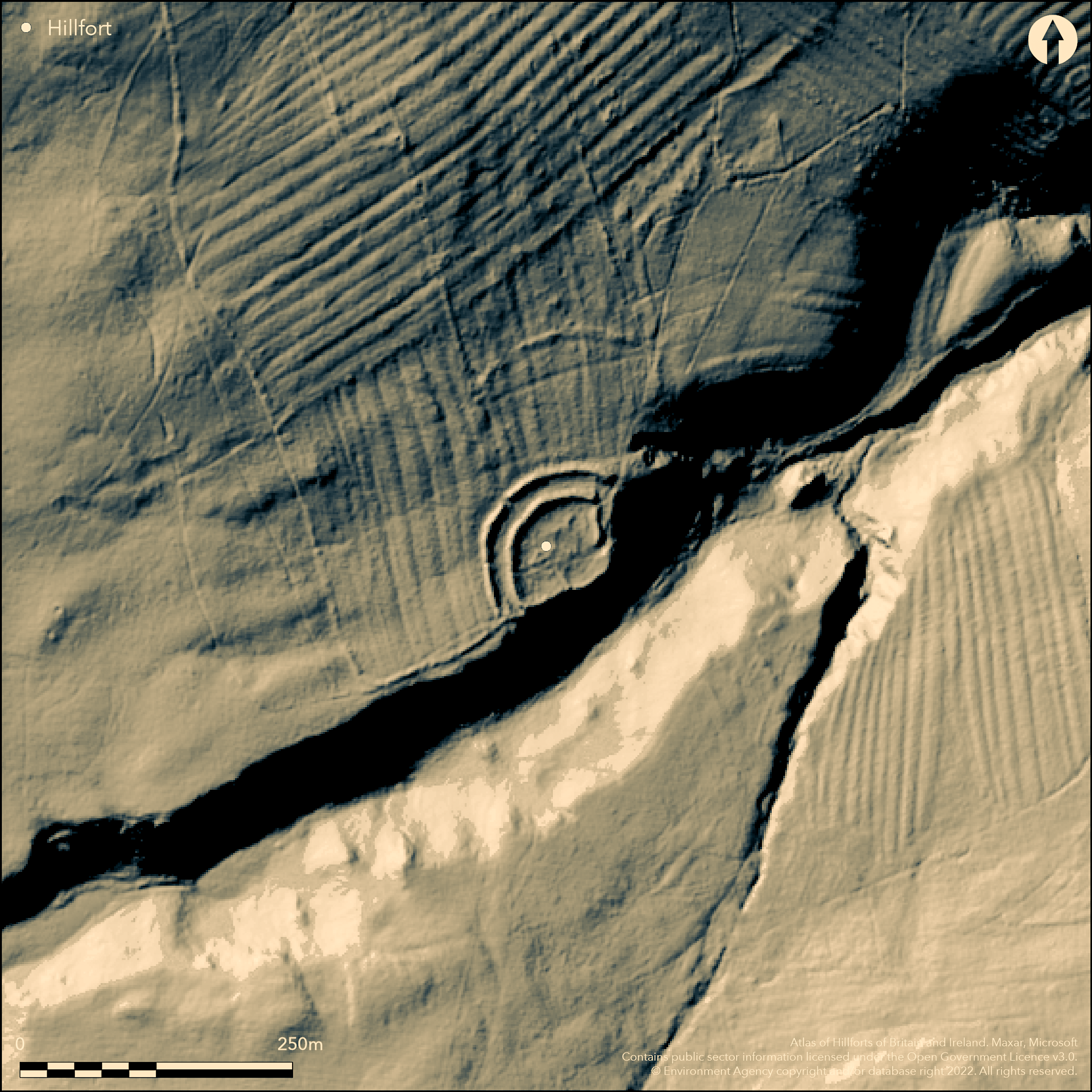
LiDAR 1m DTM Hillshade
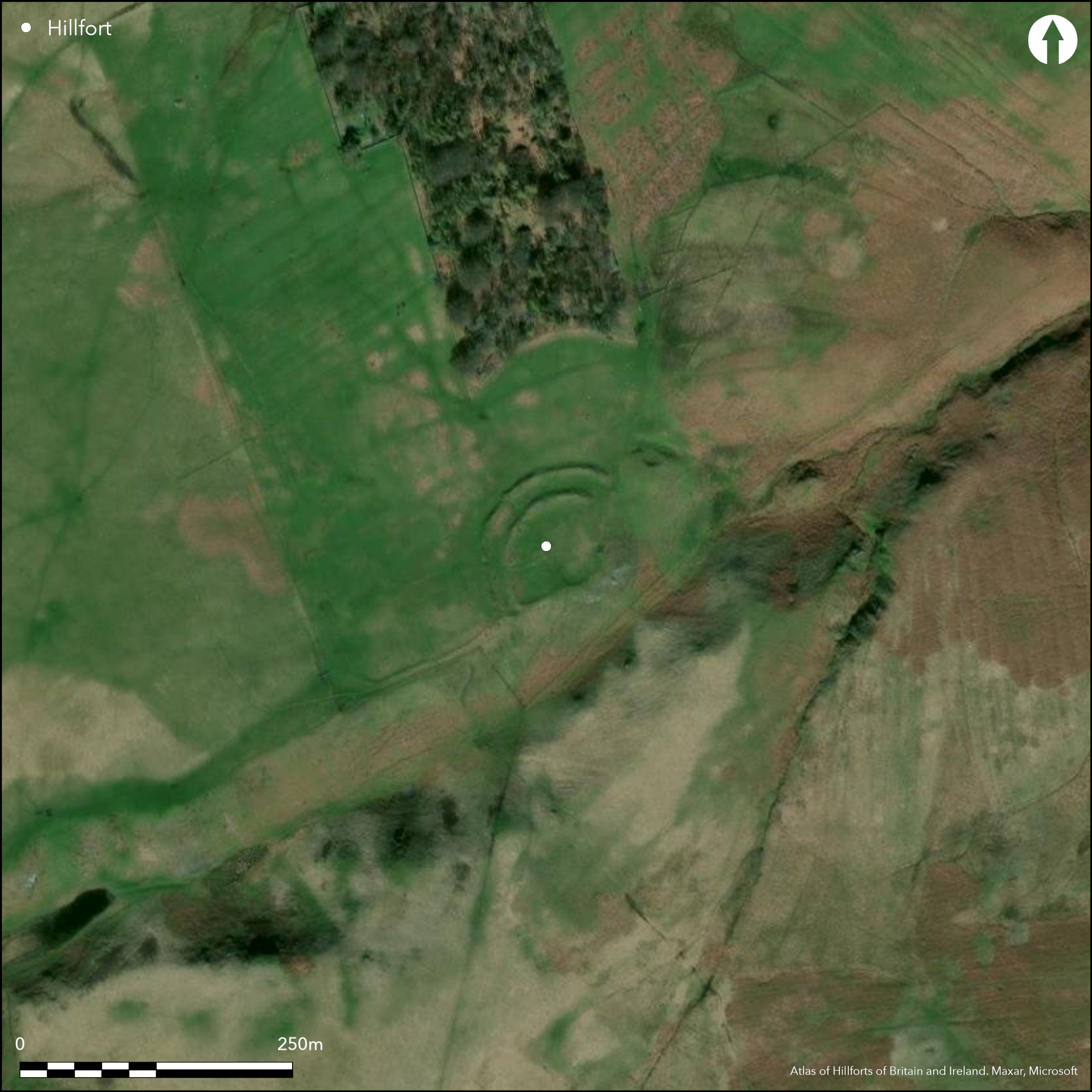
Satellite Imagery
LiDAR 1m DTM Hillshade
Satellite Imagery
Scroll left/right to view further images.
HER: Northumberland 3190 (None)
NMR: NU 01 SW 1 (1033862)
SM: 1021382
NGR: NU 0041 1463
X: 400410 Y: 614630 (OSGB36)
To the SW of Ingram, overlooking Middledean Burn in the E, Middle Dean Camp is a bivallate cliff-edge fort precipitous in the S and E and defined in the N, NE and W by two prominent concentric arcs. The enclosed area measures 0.2 ha, 60m NE-SW and 45m transversely and was possibly sited with reference to a projection in the SE taking advantage of the ravine for additional protection. The turf covered earth and stone ramparts lie 7m apart and are approximately 2m high and 6m wide. Sandstone blocks with a maximum height of 0.65m are visible in places in the outer rampart. Broad rig cultivation is visible on aerial imagery running up the outer ramparts in the N and W possibly enhancing their height. There is no evidence of ditches. A 2.8m wide break in the outer rampart in the NW, lined with partially buried stone slabs in the N and possibly the S appears original. No corresponding break can be seen through the inner rampart although there is a lowering of the bank in this area which might indicate medieval disturbance. Further staggered breaks occur in the NE, 4m wide through the outer rampart and 2.7m wide through the inner. A line of three stones lie on the summit of the inner rampart, their purpose unclear. Five circular hut platforms have been recorded within the interior between 7-10m in diameter. Minimal investigations, presumed Iron Age but undated. Recorded on 1856-65 OS mapping. Scheduled
Citizen Science: ✗
Reliability of Data: Confirmed
Reliability of Interpretation: Confirmed
X: -222090 Y: 7444909 (EPSG: 3857)
Longitude: -1.9950672628608666 Latitude: 55.42560492601839 (EPSG:4326)
Country: England
Current County or Unitary Authority: Northumberland
Historic County: Northumberland
Current Parish/Community/Council/Townland: Ingram
Lies within Ingram Farm (NU01NW 187) an area of intensive and extensive prehistoric to post medieval settlement, agricultural and funerary activity.
| Extant | ✓ |
| Cropmark | ✗ |
| Likely Destroyed | ✗ |
Satellite imagery suggests scrub and bracken or possibly heath
| Woodland | ✗ |
| Commercial Forestry Plantation | ✗ |
| Parkland | ✗ |
| Pasture (Grazing) | ✗ |
| Arable | ✗ |
| Scrub/Bracken | ✓ |
| Bare Outcrop | ✗ |
| Heather/Moorland | ✗ |
| Heath | ✓ |
| Built-up | ✗ |
| Coastal Grassland | ✗ |
| Other | ✗ |
A bivallate cliff-edge fort lying at 259m OD and possibly sited with reference to a projection in the SE
| Contour Fort | ✗ |
| Partial Contour Fort | ✗ |
| Promontory Fort | ✓ |
| Hillslope Fort | ✗ |
| Level Terrain Fort | ✗ |
| Marsh Fort | ✗ |
| Multiple Enclosure Fort | ✗ |
| Hilltop | ✗ |
| Coastal Promontory | ✗ |
| Inland Promontory | ✓ |
| Valley Bottom | ✗ |
| Knoll/Hillock/Outcrop | ✗ |
| Ridge | ✗ |
| Cliff/Plateau-edge/Scarp | ✓ |
| Hillslope | ✓ |
| Lowland | ✗ |
| Spur | ✗ |
Dominant Topographic Feature: Steep scarp in the S
| North | ✗ |
| Northeast | ✗ |
| East | ✗ |
| Southeast | ✓ |
| South | ✓ |
| Southwest | ✗ |
| West | ✗ |
| Northwest | ✗ |
| Level | ✗ |
Altitude: 259.0m
N/A
Undated, presumed Iron Age
Reliability: D - None
| Pre 1200BC | ✗ |
| 1200BC - 800BC | ✗ |
| 800BC - 400BC | ✗ |
| 400BC - AD50 | ✗ |
| AD50 - AD400 | ✗ |
| AD400 - AD 800 | ✗ |
| Post AD800 | ✗ |
| Unknown | ✓ |
| Pre Hillfort: | None |
| Post Hillfort: | Possible medieval disturbance |
Recorded on 1856-65 OS mapping. General reference in MacLauchlan 1867. OS Archaeology Division Field Investigations in 1957, 1969, 1976. Scheduled.
| 1st Identified Written Reference (1867): | None |
| Other (1934): | Scheduled |
| Other (1957): | Field investigation |
| Other (1969): | Field investigation |
| Other (1976): | Field investigation |
| 1st Identified Map Depiction (None): | None |
Five circular hut platforms set into the E and NE-facing slopes between 7-10m in diameter. No entrances to the huts have been identified.
Middledean Burn lies to the E
| None | ✓ |
| Spring | ✗ |
| Stream | ✗ |
| Pool | ✗ |
| Flush | ✗ |
| Well | ✗ |
| Other | ✗ |
None
| No Known Features | ✗ |
| Round Stone Structures | ✗ |
| Rectangular Stone Structures | ✗ |
| Curvilinear Platforms | ✓ |
| Other Roundhouse Evidence | ✗ |
| Pits | ✗ |
| Quarry Hollows | ✗ |
| Other | ✗ |
None
| No Known Excavation | ✓ |
| Pits | ✗ |
| Postholes | ✗ |
| Roundhouses | ✗ |
| Rectangular Structures | ✗ |
| Roads/Tracks | ✗ |
| Quarry Hollows | ✗ |
| Other | ✗ |
| Nothing Found | ✗ |
None
| No Known Geophysics | ✓ |
| Pits | ✗ |
| Roundhouses | ✗ |
| Rectangular Structures | ✗ |
| Roads/Tracks | ✗ |
| Quarry Hollows | ✗ |
| Other | ✗ |
| Nothing Found | ✗ |
None
| No Known Finds | ✓ |
| Pottery | ✗ |
| Metal | ✗ |
| Metalworking | ✗ |
| Human Bones | ✗ |
| Animal Bones | ✗ |
| Lithics | ✗ |
| Environmental | ✗ |
| Other | ✗ |
None
| APs Not Checked | ✓ |
| None | ✗ |
| Roundhouses | ✗ |
| Rectangular Structures | ✗ |
| Pits | ✗ |
| Postholes | ✗ |
| Roads/Tracks | ✗ |
| Other | ✗ |
A 2.8m wide break in the outer rampart in the NW, lined with partially buried stone slabs in the N and possibly the S, probably original. No corresponding break can be seen through the inner rampart although there is a lowering of the bank in this area which might indicate medieval disturbance. Further staggered breaks occur in the NE, 4m wide through the outer rampart and 2.7m wide through the inner.
| 3: | None |
| 2: | None |
Guard Chambers: ✗
Chevaux de Frise: ✗
| 1. Simple Gap (North west): | Outer rampart |
| 2. Oblique (North east): | Inner rampart |
| 2. Oblique (North east): | Outer rampart |
Two prominent concentric ramparts in the N, NE and W aligned on the cliff edge. Turf covered earth and stone spaced 7m apart and approximately 2m high and 6m wide. Sandstone blocks with a maximum height of 0.65m are visible in places in the outer rampart. Field banks running up the outer ramparts in the N and W have possibly enhanced the height of the ramparts. No evidence of ditches.
| Area 1: | 0.2ha. |
| Total: | 0.2ha. |
Total Footprint Area: 0.53ha.
None
| ✗ | Estimated from satellite imagery |
| ✗ | None |
| NE Quadrant: | 2 |
| SE Quadrant: | None |
| SW Quadrant: | None |
| NW Quadrant: | 2 |
| Total: | 2 |
| Partial Univallate | ✗ |
| Univallate | ✗ |
| Partial Bivallate | ✓ |
| Bivallate | ✗ |
| Partial Multivallate | ✗ |
| Multivallate | ✗ |
| Unknown | ✗ |
| Partial Univallate | ✗ |
| Univallate | ✗ |
| Partial Bivallate | ✗ |
| Bivallate | ✗ |
| Partial Multivallate | ✗ |
| Multivallate | ✗ |
None
| None | ✗ |
| Earthen Bank | ✓ |
| Stone Wall | ✓ |
| Rubble | ✓ |
| Wall-walk | ✗ |
| Evidence of Timber | ✗ |
| Vitrification | ✗ |
| Other Burning | ✗ |
| Palisade | ✗ |
| Counter Scarp Bank | ✗ |
| Berm | ✗ |
| Unfinished | ✗ |
| Other | ✗ |
None
| None | ✗ |
| Earthen Bank | ✗ |
| Stone Wall | ✗ |
| Murus Duplex | ✗ |
| Timber-framed | ✗ |
| Timber-laced | ✗ |
| Vitrification | ✗ |
| Other Burning | ✗ |
| Palisade | ✗ |
| Counter Scarp Bank | ✗ |
| Berm | ✗ |
| Unfinished | ✗ |
| No Known Excavation | ✓ |
| Other | ✗ |
| ✗ | None |
| ✗ | None |
Number of Ditches: None
| ✗ | None |
Hogg, A.H.A. 1979. British Hill-Forts. An Index. British Archaeological Reports, British Series 62; 123
Jobey, G.1965. Hillforts and Settlements in Northumberland. Archaeol Aeliana (4th Series) 43, 63, No. 43
MacLauchlan, H. 1867. Notes not included in the memoirs already published on Roman roads in Northumberland (London), 54
Atlas of Hillforts:
Wikidata:
This work is licensed under CC BY-SA 4.0

 and should be cited as:
Lock, Gary and Ralston, Ian. 2024. Atlas of Hillforts of Britain and Ireland. Available at: https://hillforts.arch.ox.ac.uk
Document Version 1.1