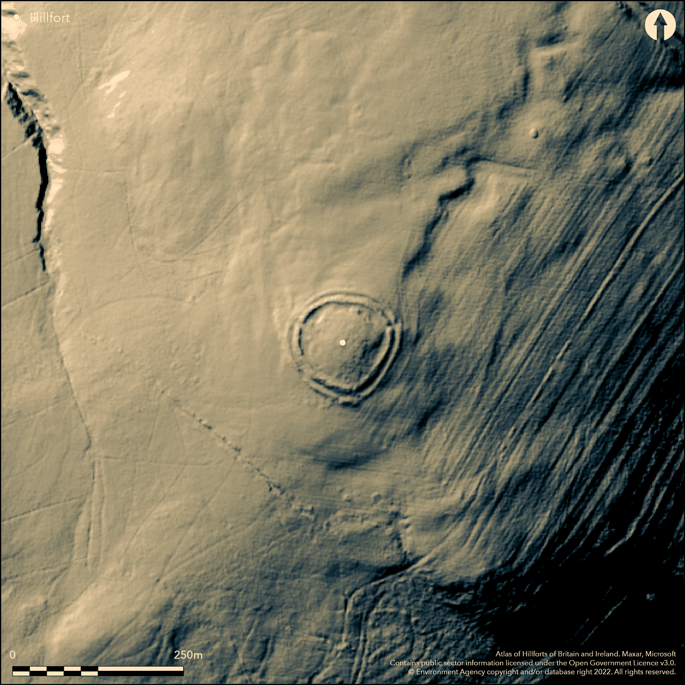
LiDAR 1m DTM Hillshade
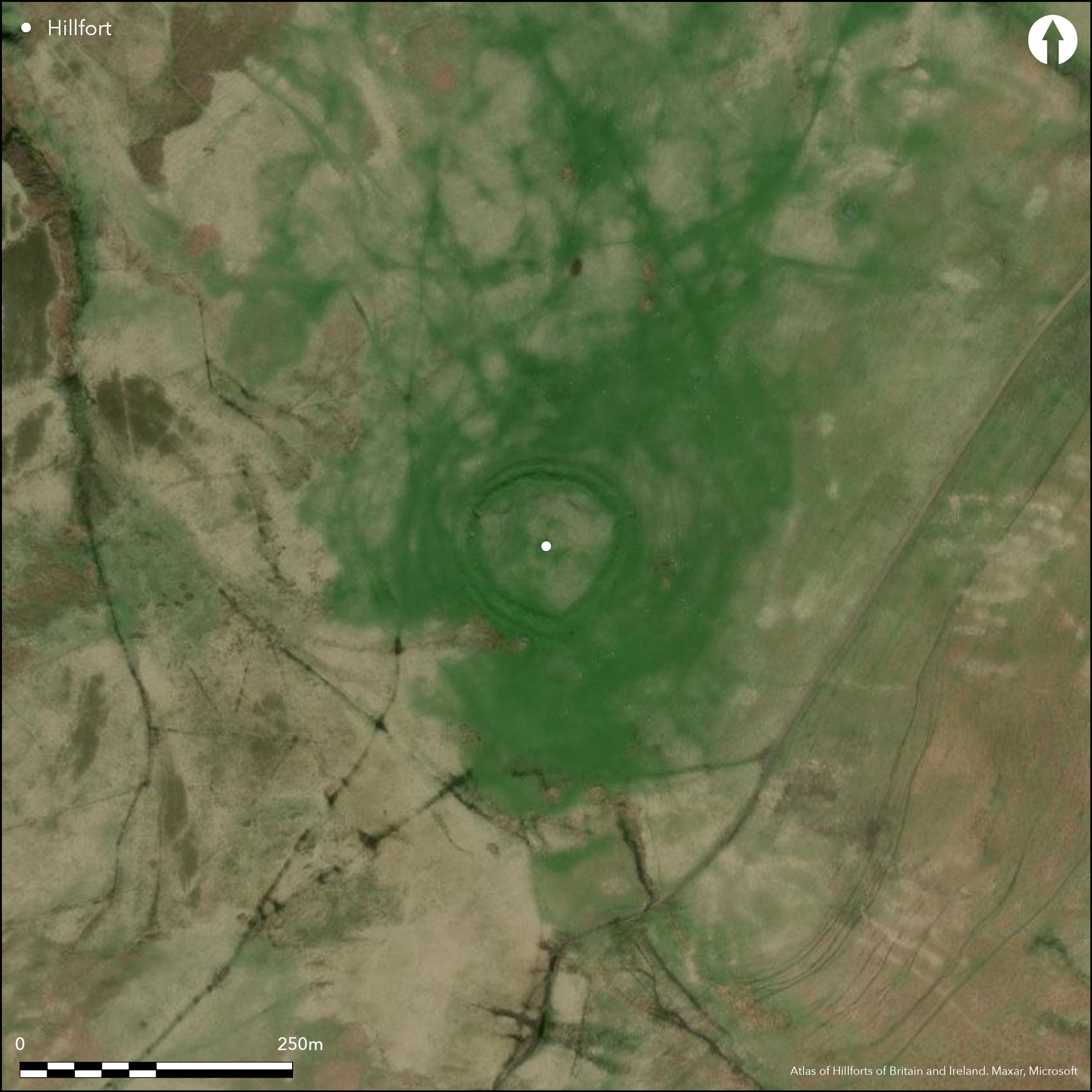
Satellite Imagery
LiDAR 1m DTM Hillshade
Satellite Imagery
Scroll left/right to view further images.
HER: Northumberland 3191 (60295 (Canmore))
NMR: NU 01 SW 2 (5329)
SM: 1021382
NGR: NU 0130 1443
X: 401306 Y: 614438 (OSGB36)
Lying 2km to the SW of Ingram village and approximately 870m to the NE of Old Fawdon (Atlas No. 0562) a sub-circular bivallate hillfort situated on a knoll on the summit of Wether Hill. The hill commands panoramic views except in the SW where the ground rises towards Cochrane Pike. Excavation and field survey have confirmed a construction sequence which followed from an unenclosed settlement to palisaded enclosure, possibly with three phases of construction, and later two banks which enclosed 0.24ha. The palisaded enclosure which cut through three ring groove houses was partially destroyed by quarrying for the construction of the hillfort. The hillfort proper comprises a substantial inner rampart 7.4m wide and 1.8m high on the outer scarp and an outer rampart 6.5m wide and 1.1m high. Radiocarbon dates acquired from excavations suggest the outer earthen rampart was supplemented by the inner stone rampart a century later (Topping and McOmish 2000, 7-8). Some damage has occurred in the E through robbing and encroaching ridge and furrow. A break in the NW is considered to be an original entrance with a further break in the inner rampart in the NE probably later. The entrance of the stone-built enclosure coincides with that of the palisade, suggesting this was a direct replacement (Oswald et al. 2008). Further breaks are visible on satellite imagery. Within the interior 15 ring groove houses have been identified, from which radiocarbon dates suggest several phases, six of which are possibly contemporary with the hillfort. Three further stone built houses have also been identified. A possible contemporary trackway crosses the enclosure from the N to the entrance in the W. A cross-ridge dyke with a double bank lies between the hillfort and Cochrane Pike. An earthwork survey and excavations were carried out by the Northumberland Archaeological Group (NAG) in 1998 and further excavations are currently underway (2012 onwards). A prehistoric inhumation burial and cremation burials have also been investigated outside the hillfort on Wether Hlll (Topping 2004), houses in the Romano-British period when ramparts not used..
Citizen Science: ✗
Reliability of Data: Confirmed
Reliability of Interpretation: Confirmed
X: -220514 Y: 7444571 (EPSG: 3857)
Longitude: -1.9809110868958966 Latitude: 55.423878280083805 (EPSG:4326)
Country: England
Current County or Unitary Authority: Northumberland
Historic County: Northumberland
Current Parish/Community/Council/Townland: Ingram
None
| Extant | ✓ |
| Cropmark | ✗ |
| Likely Destroyed | ✗ |
Moorland
| Woodland | ✗ |
| Commercial Forestry Plantation | ✗ |
| Parkland | ✗ |
| Pasture (Grazing) | ✗ |
| Arable | ✗ |
| Scrub/Bracken | ✗ |
| Bare Outcrop | ✗ |
| Heather/Moorland | ✓ |
| Heath | ✗ |
| Built-up | ✗ |
| Coastal Grassland | ✗ |
| Other | ✗ |
At 303m OD, a contour fort lying on a grassy knoll with the ground sloping gently to the SW.
| Contour Fort | ✓ |
| Partial Contour Fort | ✗ |
| Promontory Fort | ✗ |
| Hillslope Fort | ✗ |
| Level Terrain Fort | ✗ |
| Marsh Fort | ✗ |
| Multiple Enclosure Fort | ✗ |
| Hilltop | ✓ |
| Coastal Promontory | ✗ |
| Inland Promontory | ✗ |
| Valley Bottom | ✗ |
| Knoll/Hillock/Outcrop | ✓ |
| Ridge | ✗ |
| Cliff/Plateau-edge/Scarp | ✗ |
| Hillslope | ✗ |
| Lowland | ✗ |
| Spur | ✗ |
Dominant Topographic Feature: Grassy knoll on the summit of Wether Hill
| North | ✗ |
| Northeast | ✗ |
| East | ✗ |
| Southeast | ✗ |
| South | ✗ |
| Southwest | ✓ |
| West | ✗ |
| Northwest | ✗ |
| Level | ✗ |
Altitude: 303.0m
N/A
A total of 19 radiocarbon dates. Two samples from palisade trench 2220 ± 90 BP (420-40 cal BC) and 2180 ± 80 BP (400-40 cal BC); one from upper fills of early palisade trench 2000 ± 45 BP (110BC-AD 90); interior and ramparts - 17 samples taken including construction trenches of ring-groove houses showing several phases of construction. Radiocarbon dates of 2070 ± 45 BP (210 cal BC-cal AD50) and 2145 ± 45 BP (370-40 cal BC) were obtained from charcoal from the core of the rampart. (Detail taken from Passmore and Waddington, 2012). Horn (Forthcoming) suggests the hillfort start 390-295 BC, ends 320-155 BC.
Reliability: A - High
| Pre 1200BC | ✗ |
| 1200BC - 800BC | ✗ |
| 800BC - 400BC | ✓ |
| 400BC - AD50 | ✓ |
| AD50 - AD400 | ✗ |
| AD400 - AD 800 | ✗ |
| Post AD800 | ✗ |
| Unknown | ✗ |
| Pre Hillfort: | None |
| Post Hillfort: | None |
| Artefactual: | None |
| C14: | None |
The site is shown as 'Camp' on 1856-65 OS mapping; general reference in MacLauchlan 1867. Field investigation in 1957 and 1976. Investigation by the Northumberland Archaeology Group (Topping, 2004) including earthwork survey, geophysics and excavation. Nothing was recorded during a geophysical survey in 1998. Scheduled
| 1st Identified Written Reference (1867): | MacLauchlan |
| Other (1934): | Scheduled |
| Other (1957): | Field investigation |
| Other (1976): | Field investigation |
| Geophysical Survey (1998): | AML |
| Other (2002): | Visited by Hillfort Study Group |
| 1st Identified Map Depiction (None): | OS mapping |
| Excavation (None): | Part of the Ingram and Upper Breamish Valley Landscape Project |
Within the interior 15 ring groove houses have been identified, six of which are possibly contemporary with the hillfort. Three further stone built houses have also been identified.
None
| None | ✓ |
| Spring | ✗ |
| Stream | ✗ |
| Pool | ✗ |
| Flush | ✗ |
| Well | ✗ |
| Other | ✗ |
Ring-groove and ring-ditch houses
| No Known Features | ✗ |
| Round Stone Structures | ✓ |
| Rectangular Stone Structures | ✗ |
| Curvilinear Platforms | ✗ |
| Other Roundhouse Evidence | ✓ |
| Pits | ✗ |
| Quarry Hollows | ✗ |
| Other | ✗ |
None
| No Known Excavation | ✗ |
| Pits | ✗ |
| Postholes | ✗ |
| Roundhouses | ✓ |
| Rectangular Structures | ✗ |
| Roads/Tracks | ✗ |
| Quarry Hollows | ✗ |
| Other | ✗ |
| Nothing Found | ✗ |
None
| No Known Geophysics | ✓ |
| Pits | ✗ |
| Roundhouses | ✗ |
| Rectangular Structures | ✗ |
| Roads/Tracks | ✗ |
| Quarry Hollows | ✗ |
| Other | ✗ |
| Nothing Found | ✗ |
None
| No Known Finds | ✓ |
| Pottery | ✗ |
| Metal | ✗ |
| Metalworking | ✗ |
| Human Bones | ✗ |
| Animal Bones | ✗ |
| Lithics | ✗ |
| Environmental | ✗ |
| Other | ✗ |
NO APPARENT FEATURES
| APs Not Checked | ✓ |
| None | ✗ |
| Roundhouses | ✗ |
| Rectangular Structures | ✗ |
| Pits | ✗ |
| Postholes | ✗ |
| Roads/Tracks | ✗ |
| Other | ✗ |
The entrance in the NW is considered to be original with a further break in the inner rampart in the NE probably later. The entrance of the stone-built enclosure coincides with that of the palisade, suggesting this was a direct replacement (Oswald 2006).
| 4: | None |
| 2: | None |
Guard Chambers: ✗
Chevaux de Frise: ✗
| 1. Simple Gap (North west): | Inner rampart |
| 1. Simple Gap (North west): | Outer rampart |
Unenclosed settlement to palisaded enclosure, possibly with three phases of construction. Later two banks enclosing 0.24ha. The hillfort proper comprises a substantial inner rampart 7.4m wide and 1.8m high on the outer scarp and an outer rampart 6.5m wide and 1.1m high. Radiocarbon dates suggest the outer earthen rampart was supplemented by the inner stone rampart a century later
| Area 1: | 0.24ha. |
| Total: | 0.24ha. |
Total Footprint Area: 0.69ha.
None
| ✓ | Mistakenly described as univallate by Hogg (1979) and earlier authorities. Whole site footprint estimated from satelite imagery |
| ✓ | None |
| NE Quadrant: | 2 |
| SE Quadrant: | 2 |
| SW Quadrant: | 2 |
| NW Quadrant: | 2 |
| Total: | 2 |
| Partial Univallate | ✗ |
| Univallate | ✗ |
| Partial Bivallate | ✗ |
| Bivallate | ✓ |
| Partial Multivallate | ✗ |
| Multivallate | ✗ |
| Unknown | ✗ |
| Partial Univallate | ✗ |
| Univallate | ✓ |
| Partial Bivallate | ✗ |
| Bivallate | ✗ |
| Partial Multivallate | ✗ |
| Multivallate | ✗ |
None
| None | ✗ |
| Earthen Bank | ✓ |
| Stone Wall | ✗ |
| Rubble | ✗ |
| Wall-walk | ✗ |
| Evidence of Timber | ✗ |
| Vitrification | ✗ |
| Other Burning | ✗ |
| Palisade | ✗ |
| Counter Scarp Bank | ✗ |
| Berm | ✗ |
| Unfinished | ✗ |
| Other | ✗ |
None
| None | ✗ |
| Earthen Bank | ✓ |
| Stone Wall | ✓ |
| Murus Duplex | ✗ |
| Timber-framed | ✗ |
| Timber-laced | ✗ |
| Vitrification | ✗ |
| Other Burning | ✗ |
| Palisade | ✓ |
| Counter Scarp Bank | ✗ |
| Berm | ✗ |
| Unfinished | ✗ |
| No Known Excavation | ✗ |
| Other | ✗ |
| ✗ | None |
| ✗ | None |
Number of Ditches: None
| ✗ | None |
English Heritage AML. 1998, Wether Hill Hillfort, Ingram: geophysical survey. AML unpublished report.
Hamilton, D. 2010. The use of radiocarbon and Bayesian modelling to (re)write later Iron Age settlement histories in east-central Britain. PhD Thesis, University of Leicester.
Horn, J. Forthcoming. The dating of hillforts in Britain and Ireland. Unpublished PhD thesis, University of Edinburgh.
Jobey, G.1965. Hillforts and Settlements in Northumberland. Archaeol Aeliana (4th Series) 43, 63
MacLauchlan, H. 1867. Notes not included in the memoirs already published on Roman roads in Northumberland (London), 55.
Oswald, A. Ainsworth, A. and Pearson, T. 2008. Iron Age hillforts in their landscape contexts: a fresh look at the field evidence in the Northumberland Cheviots. Arch Aeliana 5th series 37, 1-45
Passmore, D.G. and Waddington, C. 2012. Archaeology and Environment in Northumberland. Till-Tweed studies, Vol 2. Oxbow
Topping, P. 2004. Hillforts, farm and fields. Excavations on Wether Hill, Ingram 1993-2002. in P Frodsham (ed.) Archaeology in Northumberland National Park. York, CBA Res Rep 136, 190-201
Topping, P. and McOmish, D. 2000. Excavations at Wether Hill, Northumberland, 1999: final interim report. NAG News: The Newsletter of the Northumberland Archaeological Group.
Atlas of Hillforts:
Wikidata:
This work is licensed under CC BY-SA 4.0

 and should be cited as:
Lock, Gary and Ralston, Ian. 2024. Atlas of Hillforts of Britain and Ireland. Available at: https://hillforts.arch.ox.ac.uk
Document Version 1.1