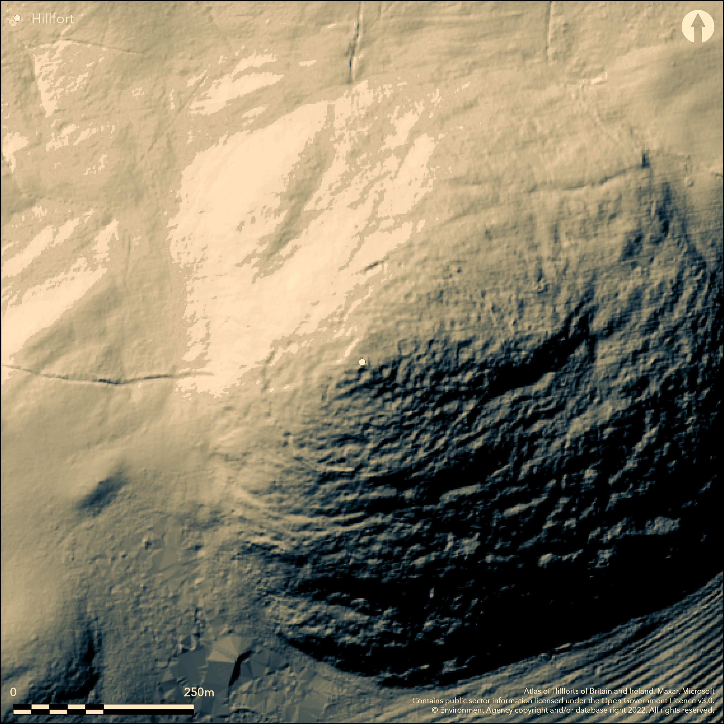
LiDAR 1m DTM Hillshade
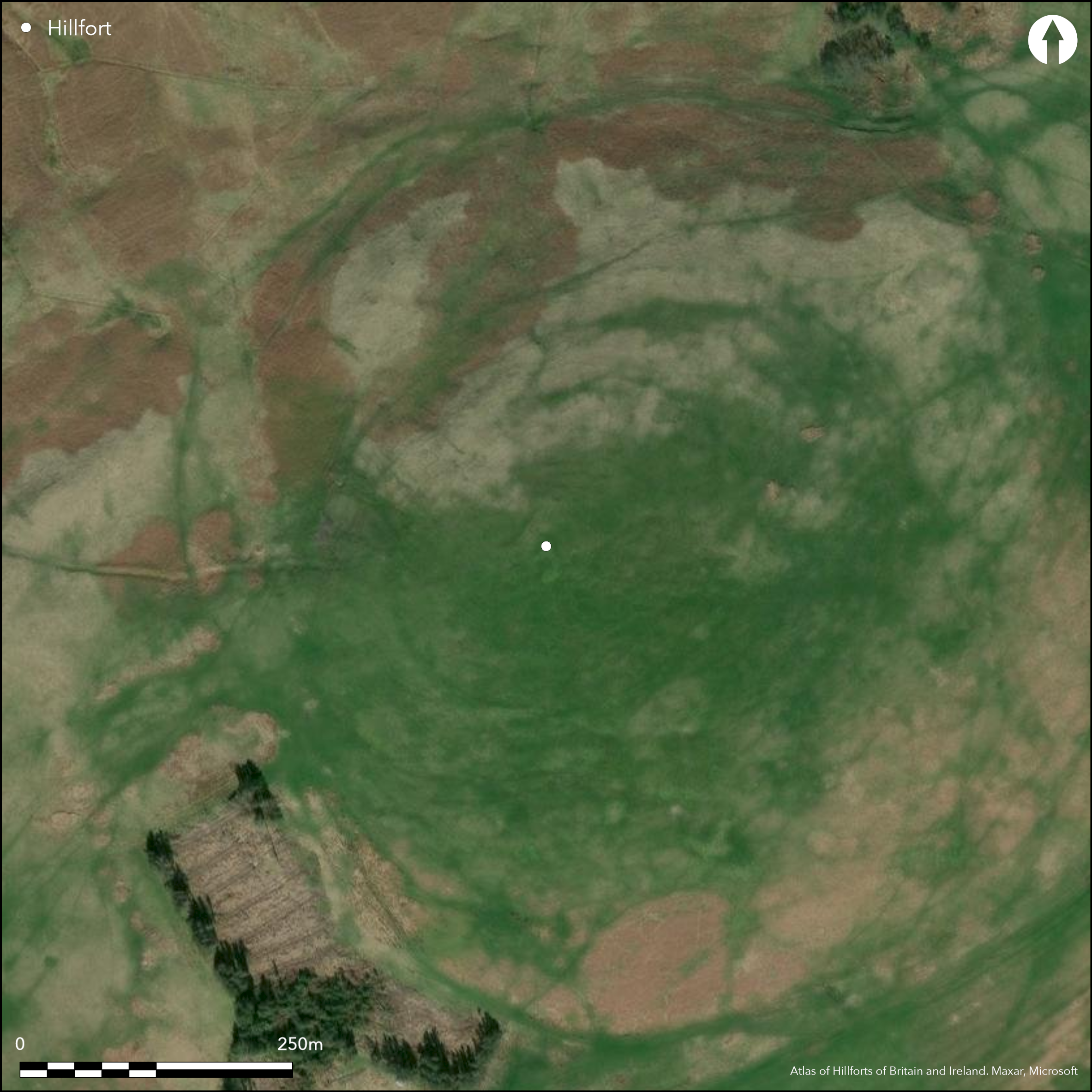
Satellite Imagery
LiDAR 1m DTM Hillshade
Satellite Imagery
Scroll left/right to view further images.
HER: Northumberland 3195 (None)
NMR: NU 01 SW 6 (5351)
SM: 1006543
NGR: NU 0225 1414
X: 402250 Y: 614140 (OSGB36)
A large double-palisaded enclosure lying 1.5km to the NE of Great Ryle on the summit of Old Fawdon Hill. The location offers commanding views in all directions, overlooking a number of other hillforts and enclosures. Oval in plan, it measures 200m NE-SW by 150m transversely, enclosing 2.4ha. A slight intermittent rampart measuring 0.4m high internally and 0.7m high externally, seen elsewhere as a shallow groove or trench 0.3-0.6m wide and 0.5m deep for a palisade, follows the 300m contour around the hill. The inner trench is represented by a groove 15m long, 0.4m wide and 0.15m deep. They can be seen in places as vegetation marks. Both are absent in the NW where the ground is steepest. Topping (1988) suggests the site might be unfinished. Further ditch circuits might now be obscured by the course grass (ibid.). A 2.5m wide oblique gap, probably an entrance, lies in the outer trench in the S with the terminal in the W turning slightly inwards. Others might have existed in the E where there are gaps in the trench (Gates and Ainsworth 1979). Internally there are the remains of up to 61 roundhouses, 48 of which are definite. Three ring banks and two ring-grooves houses range in size from 7.8-12m in diameter, the remainder are represented by shallow scoops 4-8m in diameter. The majority of the larger roundhouses lie in the area between the two circuits of palisade trench. Twenty-seven, two, or which are large, lie within the 0.6ha area created by the inner palisade (ibid.). Today the remains of the rampart survives as a low, turf covered stony scarp. A further E-W length of bank 0.7m high and 4.0m wide with a ditch 0.7m deep and 4m wide on its uphill side, lies to the W of the enclosure and forms a track extending for 180m towards the Fawdon Burn. Its relationship to the enclosure is unknown. The site is shown on 1856-65 OS mapping. Undated.
Citizen Science: ✗
Reliability of Data: Confirmed
Reliability of Interpretation: Confirmed
X: -218854 Y: 7444045 (EPSG: 3857)
Longitude: -1.965998620191545 Latitude: 55.42119730110003 (EPSG:4326)
Country: England
Current County or Unitary Authority: Northumberland
Historic County: Northumberland
Current Parish/Community/Council/Townland: Ingram
The remains of the rampart survive as a low, turf covered stony scarp
| Extant | ✓ |
| Cropmark | ✗ |
| Likely Destroyed | ✗ |
Rough grassland within the Northumberland National Park.
| Woodland | ✗ |
| Commercial Forestry Plantation | ✗ |
| Parkland | ✗ |
| Pasture (Grazing) | ✓ |
| Arable | ✗ |
| Scrub/Bracken | ✗ |
| Bare Outcrop | ✗ |
| Heather/Moorland | ✓ |
| Heath | ✗ |
| Built-up | ✗ |
| Coastal Grassland | ✗ |
| Other | ✗ |
The remains of a contour fort lying on conical hill at 315m OD. Although the ramparts follow the contour, the internal area is higher
| Contour Fort | ✓ |
| Partial Contour Fort | ✗ |
| Promontory Fort | ✗ |
| Hillslope Fort | ✗ |
| Level Terrain Fort | ✗ |
| Marsh Fort | ✗ |
| Multiple Enclosure Fort | ✓ |
| Hilltop | ✓ |
| Coastal Promontory | ✗ |
| Inland Promontory | ✗ |
| Valley Bottom | ✗ |
| Knoll/Hillock/Outcrop | ✗ |
| Ridge | ✗ |
| Cliff/Plateau-edge/Scarp | ✗ |
| Hillslope | ✗ |
| Lowland | ✗ |
| Spur | ✗ |
Dominant Topographic Feature: Conical hill
| North | ✗ |
| Northeast | ✗ |
| East | ✗ |
| Southeast | ✗ |
| South | ✗ |
| Southwest | ✗ |
| West | ✗ |
| Northwest | ✗ |
| Level | ✓ |
Altitude: 315.0m
N/A
Undated, presumed Iron Age
Reliability: D - None
| Pre 1200BC | ✗ |
| 1200BC - 800BC | ✗ |
| 800BC - 400BC | ✗ |
| 400BC - AD50 | ✗ |
| AD50 - AD400 | ✗ |
| AD400 - AD 800 | ✗ |
| Post AD800 | ✗ |
| Unknown | ✓ |
| Pre Hillfort: | None |
| Post Hillfort: | Trig point |
| Morphology/Earthwork/Typology: | None |
Shown on 1856-65 OS mapping; general reference in MacLauchlan (1867). The site was surveyed by Ainsworth and Gates 1979, ref. no. 662366 and in 1988 as part of the SE Cheviots project.
| 1st Identified Written Reference (1867): | None |
| Other (1934): | Scheduled |
| Other (1976): | Field investigation |
| Earthwork Survey (1979): | Ainsworth and Gates |
| Earthwork Survey (1988): | SE Cheviots Project |
| 1st Identified Map Depiction (None): | None |
Remains of up to 61 roundhouses, 48 of which are definite. Three ring banks and two ring-grooves houses range in size from 7.8-12m in diameter, the remainder are represented by shallow scoops 4-8m in diameter. The majority of the larger roundhouses lie in the area between the two circuits of palisade trench. Twenty-seven, 2, or which are large, lie within the 0.6ha area created by the inner palisade
Fawdon Burn lies to the W
| None | ✓ |
| Spring | ✗ |
| Stream | ✗ |
| Pool | ✗ |
| Flush | ✗ |
| Well | ✗ |
| Other | ✗ |
In addition to ring bank and ring-grooves there are also simple scoops representing houses. Quarry hollows behind the rampart
| No Known Features | ✗ |
| Round Stone Structures | ✗ |
| Rectangular Stone Structures | ✗ |
| Curvilinear Platforms | ✓ |
| Other Roundhouse Evidence | ✓ |
| Pits | ✗ |
| Quarry Hollows | ✓ |
| Other | ✗ |
None
| No Known Excavation | ✓ |
| Pits | ✗ |
| Postholes | ✗ |
| Roundhouses | ✗ |
| Rectangular Structures | ✗ |
| Roads/Tracks | ✗ |
| Quarry Hollows | ✗ |
| Other | ✗ |
| Nothing Found | ✗ |
None
| No Known Geophysics | ✓ |
| Pits | ✗ |
| Roundhouses | ✗ |
| Rectangular Structures | ✗ |
| Roads/Tracks | ✗ |
| Quarry Hollows | ✗ |
| Other | ✗ |
| Nothing Found | ✗ |
None
| No Known Finds | ✓ |
| Pottery | ✗ |
| Metal | ✗ |
| Metalworking | ✗ |
| Human Bones | ✗ |
| Animal Bones | ✗ |
| Lithics | ✗ |
| Environmental | ✗ |
| Other | ✗ |
None
| APs Not Checked | ✗ |
| None | ✗ |
| Roundhouses | ✓ |
| Rectangular Structures | ✗ |
| Pits | ✗ |
| Postholes | ✗ |
| Roads/Tracks | ✗ |
| Other | ✗ |
A 2.5m wide gap, probably an entrance lies in the outer trench in the S with the terminal in the W turning slightly inwards, giving an oblique appearance. Others might have existed in the E where there are gaps in the trench
| 3: | Possible gaps in palisade |
| 2: | None |
Guard Chambers: ✗
Chevaux de Frise: ✗
| 1. In-turned (South): | Western terminal |
| 1. Simple Gap (South): | Eastern terminal |
Oval in plan, measuring 200m NE-SW by 150m transversely, enclosing 2.4ha. A slight intermittent rampart measuring 0.4m high internally and 0.7m high externally, seen elsewhere as a shallow groove or trench 0.3-0.6m wide and 0.5m deep for a palisade, follows the 300m contour around the hill. The inner trench is represented by a groove 15m long, 0.4m wide and 0.15m deep. They can be seen in places as vegetation marks. Both are absent in the NW where the ground is steepest.
| Area 1: | 0.6ha. |
| Area 2: | 2.4ha. |
| Total: | 2.4ha. |
Total Footprint Area: Noneha.
None
| ✗ | None |
| ✗ | Absent from the NW |
| NE Quadrant: | 2 |
| SE Quadrant: | 2 |
| SW Quadrant: | 2 |
| NW Quadrant: | None |
| Total: | 2 |
| Partial Univallate | ✗ |
| Univallate | ✗ |
| Partial Bivallate | ✓ |
| Bivallate | ✗ |
| Partial Multivallate | ✗ |
| Multivallate | ✗ |
| Unknown | ✗ |
| Partial Univallate | ✗ |
| Univallate | ✗ |
| Partial Bivallate | ✗ |
| Bivallate | ✗ |
| Partial Multivallate | ✗ |
| Multivallate | ✗ |
Topping (1988) suggests the site might be unfinished
| None | ✗ |
| Earthen Bank | ✓ |
| Stone Wall | ✗ |
| Rubble | ✓ |
| Wall-walk | ✗ |
| Evidence of Timber | ✗ |
| Vitrification | ✗ |
| Other Burning | ✗ |
| Palisade | ✓ |
| Counter Scarp Bank | ✗ |
| Berm | ✗ |
| Unfinished | ✓ |
| Other | ✗ |
None
| None | ✗ |
| Earthen Bank | ✗ |
| Stone Wall | ✗ |
| Murus Duplex | ✗ |
| Timber-framed | ✗ |
| Timber-laced | ✗ |
| Vitrification | ✗ |
| Other Burning | ✗ |
| Palisade | ✗ |
| Counter Scarp Bank | ✗ |
| Berm | ✗ |
| Unfinished | ✗ |
| No Known Excavation | ✓ |
| Other | ✗ |
| ✗ | None |
| ✗ | palisade trenches |
Number of Ditches: None
| ✗ | None |
Topping, P. 1988. Landscape narratives: the South East Cheviots Project. Proc Prehist Soc, Issue 74.
MacLauchlan, H. 1867. Notes not included in the memoirs already published on Roman roads in Northumberland (Alnwick), 55
Gates, T, and Ainsworth, S. 1979. Field Survey in Northumberland. Unpublished Report for the University of Newcastle-Upon-Tyne. pt 1 1-9-79 27-8
Atlas of Hillforts:
Wikidata:
This work is licensed under CC BY-SA 4.0

 and should be cited as:
Lock, Gary and Ralston, Ian. 2024. Atlas of Hillforts of Britain and Ireland. Available at: https://hillforts.arch.ox.ac.uk
Document Version 1.1