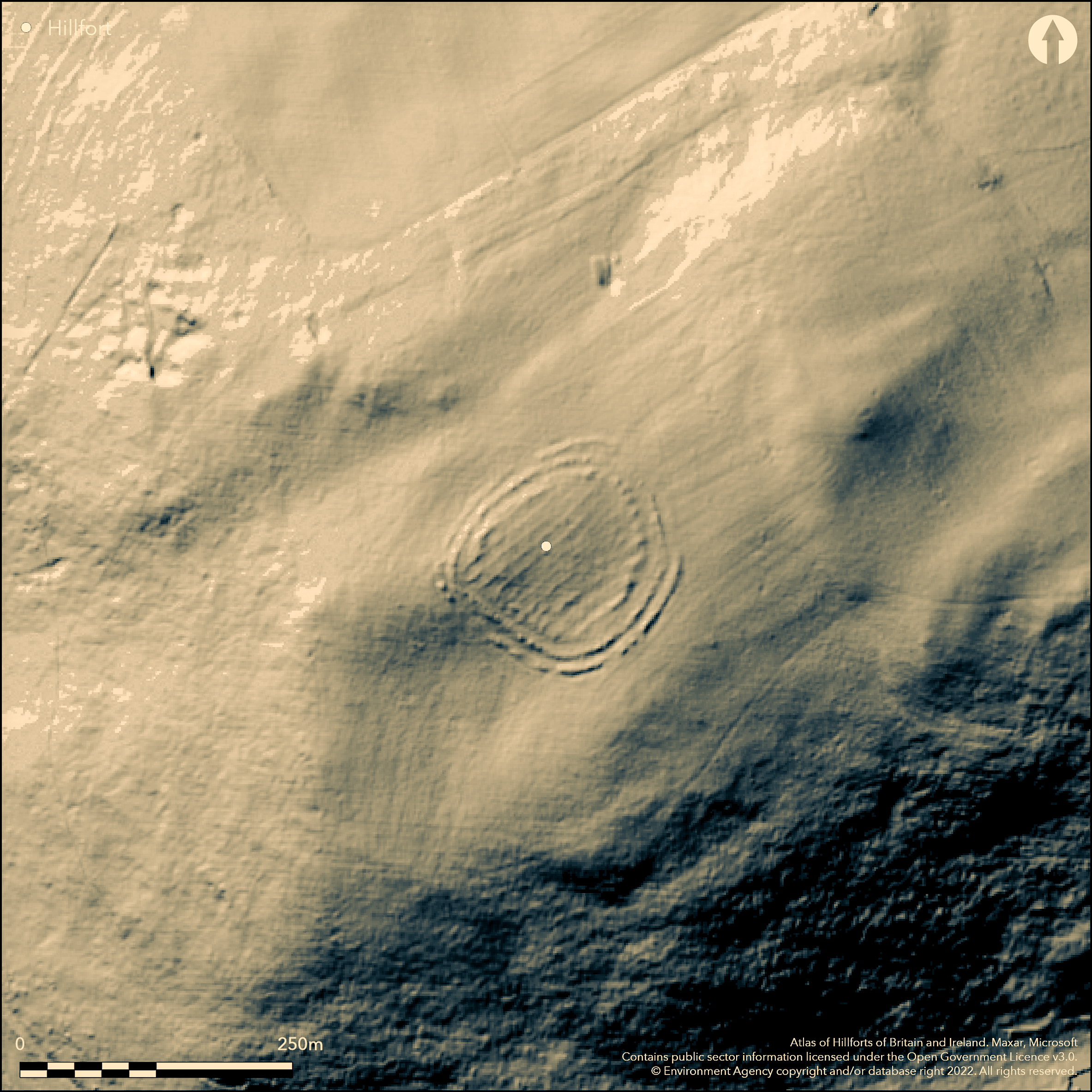
LiDAR 1m DTM Hillshade
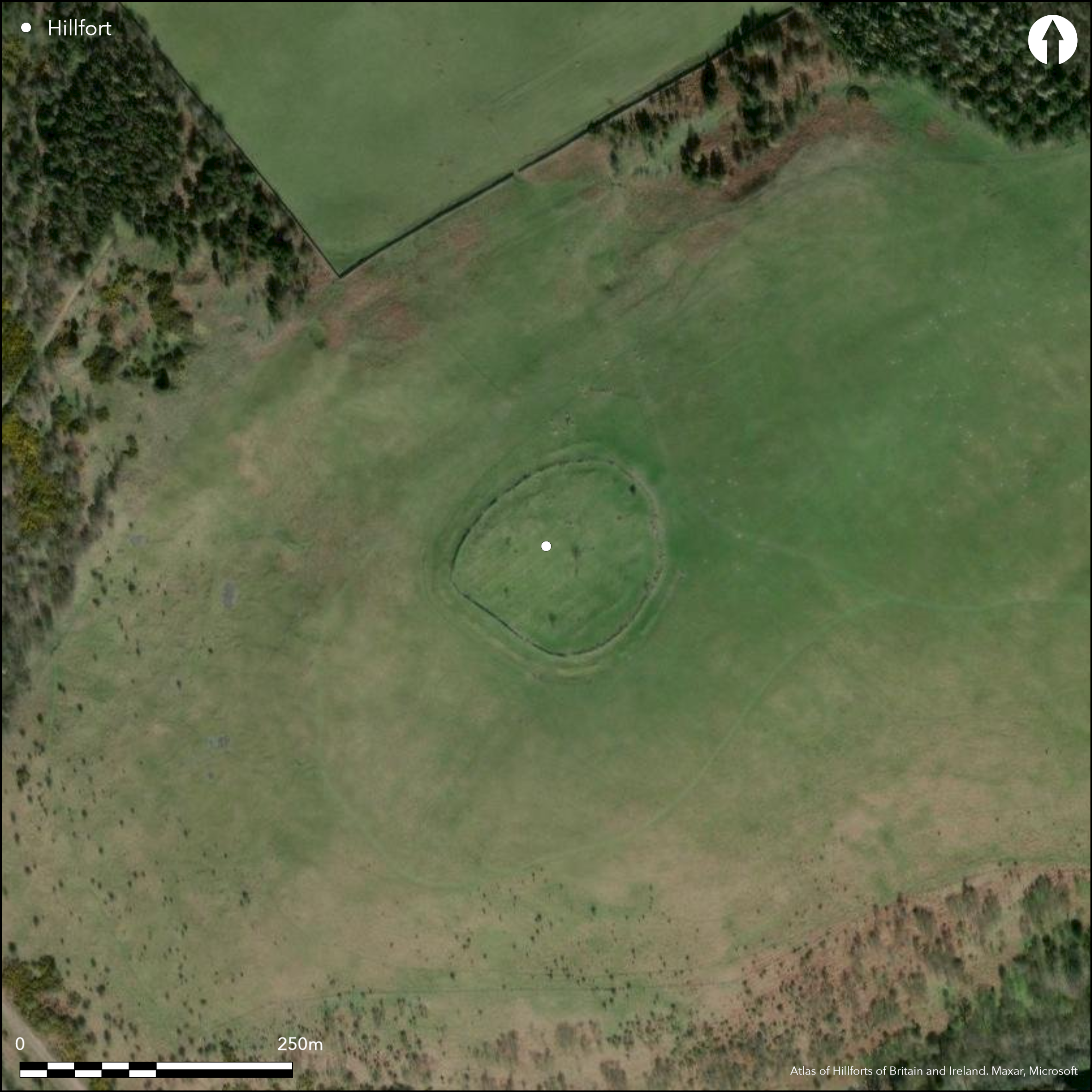
Satellite Imagery
LiDAR 1m DTM Hillshade
Satellite Imagery
Scroll left/right to view further images.
HER: Northumberland 868 (None)
NMR: NT 83 SE 23 (1238)
SM: 1006527
NGR: NT 85050 31850
X: 385050 Y: 631850 (OSGB36)
A multivallate hillfort with secondary vallation occupying a shoulder on the SW slopes of Pawston Hill. Lying at 217m OD it overlooks Bowmont Water to the N and W and Pawston Lake to the SE. Almost circular in form measuring approximately 85m by 75m it comprises three stone-walled ramparts and two ditches which enclose an inner area of 0.4ha. The inner and middle ramparts stand to a height of 0.8m with a medial ditch and the outer rampart 1.5m. The middle wall, reused as a plantation wall which enclosed 0.8ha, was constructed with stone from the ramparts and is shown on 1885-1900 OS mapping as having a plantation within it. The outer ditch is up to 1m deep. The outer rampart and ditch are not continuous and it was suggested during a scheduling investigation that they are possibly unfinished. An entrance lies in the E. Any internal features are now masked by collapsed stonework and a series of possible cultivation banks. The site is scheduled as a defended settlement. A field survey in 1994 by Tyne and Wear Museums for the Northumberland National Park concluded that although the enclosure resembles a hillfort in both location and vallation, its defensive qualities are few with its origins possibly as a status symbol and territorial marker. The site is scheduled as a defended settlement. Undated.
Citizen Science: ✗
Reliability of Data: Confirmed
Reliability of Interpretation: Confirmed
X: -249210 Y: 7475276 (EPSG: 3857)
Longitude: -2.238691844744409 Latitude: 55.580104648153494 (EPSG:4326)
Country: England
Current County or Unitary Authority: Northumberland
Historic County: Northumberland
Current Parish/Community/Council/Townland: Kilham
None
| Extant | ✓ |
| Cropmark | ✗ |
| Likely Destroyed | ✗ |
None
| Woodland | ✗ |
| Commercial Forestry Plantation | ✗ |
| Parkland | ✗ |
| Pasture (Grazing) | ✓ |
| Arable | ✗ |
| Scrub/Bracken | ✗ |
| Bare Outcrop | ✗ |
| Heather/Moorland | ✓ |
| Heath | ✗ |
| Built-up | ✗ |
| Coastal Grassland | ✗ |
| Other | ✗ |
The north-eastern extent of the enclosure lies on relatively level ground just below the summit, the remainder occupying a shoulder position with the ramparts on the western side following the contours of the hill. It lies at approximately 217m OD
| Contour Fort | ✗ |
| Partial Contour Fort | ✓ |
| Promontory Fort | ✗ |
| Hillslope Fort | ✓ |
| Level Terrain Fort | ✗ |
| Marsh Fort | ✗ |
| Multiple Enclosure Fort | ✗ |
| Hilltop | ✓ |
| Coastal Promontory | ✗ |
| Inland Promontory | ✗ |
| Valley Bottom | ✗ |
| Knoll/Hillock/Outcrop | ✗ |
| Ridge | ✗ |
| Cliff/Plateau-edge/Scarp | ✗ |
| Hillslope | ✓ |
| Lowland | ✗ |
| Spur | ✓ |
Dominant Topographic Feature: SW shoulder of Pawston Hill
| North | ✗ |
| Northeast | ✗ |
| East | ✗ |
| Southeast | ✗ |
| South | ✗ |
| Southwest | ✗ |
| West | ✓ |
| Northwest | ✗ |
| Level | ✗ |
Altitude: 217.0m
N/A
Undated
Reliability: D - None
| Pre 1200BC | ✗ |
| 1200BC - 800BC | ✗ |
| 800BC - 400BC | ✗ |
| 400BC - AD50 | ✗ |
| AD50 - AD400 | ✗ |
| AD400 - AD 800 | ✗ |
| Post AD800 | ✗ |
| Unknown | ✓ |
| Pre Hillfort: | None |
| Post Hillfort: | Plantation, field systems |
The site is shown on 1885-1900 mapping, general reference in MacLauchlan (1919-22.) Field investigation in 1966 and a field survey by Tyne and Wear Museums in 1994. Scheduled
| Other (1951): | Scheduled |
| Other (1966): | Field investigation |
| Other (1994): | Field survey including documentary and aerial photographic evidence collected |
| 1st Identified Map Depiction (None): | None |
| 1st Identified Written Reference (None): | None |
Any internal features are now masked by collapsed stonework and a series of possible cultivation rigs.
It overlooks Bowmont Water to the N and W and Pawston Lake to the SE
| None | ✓ |
| Spring | ✗ |
| Stream | ✗ |
| Pool | ✗ |
| Flush | ✗ |
| Well | ✗ |
| Other | ✗ |
None
| No Known Features | ✓ |
| Round Stone Structures | ✗ |
| Rectangular Stone Structures | ✗ |
| Curvilinear Platforms | ✗ |
| Other Roundhouse Evidence | ✗ |
| Pits | ✗ |
| Quarry Hollows | ✗ |
| Other | ✗ |
None
| No Known Excavation | ✓ |
| Pits | ✗ |
| Postholes | ✗ |
| Roundhouses | ✗ |
| Rectangular Structures | ✗ |
| Roads/Tracks | ✗ |
| Quarry Hollows | ✗ |
| Other | ✗ |
| Nothing Found | ✗ |
None
| No Known Geophysics | ✓ |
| Pits | ✗ |
| Roundhouses | ✗ |
| Rectangular Structures | ✗ |
| Roads/Tracks | ✗ |
| Quarry Hollows | ✗ |
| Other | ✗ |
| Nothing Found | ✗ |
None
| No Known Finds | ✓ |
| Pottery | ✗ |
| Metal | ✗ |
| Metalworking | ✗ |
| Human Bones | ✗ |
| Animal Bones | ✗ |
| Lithics | ✗ |
| Environmental | ✗ |
| Other | ✗ |
None
| APs Not Checked | ✓ |
| None | ✗ |
| Roundhouses | ✗ |
| Rectangular Structures | ✗ |
| Pits | ✗ |
| Postholes | ✗ |
| Roads/Tracks | ✗ |
| Other | ✗ |
An entrance lies in the E. There are a number of breaks around the outer rampart and it was suggested during scheduling that it was possibly unfinished.
| None: | Unknown number of breaks around outer rampart |
| 2: | None |
Guard Chambers: ✗
Chevaux de Frise: ✗
| 1. Simple Gap (East): | None |
| 1. Simple Gap (East): | None |
| 1. Simple Gap (East): | None |
Almost circular in form measuring approximately 85m by 75m. Comprises three stone-walled ramparts and two ditches which enclose an inner area of 0.4ha. The inner and middle ramparts stand to a height of 0.8m with a medial ditch and the outer rampart 1.5m. The middle wall, reused as a plantation wall was constructed with stone from the ramparts and encloses 0.8ha. The outer ditch is up to 1m deep. The outer rampart and ditch are not continuous and it was suggested during scheduling that they are possibly unfinished.
| Area 1: | 0.4ha. |
| Total: | 0.4ha. |
Total Footprint Area: 1.2ha.
None
| ✗ | Areas estimated from satellite imagery |
| ✓ | Outer rampart has a number of breaks and is possibly unfinished |
| NE Quadrant: | 3 |
| SE Quadrant: | 3 |
| SW Quadrant: | 3 |
| NW Quadrant: | 3 |
| Total: | 3 |
| Partial Univallate | ✗ |
| Univallate | ✗ |
| Partial Bivallate | ✗ |
| Bivallate | ✗ |
| Partial Multivallate | ✗ |
| Multivallate | ✓ |
| Unknown | ✗ |
| Partial Univallate | ✗ |
| Univallate | ✗ |
| Partial Bivallate | ✗ |
| Bivallate | ✗ |
| Partial Multivallate | ✗ |
| Multivallate | ✗ |
None
| None | ✗ |
| Earthen Bank | ✗ |
| Stone Wall | ✓ |
| Rubble | ✗ |
| Wall-walk | ✗ |
| Evidence of Timber | ✗ |
| Vitrification | ✗ |
| Other Burning | ✗ |
| Palisade | ✗ |
| Counter Scarp Bank | ✗ |
| Berm | ✗ |
| Unfinished | ✓ |
| Other | ✗ |
None
| None | ✗ |
| Earthen Bank | ✗ |
| Stone Wall | ✗ |
| Murus Duplex | ✗ |
| Timber-framed | ✗ |
| Timber-laced | ✗ |
| Vitrification | ✗ |
| Other Burning | ✗ |
| Palisade | ✗ |
| Counter Scarp Bank | ✗ |
| Berm | ✗ |
| Unfinished | ✗ |
| No Known Excavation | ✓ |
| Other | ✗ |
| ✗ | None |
| ✓ | None |
Number of Ditches: 2
| ✗ | None |
Archaeology Section, Tyne and Wear Museums,1994. Pawston Hill Camp, Kilham; Archaeological Survey. Unpublished
Jobey, G.1965. Hillforts and Settlements in Northumberland. Archaeol Aeliana (4th Series) 43
MacLauchlan, H. 1919-22. Notes on camps in the parishes of Branxton, Carham, Ford, Kirknewton and Wooler in Northumberland. Hist Berwickshire Natur Club, 461
Atlas of Hillforts:
Wikidata:
This work is licensed under CC BY-SA 4.0

 and should be cited as:
Lock, Gary and Ralston, Ian. 2024. Atlas of Hillforts of Britain and Ireland. Available at: https://hillforts.arch.ox.ac.uk
Document Version 1.1