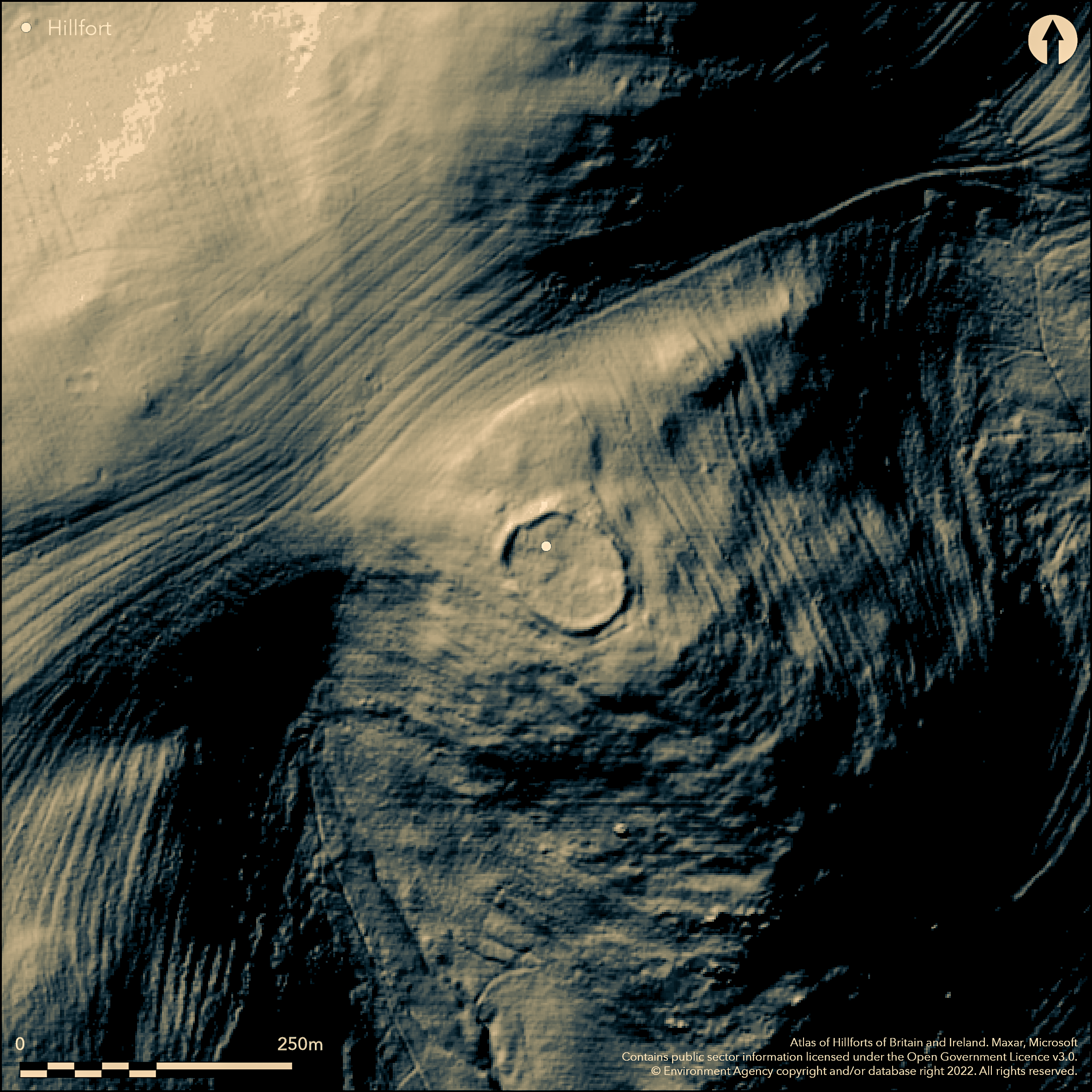
LiDAR 1m DTM Hillshade
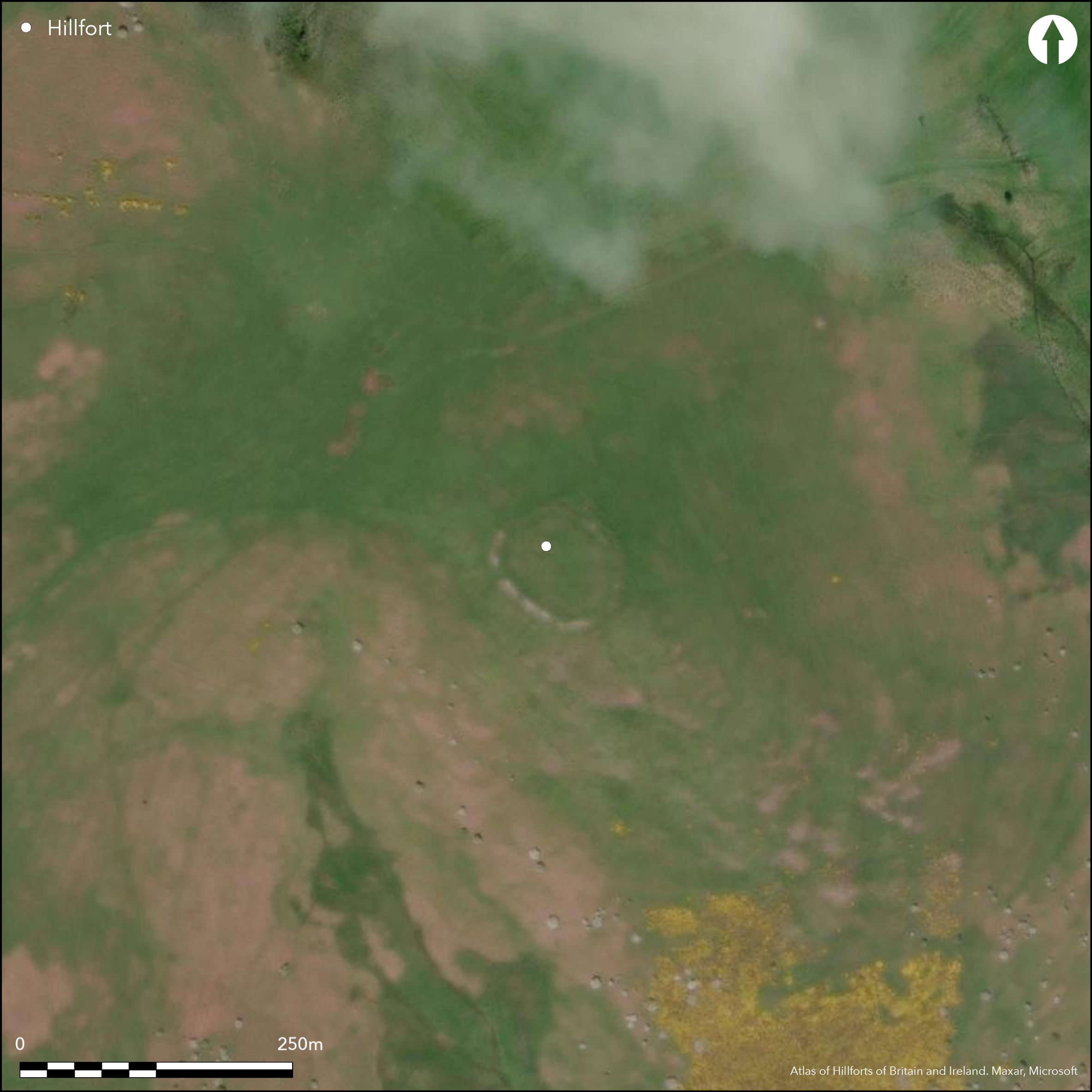
Satellite Imagery
LiDAR 1m DTM Hillshade
Satellite Imagery
Scroll left/right to view further images.
HER: Northumberland 609 (None)
NMR: NT 82 NE 45 (774)
SM: 1008358
NGR: NT 8812 2959
X: 388120 Y: 629596 (OSGB36)
Lying at 281m OD on a SE facing spur on Mid Hill, 520m to the SW of Staw Hill (Atlas No. 0472) are the remains of a stone-built univallate hillfort. It survives in its final form as a well-preserved oval earthwork with a single rampart enclosing 0.24ha. It was first described by McLauchlan in 1860 and surveyed by the Ordnance Survey from then onwards, although it fails to appear on a number of later OS maps. The site has seen several phases of construction, the earliest being a smaller, probable palisade enclosure which enclosed a tight cluster of ring ditched hut sites comparable to similar sites at Ell's Knowe (Atlas No. 1882). Later a broad, drystone wall was constructed following the contours of the hill and enclosing a larger area. This location has steep slopes on all sides except in the NW where there is a plateau, and this side was further strengthened by an earthen dump rampart or box rampart which overlies the stone walling. It is uncertain if this occurred during or after the main construction of the hillfort. It is now turf-covered. In the Roman Iron Age the enclosure was rebuilt with stone from the collapsed wall and facing stones can be seen in some parts. The width of the rampart varies from between 3m and 5m with a maximum external height of 2m and a maximum internal height of 1m. No evidence of ditches. The enclosure was divided in half internally at that time by a wall running NW to SE and two houses with yards were constructed at either end in the NW and SE. Internally between 5-8 ring grooved buildings have been identified with the largest being 11m in diameter. Two are superimposed on earlier houses showing at least two phases of construction. All have their entrances facing to the E. A simple gap entrance lies in the NW which is probably contemporary with the Iron Age phase. Of the palisaded enclosure, too little can be traced to determine if the entrance faced in the same direction. A second, opposing entrance in the E in the rebuilt stone wall, was probably created in the Roman period. The site is scheduled as a hill-top settlement (last review 1994) but was reinterpreted as a hillfort in 2002 (Oswald and McOmish 2002). The NW rampart has a recent excavation trench measuring 3m by 1.5m which is now backfilled with rubble from the core of the rampart, although the excavation is undocumented. Traces of early medieval huts or pens have been identified within the interior and the foundations of a rectangular building lies against the outside the hillfort in the S (NT82NE 118) which also probably post-dates the hillfort. Recorded on 1895 OS mapping.
Citizen Science: ✗
Reliability of Data: Confirmed
Reliability of Interpretation: Confirmed
X: -243778 Y: 7471306 (EPSG: 3857)
Longitude: -2.1898973797204055 Latitude: 55.55993657910432 (EPSG:4326)
Country: England
Current County or Unitary Authority: Northumberland
Historic County: Northumberland
Current Parish/Community/Council/Townland: Kirknewton
None
| Extant | ✓ |
| Cropmark | ✗ |
| Likely Destroyed | ✗ |
Rough grassland
| Woodland | ✗ |
| Commercial Forestry Plantation | ✗ |
| Parkland | ✗ |
| Pasture (Grazing) | ✓ |
| Arable | ✗ |
| Scrub/Bracken | ✗ |
| Bare Outcrop | ✗ |
| Heather/Moorland | ✓ |
| Heath | ✗ |
| Built-up | ✗ |
| Coastal Grassland | ✗ |
| Other | ✗ |
A contour fort lying at 281m OD on a south-easterly facing spur
| Contour Fort | ✓ |
| Partial Contour Fort | ✗ |
| Promontory Fort | ✗ |
| Hillslope Fort | ✗ |
| Level Terrain Fort | ✗ |
| Marsh Fort | ✗ |
| Multiple Enclosure Fort | ✗ |
| Hilltop | ✓ |
| Coastal Promontory | ✗ |
| Inland Promontory | ✗ |
| Valley Bottom | ✗ |
| Knoll/Hillock/Outcrop | ✗ |
| Ridge | ✗ |
| Cliff/Plateau-edge/Scarp | ✗ |
| Hillslope | ✗ |
| Lowland | ✗ |
| Spur | ✓ |
Dominant Topographic Feature: South-easterly facing spur
| North | ✗ |
| Northeast | ✗ |
| East | ✗ |
| Southeast | ✓ |
| South | ✗ |
| Southwest | ✗ |
| West | ✗ |
| Northwest | ✗ |
| Level | ✗ |
Altitude: 281.0m
N/A
Undated, but the sequence from survey suggests a multi-phased site beginning with an Iron Age or earlier pallisaded enclosure on the site. This was later enclosed by a pre-Roman Iron Age enclosure. The enclosure was rebuilt in the Roman period when internal divisions and house were constructed.
Reliability: D - None
| Pre 1200BC | ✗ |
| 1200BC - 800BC | ✓ |
| 800BC - 400BC | ✓ |
| 400BC - AD50 | ✓ |
| AD50 - AD400 | ✗ |
| AD400 - AD 800 | ✗ |
| Post AD800 | ✗ |
| Unknown | ✗ |
| Pre Hillfort: | None |
| Post Hillfort: | None |
| Morphology/Earthwork/Typology: | None |
On 1895 OS mapping. General reference in MacLauchlan in 1860 and first scheduled in 1935, with a later revision in 1994. Field investigations in 1955, 1969, 1979 and 1993. In 2002 the site underwent a detailed analytical survey and reinterpretation by English Heritage at the request of the Northumberland National Park Authority.
| 1st Identified Map Depiction (1895): | 1:25,000 OS mapping |
| Other (1935): | Scheduled |
| Other (1955): | Field investigation |
| Other (1969): | Field investigation |
| Other (1979): | Field investigation |
| Other (1993): | Field investigation |
| Earthwork Survey (2002): | 'Discovering our Hillfort Heritage' Project |
Between 5-8 ring grooved buildings the largest being 11m in diameter. Two are superimposed on earlier houses showing at least two phases of construction. All have entrances facing to the E.
None
| None | ✓ |
| Spring | ✗ |
| Stream | ✗ |
| Pool | ✗ |
| Flush | ✗ |
| Well | ✗ |
| Other | ✗ |
Ring-grooves
| No Known Features | ✗ |
| Round Stone Structures | ✗ |
| Rectangular Stone Structures | ✗ |
| Curvilinear Platforms | ✗ |
| Other Roundhouse Evidence | ✓ |
| Pits | ✗ |
| Quarry Hollows | ✗ |
| Other | ✗ |
Evidence for an excavation trench has been identified but is undocumented.
| No Known Excavation | ✓ |
| Pits | ✗ |
| Postholes | ✗ |
| Roundhouses | ✗ |
| Rectangular Structures | ✗ |
| Roads/Tracks | ✗ |
| Quarry Hollows | ✗ |
| Other | ✗ |
| Nothing Found | ✗ |
None
| No Known Geophysics | ✓ |
| Pits | ✗ |
| Roundhouses | ✗ |
| Rectangular Structures | ✗ |
| Roads/Tracks | ✗ |
| Quarry Hollows | ✗ |
| Other | ✗ |
| Nothing Found | ✗ |
None
| No Known Finds | ✓ |
| Pottery | ✗ |
| Metal | ✗ |
| Metalworking | ✗ |
| Human Bones | ✗ |
| Animal Bones | ✗ |
| Lithics | ✗ |
| Environmental | ✗ |
| Other | ✗ |
None
| APs Not Checked | ✓ |
| None | ✗ |
| Roundhouses | ✗ |
| Rectangular Structures | ✗ |
| Pits | ✗ |
| Postholes | ✗ |
| Roads/Tracks | ✗ |
| Other | ✗ |
A simple gap entrance lies in the NW which is probably contemporary with the Iron Age phase. A second, opposing entrance in the E in the rebuilt stone wall, was probably created in the Roman period
| 2: | None |
| 2: | None |
Guard Chambers: ✗
Chevaux de Frise: ✗
| 1. Simple Gap (North west): | None |
A broad, drystone wall constructed following the contours of the hill enclosing 0.24ha. Strengthened in the NW by an earthen dump rampart or box rampart which overlies the stone walling, now turf-covered. In the Roman Iron Age the enclosure was rebuilt with stone from the collapsed wall and facing stones can be seen in some parts. The width of the rampart varies from between 3m and 5m with a maximum external height of 2m and a maximum internal height of 1m. No evidence of ditches.
| Area 1: | 0.24ha. |
| Total: | 0.24ha. |
Total Footprint Area: Noneha.
None
| ✓ | None |
| ✓ | Earlier palisaded phase |
| NE Quadrant: | 1 |
| SE Quadrant: | 1 |
| SW Quadrant: | 1 |
| NW Quadrant: | 1 |
| Total: | 1 |
| Partial Univallate | ✗ |
| Univallate | ✓ |
| Partial Bivallate | ✗ |
| Bivallate | ✗ |
| Partial Multivallate | ✗ |
| Multivallate | ✗ |
| Unknown | ✗ |
| Partial Univallate | ✗ |
| Univallate | ✗ |
| Partial Bivallate | ✗ |
| Bivallate | ✗ |
| Partial Multivallate | ✗ |
| Multivallate | ✗ |
None
| None | ✗ |
| Earthen Bank | ✓ |
| Stone Wall | ✓ |
| Rubble | ✓ |
| Wall-walk | ✗ |
| Evidence of Timber | ✗ |
| Vitrification | ✗ |
| Other Burning | ✗ |
| Palisade | ✓ |
| Counter Scarp Bank | ✗ |
| Berm | ✗ |
| Unfinished | ✗ |
| Other | ✗ |
Nothing recorded
| None | ✓ |
| Earthen Bank | ✗ |
| Stone Wall | ✗ |
| Murus Duplex | ✗ |
| Timber-framed | ✗ |
| Timber-laced | ✗ |
| Vitrification | ✗ |
| Other Burning | ✗ |
| Palisade | ✗ |
| Counter Scarp Bank | ✗ |
| Berm | ✗ |
| Unfinished | ✗ |
| No Known Excavation | ✗ |
| Other | ✗ |
| ✗ | None |
| ✗ | None |
Number of Ditches: None
| ✗ | None |
Jobey, G.1965. Hillforts and Settlements in Northumberland. Archaeol Aeliana (4th Series) 43
Oswald, A. and McOmish, D. Hillforts in the Northumberland National Park project: Mid Hill survey. English Heritage Report No: AI/2/2002. Unpublished
Oswald, A. Ainsworth, S. and Pearson, T 2006 Hillforts: Prehistoric Strongholds of Northumberland National Park. English Heritage
Atlas of Hillforts:
Wikidata:
This work is licensed under CC BY-SA 4.0

 and should be cited as:
Lock, Gary and Ralston, Ian. 2024. Atlas of Hillforts of Britain and Ireland. Available at: https://hillforts.arch.ox.ac.uk
Document Version 1.1