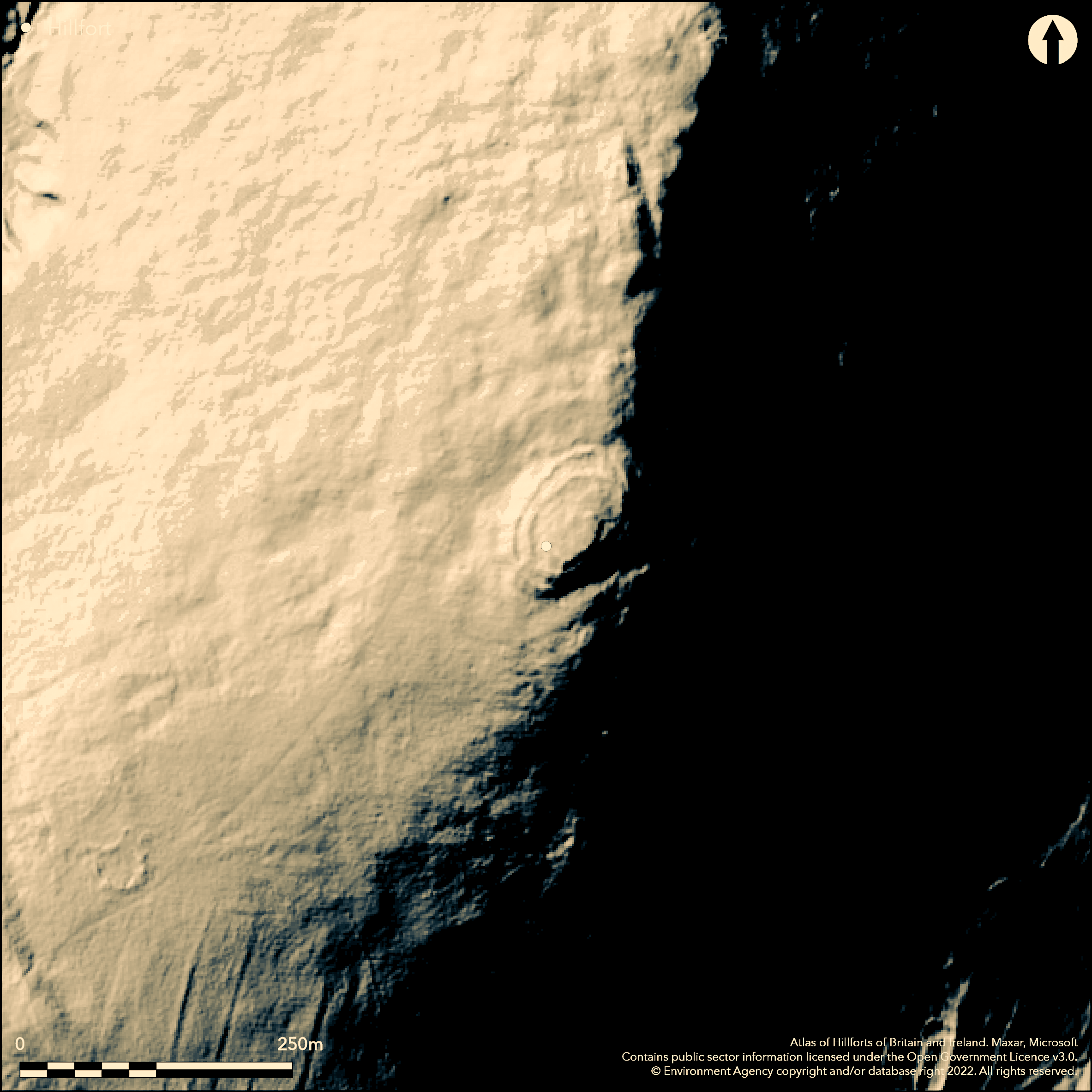
LiDAR 1m DTM Hillshade
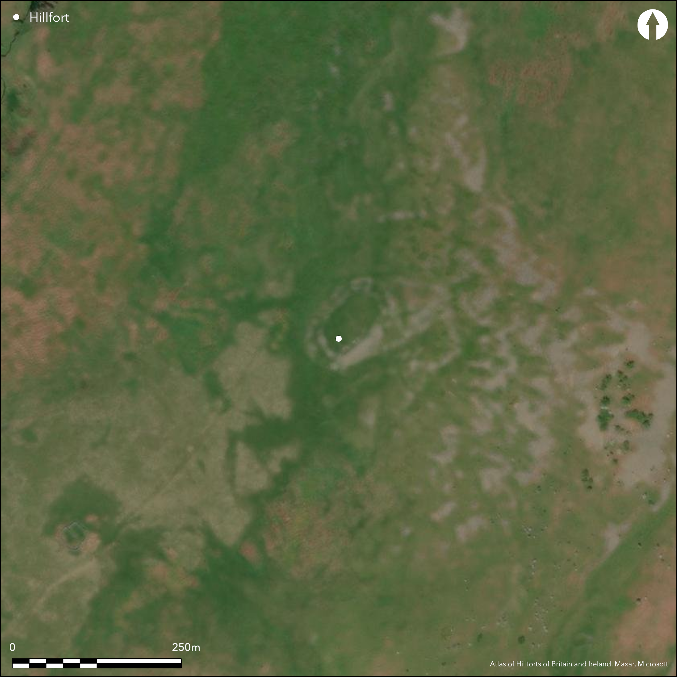
Satellite Imagery
LiDAR 1m DTM Hillshade
Satellite Imagery
Scroll left/right to view further images.
HER: Northumberland 580 (None)
NMR: NT 82 NE 16 (637)
SM: 1010336
NGR: NT 8833 2503
X: 388350 Y: 625030 (OSGB36)
A much denuded stone-built fort lying 700m to the NW of Southernknowe across the College Valley. The hillfort is oval in plan measuring 85m NW to SE by 60m transversely, enclosing 0.5ha. It lies at 353m OD on the NE shoulder of Blackhaggs Rigg with extensive views along the College valley in the N and S, but restricted in the SW by rising ground. It comprises two concentric stone ramparts which have been artificially enhanced in the S by scarping the natural slope. They are missing in the E where the steep scree slope has been incorporated into the defences. No evidence of ditches. An entrance lies in the E where the approach is slightly terraced into the slope. Within the interior the remains of four scooped platforms for Iron Age timber houses 12m in diameter and 0.6m deep, are aligned around the perimeter in the W. Modern cairns lie on the ramparts in the E and SE. Outside the fort circular stone foundations 7m in diameter and standing 0.3m high abut the rampart in the SW. The hillfort now survives only as core material and a spread of loose stones. The remains of a sheep shelter overlies the northern rampart. The site was portrayed on Greenwood's map in 1828 as 'Ring Cairn' but was shown 750m to the SW of its actual position (Topping 1999). It did not appear on OS mapping until the late 20th century. It has not been excavated and is undated. Scheduled as a defended settlement.
Citizen Science: ✗
Reliability of Data: Confirmed
Reliability of Interpretation: Confirmed
X: -243351 Y: 7463235 (EPSG: 3857)
Longitude: -2.186057137576348 Latitude: 55.5189144071421 (EPSG:4326)
Country: England
Current County or Unitary Authority: Northumberland
Historic County: Northumberland
Current Parish/Community/Council/Townland: Kirknewton
In poor condition
| Extant | ✓ |
| Cropmark | ✗ |
| Likely Destroyed | ✗ |
None
| Woodland | ✗ |
| Commercial Forestry Plantation | ✗ |
| Parkland | ✗ |
| Pasture (Grazing) | ✓ |
| Arable | ✗ |
| Scrub/Bracken | ✓ |
| Bare Outcrop | ✗ |
| Heather/Moorland | ✗ |
| Heath | ✗ |
| Built-up | ✗ |
| Coastal Grassland | ✗ |
| Other | ✗ |
A contour fort lying at 353m OD on the summit of the NE shoulder of Blackhaggs Rigg
| Contour Fort | ✓ |
| Partial Contour Fort | ✗ |
| Promontory Fort | ✗ |
| Hillslope Fort | ✗ |
| Level Terrain Fort | ✗ |
| Marsh Fort | ✗ |
| Multiple Enclosure Fort | ✗ |
| Hilltop | ✓ |
| Coastal Promontory | ✗ |
| Inland Promontory | ✗ |
| Valley Bottom | ✗ |
| Knoll/Hillock/Outcrop | ✗ |
| Ridge | ✗ |
| Cliff/Plateau-edge/Scarp | ✗ |
| Hillslope | ✗ |
| Lowland | ✗ |
| Spur | ✓ |
Dominant Topographic Feature: Summit of the NE shoulder of Blackhaggs Rigg
| North | ✓ |
| Northeast | ✗ |
| East | ✗ |
| Southeast | ✗ |
| South | ✓ |
| Southwest | ✗ |
| West | ✗ |
| Northwest | ✗ |
| Level | ✗ |
Altitude: 353.0m
N/A
Undated
Reliability: D - None
| Pre 1200BC | ✗ |
| 1200BC - 800BC | ✗ |
| 800BC - 400BC | ✗ |
| 400BC - AD50 | ✗ |
| AD50 - AD400 | ✗ |
| AD400 - AD 800 | ✗ |
| Post AD800 | ✗ |
| Unknown | ✓ |
| Pre Hillfort: | None |
| Post Hillfort: | None |
Located incorrectly on Greenwood's 1828 map and included in MacLauchlan's 'memoirs' of 1867. It was first shown on late 20th century OS mapping where it is located correctly. Greenwood's 'Ring Cairn' was thought by Topping and the OS to be Fawcett Shank hillfort and a further discussion can be found in Topping (1999). Field investigation in 1955 and 1967. Scheduled
| 1st Identified Map Depiction (1828): | None |
| 1st Identified Written Reference (1867): | None |
| Other (1955): | Field investigation |
| Other (1967): | Field investigation |
| Other (1994): | Scheduled |
| Earthwork Survey (1999): | None |
The remains of four scooped platforms for Iron Age timber houses 12m in diameter and 0.6m deep, aligned around the perimeter in the W.
College Burn to the E and feeder tributaries to the W
| None | ✓ |
| Spring | ✗ |
| Stream | ✗ |
| Pool | ✗ |
| Flush | ✗ |
| Well | ✗ |
| Other | ✗ |
Scoops for timber-framed houses
| No Known Features | ✗ |
| Round Stone Structures | ✗ |
| Rectangular Stone Structures | ✗ |
| Curvilinear Platforms | ✓ |
| Other Roundhouse Evidence | ✗ |
| Pits | ✗ |
| Quarry Hollows | ✗ |
| Other | ✗ |
None
| No Known Excavation | ✓ |
| Pits | ✗ |
| Postholes | ✗ |
| Roundhouses | ✗ |
| Rectangular Structures | ✗ |
| Roads/Tracks | ✗ |
| Quarry Hollows | ✗ |
| Other | ✗ |
| Nothing Found | ✗ |
None
| No Known Geophysics | ✓ |
| Pits | ✗ |
| Roundhouses | ✗ |
| Rectangular Structures | ✗ |
| Roads/Tracks | ✗ |
| Quarry Hollows | ✗ |
| Other | ✗ |
| Nothing Found | ✗ |
None
| No Known Finds | ✓ |
| Pottery | ✗ |
| Metal | ✗ |
| Metalworking | ✗ |
| Human Bones | ✗ |
| Animal Bones | ✗ |
| Lithics | ✗ |
| Environmental | ✗ |
| Other | ✗ |
None
| APs Not Checked | ✓ |
| None | ✗ |
| Roundhouses | ✗ |
| Rectangular Structures | ✗ |
| Pits | ✗ |
| Postholes | ✗ |
| Roads/Tracks | ✗ |
| Other | ✗ |
An entrance lies in the E where the approach is slightly terraced into the slope
| 1: | None |
| 2: | None |
Guard Chambers: ✗
Chevaux de Frise: ✗
| 1. Simple Gap (East): | None |
Oval in plan measuring 85m NW to SE by 60m transversely. It comprises two concentric stone ramparts which have been artificially enhanced in the S by scarping the natural slope. They are missing in the E where the steep scree slope has been incorporated into the defences. No evidence of ditches.
| Area 1: | 0.19ha. |
| Total: | 0.19ha. |
Total Footprint Area: 0.4ha.
None
| ✗ | Estimated from satellite imagery |
| ✗ | Absent in the E |
| NE Quadrant: | None |
| SE Quadrant: | None |
| SW Quadrant: | 2 |
| NW Quadrant: | 2 |
| Total: | 2 |
| Partial Univallate | ✗ |
| Univallate | ✗ |
| Partial Bivallate | ✓ |
| Bivallate | ✗ |
| Partial Multivallate | ✗ |
| Multivallate | ✗ |
| Unknown | ✗ |
| Partial Univallate | ✗ |
| Univallate | ✗ |
| Partial Bivallate | ✗ |
| Bivallate | ✗ |
| Partial Multivallate | ✗ |
| Multivallate | ✗ |
Now survives as a spread of material
| None | ✗ |
| Earthen Bank | ✗ |
| Stone Wall | ✓ |
| Rubble | ✗ |
| Wall-walk | ✗ |
| Evidence of Timber | ✗ |
| Vitrification | ✗ |
| Other Burning | ✗ |
| Palisade | ✗ |
| Counter Scarp Bank | ✗ |
| Berm | ✗ |
| Unfinished | ✗ |
| Other | ✗ |
None
| None | ✗ |
| Earthen Bank | ✗ |
| Stone Wall | ✗ |
| Murus Duplex | ✗ |
| Timber-framed | ✗ |
| Timber-laced | ✗ |
| Vitrification | ✗ |
| Other Burning | ✗ |
| Palisade | ✗ |
| Counter Scarp Bank | ✗ |
| Berm | ✗ |
| Unfinished | ✗ |
| No Known Excavation | ✓ |
| Other | ✗ |
| ✗ | None |
| ✗ | None |
Number of Ditches: None
| ✗ | None |
Jobey, G.1965. Hillforts and Settlements in Northumberland. Archaeol Aeliana (4th Series) 43
MacLauchlan, H. 1867. Notes not included in the memoirs already published on Roman roads in Northumberland', 39
Topping, P. 1999. A survey of North Black Hagg hillfort, Northumberland (NT 8836 2505) Northern Archaeol. 1999, 27-28
Atlas of Hillforts:
Wikidata:
This work is licensed under CC BY-SA 4.0

 and should be cited as:
Lock, Gary and Ralston, Ian. 2024. Atlas of Hillforts of Britain and Ireland. Available at: https://hillforts.arch.ox.ac.uk
Document Version 1.1