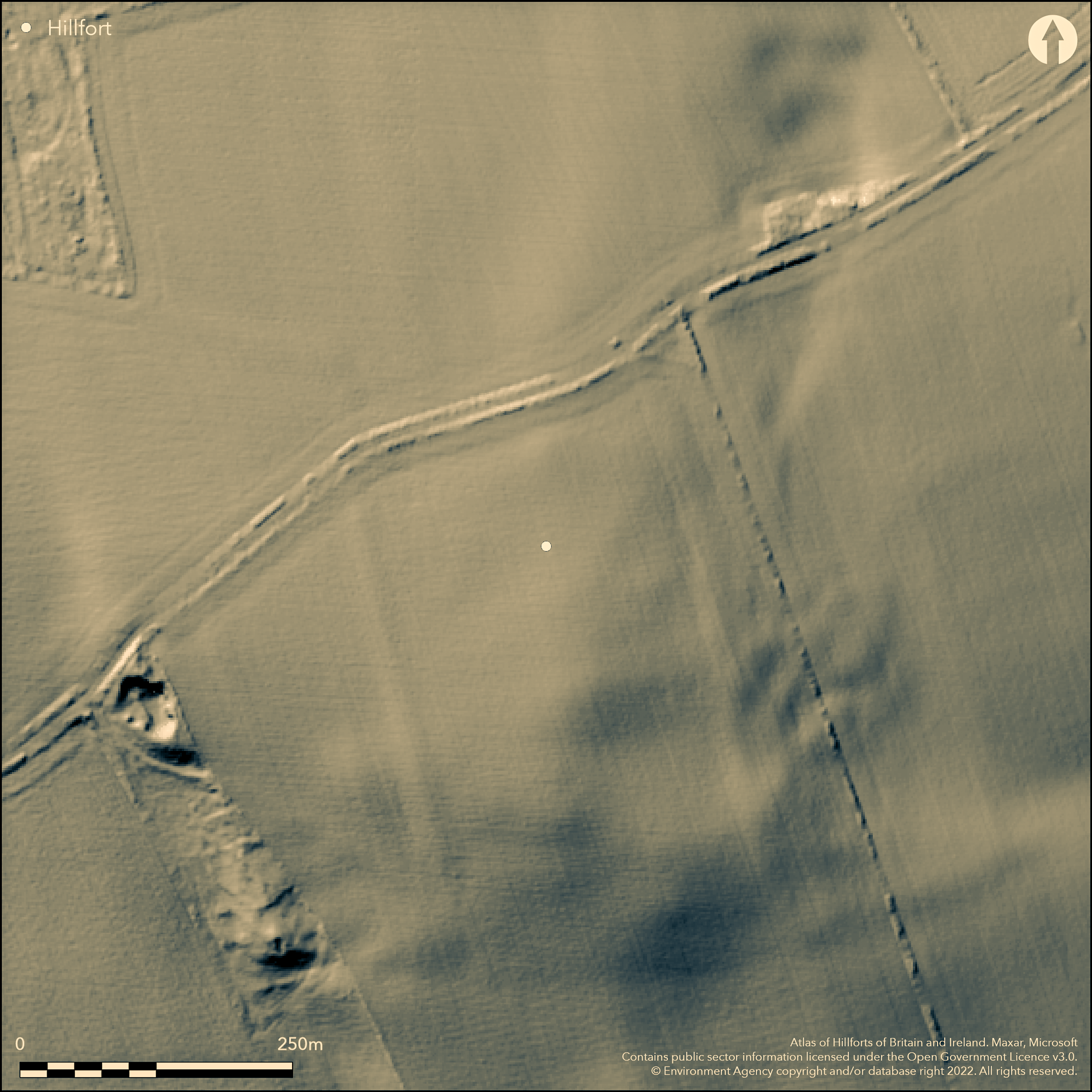
LiDAR 1m DTM Hillshade
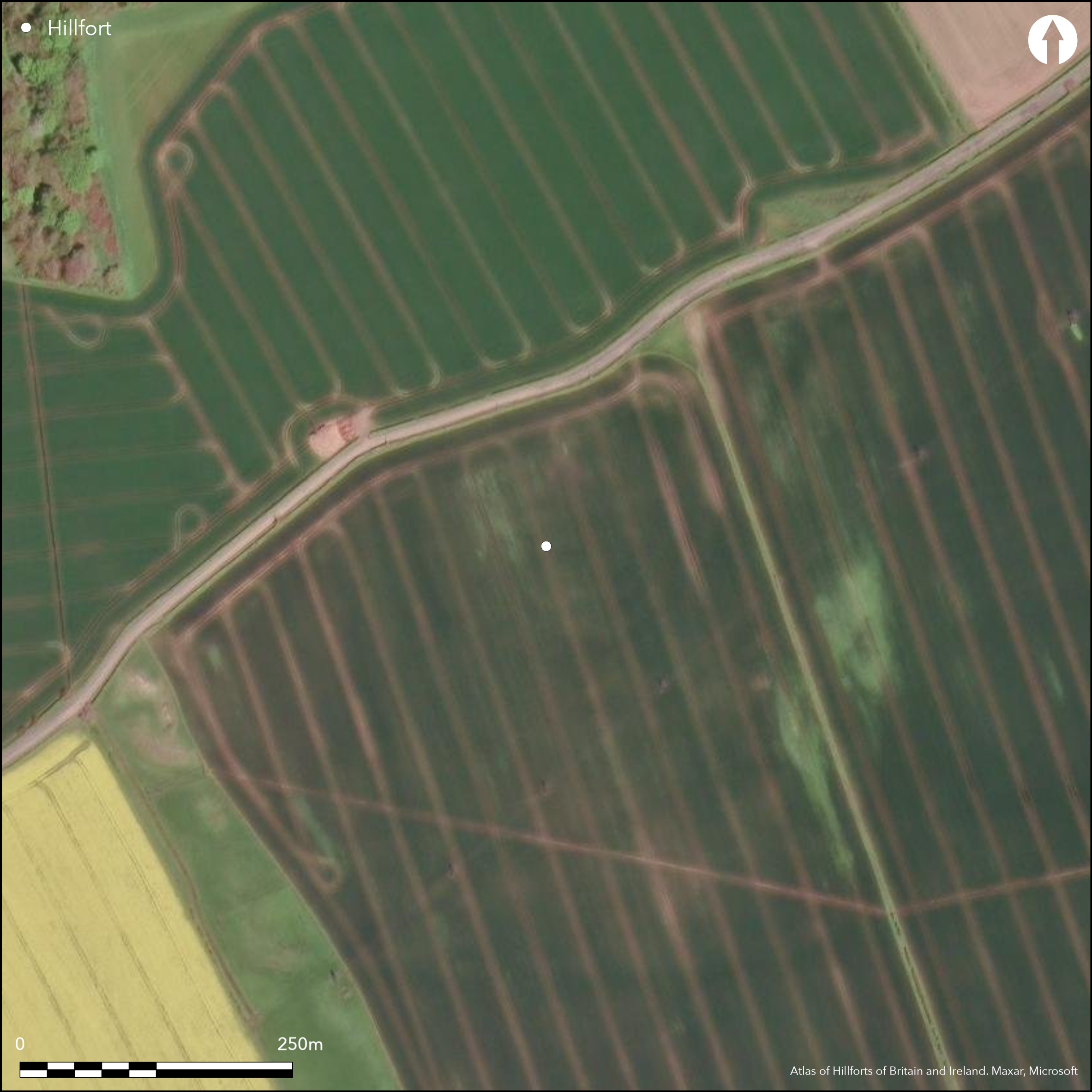
Satellite Imagery
LiDAR 1m DTM Hillshade
Satellite Imagery
Scroll left/right to view further images.
HER: Northumberland 4044 (None)
NMR: NU 04 SW 30 (1581564)
SM: None
NGR: NU 0439 4145
X: 404399 Y: 641453 (OSGB36)
Lying 530m to the NE of Kentsone on the summit of Kentstone Hill, the cropmarked remains of a circular multivallate enclosure, probably a hillfort. It survives as the cropmarks of three broad concentric ditches with an internal area estimated at 0.6ha and a whole site footprint of 1.7ha. The outer ditch is cut by a modern road in the N. The hill is relatively low with only a shallow rise and the enclosure occupies the highest point at 79m OD. Staggered entrances cut obliquely through the enclosure ditches in the S and in the NW. Internally there are cropmarks of an oval enclosure and a small penannular feature 5m in diameter with a 2m wide ditch. A rectangular enclosure measuring 40m by 50m with a palisade ditch which is double on the S and W sides, partially blocks the entrance in the S. Two entrances to this can be identified, a wide entrance in the E and a further entrance in the N which faces the southern entrance of the hillfort. Within this enclosure is a rectangular feature 5m by 12m. It is uncertain how these features relate to the hillfort and they may not be contemporary. The site can be best seen on 2006 Google Earth imagery. It is not shown on historic OS mapping and no investigation has been carried out. Undated.
Citizen Science: ✗
Reliability of Data: Confirmed
Reliability of Interpretation: Confirmed
X: -215027 Y: 7492330 (EPSG: 3857)
Longitude: -1.9316231081160524 Latitude: 55.66660490389649 (EPSG:4326)
Country: England
Current County or Unitary Authority: Northumberland
Historic County: Northumberland
Current Parish/Community/Council/Townland: Kyloe
None
| Extant | ✗ |
| Cropmark | ✓ |
| Likely Destroyed | ✗ |
None
| Woodland | ✗ |
| Commercial Forestry Plantation | ✗ |
| Parkland | ✗ |
| Pasture (Grazing) | ✗ |
| Arable | ✓ |
| Scrub/Bracken | ✗ |
| Bare Outcrop | ✗ |
| Heather/Moorland | ✗ |
| Heath | ✗ |
| Built-up | ✗ |
| Coastal Grassland | ✗ |
| Other | ✗ |
A possible multivallate contour fort lying on level ground at 79m OD on the summit of Kentstone Hill
| Contour Fort | ✓ |
| Partial Contour Fort | ✗ |
| Promontory Fort | ✗ |
| Hillslope Fort | ✗ |
| Level Terrain Fort | ✗ |
| Marsh Fort | ✗ |
| Multiple Enclosure Fort | ✗ |
| Hilltop | ✓ |
| Coastal Promontory | ✗ |
| Inland Promontory | ✗ |
| Valley Bottom | ✗ |
| Knoll/Hillock/Outcrop | ✗ |
| Ridge | ✗ |
| Cliff/Plateau-edge/Scarp | ✗ |
| Hillslope | ✗ |
| Lowland | ✓ |
| Spur | ✗ |
Dominant Topographic Feature: Summit of Kentstone Hill
| North | ✗ |
| Northeast | ✗ |
| East | ✗ |
| Southeast | ✗ |
| South | ✗ |
| Southwest | ✗ |
| West | ✗ |
| Northwest | ✗ |
| Level | ✓ |
Altitude: 79.0m
N/A
Undated, presumed Iron Age. An oval enclosure within the interior is judged to be possibly earlier. A rectangular feature across the entrance in the S is possibly later
Reliability: D - None
| Pre 1200BC | ✗ |
| 1200BC - 800BC | ✗ |
| 800BC - 400BC | ✗ |
| 400BC - AD50 | ✗ |
| AD50 - AD400 | ✗ |
| AD400 - AD 800 | ✗ |
| Post AD800 | ✗ |
| Unknown | ✓ |
| Pre Hillfort: | An oval enclosure within the interior is judged to be possibly earlier |
| Post Hillfort: | A rectangular feature across the entrance in the S is possibly later |
| Morphology/Earthwork/Typology: | None |
No investigation has taken place
Cropmarks of an oval enclosure and a small penannular feature 5m in diameter with a 2m wide ditch
None
| None | ✓ |
| Spring | ✗ |
| Stream | ✗ |
| Pool | ✗ |
| Flush | ✗ |
| Well | ✗ |
| Other | ✗ |
None
| No Known Features | ✓ |
| Round Stone Structures | ✗ |
| Rectangular Stone Structures | ✗ |
| Curvilinear Platforms | ✗ |
| Other Roundhouse Evidence | ✗ |
| Pits | ✗ |
| Quarry Hollows | ✗ |
| Other | ✗ |
None
| No Known Excavation | ✓ |
| Pits | ✗ |
| Postholes | ✗ |
| Roundhouses | ✗ |
| Rectangular Structures | ✗ |
| Roads/Tracks | ✗ |
| Quarry Hollows | ✗ |
| Other | ✗ |
| Nothing Found | ✗ |
None
| No Known Geophysics | ✓ |
| Pits | ✗ |
| Roundhouses | ✗ |
| Rectangular Structures | ✗ |
| Roads/Tracks | ✗ |
| Quarry Hollows | ✗ |
| Other | ✗ |
| Nothing Found | ✗ |
None
| No Known Finds | ✓ |
| Pottery | ✗ |
| Metal | ✗ |
| Metalworking | ✗ |
| Human Bones | ✗ |
| Animal Bones | ✗ |
| Lithics | ✗ |
| Environmental | ✗ |
| Other | ✗ |
Cropmarks of an oval enclosure and a small penannular feature 5m in diameter with a 2m wide ditch
| APs Not Checked | ✗ |
| None | ✗ |
| Roundhouses | ✗ |
| Rectangular Structures | ✗ |
| Pits | ✗ |
| Postholes | ✗ |
| Roads/Tracks | ✗ |
| Other | ✓ |
Staggered entrances cut obliquely through the three enclosure ditches in the S and in the NW.
| 6: | None |
| 2: | None |
Guard Chambers: ✗
Chevaux de Frise: ✗
| 1. Oblique (South): | Inner rampart |
| 1. Oblique (South): | Middle rampart |
| 1. Oblique (South): | Outer rampart |
| 2. Oblique (North west): | Inner rampart |
| 2. Oblique (North west): | Middle rampart |
| 2. Oblique (North west): | Outer rampart |
Cropmarked remains of a circular multivallate enclosure, probably a hillfort. It survives as the cropmarks of three broad concentric ditches with an internal area estimated at 0.6ha and a whole site footprint of 1.7ha.
| Area 1: | 0.6ha. |
| Total: | 0.6ha. |
Total Footprint Area: 1.7ha.
None
| ✗ | None |
| ✓ | None |
| NE Quadrant: | 3 |
| SE Quadrant: | 3 |
| SW Quadrant: | 3 |
| NW Quadrant: | 3 |
| Total: | 3 |
| Partial Univallate | ✗ |
| Univallate | ✗ |
| Partial Bivallate | ✗ |
| Bivallate | ✗ |
| Partial Multivallate | ✗ |
| Multivallate | ✓ |
| Unknown | ✗ |
| Partial Univallate | ✗ |
| Univallate | ✗ |
| Partial Bivallate | ✗ |
| Bivallate | ✗ |
| Partial Multivallate | ✗ |
| Multivallate | ✗ |
None
| None | ✓ |
| Earthen Bank | ✗ |
| Stone Wall | ✗ |
| Rubble | ✗ |
| Wall-walk | ✗ |
| Evidence of Timber | ✗ |
| Vitrification | ✗ |
| Other Burning | ✗ |
| Palisade | ✗ |
| Counter Scarp Bank | ✗ |
| Berm | ✗ |
| Unfinished | ✗ |
| Other | ✗ |
None
| None | ✗ |
| Earthen Bank | ✗ |
| Stone Wall | ✗ |
| Murus Duplex | ✗ |
| Timber-framed | ✗ |
| Timber-laced | ✗ |
| Vitrification | ✗ |
| Other Burning | ✗ |
| Palisade | ✗ |
| Counter Scarp Bank | ✗ |
| Berm | ✗ |
| Unfinished | ✗ |
| No Known Excavation | ✓ |
| Other | ✗ |
| ✗ | None |
| ✓ | None |
Number of Ditches: 3
| ✓ | Uncertain. A rectangular enclosure measuring 40m by 50m with a palisade ditch which is double on the S and W sides, partially blocks the entrances in the S. It has two entrances - a wide entrance in the E and a further entrance in the N which faces the southern entrance of the hillfort. Within this enclosure is a rectangular feature 5m by 12m. It is uncertain how these features relate to the hillfort and they may not be contemporary or could be an annex to the hillfort. |
No related records
Atlas of Hillforts:
Wikidata:
This work is licensed under CC BY-SA 4.0

 and should be cited as:
Lock, Gary and Ralston, Ian. 2024. Atlas of Hillforts of Britain and Ireland. Available at: https://hillforts.arch.ox.ac.uk
Document Version 1.1