LiDAR 1m DTM Hillshade
Satellite Imagery
LiDAR 1m DTM Hillshade
Satellite Imagery
Scroll left/right to view further images.
HER: Northumberland 2290 (None)
NMR: NT 94 NE 14 (3985)
SM: 1006422
NGR: NT 9630 4950
X: 396300 Y: 649500 (OSGB36)
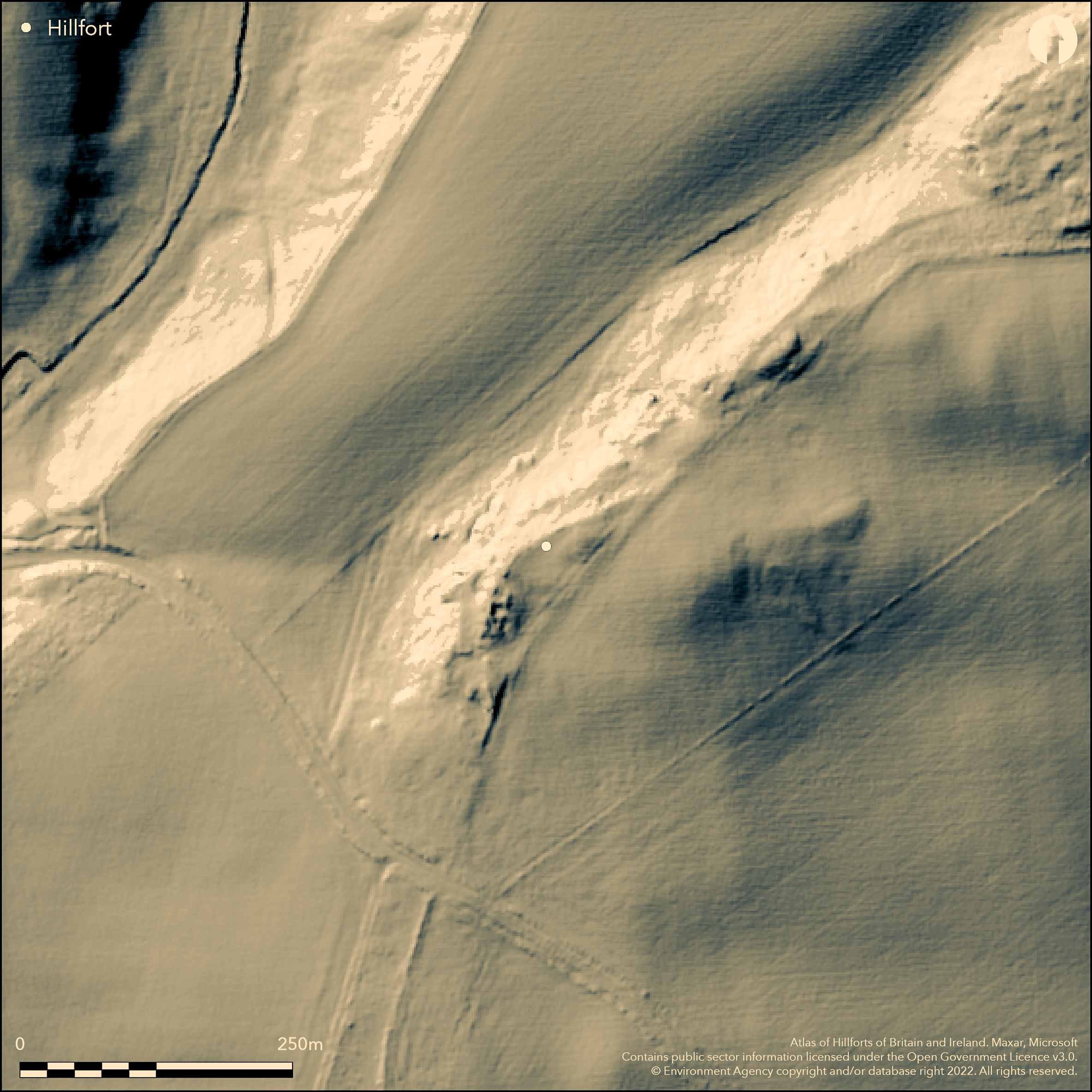
The cropmarks of a multi-phased enclosure lying 500m to the SE of Longridge Towers, identified on an RAF aerial photograph taken in 1961. A lowland site, it lies on the crest of a hill at 83m OD. Excavations revealed two concentric lines of palisades which encircled the summit of the hill (Jobey and Jobey 1987). They were later succeeded by three, possibly four phases of earthen ramparts and two shallow ditches described as 'no more than a series of shallow linear scoops'. In the final, probably Romano-British phase, it was enclosed by a substantial sandstone wall, the stone partly shaped but not dressed. The palisaded enclosure was constructed in the early 2nd century BC and occupied until the late 2nd -3rd centuries AD. Quarrying destroyed the entrance in the 19th century. Within the excavated area nine or ten round timber buildings were found within the inner palisade trench, with doorways facing S or SE. These are undated but overlain with a similar number of stone-built roundhouses, some superimposed, with associated paving which are probably Romano-British in date. Charred material from the timber-built house was dated 380 cal BC-cal AD 140 (ibid.). Wheat chaff from beneath the enclosure wall and above the filled inner ditch dated 200 cal BC-cal AD 140 and 170 cal BC-cal AD 230; from the floor area of the timber-built house 50 cal BC-cal AD 250. The ring-grooved hut circle outside the enclosure is earlier. Bronze Age burials found in the past. The site is not recorded on OS mapping. Scheduled as Murton High Crags settlements.
Citizen Science: ✗
Reliability of Data: Confirmed
Reliability of Interpretation: Confirmed
X: -229372 Y: 7506615 (EPSG: 3857)
Longitude: -2.060486010719871 Latitude: 55.73891377615124 (EPSG:4326)
Country: England; None
Current County or Unitary Authority: Northumberland
Historic County: Northumberland
Current Parish/Community/Council/Townland: Ord; Horncliffe
Part excavated
| Extant | ✗ |
| Cropmark | ✓ |
| Likely Destroyed | ✓ |
It lies partially on pasture and partly on rough ground
| Woodland | ✗ |
| Commercial Forestry Plantation | ✗ |
| Parkland | ✗ |
| Pasture (Grazing) | ✓ |
| Arable | ✗ |
| Scrub/Bracken | ✓ |
| Bare Outcrop | ✗ |
| Heather/Moorland | ✗ |
| Heath | ✗ |
| Built-up | ✗ |
| Coastal Grassland | ✗ |
| Other | ✗ |
A lowland contour fort lying on the crest of a hill at 83m OD
| Contour Fort | ✓ |
| Partial Contour Fort | ✗ |
| Promontory Fort | ✗ |
| Hillslope Fort | ✗ |
| Level Terrain Fort | ✗ |
| Marsh Fort | ✗ |
| Multiple Enclosure Fort | ✗ |
| Hilltop | ✓ |
| Coastal Promontory | ✗ |
| Inland Promontory | ✗ |
| Valley Bottom | ✗ |
| Knoll/Hillock/Outcrop | ✗ |
| Ridge | ✗ |
| Cliff/Plateau-edge/Scarp | ✗ |
| Hillslope | ✗ |
| Lowland | ✓ |
| Spur | ✗ |
Dominant Topographic Feature: Crest of a hill
| North | ✗ |
| Northeast | ✗ |
| East | ✗ |
| Southeast | ✗ |
| South | ✗ |
| Southwest | ✗ |
| West | ✗ |
| Northwest | ✓ |
| Level | ✗ |
Altitude: 83.0m
The parish boundary between Ord and Horncliffe runs to the NW
Boundary Type: Parish/Townland
Charred material from enclosed timber-built house 380 cal BC-cal AD 140 (Jobey et al. 1987). Wheat chaff from beneath enclosure wall and above filled inner ditch 200 cal BC-cal AD 140 and 170 cal BC-cal AD 230; from floor area of timber-built house 50 cal BC-cal AD 250
Reliability: A - High
| Pre 1200BC | ✗ |
| 1200BC - 800BC | ✗ |
| 800BC - 400BC | ✓ |
| 400BC - AD50 | ✓ |
| AD50 - AD400 | ✓ |
| AD400 - AD 800 | ✗ |
| Post AD800 | ✗ |
| Unknown | ✗ |
| Pre Hillfort: | None |
| Post Hillfort: | None |
| C14: | None |
Recorded in 1961 on aerial photograph RAF 543/1393 0028-29 3/8/1961. OS field investigation in 1967. Three seasons of excavation between 1979-1981 when a 0.25ha area was stripped on the W side of the site to investigate a 35m wide stretch of the defences and a representative area of the interior.(Jobey and Jobey 1987). Further small investigation in 1983 to collect samples for flotation (Van der Veen 1985). Scheduled as Murton High Crags settlements. Not recorded on OS mapping
| Other (1967): | Field investigation |
| Excavation (1983): | None |
| 1st Identified Written Reference (1987): | (Jobey et al. 1987) |
| Excavation (None): | None |
| Other (None): | Scheduled, amended June 2016 |
Within the excavated area nine or ten round timber buildings were found within the inner palisade trench with doorways facing S or SE and a similar number of stone-built roundhouses, some superimposed, with associated paving, with the latest probably Romano-British in date. Charcoal, charred grain, pottery and human bones.
None
| None | ✓ |
| Spring | ✗ |
| Stream | ✗ |
| Pool | ✗ |
| Flush | ✗ |
| Well | ✗ |
| Other | ✗ |
None
| No Known Features | ✓ |
| Round Stone Structures | ✗ |
| Rectangular Stone Structures | ✗ |
| Curvilinear Platforms | ✗ |
| Other Roundhouse Evidence | ✗ |
| Pits | ✗ |
| Quarry Hollows | ✗ |
| Other | ✗ |
Paved areas
| No Known Excavation | ✗ |
| Pits | ✗ |
| Postholes | ✗ |
| Roundhouses | ✓ |
| Rectangular Structures | ✗ |
| Roads/Tracks | ✗ |
| Quarry Hollows | ✓ |
| Other | ✓ |
| Nothing Found | ✗ |
None
| No Known Geophysics | ✓ |
| Pits | ✗ |
| Roundhouses | ✗ |
| Rectangular Structures | ✗ |
| Roads/Tracks | ✗ |
| Quarry Hollows | ✗ |
| Other | ✗ |
| Nothing Found | ✗ |
Charcoal, charred grain. Bronze Age burials
| No Known Finds | ✗ |
| Pottery | ✓ |
| Metal | ✗ |
| Metalworking | ✗ |
| Human Bones | ✓ |
| Animal Bones | ✗ |
| Lithics | ✗ |
| Environmental | ✓ |
| Other | ✗ |
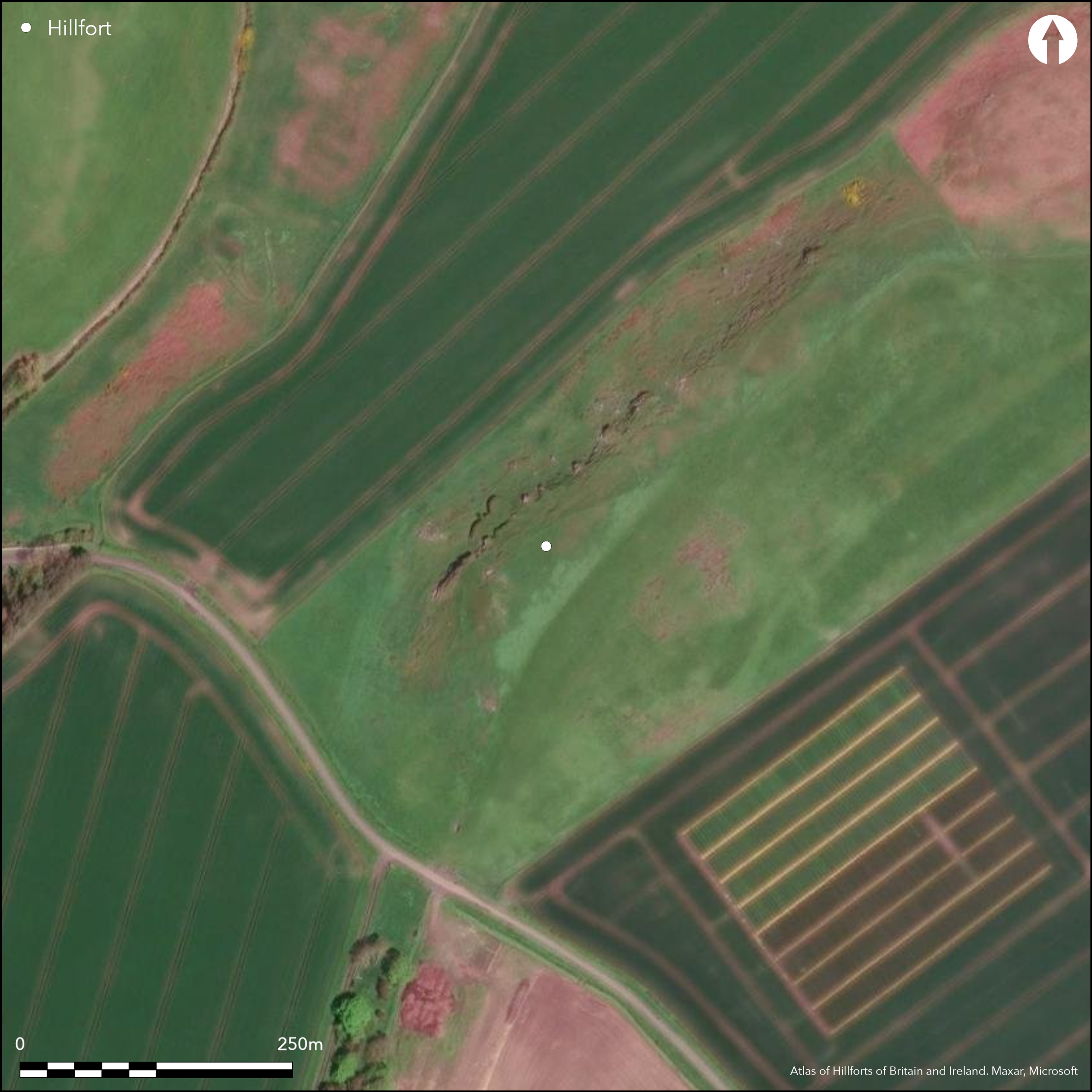
No features visible on satellite imagery
| APs Not Checked | ✗ |
| None | ✓ |
| Roundhouses | ✗ |
| Rectangular Structures | ✗ |
| Pits | ✗ |
| Postholes | ✗ |
| Roads/Tracks | ✗ |
| Other | ✗ |
Location not given, said to have been destroyed through quarrying
| None: | None |
| 2: | None |
Guard Chambers: ✗
Chevaux de Frise: ✗
Two concentric lines of palisades which encircled the summit of the hill Later succeeded by three, possibly four phases of earthen ramparts and two shallow ditches described by Jobey as 'no more than a series of shallow linear scoops'. In the final, probably Romano-British phase, it was enclosed by a substantial stone wall, the sandstone partly shaped but not dressed. The palisaded enclosure was constructed in the early 2nd century BC and occupied until the late 2nd -3rd centuries AD.
| Area 1: | Noneha. |
| Total: | Noneha. |
Total Footprint Area: Noneha.
None
| ✓ | Enclosed area not known |
| ✓ | None |
| NE Quadrant: | 2 |
| SE Quadrant: | 2 |
| SW Quadrant: | 2 |
| NW Quadrant: | 2 |
| Total: | 2 |
| Partial Univallate | ✗ |
| Univallate | ✗ |
| Partial Bivallate | ✗ |
| Bivallate | ✓ |
| Partial Multivallate | ✗ |
| Multivallate | ✗ |
| Unknown | ✗ |
| Partial Univallate | ✗ |
| Univallate | ✓ |
| Partial Bivallate | ✗ |
| Bivallate | ✓ |
| Partial Multivallate | ✗ |
| Multivallate | ✗ |
Stone-built phase probably constructed in the Romano-British period
| None | ✗ |
| Earthen Bank | ✓ |
| Stone Wall | ✓ |
| Rubble | ✗ |
| Wall-walk | ✗ |
| Evidence of Timber | ✗ |
| Vitrification | ✗ |
| Other Burning | ✗ |
| Palisade | ✗ |
| Counter Scarp Bank | ✗ |
| Berm | ✗ |
| Unfinished | ✗ |
| Other | ✗ |
None
| None | ✗ |
| Earthen Bank | ✓ |
| Stone Wall | ✓ |
| Murus Duplex | ✗ |
| Timber-framed | ✗ |
| Timber-laced | ✗ |
| Vitrification | ✗ |
| Other Burning | ✗ |
| Palisade | ✓ |
| Counter Scarp Bank | ✗ |
| Berm | ✗ |
| Unfinished | ✗ |
| No Known Excavation | ✗ |
| Other | ✗ |
| ✗ | None |
| ✓ | None |
Number of Ditches: 2
| ✗ | None |
Jobey, I. and Jobey, G. 1987. Prehistoric, Romano-British and later remains on Murton High Crags, Northumberland. Archaeol Aeliana 5 ser. 15, 151-98
Van der Veen, M. 1985. The plant remains from Murton High Crags, Northumberland. https://services.english-heritage.org.uk/ResearchReportsPdfs/4720.pdf. Accessed Nov 2015
Atlas of Hillforts:
Wikidata:
This work is licensed under CC BY-SA 4.0![]()
![]()
![]() and should be cited as:
and should be cited as:
Lock, Gary and Ralston, Ian. 2024. Atlas of Hillforts of Britain and Ireland. Available at: https://hillforts.arch.ox.ac.uk
Document Version 1.1