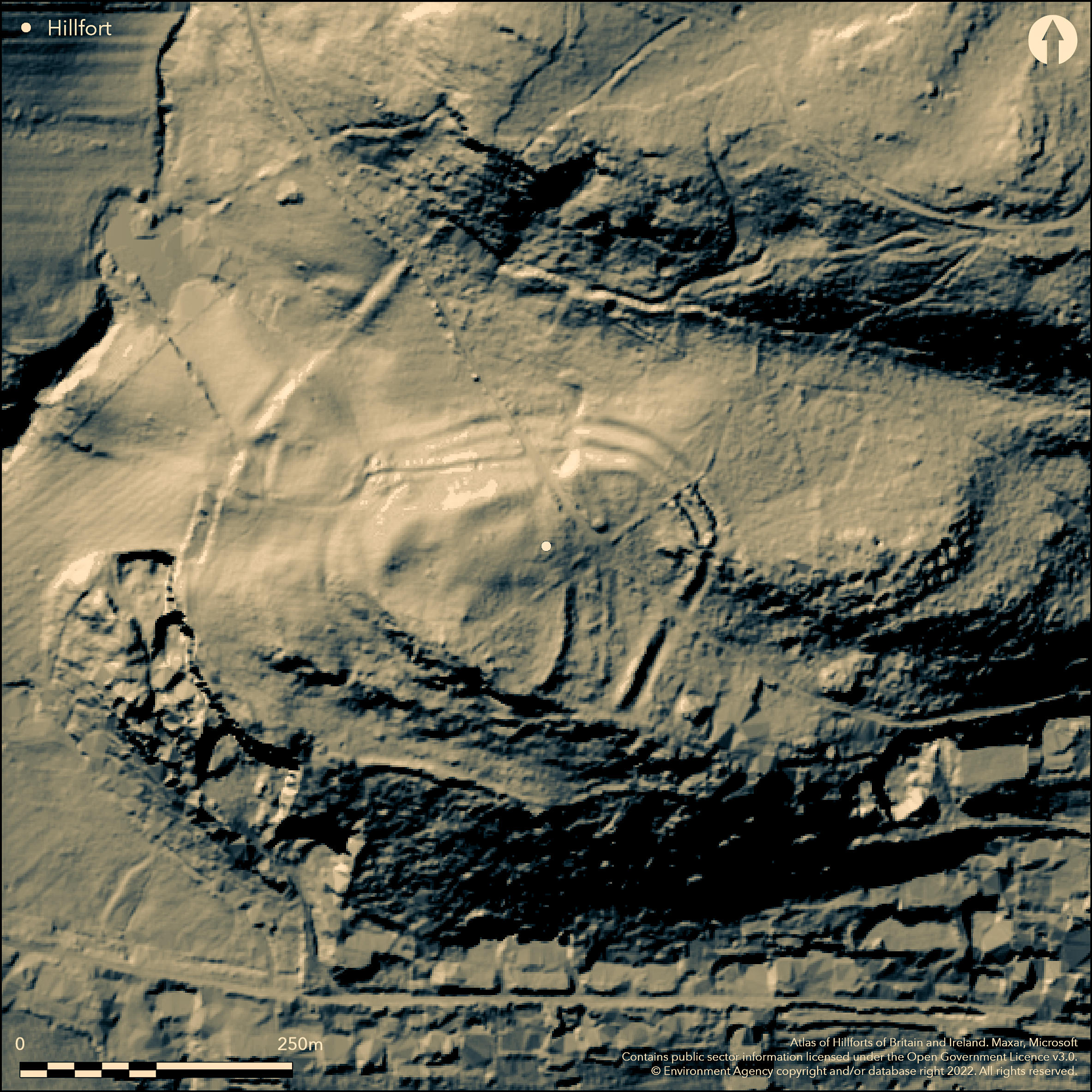
LiDAR 1m DTM Hillshade
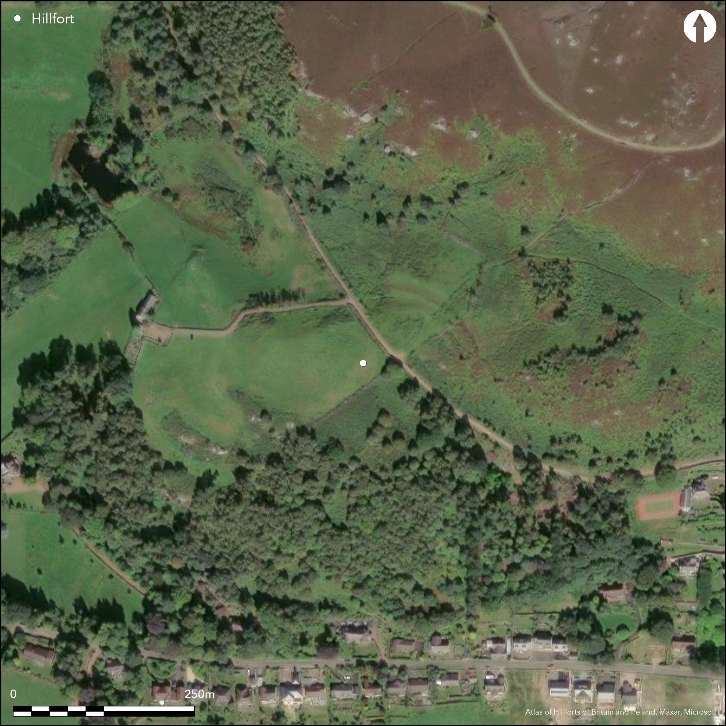
Satellite Imagery
LiDAR 1m DTM Hillshade
Satellite Imagery
Scroll left/right to view further images.
HER: Northumberland 2839 (None)
NMR: NU 00 SW 25 (4718)
SM: 1011616
NGR: NU 04615 01980
X: 404615 Y: 601980 (OSGB36)
A bivallate hillfort lying 160m to the NW outskirts of Rothbury. Oval in plan it measures 165m E-W by 125m N-S, enclosing 1.7ha. It lies on a knoll known as Kimmer Nod, above a rocky spur where it commands views along the Coquet Valley to the SW and SE. It comprises an inner rampart except in the SW where there are steep slopes. An external ditch lies in the N and E with the rampart standing 1m high above the bottom of the ditch. A rampart and ditch lie in the NE and SW corners with traces of a further outer bank and ditch in the N. In the NW corner a continuation of the ramparts extend along the steep slopes for 100m. Further earthworks lie approximately 60-90m to the N, S and W sides of the hillfort comprising unhewn stone and packed with earth and smaller stones and laid out as straight lines with a large 1m deep ditch in the N. Nine clearance cairns 30m to the N of the hillfort, probably representing agricultural land clearance contemporary with the hillfort, are bounded in the W by the outworks. An entrance lies in the E through the double ramparts with a causeway across the ditch and with scooped hut platforms immediately outside. An earth and stone bank runs across the enclosure from the S towards the centre where three stone-founded hut circles 5-8m in diameter and a small D-shaped enclosure bounded by an internal bank, are aligned along the eastern side. Further hut circles lie in the SE corner and in the southern extremity of the enclosure. The earthworks are now reduced in the W through ploughing and are barely visible in the S. Shown on 1856-65 OS mapping, Minimal investigations, undated.
Citizen Science: ✗
Reliability of Data: Confirmed
Reliability of Interpretation: Confirmed
X: -214717 Y: 7422639 (EPSG: 3857)
Longitude: -1.9288315942689818 Latitude: 55.311914003157995 (EPSG:4326)
Country: England
Current County or Unitary Authority: Northumberland
Historic County: Northumberland
Current Parish/Community/Council/Townland: Rothbury
Included in the 2015 Heritage at Risk Register, with extensive, significant problems from plant growth
| Extant | ✓ |
| Cropmark | ✗ |
| Likely Destroyed | ✗ |
A modern field wall crosses the enclosure SW to NE. Possible arable in the NW with encroaching tree cover and bracken in the SE. A road or track cuts across the hillfort SE to NW.
| Woodland | ✓ |
| Commercial Forestry Plantation | ✗ |
| Parkland | ✗ |
| Pasture (Grazing) | ✗ |
| Arable | ✓ |
| Scrub/Bracken | ✓ |
| Bare Outcrop | ✗ |
| Heather/Moorland | ✗ |
| Heath | ✗ |
| Built-up | ✗ |
| Coastal Grassland | ✗ |
| Other | ✗ |
A hillslope fort lying at approximately 185m OD on a knoll known as Kimmer Nod above a rocky spur. Boggy ground in the E.
| Contour Fort | ✗ |
| Partial Contour Fort | ✓ |
| Promontory Fort | ✗ |
| Hillslope Fort | ✓ |
| Level Terrain Fort | ✗ |
| Marsh Fort | ✗ |
| Multiple Enclosure Fort | ✗ |
| Hilltop | ✗ |
| Coastal Promontory | ✗ |
| Inland Promontory | ✗ |
| Valley Bottom | ✗ |
| Knoll/Hillock/Outcrop | ✓ |
| Ridge | ✗ |
| Cliff/Plateau-edge/Scarp | ✗ |
| Hillslope | ✓ |
| Lowland | ✗ |
| Spur | ✗ |
Dominant Topographic Feature: Knoll above a rocky spur
| North | ✗ |
| Northeast | ✗ |
| East | ✗ |
| Southeast | ✗ |
| South | ✗ |
| Southwest | ✓ |
| West | ✗ |
| Northwest | ✗ |
| Level | ✗ |
Altitude: 185.0m
N/A
Undated, presumed Iron Age
Reliability: D - None
| Pre 1200BC | ✗ |
| 1200BC - 800BC | ✗ |
| 800BC - 400BC | ✗ |
| 400BC - AD50 | ✗ |
| AD50 - AD400 | ✗ |
| AD400 - AD 800 | ✗ |
| Post AD800 | ✗ |
| Unknown | ✓ |
| Pre Hillfort: | None |
| Post Hillfort: | None |
| Morphology/Earthwork/Typology: | None |
Shown on 1856-65 OS mapping and included in MacLauchlan 1867. First scheduled in 1934, field investigations in 1957 and 1972
| 1st Identified Written Reference (1867): | None |
| Other (1934): | Scheduled |
| Other (1957): | Field investigation |
| Other (1972): | Field investigation |
| 1st Identified Map Depiction (None): | None |
An earth and stone bank runs across the enclosure from the S towards the centre where three stone-founded hut circles 5-8m in diameter and a small D-shaped enclosure bounded by an internal bank, are aligned along the eastern side. Further hut circles lie in the SE corner and in the southern extremity of the enclosure.
None
| None | ✓ |
| Spring | ✗ |
| Stream | ✗ |
| Pool | ✗ |
| Flush | ✗ |
| Well | ✗ |
| Other | ✗ |
Earth and stone bank runs across the enclosure
| No Known Features | ✗ |
| Round Stone Structures | ✓ |
| Rectangular Stone Structures | ✗ |
| Curvilinear Platforms | ✗ |
| Other Roundhouse Evidence | ✗ |
| Pits | ✗ |
| Quarry Hollows | ✗ |
| Other | ✓ |
None
| No Known Excavation | ✓ |
| Pits | ✗ |
| Postholes | ✗ |
| Roundhouses | ✗ |
| Rectangular Structures | ✗ |
| Roads/Tracks | ✗ |
| Quarry Hollows | ✗ |
| Other | ✗ |
| Nothing Found | ✗ |
None
| No Known Geophysics | ✓ |
| Pits | ✗ |
| Roundhouses | ✗ |
| Rectangular Structures | ✗ |
| Roads/Tracks | ✗ |
| Quarry Hollows | ✗ |
| Other | ✗ |
| Nothing Found | ✗ |
None
| No Known Finds | ✓ |
| Pottery | ✗ |
| Metal | ✗ |
| Metalworking | ✗ |
| Human Bones | ✗ |
| Animal Bones | ✗ |
| Lithics | ✗ |
| Environmental | ✗ |
| Other | ✗ |
None
| APs Not Checked | ✓ |
| None | ✗ |
| Roundhouses | ✗ |
| Rectangular Structures | ✗ |
| Pits | ✗ |
| Postholes | ✗ |
| Roads/Tracks | ✗ |
| Other | ✗ |
An entrance lies in the E through the double ramparts with a causeway across the ditch
| 2: | None |
| 2: | None |
Guard Chambers: ✗
Chevaux de Frise: ✗
| 1. Simple Gap (East): | None |
| 1. Simple Gap (East): | None |
Oval in plan it measures 165m E-W by 125m N-S. Naturally defended by precipitous slopes in the SW, an external ditch lies in the N and E with the rampart standing 1m high above the bottom of the ditch. A rampart and ditch lie in the NE and SW corners with traces of a further outer bank and ditch in the N. In the NW corner a continuation of the ramparts extend along the steep slopes for 100m. Further defensive earthworks lie approximately 60-90m to the N, S and W sides of the hillfort laid out as straight lines with a large 1m deep ditch in the N.
| Area 1: | 1.7ha. |
| Total: | 1.7ha. |
Total Footprint Area: Noneha.
None
| ✗ | Area estimated from satellite imagery. |
| ✗ | None |
| NE Quadrant: | 2 |
| SE Quadrant: | 1 |
| SW Quadrant: | 1 |
| NW Quadrant: | 2 |
| Total: | 2 |
| Partial Univallate | ✓ |
| Univallate | ✗ |
| Partial Bivallate | ✓ |
| Bivallate | ✗ |
| Partial Multivallate | ✗ |
| Multivallate | ✗ |
| Unknown | ✗ |
| Partial Univallate | ✗ |
| Univallate | ✗ |
| Partial Bivallate | ✗ |
| Bivallate | ✗ |
| Partial Multivallate | ✗ |
| Multivallate | ✗ |
The main rampart material in the N is described as stone, but no further information is available.
| None | ✗ |
| Earthen Bank | ✗ |
| Stone Wall | ✓ |
| Rubble | ✓ |
| Wall-walk | ✗ |
| Evidence of Timber | ✗ |
| Vitrification | ✗ |
| Other Burning | ✗ |
| Palisade | ✗ |
| Counter Scarp Bank | ✗ |
| Berm | ✗ |
| Unfinished | ✗ |
| Other | ✗ |
None
| None | ✗ |
| Earthen Bank | ✗ |
| Stone Wall | ✗ |
| Murus Duplex | ✗ |
| Timber-framed | ✗ |
| Timber-laced | ✗ |
| Vitrification | ✗ |
| Other Burning | ✗ |
| Palisade | ✗ |
| Counter Scarp Bank | ✗ |
| Berm | ✗ |
| Unfinished | ✗ |
| No Known Excavation | ✓ |
| Other | ✗ |
| ✗ | None |
| ✓ | External ditch in N and E. Traces of a second rampart and ditch at the NE and SW corners of the hillfort |
Number of Ditches: 3
| ✗ | None |
Hedley, R.C. 1989: The Pre-Historic Camps of Northumberland. Old Rothbury Camp. Archaeol Aeliana 13, 230-3
Jobey, G.1965. Hillforts and Settlements in Northumberland. Archaeol Aeliana (4th Series) 43, 60.
MacLauchlan, H., 1867. Notes not included in the memoirs already published on Roman roads in Northumberland (Alnwick), 82
Atlas of Hillforts:
Wikidata:
This work is licensed under CC BY-SA 4.0

 and should be cited as:
Lock, Gary and Ralston, Ian. 2024. Atlas of Hillforts of Britain and Ireland. Available at: https://hillforts.arch.ox.ac.uk
Document Version 1.1