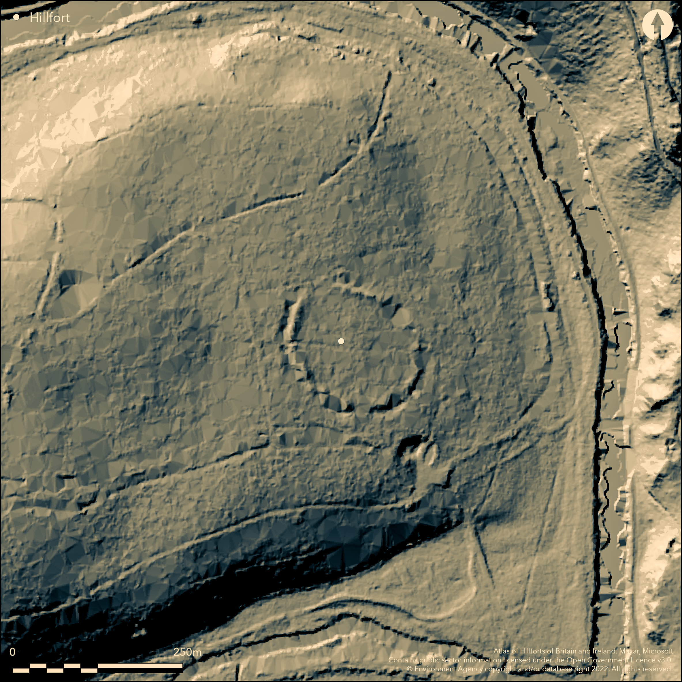
LiDAR 1m DTM Hillshade
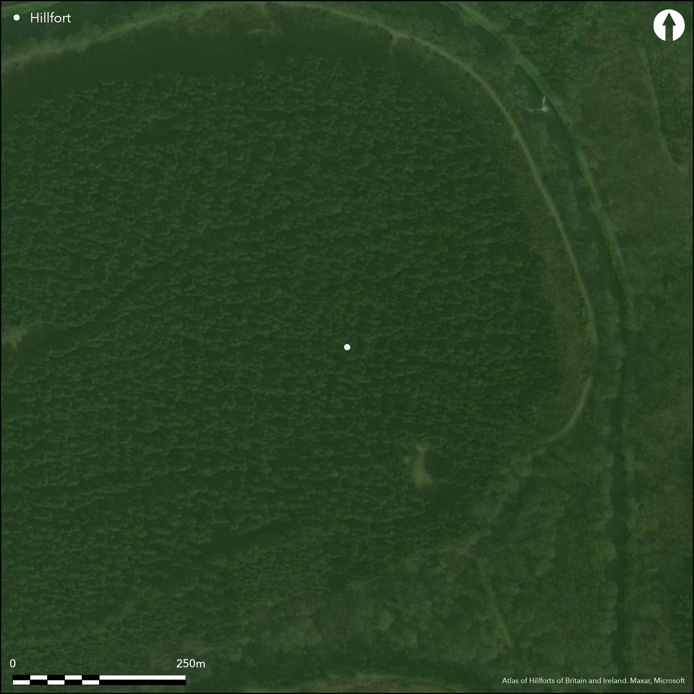
Satellite Imagery
LiDAR 1m DTM Hillshade
Satellite Imagery
Scroll left/right to view further images.
HER: Cornwall and Scilly MCO41 (6974)
NMR: SX 37 NE 4 (436749)
SM: None
NGR: SX37757825
X: 237750 Y: 78250 (OSGB36)
Round, multivallate, contour hillfort located on wooded spur commanding bends of River Tamar to N and River Inney to S. Sloping gently from SW - NE, with much higher ground to S on the S side of the River Inney. Internal diameter c. 100m, encloses 0.8ha. Single mixed stone and earth bank with ditch discontinuous suggests possibly unfinished. Rampart fairly strong to 2m high above ditch bottom in places, although the ditch mostly filled and incomplete in part and intended course marked by series of pits, suggesting possible gang construction. Both rampart and ditch interrupted by broad causeways, again suggesting an unfinished state. Trial excavations (unpublished) by C.K.C. Andrew 1937-38 for the Duke of Bedford, and remains of pit in ditch bottom and trench through the rampart, left open. Trench shows the mixed stone and earth construction of bank. Possible huts in interior. Generally survives well despite tree cover. On 1st Ed. OS map (1884). Undated.
Citizen Science: ✗
Reliability of Data: Confirmed
Reliability of Interpretation: Confirmed
X: -477914 Y: 6547566 (EPSG: 3857)
Longitude: -4.293172221632887 Latitude: 50.581324969128 (EPSG:4326)
Country: England; None
Current County or Unitary Authority: Cornwall
Historic County: Cornwall
Current Parish/Community/Council/Townland: Lezant
Ditch mostly filled and incomplete, but generally survives well despite tree cover.
| Extant | ✓ |
| Cropmark | ✗ |
| Likely Destroyed | ✗ |
Dense woodland over total site.
| Woodland | ✓ |
| Commercial Forestry Plantation | ✗ |
| Parkland | ✗ |
| Pasture (Grazing) | ✗ |
| Arable | ✗ |
| Scrub/Bracken | ✗ |
| Bare Outcrop | ✗ |
| Heather/Moorland | ✗ |
| Heath | ✗ |
| Built-up | ✗ |
| Coastal Grassland | ✗ |
| Other | ✗ |
Round, multivallate, contour hillfort located on wooded spur commanding bends of River Tamar to N and River Inney to S. Sloping gently from SW - NE, with much higher ground to S on the S side of the River Inney.
| Contour Fort | ✓ |
| Partial Contour Fort | ✗ |
| Promontory Fort | ✗ |
| Hillslope Fort | ✗ |
| Level Terrain Fort | ✗ |
| Marsh Fort | ✗ |
| Multiple Enclosure Fort | ✗ |
Located in Carthamartha Wood on a spur overlooking the River Tamar
| Hilltop | ✗ |
| Coastal Promontory | ✗ |
| Inland Promontory | ✗ |
| Valley Bottom | ✗ |
| Knoll/Hillock/Outcrop | ✗ |
| Ridge | ✗ |
| Cliff/Plateau-edge/Scarp | ✗ |
| Hillslope | ✗ |
| Lowland | ✗ |
| Spur | ✓ |
Dominant Topographic Feature: Inland spur
| North | ✗ |
| Northeast | ✗ |
| East | ✗ |
| Southeast | ✗ |
| South | ✗ |
| Southwest | ✓ |
| West | ✗ |
| Northwest | ✗ |
| Level | ✗ |
Altitude: 52.0m
County boundary with Devon just to the N
Boundary Type: County
None
Reliability: D - None
| Pre 1200BC | ✗ |
| 1200BC - 800BC | ✗ |
| 800BC - 400BC | ✗ |
| 400BC - AD50 | ✗ |
| AD50 - AD400 | ✗ |
| AD400 - AD 800 | ✗ |
| Post AD800 | ✗ |
| Unknown | ✓ |
| Pre Hillfort: | None |
| Post Hillfort: | None |
On 1st Ed. OS map (1884). Trial excavation by C.K.C. Andrew 1937-38.
| 1st Identified Map Depiction (1884): | OS map |
| Excavation (None): | C.K.C. Andrew. |
Possible hearth and huts, lightly framed in timber. Remains of pit in ditch bottom. Point of an iron pick or similar implement. Leaf-shaped arrowhead. Slingstones.
None
| None | ✓ |
| Spring | ✗ |
| Stream | ✗ |
| Pool | ✗ |
| Flush | ✗ |
| Well | ✗ |
| Other | ✗ |
None
| No Known Features | ✓ |
| Round Stone Structures | ✗ |
| Rectangular Stone Structures | ✗ |
| Curvilinear Platforms | ✗ |
| Other Roundhouse Evidence | ✗ |
| Pits | ✗ |
| Quarry Hollows | ✗ |
| Other | ✗ |
Possible hearth and huts, lightly framed in timber. Remains of pit in ditch bottom.
| No Known Excavation | ✗ |
| Pits | ✓ |
| Postholes | ✗ |
| Roundhouses | ✓ |
| Rectangular Structures | ✗ |
| Roads/Tracks | ✗ |
| Quarry Hollows | ✗ |
| Other | ✓ |
| Nothing Found | ✗ |
None
| No Known Geophysics | ✓ |
| Pits | ✗ |
| Roundhouses | ✗ |
| Rectangular Structures | ✗ |
| Roads/Tracks | ✗ |
| Quarry Hollows | ✗ |
| Other | ✗ |
| Nothing Found | ✗ |
Point of an iron pick or similar implement. Leaf-shaped arrowhead. Slingstones.
| No Known Finds | ✗ |
| Pottery | ✗ |
| Metal | ✓ |
| Metalworking | ✗ |
| Human Bones | ✗ |
| Animal Bones | ✗ |
| Lithics | ✓ |
| Environmental | ✗ |
| Other | ✗ |
None
| APs Not Checked | ✓ |
| None | ✗ |
| Roundhouses | ✗ |
| Rectangular Structures | ✗ |
| Pits | ✗ |
| Postholes | ✗ |
| Roads/Tracks | ✗ |
| Other | ✗ |
Possibly five gaps. Original entrance not determined, but E and W entrances surmised.
| 5: | Possibly five gaps. Original entrance not determined, but E and W entrances surmised. |
| 2: | None |
Guard Chambers: ✗
Chevaux de Frise: ✗
| 1. Simple Gap (East): | Entrance surmised. |
| 2. Simple Gap (West): | Entrance surmised. |
Single mixed stone and earth bank with ditch discontinuous suggests possibly unfinished. Rampart fairly strong to 2m high above ditch bottom in places, although the ditch mostly filled and incomplete in part and intended course marked by series of pits, suggesting possible gang construction. Both rampart and ditch interrupted by broad causeways, again suggesting an unfinished state. Trial excavations (unpublished) by C.K.C Andrew 1937-38 for the Duke of Bedford, and remains of pit in ditch bottom and trench through the rampart, left open. Trench shows the mixed stone and earth construction of bank.
| Area 1: | 0.8ha. |
| Total: | 0.8ha. |
Total Footprint Area: Noneha.
None
| ✗ | None |
| ✗ | Bank and ditch discontinuous around circuit and, as such, causeways suggest possibly unfinished. |
| NE Quadrant: | 1 |
| SE Quadrant: | 1 |
| SW Quadrant: | 1 |
| NW Quadrant: | 1 |
| Total: | 1 |
| Partial Univallate | ✗ |
| Univallate | ✓ |
| Partial Bivallate | ✗ |
| Bivallate | ✗ |
| Partial Multivallate | ✗ |
| Multivallate | ✗ |
| Unknown | ✗ |
| Partial Univallate | ✗ |
| Univallate | ✗ |
| Partial Bivallate | ✗ |
| Bivallate | ✗ |
| Partial Multivallate | ✗ |
| Multivallate | ✗ |
Trial trench left open reveals mixed earth and stone bank material. Bank and ditch discontinuous around circuit and, as such, causeways suggest possibly unfinished.
| None | ✗ |
| Earthen Bank | ✓ |
| Stone Wall | ✗ |
| Rubble | ✓ |
| Wall-walk | ✗ |
| Evidence of Timber | ✗ |
| Vitrification | ✗ |
| Other Burning | ✗ |
| Palisade | ✗ |
| Counter Scarp Bank | ✗ |
| Berm | ✗ |
| Unfinished | ✓ |
| Other | ✗ |
Mixed earth and stone bank.
| None | ✗ |
| Earthen Bank | ✓ |
| Stone Wall | ✗ |
| Murus Duplex | ✗ |
| Timber-framed | ✗ |
| Timber-laced | ✗ |
| Vitrification | ✗ |
| Other Burning | ✗ |
| Palisade | ✗ |
| Counter Scarp Bank | ✗ |
| Berm | ✗ |
| Unfinished | ✗ |
| No Known Excavation | ✗ |
| Other | ✓ |
| ✓ | Although the ditch mostly filled and incomplete in part, intended course marked by series of pits, suggesting possible gang construction. |
| ✓ | Ditch mostly filled and incomplete in part. |
Number of Ditches: 1
| ✗ | None |
Page, W. ed. 1906. The Victoria History of the County of Cornwall, 1, London: James Street, 466.
Peter, O.B. 1902. Ancient earth-fenced town and village sites of Cornwall, J Royal Inst Cornwall, 15.
Walford, G.F. and Quinnell, N. 1997. C.K. Andrews's excavations in Tavistock Woodlands in 1937 and 1938, Cornish Archaeol, 36, 77-95.
Atlas of Hillforts:
Wikidata:
This work is licensed under CC BY-SA 4.0

 and should be cited as:
Lock, Gary and Ralston, Ian. 2024. Atlas of Hillforts of Britain and Ireland. Available at: https://hillforts.arch.ox.ac.uk
Document Version 1.1