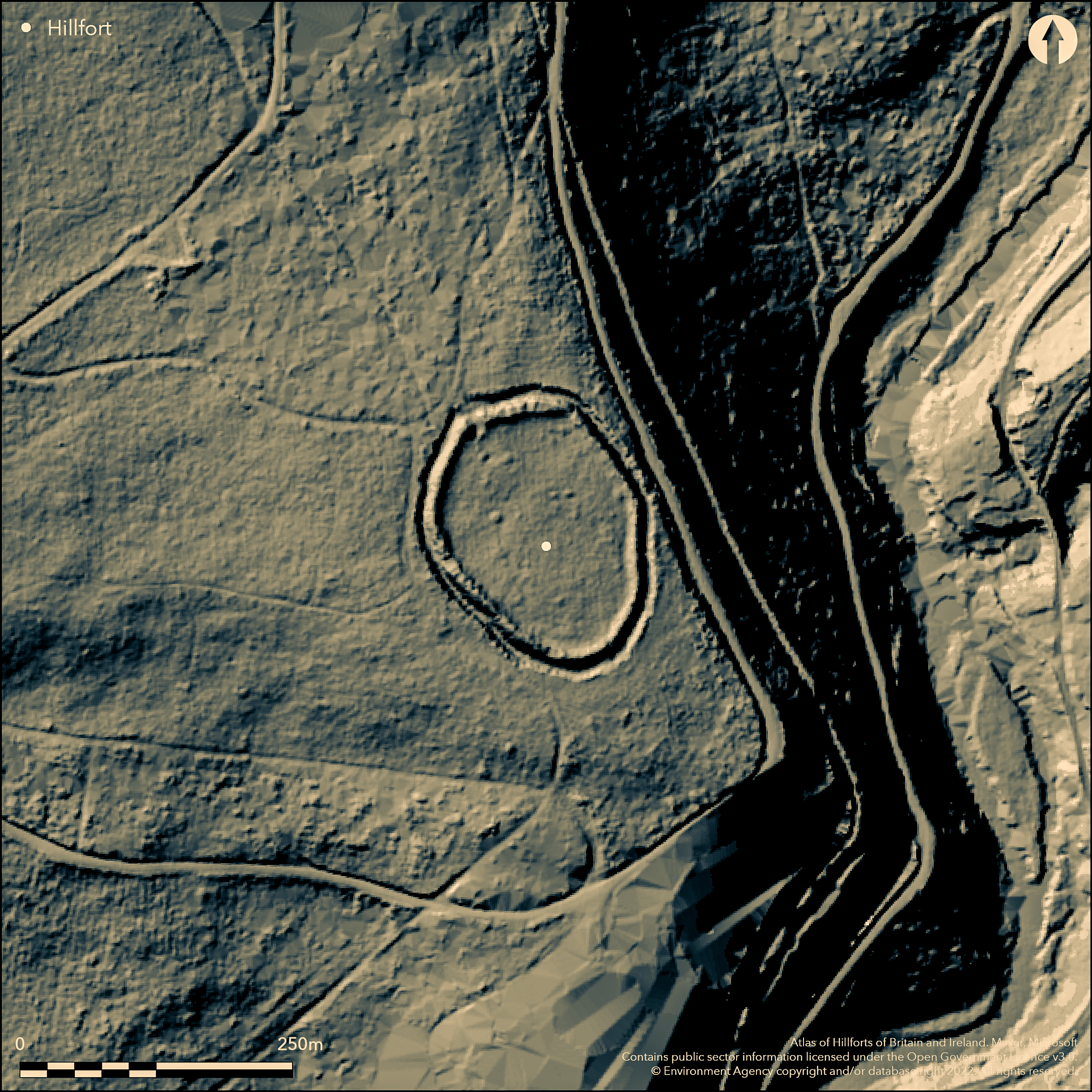
LiDAR 1m DTM Hillshade
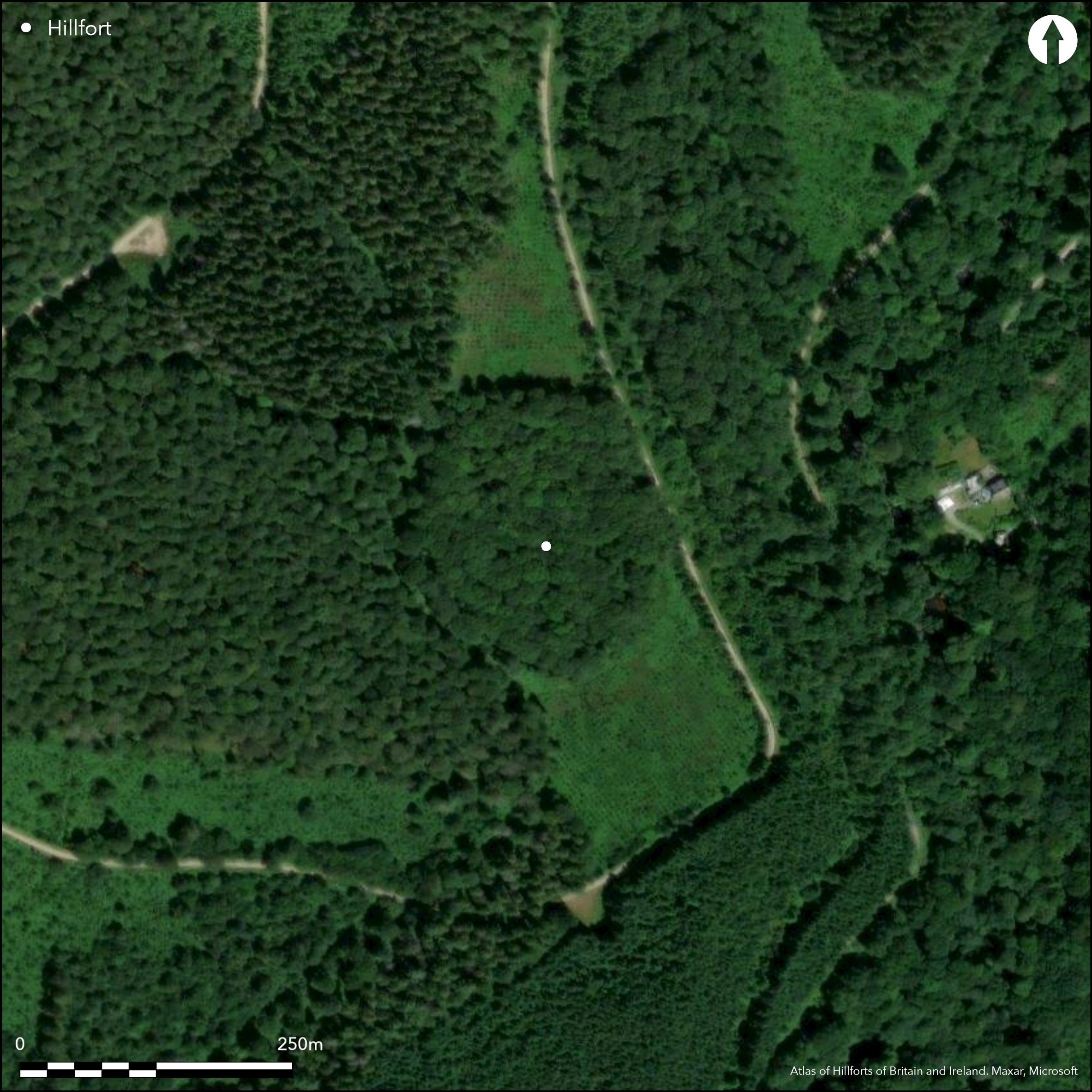
Satellite Imagery
LiDAR 1m DTM Hillshade
Satellite Imagery
Scroll left/right to view further images.
HER: Cornwall and Scilly MCO57 (4301)
NMR: SX 06 NE 20 (431336)
SM: 1004424
NGR: SX0508068650
X: 205080 Y: 68650 (OSGB36)
Univallate partial contour hillfort located in Dunmere Wood on high, nearly level, ground of upper SE-facing slopes of prominent hill, and at top of steep W valley side of River Camel, just N of Bodmin in central Cornwall. Very steep/precipitous surrounding slopes to E above wooded river valley (E side of fort abuts this precipitous valley), steep, then very steep, also above river on S, steep on SW and moderate to steep on NW. Takes advantage of sloping shoulder of the hill, gaining good natural position on two sides. Sub-oval measures c. 180m long by 135m wide enclosing possible internal area 2.5ha. Defined by single, strong and steep, rampart to 3m high, with rock-cut outer ditch of to 2m deep with near vertical sides in part. Both complete around circuit. Slightly inturned causewayed entrance to NW, with two short 1m high outer banks and inner bank, these possibly modern. In interior, two slight hollows to SSE may be terraces for houses or later charcoal burning platforms. Known locally as 'Dunmere Camp', first recorded by H. MacLauchlan 1849. Belonged to Priory of Bodmin in medieval period and already covered in woodland then. Place-name 'Dunmere', which means 'Great Fort', first recorded in 1220. Densely wooded with tree and path damage. On 1st Ed. OS 1" map (1813) and 1st Ed. OS 1:2500 map (1881). Undated.
Citizen Science: ✗
Reliability of Data: Confirmed
Reliability of Interpretation: Confirmed
X: -528667 Y: 6530714 (EPSG: 3857)
Longitude: -4.74909843579651 Latitude: 50.485097127116894 (EPSG:4326)
Country: England; None
Current County or Unitary Authority: Cornwall
Historic County: Cornwall
Current Parish/Community/Council/Townland: Lanivet; Helland
Paths and tree damage and very overgrown, but strong, well-preserved, rampart and ditch complete.
| Extant | ✓ |
| Cropmark | ✗ |
| Likely Destroyed | ✗ |
Dense woodland cover.
| Woodland | ✓ |
| Commercial Forestry Plantation | ✗ |
| Parkland | ✗ |
| Pasture (Grazing) | ✗ |
| Arable | ✗ |
| Scrub/Bracken | ✗ |
| Bare Outcrop | ✗ |
| Heather/Moorland | ✗ |
| Heath | ✗ |
| Built-up | ✗ |
| Coastal Grassland | ✗ |
| Other | ✗ |
Univallate partial contour hillfort located in Dunmere Wood on high, nearly level, ground of upper SE-facing slopes of prominent hill, and at top of steep W valley side of River Camel, just N of Bodmin in central Cornwall. Very steep/precipitous surrounding slopes to E above wooded river valley (E side of fort abuts this precipitous valley), steep, then very steep, also above river on S, steep on SW and moderate to steep on NW. Takes advantage of sloping shoulder of the hill, gaining good natural position on two sides.
| Contour Fort | ✗ |
| Partial Contour Fort | ✓ |
| Promontory Fort | ✗ |
| Hillslope Fort | ✗ |
| Level Terrain Fort | ✗ |
| Marsh Fort | ✗ |
| Multiple Enclosure Fort | ✗ |
Located on high ground with the slope precipitous on the east side
| Hilltop | ✗ |
| Coastal Promontory | ✗ |
| Inland Promontory | ✗ |
| Valley Bottom | ✗ |
| Knoll/Hillock/Outcrop | ✗ |
| Ridge | ✗ |
| Cliff/Plateau-edge/Scarp | ✗ |
| Hillslope | ✗ |
| Lowland | ✗ |
| Spur | ✓ |
Dominant Topographic Feature: Spur
| North | ✗ |
| Northeast | ✗ |
| East | ✗ |
| Southeast | ✓ |
| South | ✗ |
| Southwest | ✗ |
| West | ✗ |
| Northwest | ✗ |
| Level | ✗ |
Altitude: 110.0m
Parish boundary with Helland runs just to the E
Boundary Type: Parish/Townland
None.
Reliability: D - None
| Pre 1200BC | ✗ |
| 1200BC - 800BC | ✗ |
| 800BC - 400BC | ✗ |
| 400BC - AD50 | ✗ |
| AD50 - AD400 | ✗ |
| AD400 - AD 800 | ✗ |
| Post AD800 | ✗ |
| Unknown | ✓ |
| Pre Hillfort: | None |
| Post Hillfort: | Possible. In interior, two slight hollows to SSE may be terraces for contemporary houses or later charcoal burning platforms. |
Place-name 'Dunmere', which means 'Great Fort', first recorded in 1220. On 1st Ed. OS 1" map (1813) and 1st Ed. OS 1:2500 map (1881). Recorded by H. MacLaughlan 1849. Mentioned by D. and S. Lysons (1814). Field investigation Ordnance Survey 1974.
| 1st Identified Written Reference (1220): | Place-name 'Dunmere', which means 'Great Fort', first recorded in 1220. |
| 1st Identified Map Depiction (1813): | OS 1" map. |
| Other (1814): | Mentioned by D. and S. Lysons. |
| Other (1849): | Recorded H. MacLaughlan. |
| Other (1881): | OS 1:2500 map. |
| Other (1974): | Field investigation OS. |
In interior, two slight hollows to SSE may be terraces for contemporary houses or charcoal burning platforms.
None
| None | ✓ |
| Spring | ✗ |
| Stream | ✗ |
| Pool | ✗ |
| Flush | ✗ |
| Well | ✗ |
| Other | ✗ |
In interior, two slight hollows to SSE may be terraces for houses or charcoal burning platforms.
| No Known Features | ✗ |
| Round Stone Structures | ✗ |
| Rectangular Stone Structures | ✗ |
| Curvilinear Platforms | ✓ |
| Other Roundhouse Evidence | ✗ |
| Pits | ✗ |
| Quarry Hollows | ✗ |
| Other | ✓ |
None
| No Known Excavation | ✓ |
| Pits | ✗ |
| Postholes | ✗ |
| Roundhouses | ✗ |
| Rectangular Structures | ✗ |
| Roads/Tracks | ✗ |
| Quarry Hollows | ✗ |
| Other | ✗ |
| Nothing Found | ✗ |
None
| No Known Geophysics | ✓ |
| Pits | ✗ |
| Roundhouses | ✗ |
| Rectangular Structures | ✗ |
| Roads/Tracks | ✗ |
| Quarry Hollows | ✗ |
| Other | ✗ |
| Nothing Found | ✗ |
None
| No Known Finds | ✓ |
| Pottery | ✗ |
| Metal | ✗ |
| Metalworking | ✗ |
| Human Bones | ✗ |
| Animal Bones | ✗ |
| Lithics | ✗ |
| Environmental | ✗ |
| Other | ✗ |
None
| APs Not Checked | ✓ |
| None | ✗ |
| Roundhouses | ✗ |
| Rectangular Structures | ✗ |
| Pits | ✗ |
| Postholes | ✗ |
| Roads/Tracks | ✗ |
| Other | ✗ |
Slightly inturned causewayed entrance to NW. This simple entrance has two short 1m high outer "covering" banks and an inner bank, all possibly modern.
| 1: | None |
| 2: | Possibly modern outer banks. |
Guard Chambers: ✗
Chevaux de Frise: ✗
| 1. In-turned (North west): | Slightly inturned causewayed entrance. |
Takes advantage of sloping shoulder of the hill, gaining good natural defences on two sides. Measures c. 180m long by 135m wide. Single strong and steep rampart to 3m high, with rock-cut outer ditch of to 2m deep with near vertical sides in part. Both complete around circuit.
| Area 1: | 2.5ha. |
| Total: | 2.5ha. |
Total Footprint Area: Noneha.
None
| ✗ | None |
| ✓ | None |
| NE Quadrant: | 1 |
| SE Quadrant: | 1 |
| SW Quadrant: | 1 |
| NW Quadrant: | 1 |
| Total: | 1 |
| Partial Univallate | ✗ |
| Univallate | ✓ |
| Partial Bivallate | ✗ |
| Bivallate | ✗ |
| Partial Multivallate | ✗ |
| Multivallate | ✗ |
| Unknown | ✗ |
| Partial Univallate | ✗ |
| Univallate | ✗ |
| Partial Bivallate | ✗ |
| Bivallate | ✗ |
| Partial Multivallate | ✗ |
| Multivallate | ✗ |
None
| None | ✗ |
| Earthen Bank | ✓ |
| Stone Wall | ✗ |
| Rubble | ✗ |
| Wall-walk | ✗ |
| Evidence of Timber | ✗ |
| Vitrification | ✗ |
| Other Burning | ✗ |
| Palisade | ✗ |
| Counter Scarp Bank | ✗ |
| Berm | ✗ |
| Unfinished | ✗ |
| Other | ✗ |
None
| None | ✗ |
| Earthen Bank | ✗ |
| Stone Wall | ✗ |
| Murus Duplex | ✗ |
| Timber-framed | ✗ |
| Timber-laced | ✗ |
| Vitrification | ✗ |
| Other Burning | ✗ |
| Palisade | ✗ |
| Counter Scarp Bank | ✗ |
| Berm | ✗ |
| Unfinished | ✗ |
| No Known Excavation | ✓ |
| Other | ✗ |
| ✗ | None |
| ✓ | Rock-cut outer ditch. |
Number of Ditches: 1
| ✗ | None |
Forde-Johnston, J. 1977. Hillforts of the Iron Age in England and Wales, Liverpool: Liverpool University Press, 77.
Lysons, D. and Lysons, S. 1814. Magna Britannia, Vol III, Cornwall.
MacLauchlan, W. 1849. Report, J Royal Inst Cornwall, 31, 24.
Page, W (Ed), 1906. Victoria History of the County of Cornwall. Vol. 1, 464.
Atlas of Hillforts:
Wikidata:
This work is licensed under CC BY-SA 4.0

 and should be cited as:
Lock, Gary and Ralston, Ian. 2024. Atlas of Hillforts of Britain and Ireland. Available at: https://hillforts.arch.ox.ac.uk
Document Version 1.1