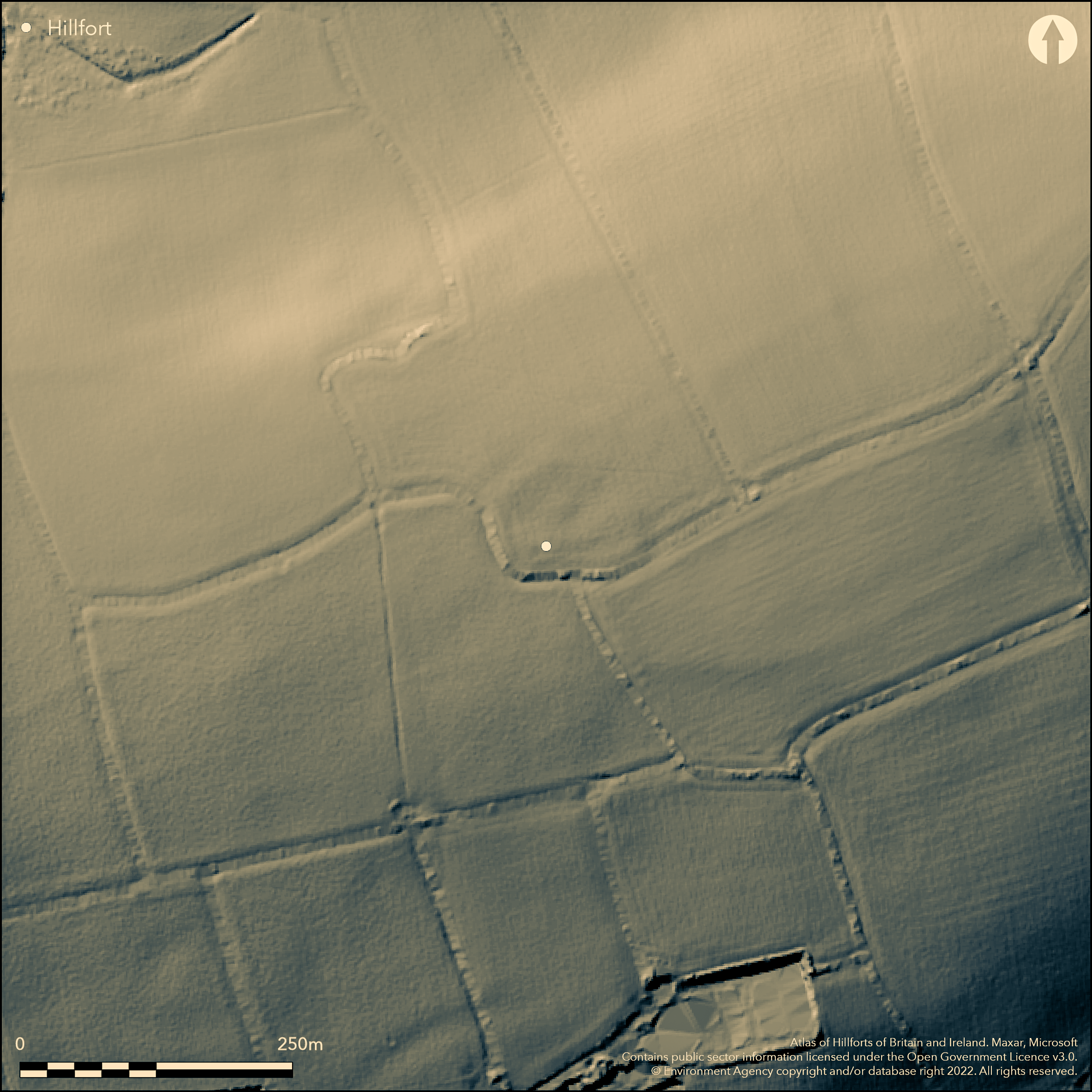
LiDAR 1m DTM Hillshade
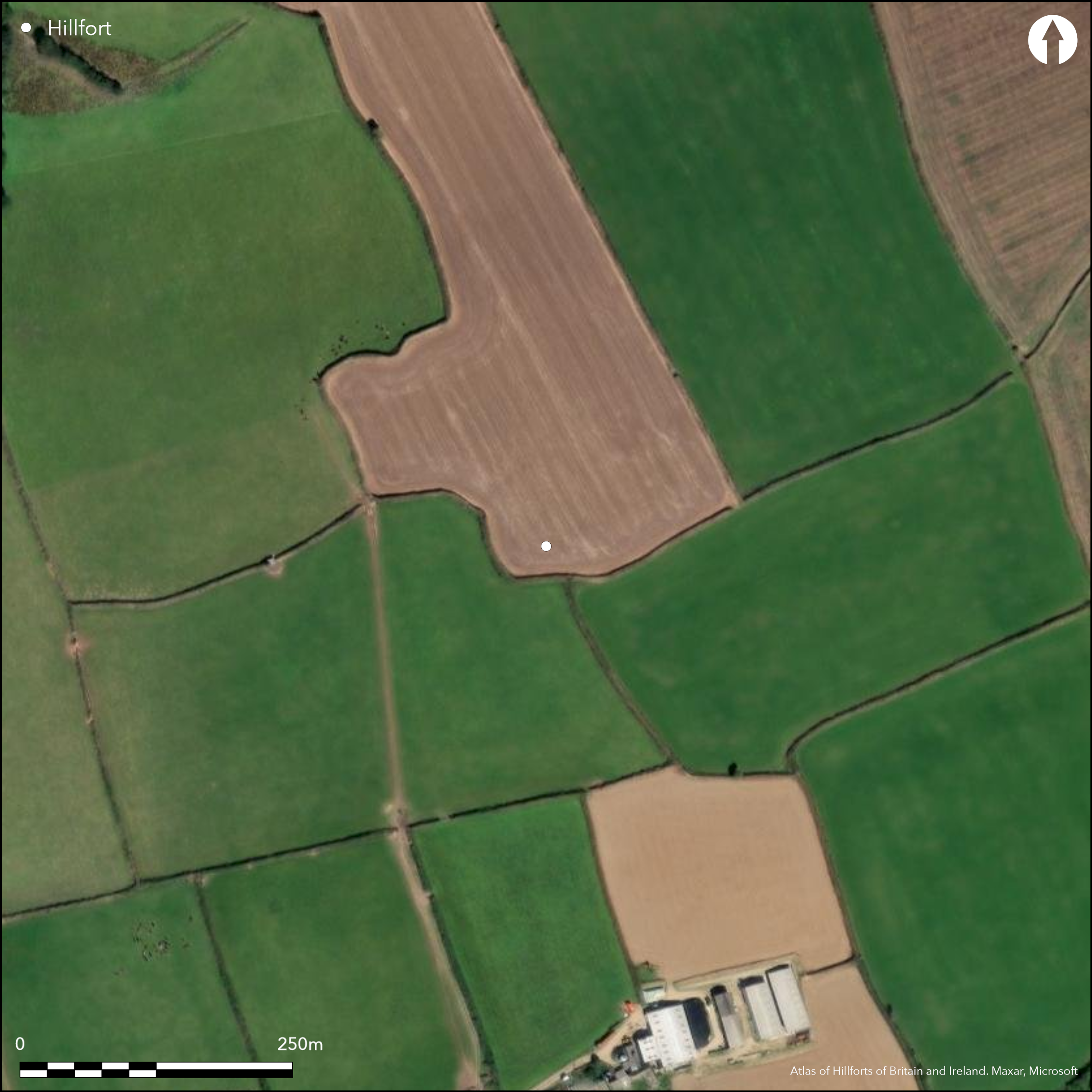
Satellite Imagery
LiDAR 1m DTM Hillshade
Satellite Imagery
Scroll left/right to view further images.
HER: Cornwall and Scilly MCO58 (32017)
NMR: SW 85 SW 22 (429134)
SM: 1020177
NGR: SW 8047 5269
X: 180470 Y: 52690 (OSGB36)
Complex multiple enclosure hillfort sited on slight slope on SW shoulder of a spur/ridge N of Zelah. Steep slopes to S, moderate to N, E, W. Irregular and slightly angular site, measures c. 150m NW-SE and 110m SW-NE overall. Contains ovoid fort, c. 120m NW-SE by 100m NE-SW, with sub-rectangular inner enclosure, and surrounding outer enclosure; in total three enclosed areas of 0.3ha, 1.2ha and 1.65ha respectively. On NE and SE possible parts of associated outwork and field boundary respectively. Inner enclosure, with earth and stone rampart, c. 70m WSW-ENE by 45m NNW-SSE, visible to S and W where modified to form modern field boundary bank, with traces of external ditch c. 5m wide and 0.5m deep at SW corner. Aerial photographs show buried ditch continuing around site, with gap on NE possible entrance and pit-like feature in interior towards N. Outer area enclosed by double ramparts with external ditches. Innermost of these ramparts visible to N and E as bank of earth and stone c.14m wide and to 0.4m high. Aerial photographs show buried ditch outside this bank and continuing beyond it. Also show segments of outermost of these double earthworks which, no doubt, continued around the circuit in prehistory. Gap on side is original entrance, aligned with inner entrance above. Gap 10m-40m wide to bank of inner enclosure. Aerial photographs show possible ditch forming angular outwork (possibly part of an annexe) N from W side of outer entrance. Also show bank running SE from outer enclosure on S thought to be 19th century field boundary, now removed. This feature appears on the St Allen tithe map of 1840. An early 17th century document gives the name 'Plyn en Gwear' for the fort, apparently a variant of the Cornish term 'plain an gwarry', or medieval playing place, a circular embanked arena for miracle plays. Evidence for medieval use as possible quarry. Pasture. Substantially intact. On 1st Ed. OS map (1880). Undated.
Citizen Science: ✗
Reliability of Data: Confirmed
Reliability of Interpretation: Confirmed
X: -566191 Y: 6504158 (EPSG: 3857)
Longitude: -5.086177419293503 Latitude: 50.33306820227505 (EPSG:4326)
Country: England; None
Current County or Unitary Authority: Cornwall
Historic County: Cornwall
Current Parish/Community/Council/Townland: St Allen; Perranzabuloe
Substantially intact despite reduction and modification of banks and ditches. Traces of ditch remain.
| Extant | ✓ |
| Cropmark | ✗ |
| Likely Destroyed | ✗ |
Pasture site.
| Woodland | ✗ |
| Commercial Forestry Plantation | ✗ |
| Parkland | ✗ |
| Pasture (Grazing) | ✓ |
| Arable | ✗ |
| Scrub/Bracken | ✗ |
| Bare Outcrop | ✗ |
| Heather/Moorland | ✗ |
| Heath | ✗ |
| Built-up | ✗ |
| Coastal Grassland | ✗ |
| Other | ✗ |
Complex multiple enclosure hillfort sited on slight slope on SW shoulder of a spur/ridge N of Zelah. Steep slopes to S, moderate to N, E, W.
| Contour Fort | ✗ |
| Partial Contour Fort | ✗ |
| Promontory Fort | ✗ |
| Hillslope Fort | ✗ |
| Level Terrain Fort | ✗ |
| Marsh Fort | ✗ |
| Multiple Enclosure Fort | ✓ |
| Hilltop | ✗ |
| Coastal Promontory | ✗ |
| Inland Promontory | ✗ |
| Valley Bottom | ✗ |
| Knoll/Hillock/Outcrop | ✗ |
| Ridge | ✓ |
| Cliff/Plateau-edge/Scarp | ✗ |
| Hillslope | ✗ |
| Lowland | ✗ |
| Spur | ✓ |
Dominant Topographic Feature: Spur/ridge
| North | ✗ |
| Northeast | ✗ |
| East | ✗ |
| Southeast | ✗ |
| South | ✗ |
| Southwest | ✓ |
| West | ✗ |
| Northwest | ✗ |
| Level | ✗ |
Altitude: 105.0m
Boundary Type: Parish/Townland
None.
Reliability: D - None
| Pre 1200BC | ✗ |
| 1200BC - 800BC | ✗ |
| 800BC - 400BC | ✗ |
| 400BC - AD50 | ✗ |
| AD50 - AD400 | ✗ |
| AD400 - AD 800 | ✗ |
| Post AD800 | ✗ |
| Unknown | ✓ |
| Pre Hillfort: | None |
| Post Hillfort: | An early 17th century document gives the name 'Plyn en Gwear' for the fort, apparently a variant of the Cornish term 'plain an gwarry', or medieval playing place, a circular embanked arena for miracle plays. Evidence for medieval use as possible quarry. |
St Allen tithe map of 1840. Early 17th century document gives the name 'Plyn en Gwear' for site, possibly variant of Cornish 'plain an gwarry', or medieval 'playing place', a circular embanked arena for miracle plays. Suggested in listing that inner enclosure reused in this way. On 1st Ed. OS map (1880). Field investigation Ordnance Survey 1970.
| 1st Identified Map Depiction (1840): | Perranzabuloe Tithe Apportionment. St Allen Tithe Apportionment. |
| Other (1880): | OS map. |
| Other (1970): | Field investigation OS. |
| 1st Identified Written Reference (None): | Document - no details. |
Aerial photographs show pit-like feature in interior towards N. Evidence for medieval use as possible quarry.
None
| None | ✓ |
| Spring | ✗ |
| Stream | ✗ |
| Pool | ✗ |
| Flush | ✗ |
| Well | ✗ |
| Other | ✗ |
Evidence for medieval use as possible quarry.
| No Known Features | ✓ |
| Round Stone Structures | ✗ |
| Rectangular Stone Structures | ✗ |
| Curvilinear Platforms | ✗ |
| Other Roundhouse Evidence | ✗ |
| Pits | ✗ |
| Quarry Hollows | ✗ |
| Other | ✗ |
None
| No Known Excavation | ✓ |
| Pits | ✗ |
| Postholes | ✗ |
| Roundhouses | ✗ |
| Rectangular Structures | ✗ |
| Roads/Tracks | ✗ |
| Quarry Hollows | ✗ |
| Other | ✗ |
| Nothing Found | ✗ |
None
| No Known Geophysics | ✓ |
| Pits | ✗ |
| Roundhouses | ✗ |
| Rectangular Structures | ✗ |
| Roads/Tracks | ✗ |
| Quarry Hollows | ✗ |
| Other | ✗ |
| Nothing Found | ✗ |
None
| No Known Finds | ✓ |
| Pottery | ✗ |
| Metal | ✗ |
| Metalworking | ✗ |
| Human Bones | ✗ |
| Animal Bones | ✗ |
| Lithics | ✗ |
| Environmental | ✗ |
| Other | ✗ |
Show pit-like feature in interior towards N.
| APs Not Checked | ✗ |
| None | ✗ |
| Roundhouses | ✗ |
| Rectangular Structures | ✗ |
| Pits | ✓ |
| Postholes | ✗ |
| Roads/Tracks | ✗ |
| Other | ✗ |
Aligned NE entrances to outer and inner circuits.
| 2: | None |
| 2: | None |
Guard Chambers: ✗
Chevaux de Frise: ✗
| 1. Simple Gap (North east): | To inner enlosure |
| 2. Simple Gap (North east): | To outer enclosure |
Irregular site, c.150m NW-SE and 110m SW-NE. Contains ovoid fort, c. 120m NW-SE by 100m NE-SW, with sub-rectangular inner enclosure, and surrounding outer enclosure, three enclosed areas of 0.3ha, 1.2ha and 1.65ha. On NE and SE possible parts of associated outwork and field boundary respectively. Inner enclosure, with earth and stone rampart, c. 70m WSW-ENE by 45m NNW-SSE, visible to S and W where modified to form modern field boundary bank, with traces of an external ditch c. 5m wide and 0.5m deep at SW corner. Aerial photographs show buried ditch continuing around site. Outer area enclosed by double ramparts with external ditches. Innermost of these ramparts visible to N and E as bank of earth and stone c. 14m wide and to 0.4m high. Aerial photographs show buried ditch outside this bank and continuing beyond it. Also show segments of the outermost of these double earthworks which, no doubt, continued around the circuit in prehistory.
| Area 1: | 0.3ha. |
| Area 2: | 1.2ha. |
| Area 3: | 1.65ha. |
| Total: | 1.65ha. |
Total Footprint Area: Noneha.
None
| ✗ | None |
| ✓ | None |
| NE Quadrant: | 3 |
| SE Quadrant: | 3 |
| SW Quadrant: | 3 |
| NW Quadrant: | 3 |
| Total: | 3 |
| Partial Univallate | ✗ |
| Univallate | ✗ |
| Partial Bivallate | ✗ |
| Bivallate | ✗ |
| Partial Multivallate | ✗ |
| Multivallate | ✓ |
| Unknown | ✗ |
| Partial Univallate | ✗ |
| Univallate | ✗ |
| Partial Bivallate | ✗ |
| Bivallate | ✗ |
| Partial Multivallate | ✗ |
| Multivallate | ✗ |
Aerial photograph evidence of ditches and banks.
| None | ✗ |
| Earthen Bank | ✓ |
| Stone Wall | ✗ |
| Rubble | ✓ |
| Wall-walk | ✗ |
| Evidence of Timber | ✗ |
| Vitrification | ✗ |
| Other Burning | ✗ |
| Palisade | ✗ |
| Counter Scarp Bank | ✗ |
| Berm | ✗ |
| Unfinished | ✗ |
| Other | ✓ |
None
| None | ✗ |
| Earthen Bank | ✗ |
| Stone Wall | ✗ |
| Murus Duplex | ✗ |
| Timber-framed | ✗ |
| Timber-laced | ✗ |
| Vitrification | ✗ |
| Other Burning | ✗ |
| Palisade | ✗ |
| Counter Scarp Bank | ✗ |
| Berm | ✗ |
| Unfinished | ✗ |
| No Known Excavation | ✓ |
| Other | ✗ |
| ✗ | None |
| ✓ | Aerial photograph evidence. |
Number of Ditches: 3
| ✓ | Aerial photographs show possible ditch forming angular outwork (possibly part of an annexe) N from W side of outer entrance. |
Henderson, C. 1914. Notebooks of Parochial Antiquities, MS At RIC, Vol 3, 191.
Henderson, C. 1915. Topography of Cornwall, MS At RIC. Vol 4, 9, 120.
Maclaughlan, H. 1849. Notes on Restormel Castle, RRIC, Vol 32. Vol XXIX, 29.
Thomas, R. 1851. Letters to the West Briton, At CSL, Redruth. Nos 40, 43.
Tithe Award. 1840s. Perranzabuloe.
Warner, R. 1964. St Allen Checklist, CA No 3. Vol 3, 98-99.
Atlas of Hillforts:
Wikidata:
This work is licensed under CC BY-SA 4.0

 and should be cited as:
Lock, Gary and Ralston, Ian. 2024. Atlas of Hillforts of Britain and Ireland. Available at: https://hillforts.arch.ox.ac.uk
Document Version 1.1