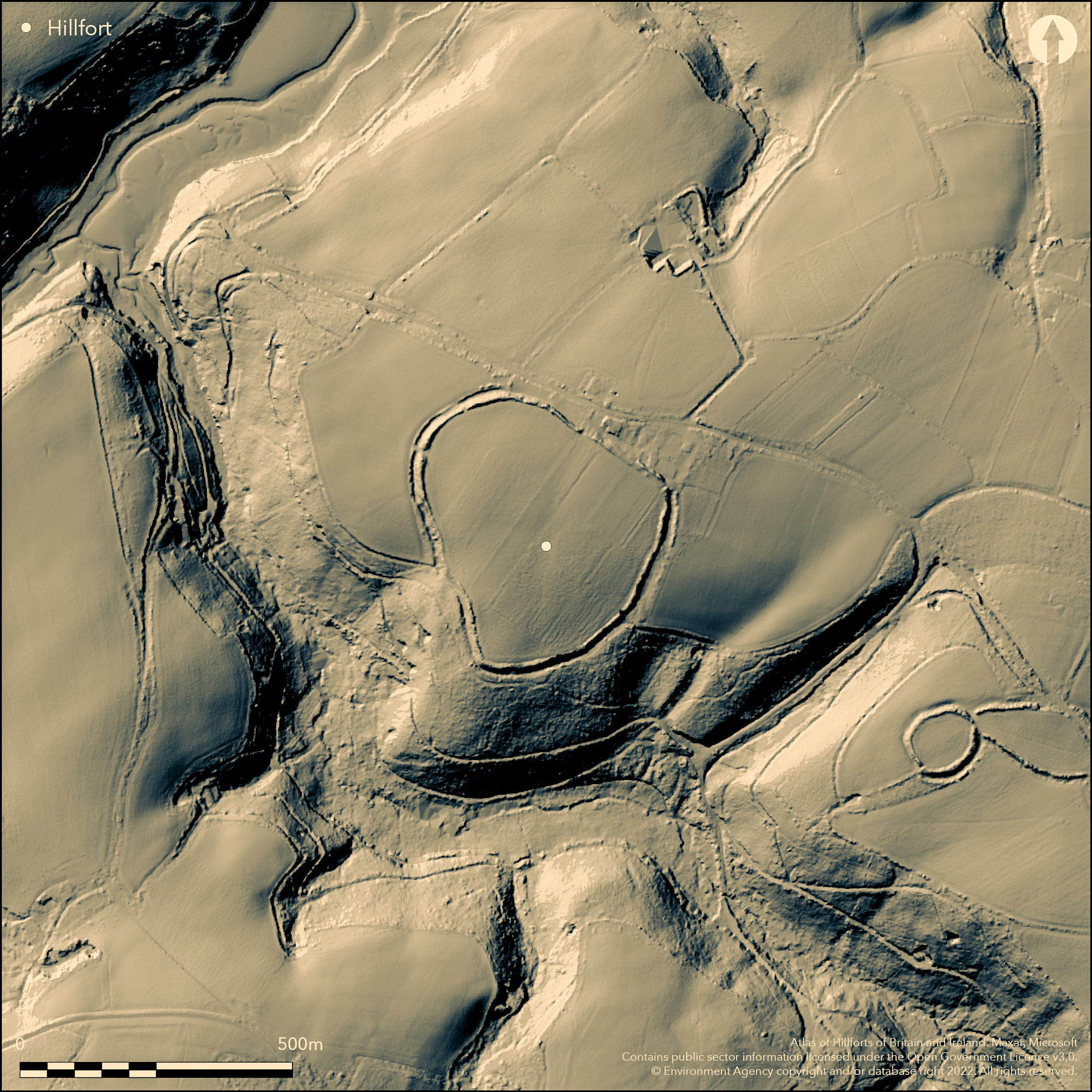
LiDAR 1m DTM Hillshade
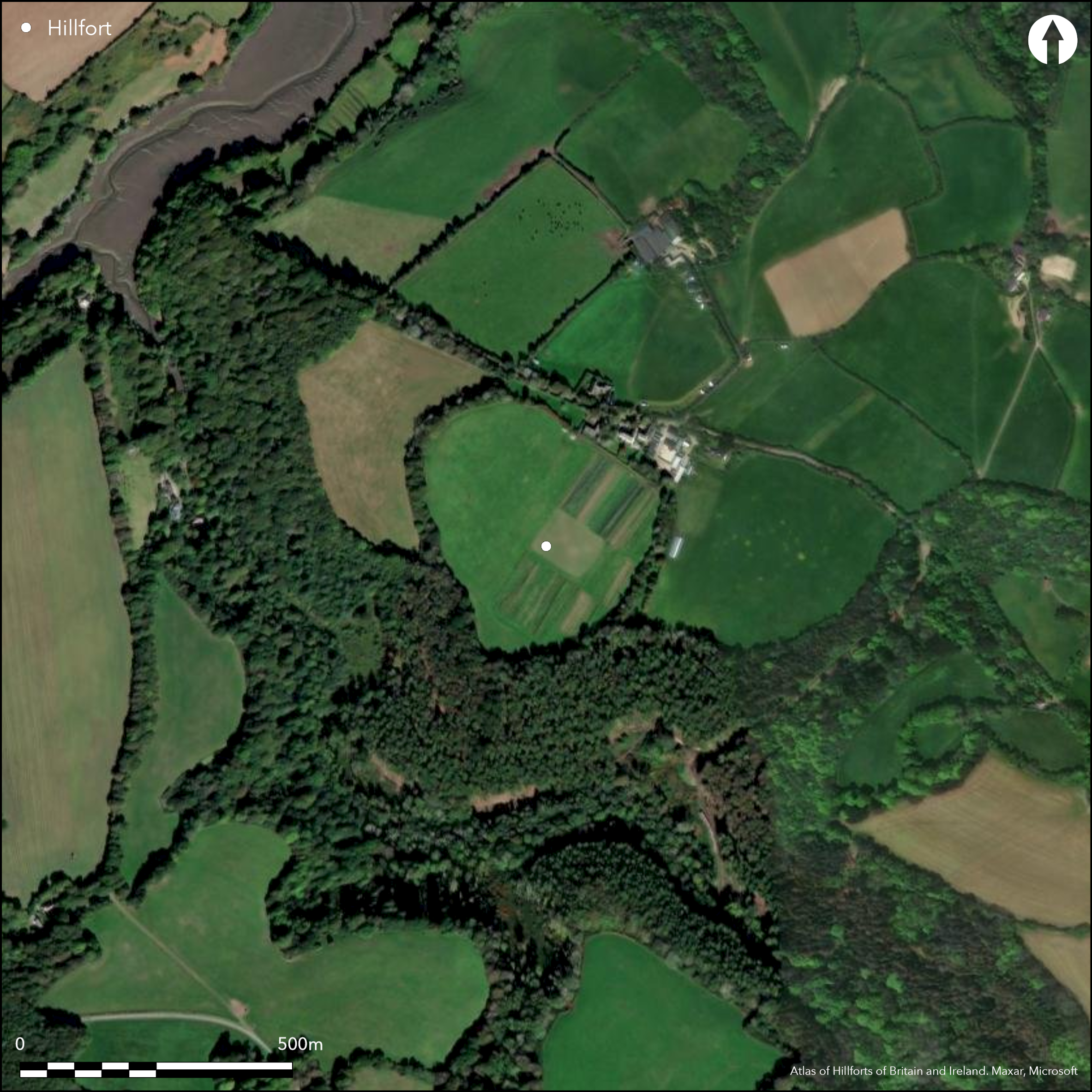
Satellite Imagery
LiDAR 1m DTM Hillshade
Satellite Imagery
Scroll left/right to view further images.
HER: Cornwall and Scilly MCO59 (None)
NMR: SW 72 SW 13 (427434)
SM: 1004430
NGR: SW 7210 2480
X: 172100 Y: 24800 (OSGB36)
Slight, univallate, partial contour hillfort, situated close to crest of NW-facing ridge, overlooking the Helford River to NE. Single rampart to 1.7m high internally with partially buried outer ditch to 0.6m deep enclosing 6.1ha. Park pale (boundary), of probably late origin, defined by 1.3m high revetted wall and outer 1.5m ditch, within the ditch on W and to S same park pale incorporates part of rampart and ditch. To SE rampart and ditch cut by a duck pond. Original entrance to N, now cut by farm buildings, and possibly original to W. Place name 'Gear' derived from Cornish 'ker' meaning 'fort' or 'round' and first appears in documents dating to 1262-6. Rev Richard Polwhele, writing in 1803, first to describe the hillfort. Time Team excavation 2001 (no details). Nearby round of Caer Vallack. Farmed pasture interior. Rampart and ditch under thick vegetation with trees on boundary banks. Generally well-preserved, but mutilated in part. On 1st Ed. OS map (1878). Undated.
Citizen Science: ✗
Reliability of Data: Confirmed
Reliability of Interpretation: Confirmed
X: -577399 Y: 6460046 (EPSG: 3857)
Longitude: -5.186862648988053 Latitude: 50.07944665310031 (EPSG:4326)
Country: England; None
Current County or Unitary Authority: Cornwall
Historic County: Cornwall
Current Parish/Community/Council/Townland: St Martin-in- Meneage; Mawgan-in-Meneage
Generally rampart well-preserved, but ditch mutilated on S and SE. Ditch on E side infilled with farm refuse and to SE rampart and ditch cut by modern duck pond. Trees on boundary banks.
| Extant | ✓ |
| Cropmark | ✗ |
| Likely Destroyed | ✗ |
Farmed pasture interior. Rampart and ditch under thick vegetation with trees on boundary banks. Wooded slopes of Gearhill Wood to W and S.
| Woodland | ✓ |
| Commercial Forestry Plantation | ✗ |
| Parkland | ✗ |
| Pasture (Grazing) | ✓ |
| Arable | ✗ |
| Scrub/Bracken | ✗ |
| Bare Outcrop | ✗ |
| Heather/Moorland | ✗ |
| Heath | ✗ |
| Built-up | ✗ |
| Coastal Grassland | ✗ |
| Other | ✗ |
Slight, univallate, partial contour hillfort, situated close to crest of NW-facing ridge, above overlooking the Helford River to NE.
| Contour Fort | ✗ |
| Partial Contour Fort | ✓ |
| Promontory Fort | ✗ |
| Hillslope Fort | ✗ |
| Level Terrain Fort | ✗ |
| Marsh Fort | ✗ |
| Multiple Enclosure Fort | ✗ |
Sited on a hill crest
| Hilltop | ✗ |
| Coastal Promontory | ✗ |
| Inland Promontory | ✗ |
| Valley Bottom | ✗ |
| Knoll/Hillock/Outcrop | ✗ |
| Ridge | ✓ |
| Cliff/Plateau-edge/Scarp | ✗ |
| Hillslope | ✗ |
| Lowland | ✗ |
| Spur | ✓ |
Dominant Topographic Feature: Ridge/spur
| North | ✗ |
| Northeast | ✗ |
| East | ✗ |
| Southeast | ✗ |
| South | ✗ |
| Southwest | ✓ |
| West | ✗ |
| Northwest | ✗ |
| Level | ✗ |
Altitude: 64.0m
Parish boundary near by
Boundary Type: Parish/Townland
None
Reliability: D - None
| Pre 1200BC | ✗ |
| 1200BC - 800BC | ✗ |
| 800BC - 400BC | ✗ |
| 400BC - AD50 | ✗ |
| AD50 - AD400 | ✗ |
| AD400 - AD 800 | ✗ |
| Post AD800 | ✗ |
| Unknown | ✓ |
| Pre Hillfort: | None |
| Post Hillfort: | None |
Place name 'Gear' derived Cornish 'ker' meaning 'fort' or 'round', and first appears in documents dating to 1262-6. Polwhele writing in 1803 was the first to describe the hillfort. On 1st Ed. OS map (1878). Field investigation Ordnance Survey 1972. Time Team excavation 2001, geophysics (ADS Grey Lit Library, OASIS ref. gsbprosp1-22866.
| Other (1262): | Documents - no details. |
| 1st Identified Written Reference (1803): | R. Polwhele description. |
| 1st Identified Map Depiction (1878): | OS map. |
| Other (1972): | Field investigation OS. |
| Other (2001): | Time Team investigation |
| Geophysical Survey (2001): | GSB prospection |
No details of Time Team investigation.
None
| None | ✓ |
| Spring | ✗ |
| Stream | ✗ |
| Pool | ✗ |
| Flush | ✗ |
| Well | ✗ |
| Other | ✗ |
None
| No Known Features | ✓ |
| Round Stone Structures | ✗ |
| Rectangular Stone Structures | ✗ |
| Curvilinear Platforms | ✗ |
| Other Roundhouse Evidence | ✗ |
| Pits | ✗ |
| Quarry Hollows | ✗ |
| Other | ✗ |
No details of Time Team invesitigation.
| No Known Excavation | ✗ |
| Pits | ✗ |
| Postholes | ✗ |
| Roundhouses | ✗ |
| Rectangular Structures | ✗ |
| Roads/Tracks | ✗ |
| Quarry Hollows | ✗ |
| Other | ✗ |
| Nothing Found | ✓ |
No details of any Time Team investigation.
| No Known Geophysics | ✓ |
| Pits | ✗ |
| Roundhouses | ✗ |
| Rectangular Structures | ✗ |
| Roads/Tracks | ✗ |
| Quarry Hollows | ✗ |
| Other | ✗ |
| Nothing Found | ✗ |
None
| No Known Finds | ✓ |
| Pottery | ✗ |
| Metal | ✗ |
| Metalworking | ✗ |
| Human Bones | ✗ |
| Animal Bones | ✗ |
| Lithics | ✗ |
| Environmental | ✗ |
| Other | ✗ |
None
| APs Not Checked | ✓ |
| None | ✗ |
| Roundhouses | ✗ |
| Rectangular Structures | ✗ |
| Pits | ✗ |
| Postholes | ✗ |
| Roads/Tracks | ✗ |
| Other | ✗ |
Original entrance, now partly cut by farm buildings, on N and possibly original to W.
| 2: | None |
| 2: | None |
Guard Chambers: ✗
Chevaux de Frise: ✗
| 1. Simple Gap (North): | Part-cut by farm buildings. |
| 2. Simple Gap (West): | Possible. |
Single rampart to 1.7m high internally with partially buried outer ditch to 0.6m deep. Park pale (boundary), of probably late origin, defined by 1.3m high revetted wall and outer 1.5m ditch, within the ditch on W and to S same park pale incorporates part of rampart and ditch. To SE rampart and ditch cut by a duck pond.
| Area 1: | 6.1ha. |
| Total: | 6.1ha. |
Total Footprint Area: 7.5ha.
None
| ✗ | None |
| ✗ | Discontinuous circuit affected by park pale (boundary). |
| NE Quadrant: | 1 |
| SE Quadrant: | 1 |
| SW Quadrant: | 1 |
| NW Quadrant: | 1 |
| Total: | 1 |
| Partial Univallate | ✗ |
| Univallate | ✓ |
| Partial Bivallate | ✗ |
| Bivallate | ✗ |
| Partial Multivallate | ✗ |
| Multivallate | ✗ |
| Unknown | ✗ |
| Partial Univallate | ✗ |
| Univallate | ✗ |
| Partial Bivallate | ✗ |
| Bivallate | ✗ |
| Partial Multivallate | ✗ |
| Multivallate | ✗ |
Park pale boundary revetted incorporating part of rampart and ditch. Revetting probably modern.
| None | ✗ |
| Earthen Bank | ✓ |
| Stone Wall | ✗ |
| Rubble | ✗ |
| Wall-walk | ✗ |
| Evidence of Timber | ✗ |
| Vitrification | ✗ |
| Other Burning | ✗ |
| Palisade | ✗ |
| Counter Scarp Bank | ✗ |
| Berm | ✗ |
| Unfinished | ✗ |
| Other | ✗ |
No details of Time Team investigation.
| None | ✓ |
| Earthen Bank | ✗ |
| Stone Wall | ✗ |
| Murus Duplex | ✗ |
| Timber-framed | ✗ |
| Timber-laced | ✗ |
| Vitrification | ✗ |
| Other Burning | ✗ |
| Palisade | ✗ |
| Counter Scarp Bank | ✗ |
| Berm | ✗ |
| Unfinished | ✗ |
| No Known Excavation | ✗ |
| Other | ✗ |
| ✗ | None |
| ✓ | None |
Number of Ditches: 1
| ✗ | None |
Fox, A. 1952, Hill-slope forts and related earthworks in south-west England and South Wales, Archaeol J, 109, 1-22.
Page, W. ed. 1906. The Victoria History of the County of Cornwall, 1, London: James Street, 469.
Polwhele, Rev R. 1803. The history of Cornwall, Vol I, London, 125.
Atlas of Hillforts:
Wikidata:
This work is licensed under CC BY-SA 4.0

 and should be cited as:
Lock, Gary and Ralston, Ian. 2024. Atlas of Hillforts of Britain and Ireland. Available at: https://hillforts.arch.ox.ac.uk
Document Version 1.1