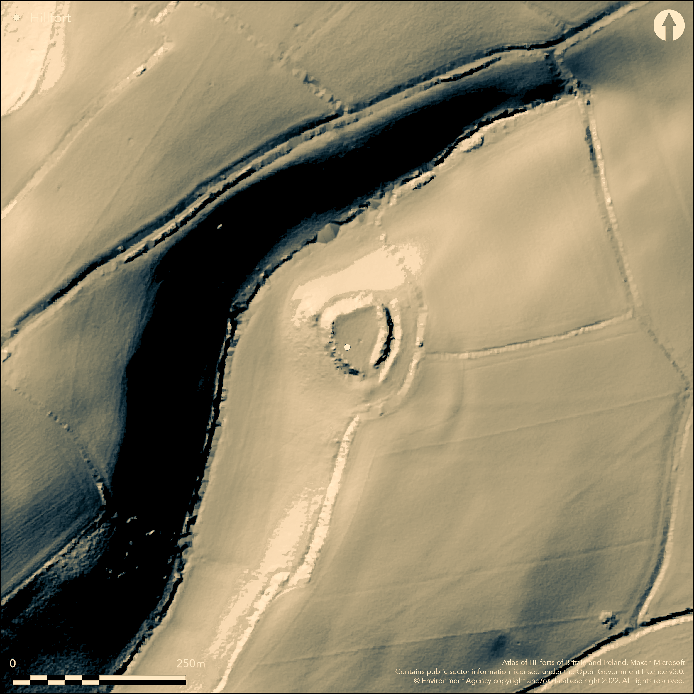
LiDAR 1m DTM Hillshade
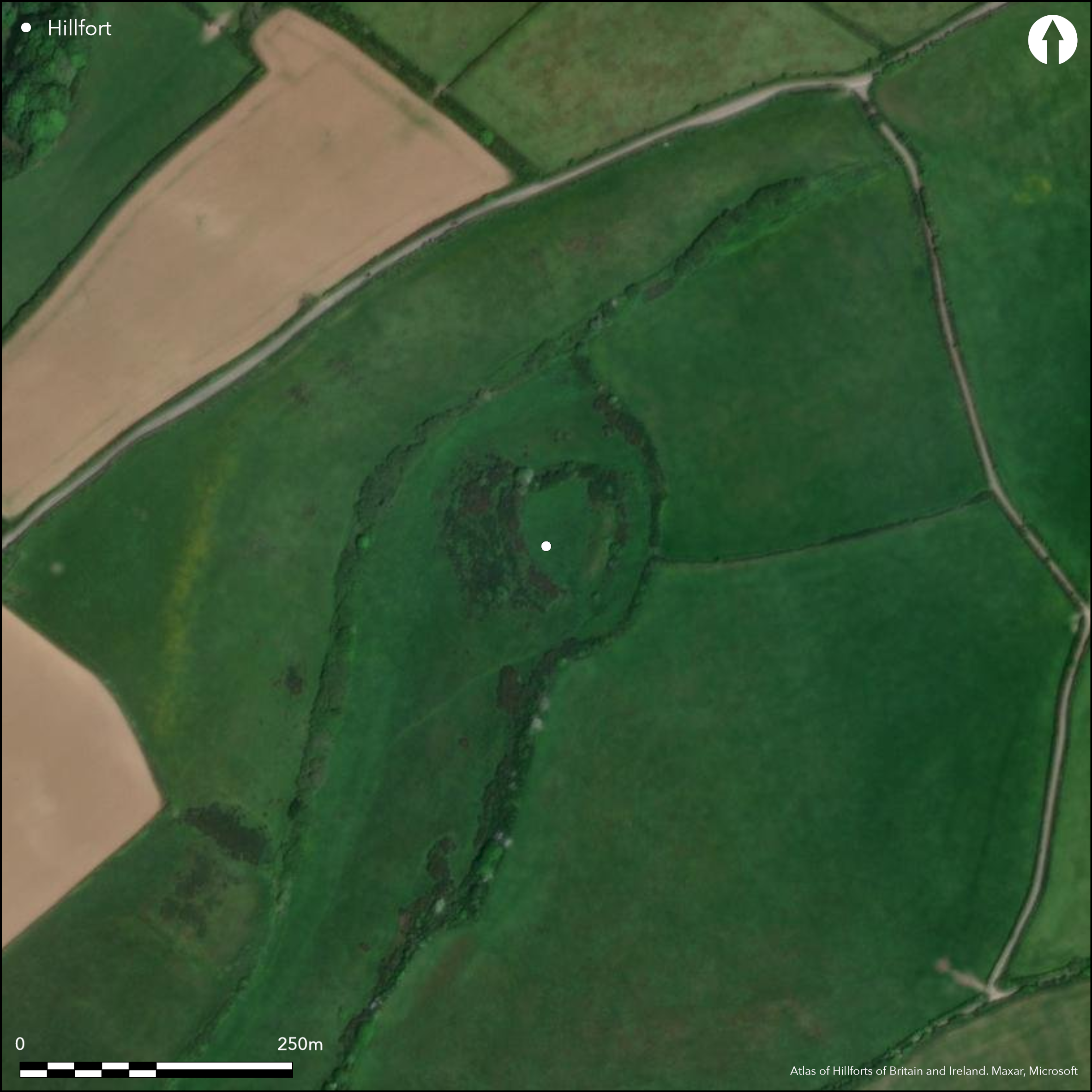
Satellite Imagery
LiDAR 1m DTM Hillshade
Satellite Imagery
Scroll left/right to view further images.
HER: Cornwall and Scilly MCO87 (22826)
NMR: SW 93 NW 2 (429574)
SM: 1019746
NGR: SW 9089 3880
X: 190896 Y: 38809 (OSGB36)
Multivallate, sub-oval, multiple enclosure fort and annexe, sited on steep W-facing slope near and above Gerrans Bay, SW Veryan. Very steep surrounding slopes to stream valley on W and NW, steep to S and moderate to E. Oval inner circuit has concentric outer circuit to S and E, and a crescentic annexe lies to SE; in total measuring 180m NW-SE and 130m NE-SW, enclosing c. 2.3ha. Inner circuit, 60m N-S by 42m E-W internally, with area c. 0.25ha, cut into slope uphill and building out downhill. To E an earth and stone enclosing rampart c. 6m-8m wide and 6m high with external ditch 2.2m-4m wide at base and c. 4m deep. On W side enclosure is defined by scarp 7.5m high, with basal terrace c. 3m-4m wide and sloping outwards. This is probably a silted external ditch above the very steep natural slope. Probable original entrance from outer enclosure to SE now gap c. 6m wide between E bank and scarp on W. Outer circuit surrounding the inner on S and E, c. to 25m across, sloping W. Earth and stone boundary bank of earth with stone facing, possibly recent in visible form, suggested to incorporate remains surrounding rampart. N part of bank c. 2m wide and 2m high inside, 1.5m high outside, with external ditch 2.6m wide and to 0.6m deep. To SW return to inner enclosure formed by scarp c. 6m across and 2m-3m high. Original entrance into outer enclosure to S, where approached by a hollow way. An annexe on SE side with enclosing bank visible as scarp c. 12m across and 0.7m high, with traces of external ditch. These can be seen on aerial photographs. Has been defined as a round with an annexe in the past. Inner circuit in good order, outer hardly visible. On 1st Ed. OS map (1880). Pasture interiors, scrub and trees on banks. Survives well. Geophysical survey 2013. Also called 'Ringarounds'. Undated.
Citizen Science: ✗
Reliability of Data: Confirmed
Reliability of Interpretation: Confirmed
X: -549051 Y: 6483104 (EPSG: 3857)
Longitude: -4.932208788303021 Latitude: 50.21218677471992 (EPSG:4326)
Country: England
Current County or Unitary Authority: Cornwall
Historic County: Cornwall
Current Parish/Community/Council/Townland: Veryan
Despite reduction of annexe ramparts and outer rampart, hardly visible on NW, site survives well and substantially intact. Scrub clearance and repairs undertaken. National Trust site.
| Extant | ✓ |
| Cropmark | ✗ |
| Likely Destroyed | ✗ |
Pasture interior. Scrub and tree growth on banks.
| Woodland | ✗ |
| Commercial Forestry Plantation | ✗ |
| Parkland | ✗ |
| Pasture (Grazing) | ✓ |
| Arable | ✗ |
| Scrub/Bracken | ✓ |
| Bare Outcrop | ✗ |
| Heather/Moorland | ✗ |
| Heath | ✗ |
| Built-up | ✗ |
| Coastal Grassland | ✗ |
| Other | ✗ |
Multivallate multiple enclosure fort and annexe, sited on steep W-facing slope near and above Gerrans Bay, SW Veryan. Very steep surrounding slopes to stream valley on W and NW, steep to S and moderate to E.
| Contour Fort | ✗ |
| Partial Contour Fort | ✗ |
| Promontory Fort | ✗ |
| Hillslope Fort | ✓ |
| Level Terrain Fort | ✗ |
| Marsh Fort | ✗ |
| Multiple Enclosure Fort | ✓ |
Located on a steep hill, steep to the west with a level interior
| Hilltop | ✗ |
| Coastal Promontory | ✗ |
| Inland Promontory | ✗ |
| Valley Bottom | ✗ |
| Knoll/Hillock/Outcrop | ✗ |
| Ridge | ✗ |
| Cliff/Plateau-edge/Scarp | ✗ |
| Hillslope | ✓ |
| Lowland | ✗ |
| Spur | ✗ |
Dominant Topographic Feature: Steep W-facing slope.
| North | ✗ |
| Northeast | ✗ |
| East | ✗ |
| Southeast | ✗ |
| South | ✗ |
| Southwest | ✗ |
| West | ✓ |
| Northwest | ✗ |
| Level | ✗ |
Altitude: 75.0m
N/A
None.
Reliability: D - None
| Pre 1200BC | ✗ |
| 1200BC - 800BC | ✗ |
| 800BC - 400BC | ✗ |
| 400BC - AD50 | ✗ |
| AD50 - AD400 | ✗ |
| AD400 - AD 800 | ✗ |
| Post AD800 | ✗ |
| Unknown | ✓ |
| Pre Hillfort: | None |
| Post Hillfort: | None |
On 1st Ed. OS map (1880). Site monitoring Cornwall Archaeological Society 2011. Geophysical survey ArchaeoPhysica - National Trust 2013.
| 1st Identified Map Depiction (1840): | Tithe Apportionment of Veryan. |
| Other (1880): | OS map. |
| Other (2011): | Site monitoring Cornwall Archaeological Society. |
| Geophysical Survey (2013): | ArchaeoPhysica - National Trust. |
2013 geophysical survey - no details of any interior features.
None
| None | ✓ |
| Spring | ✗ |
| Stream | ✗ |
| Pool | ✗ |
| Flush | ✗ |
| Well | ✗ |
| Other | ✗ |
None
| No Known Features | ✓ |
| Round Stone Structures | ✗ |
| Rectangular Stone Structures | ✗ |
| Curvilinear Platforms | ✗ |
| Other Roundhouse Evidence | ✗ |
| Pits | ✗ |
| Quarry Hollows | ✗ |
| Other | ✗ |
None
| No Known Excavation | ✓ |
| Pits | ✗ |
| Postholes | ✗ |
| Roundhouses | ✗ |
| Rectangular Structures | ✗ |
| Roads/Tracks | ✗ |
| Quarry Hollows | ✗ |
| Other | ✗ |
| Nothing Found | ✗ |
2013 survey - no details of any interior features.
| No Known Geophysics | ✗ |
| Pits | ✗ |
| Roundhouses | ✗ |
| Rectangular Structures | ✗ |
| Roads/Tracks | ✗ |
| Quarry Hollows | ✗ |
| Other | ✓ |
| Nothing Found | ✗ |
None
| No Known Finds | ✓ |
| Pottery | ✗ |
| Metal | ✗ |
| Metalworking | ✗ |
| Human Bones | ✗ |
| Animal Bones | ✗ |
| Lithics | ✗ |
| Environmental | ✗ |
| Other | ✗ |
None
| APs Not Checked | ✓ |
| None | ✗ |
| Roundhouses | ✗ |
| Rectangular Structures | ✗ |
| Pits | ✗ |
| Postholes | ✗ |
| Roads/Tracks | ✗ |
| Other | ✗ |
Probable original entrance from the outer enclosure to inner to SE, now gap c. 6m wide between E bank and scarp on W. Original entrance into outer enclosure to S, where approached by a hollow way.
| 2: | None |
| 2: | None |
Guard Chambers: ✗
Chevaux de Frise: ✗
| 1. Simple Gap (South east): | Into inner enclosure from outer enclosure. |
| 2. Hollow Way (South): | Into outer enclosure approached by hollow way. |
Inner circuit, 60m N-S by 42m E-W internally, cut into slope uphill and building out downhill. To E an earth and stone enclosing rampart c. 6m-8m wide and 6m high with external ditch 2.2m-4m wide at base and c. 4m deep. On W side enclosure is defined by scarp c. 7.5m high, with basal terrace c. 3m-4m wide and sloping outwards. This is probably a silted external ditch above the very steep natural slope. Outer circuit surrounding the inner on S and E, c. to 25m across, sloping W. Earth and stone boundary bank of earth with stone facing, possibly recent in visible form, suggested to incorporate remains surrounding rampart. N part of bank c. 2m wide and 2m high inside, 1.5m high outside, with external ditch 2.6m wide and to 0.6m deep. To SW return to inner enclosure formed by scarp c. 6m across and 2m-3m high.
| Area 1: | 0.25ha. |
| Area 2: | 2.3ha. |
| Total: | 2.3ha. |
Total Footprint Area: Noneha.
None
| ✗ | None |
| ✓ | Possible annexe rampart not included. |
| NE Quadrant: | 2 |
| SE Quadrant: | 2 |
| SW Quadrant: | 2 |
| NW Quadrant: | 2 |
| Total: | 2 |
| Partial Univallate | ✗ |
| Univallate | ✗ |
| Partial Bivallate | ✗ |
| Bivallate | ✓ |
| Partial Multivallate | ✗ |
| Multivallate | ✗ |
| Unknown | ✗ |
| Partial Univallate | ✗ |
| Univallate | ✗ |
| Partial Bivallate | ✗ |
| Bivallate | ✗ |
| Partial Multivallate | ✗ |
| Multivallate | ✗ |
Earth and stone boundary bank of earth with stone facing of outer circuit, possibly recent in visible form, suggested to incorporate remains surrounding rampart.
| None | ✗ |
| Earthen Bank | ✓ |
| Stone Wall | ✓ |
| Rubble | ✓ |
| Wall-walk | ✗ |
| Evidence of Timber | ✗ |
| Vitrification | ✗ |
| Other Burning | ✗ |
| Palisade | ✗ |
| Counter Scarp Bank | ✗ |
| Berm | ✗ |
| Unfinished | ✗ |
| Other | ✗ |
None
| None | ✗ |
| Earthen Bank | ✗ |
| Stone Wall | ✗ |
| Murus Duplex | ✗ |
| Timber-framed | ✗ |
| Timber-laced | ✗ |
| Vitrification | ✗ |
| Other Burning | ✗ |
| Palisade | ✗ |
| Counter Scarp Bank | ✗ |
| Berm | ✗ |
| Unfinished | ✗ |
| No Known Excavation | ✓ |
| Other | ✗ |
| ✗ | None |
| ✓ | None |
Number of Ditches: 3
| ✓ | An annexe on SE side with enclosing bank visible as scarp c. 12m across and 0.7m high, with traces of external ditch. These can be seen on aerial photographs. |
King, A. and Alcock, L. 1969. Ringworks of England and Wales, Chateau Gaillard, 3, 112.
Roseveare, M.J. and Roseveare, A.C. 2013. Veryan Castle, Cornwall: geophysical report. Unpublished report ArchaeoPhysica to National Trust.
Atlas of Hillforts:
Wikidata:
This work is licensed under CC BY-SA 4.0

 and should be cited as:
Lock, Gary and Ralston, Ian. 2024. Atlas of Hillforts of Britain and Ireland. Available at: https://hillforts.arch.ox.ac.uk
Document Version 1.1