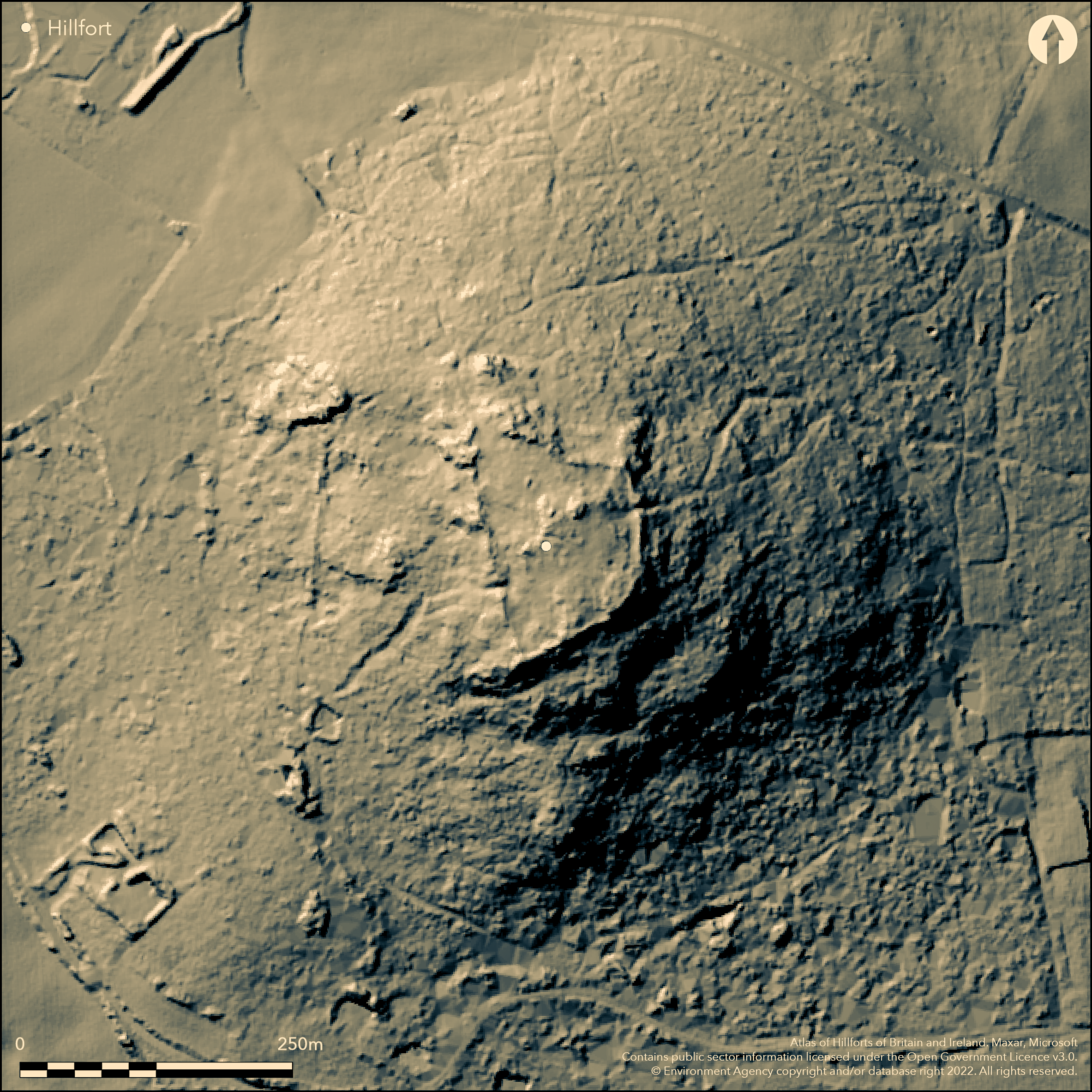
LiDAR 1m DTM Hillshade
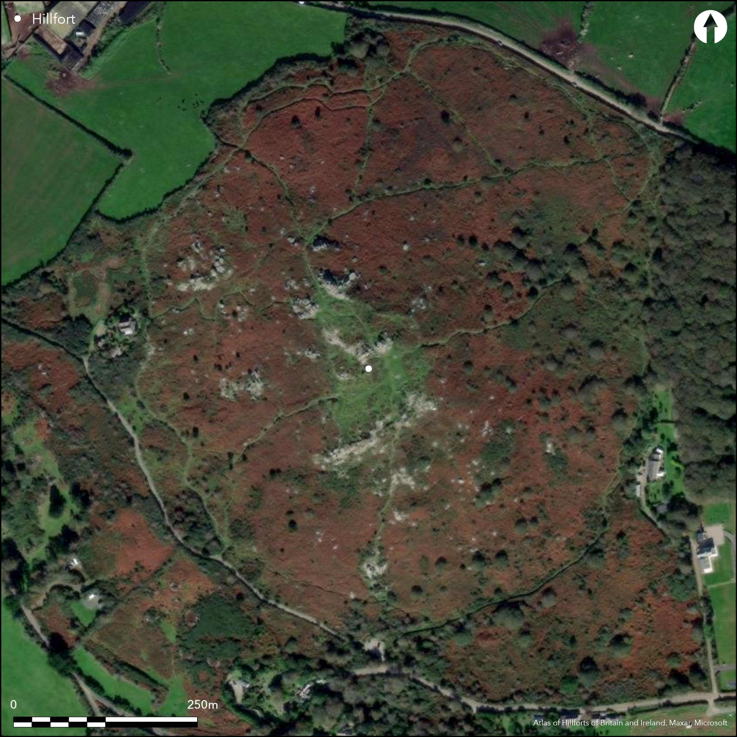
Satellite Imagery
LiDAR 1m DTM Hillshade
Satellite Imagery
Scroll left/right to view further images.
HER: Cornwall and Scilly MCO91 (31136)
NMR: SW 53 NW 18 (424816)
SM: 1006721
NGR: SW51793621
X: 151790 Y: 36210 (OSGB36)
Small contour hillfort situated in a commanding position on summit of steep and prominent Trencrom Hill on Lelant Downs. Irregular shape enclosing 0.92ha. Defined by single, much-robbed, rampart of double-faced horizontally or vertically placed rocks in-filled with earth and small stones, with possible semi-circular annexe, defined by scarp, to E. Rampart varies 1.8m-3.7m wide and to 2.2m high. At centre of the bank the closely-set double line of large (to 2m by 1.4m), flattish, weathered stones, set on edge so as to overlap, may be of Neolithic date. This possible early phase then enlarged by addition of the facade-like walls of smaller quarried stones, c. 3m apart, the remainder of the internal space filled with earth and fist-sized stones. To W, c. 30m S of gateway, at least four courses of similar walling survive. Brush fire in 1995, with subsequent erosion, revealed length of walling to SW. The possible hill-slope annexe on the gentler E shoulder of the hill, runs in fairly regular semi-circle from one natural outcrop at the N end of hill to another at S, surviving mainly as a scarp, but there are occasional small orthostats, most massive being up to 0.8m high on either side of a hollow way, which enters from NE, and is probably contemporary. Interior is divided by natural rock outcrop. E and W entrances, both with pair of granite jamb stones with rampart slightly inturned and widened. Both entrances have to 6m wide hollow ways leading from them. Possible c. 20 hut platforms within enclosure, although questioned, and some (or all) may be result of later quarrying. Mineral prospecting pits and associated spoil heaps. Also post medieval stone splitting and quarrying. The tors, around which enclosure runs, formerly impressive natural features. Donated to National Trust in 1946 as a war memorial. Site heavily overgrown and interpretation difficult. Much robbed. On 1st Ed OS map (1877-78). Undated. 6
Citizen Science: ✗
Reliability of Data: Confirmed
Reliability of Interpretation: Confirmed
X: -609768 Y: 6476420 (EPSG: 3857)
Longitude: -5.477640838587507 Latitude: 50.17374353580204 (EPSG:4326)
Country: England
Current County or Unitary Authority: Cornwall
Historic County: Cornwall
Current Parish/Community/Council/Townland: Ludgvan
Much affected by later quarrying, mineral prospecting pits and associated spoil heaps. Also post medieval stone splitting and quarrying. Dilapidated and much- robbed walls. Brush fire in 1995 resulted in subsequent erosion. Footpath passes through probably modern gaps to N and S. National Trust site.
| Extant | ✓ |
| Cropmark | ✗ |
| Likely Destroyed | ✓ |
Heavily overgrown and interpretation difficult. Spoil heaps.
| Woodland | ✗ |
| Commercial Forestry Plantation | ✗ |
| Parkland | ✗ |
| Pasture (Grazing) | ✗ |
| Arable | ✗ |
| Scrub/Bracken | ✗ |
| Bare Outcrop | ✗ |
| Heather/Moorland | ✓ |
| Heath | ✗ |
| Built-up | ✗ |
| Coastal Grassland | ✗ |
| Other | ✓ |
Small contour fort situated in a commanding position on summit of steep and prominent Trencrom Hill on Lelant Downs.
| Contour Fort | ✓ |
| Partial Contour Fort | ✗ |
| Promontory Fort | ✗ |
| Hillslope Fort | ✗ |
| Level Terrain Fort | ✗ |
| Marsh Fort | ✗ |
| Multiple Enclosure Fort | ✗ |
Located on the level summit of a hill
| Hilltop | ✓ |
| Coastal Promontory | ✗ |
| Inland Promontory | ✗ |
| Valley Bottom | ✗ |
| Knoll/Hillock/Outcrop | ✗ |
| Ridge | ✗ |
| Cliff/Plateau-edge/Scarp | ✗ |
| Hillslope | ✗ |
| Lowland | ✗ |
| Spur | ✗ |
Dominant Topographic Feature: Hill top.
| North | ✗ |
| Northeast | ✗ |
| East | ✗ |
| Southeast | ✗ |
| South | ✗ |
| Southwest | ✗ |
| West | ✗ |
| Northwest | ✗ |
| Level | ✓ |
Altitude: 174.0m
N/A
Possible late Bronze Age/Iron Age activity?
Reliability: C - Low
| Pre 1200BC | ✗ |
| 1200BC - 800BC | ✗ |
| 800BC - 400BC | ✓ |
| 400BC - AD50 | ✗ |
| AD50 - AD400 | ✗ |
| AD400 - AD 800 | ✗ |
| Post AD800 | ✗ |
| Unknown | ✗ |
| Pre Hillfort: | None |
| Post Hillfort: | None |
First mentioned by W. Borlase 1769. On 1st Ed OS map (1877-78). Surveyed at large scale and described as a 'Neolithic city' by Charles Henderson 1914 and 1917 - never published, but manuscript c.1917 held in Royal Institution of Cornwall. Also surveyed by C. Weatherhill c. 1981, who mentions finds of late Iron Age and possible Saxon material - no details. Desk-based assessment, Cornwall Archaeological Unit, Cornwall County Council 1992, 1996. Measured survey, RCHME 1996, ref. no. 1062530.
| 1st Identified Written Reference (1740): | W.Borlase. |
| 1st Identified Written Reference (1769): | W. Borlase mention. |
| Other (1978): | Visit by Hillfort Study Group |
| Other (1981): | C. Weatherhill survey. |
| Earthwork Survey (1996): | Measured survey, RCHME. |
| Other (2006): | Visited by Hillfort Study Group |
| 1st Identified Map Depiction (None): | OS map. |
| Other (None): | Charles Henderson survey - never published. |
| Other (None): | Desk-based assessment, Cornwall Archaeological Unit, Cornwall County Council. |
Possible c. 20 hut platforms within enclosure, although nature questioned, and some (or all) may be result of later quarrying.
None
| None | ✓ |
| Spring | ✗ |
| Stream | ✗ |
| Pool | ✗ |
| Flush | ✗ |
| Well | ✗ |
| Other | ✗ |
Possible c. 20 hut platforms within enclosure, although their veracity has been questioned, and some (or all) may be result of later quarrying.
| No Known Features | ✗ |
| Round Stone Structures | ✗ |
| Rectangular Stone Structures | ✗ |
| Curvilinear Platforms | ✓ |
| Other Roundhouse Evidence | ✗ |
| Pits | ✗ |
| Quarry Hollows | ✗ |
| Other | ✗ |
None
| No Known Excavation | ✓ |
| Pits | ✗ |
| Postholes | ✗ |
| Roundhouses | ✗ |
| Rectangular Structures | ✗ |
| Roads/Tracks | ✗ |
| Quarry Hollows | ✗ |
| Other | ✗ |
| Nothing Found | ✗ |
None
| No Known Geophysics | ✓ |
| Pits | ✗ |
| Roundhouses | ✗ |
| Rectangular Structures | ✗ |
| Roads/Tracks | ✗ |
| Quarry Hollows | ✗ |
| Other | ✗ |
| Nothing Found | ✗ |
None
| No Known Finds | ✓ |
| Pottery | ✗ |
| Metal | ✗ |
| Metalworking | ✗ |
| Human Bones | ✗ |
| Animal Bones | ✗ |
| Lithics | ✗ |
| Environmental | ✗ |
| Other | ✗ |
None
| APs Not Checked | ✓ |
| None | ✗ |
| Roundhouses | ✗ |
| Rectangular Structures | ✗ |
| Pits | ✗ |
| Postholes | ✗ |
| Roads/Tracks | ✗ |
| Other | ✗ |
E and W entrances, both with pair of granite jamb stones with rampart slightly inturned and widened. Both entrances have to 6m wide hollow ways leading from them. C. four modern gaps. Footpath passes through probably modern gaps to N and S.
| 6: | C. four modern gaps. |
| 2: | None |
Guard Chambers: ✗
Chevaux de Frise: ✗
| 1. In-turned (East): | Both entrances have to 6m wide hollow ways leading from them. |
| 1. Hollow Way (East): | 6m wide hollow way. |
| 2. In-turned (West): | Both entrances have to 6m wide hollow ways leading from them. |
| 2. Hollow Way (West): | 6m wide hollow way. |
Single, much robbed, rampart of double-faced horizontally or vertically placed rocks in-filled with earth and small stones. Rampart varies 1.8m-3.7m wide and to 2.2m high. Thus, at centre of the bank the closely-set double line of large (to 2m by 1.4m), flattish, weathered stones set on edge so as to overlap may be of Neolithic date. This possible early phase then enlarged by addition of the facade-like walls of smaller quarried stones, c. 3m apart, the remainder of the internal space filled with earth and fist sized stones. To W, c. 30m S of gateway, at least four courses of similar walling survive.
| Area 1: | 0.92ha. |
| Total: | 0.92ha. |
Total Footprint Area: Noneha.
None
| ✓ | Possible earlier Neolithic tor enclosure phase, then enlarged by addition of the facade-like walls of smaller quarried stones, c. 3m apart, the remainder of the internal space filled with earth and fist- sized stones. |
| ✓ | None |
| NE Quadrant: | 1 |
| SE Quadrant: | 1 |
| SW Quadrant: | 1 |
| NW Quadrant: | 1 |
| Total: | 1 |
| Partial Univallate | ✗ |
| Univallate | ✓ |
| Partial Bivallate | ✗ |
| Bivallate | ✗ |
| Partial Multivallate | ✗ |
| Multivallate | ✗ |
| Unknown | ✗ |
| Partial Univallate | ✗ |
| Univallate | ✗ |
| Partial Bivallate | ✗ |
| Bivallate | ✗ |
| Partial Multivallate | ✗ |
| Multivallate | ✗ |
Rampart of double-faced horizontally or vertically placed rocks in-filled with earth and small stones.
| None | ✗ |
| Earthen Bank | ✓ |
| Stone Wall | ✓ |
| Rubble | ✓ |
| Wall-walk | ✗ |
| Evidence of Timber | ✗ |
| Vitrification | ✗ |
| Other Burning | ✗ |
| Palisade | ✗ |
| Counter Scarp Bank | ✗ |
| Berm | ✗ |
| Unfinished | ✗ |
| Other | ✗ |
None
| None | ✗ |
| Earthen Bank | ✗ |
| Stone Wall | ✗ |
| Murus Duplex | ✗ |
| Timber-framed | ✗ |
| Timber-laced | ✗ |
| Vitrification | ✗ |
| Other Burning | ✗ |
| Palisade | ✗ |
| Counter Scarp Bank | ✗ |
| Berm | ✗ |
| Unfinished | ✗ |
| No Known Excavation | ✓ |
| Other | ✗ |
| ✗ | None |
| ✗ | No ditches visible. |
Number of Ditches: 0
| ✓ | Possible hill-slope annexe on the gentler E shoulder of the hill, runs in fairly regular semi-circle from one natural outcrop at the N end of hill to another at S, surviving mainly as a scarp, but there are occasional small orthostats. Most massive, up to 0.8m high, on either side of a hollow way which enters from NE, and is probably contemporary. |
Borlase, W. 1769. The antiquities of Cornwall, London: W. Bowyer and J. Nichols.
Hencken, H.O. 1932. The Archaeology of Cornwall and Scilly, 130, 301.
Henderson, C. 1917. Manuscript on Trencrom Castle held in the Royal Institution of Cornwall - no details.
Herring, P.1999. Trencrom, Lelant; Archaeological and Historical Assessment, Cornwall Archaeological Unit assessment and evaluation report, Cornwall County Council.
Russell, V. 1971. West Penwith Survey, 31, 50.
Thomas, A.C. 1957. National Trust pamphlet.
Weatherhill, C. 1981. Belerion: Ancient Sites of Land's End, 57-58.
Atlas of Hillforts:
Wikidata:
This work is licensed under CC BY-SA 4.0

 and should be cited as:
Lock, Gary and Ralston, Ian. 2024. Atlas of Hillforts of Britain and Ireland. Available at: https://hillforts.arch.ox.ac.uk
Document Version 1.1