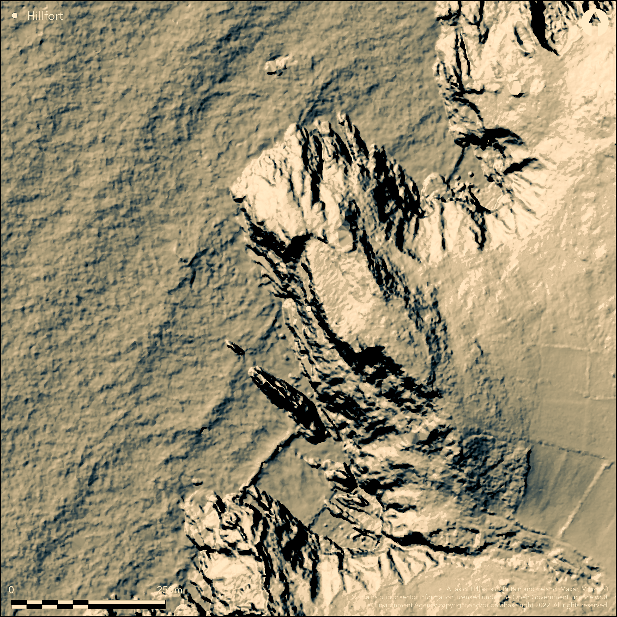
LiDAR 1m DTM Hillshade
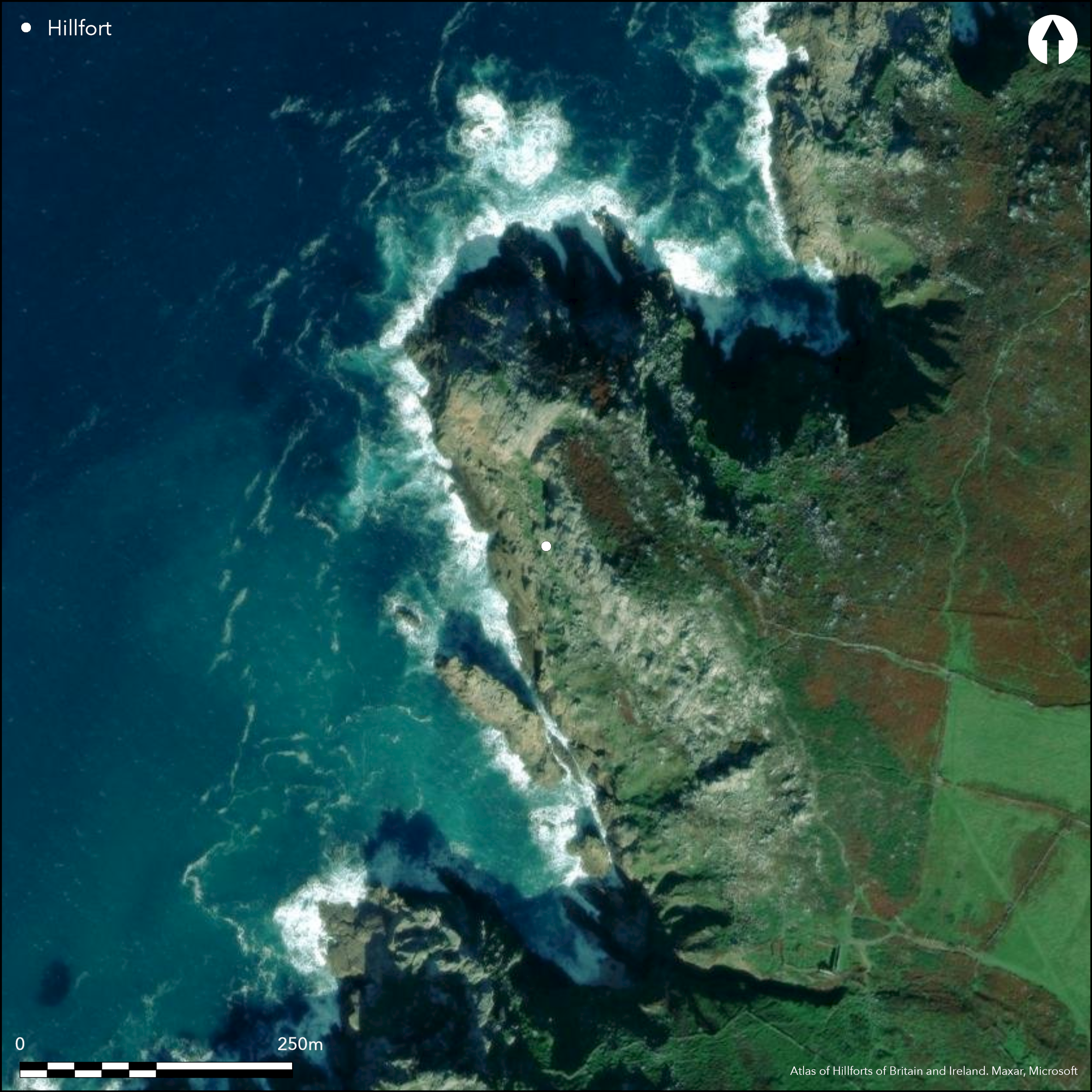
Satellite Imagery
LiDAR 1m DTM Hillshade
Satellite Imagery
Scroll left/right to view further images.
HER: Cornwall and Scilly MCO6532 (30695)
NMR: SW 43 NW 6 (423566)
SM: 1003106
NGR: SW 4160 3695
X: 141600 Y: 36950 (OSGB36)
Irregularly shaped promontory fort situated on rocky granite NNW-facing headland between Halldrine and Porthmoina Coves, Zennor. Steep natural sea cliffs on all sides except landward SE quadrant, where sited crude, dilapidated, dry-stone-faced rampart, up to 103m long and 2m high, which retains on W a granite rubble-built bank c. 4m wide and 1.2m high, follows upper edge of escarpment cliff to cliff, enclosing 0.8ha. S part of retaining wall possibly modern. No visible traces of outer ditch. No traces of internal occupation in boulder strewn and bare rock interior. To S central entrance small gap in rubble bank possibly original entrance and now blocked. Stile (listed Grade II) stands within monument. Coastal grassland with large area of boulders and bare rock. On 1st Ed. OS map (1887-88). Undated.
Citizen Science: ✗
Reliability of Data: Confirmed
Reliability of Interpretation: Confirmed
X: -625678 Y: 6476817 (EPSG: 3857)
Longitude: -5.620561883111019 Latitude: 50.17602906192812 (EPSG:4326)
Country: England; None
Current County or Unitary Authority: Cornwall
Historic County: Cornwall
Current Parish/Community/Council/Townland: Zennor; Morvah
The dilapidated nature of the wall suggest higher in prehistory. Stile (listed Grade II) stands within monument. The S part of the retaining wall may be modern. National Trust site. On Heritage at Risk Register (2015).
| Extant | ✓ |
| Cropmark | ✗ |
| Likely Destroyed | ✗ |
Coastal grassland with large area of boulders and bare rock. Stile (listed Grade II).
| Woodland | ✗ |
| Commercial Forestry Plantation | ✗ |
| Parkland | ✗ |
| Pasture (Grazing) | ✗ |
| Arable | ✗ |
| Scrub/Bracken | ✗ |
| Bare Outcrop | ✗ |
| Heather/Moorland | ✗ |
| Heath | ✗ |
| Built-up | ✗ |
| Coastal Grassland | ✓ |
| Other | ✓ |
Irregularly shaped promontory fort (aka cliff castle) situated on a rocky NW-facing headland between Halldrine and Porthmoina Coves, Zennor. Steep natural sea cliffs on all sides except landward SE quadrant, Steep natural sea cliffs on all sides except landward SE quadrant.
| Contour Fort | ✗ |
| Partial Contour Fort | ✗ |
| Promontory Fort | ✓ |
| Hillslope Fort | ✗ |
| Level Terrain Fort | ✗ |
| Marsh Fort | ✗ |
| Multiple Enclosure Fort | ✗ |
Headland site above the sea
| Hilltop | ✗ |
| Coastal Promontory | ✓ |
| Inland Promontory | ✗ |
| Valley Bottom | ✗ |
| Knoll/Hillock/Outcrop | ✗ |
| Ridge | ✗ |
| Cliff/Plateau-edge/Scarp | ✗ |
| Hillslope | ✗ |
| Lowland | ✗ |
| Spur | ✗ |
Dominant Topographic Feature: Rocky coastal headland.
| North | ✗ |
| Northeast | ✗ |
| East | ✗ |
| Southeast | ✗ |
| South | ✗ |
| Southwest | ✗ |
| West | ✗ |
| Northwest | ✓ |
| Level | ✗ |
Altitude: 102.0m
On parish boundary with Morvah
Boundary Type: Parish/Townland
None.
Reliability: D - None
| Pre 1200BC | ✗ |
| 1200BC - 800BC | ✗ |
| 800BC - 400BC | ✗ |
| 400BC - AD50 | ✗ |
| AD50 - AD400 | ✗ |
| AD400 - AD 800 | ✗ |
| Post AD800 | ✗ |
| Unknown | ✓ |
| Pre Hillfort: | Possible. Associated Bronze Age field system. |
| Post Hillfort: | Stile (listed Grade II) stands within monument. |
Recorded as 'The Castle' on 1842 Tithe map. On 1st Ed. OS map (1887-88). Field investigation Ordnance Survey 1961, 1975. West Penwith Survey, Cornwall County Council 1971. Surveyed by CCRA 1982.
| 1st Identified Map Depiction (1842): | Recorded as 'The Castle' on 1842 Tithe map. |
| Other (1971): | West Penwith Survey, Cornwall County Council. |
| Other (1982): | Surveyed by CCRA 1982. |
| Other (None): | OS map |
| Other (None): | Field investigation OS. |
None.
None
| None | ✓ |
| Spring | ✗ |
| Stream | ✗ |
| Pool | ✗ |
| Flush | ✗ |
| Well | ✗ |
| Other | ✗ |
None
| No Known Features | ✓ |
| Round Stone Structures | ✗ |
| Rectangular Stone Structures | ✗ |
| Curvilinear Platforms | ✗ |
| Other Roundhouse Evidence | ✗ |
| Pits | ✗ |
| Quarry Hollows | ✗ |
| Other | ✗ |
None
| No Known Excavation | ✓ |
| Pits | ✗ |
| Postholes | ✗ |
| Roundhouses | ✗ |
| Rectangular Structures | ✗ |
| Roads/Tracks | ✗ |
| Quarry Hollows | ✗ |
| Other | ✗ |
| Nothing Found | ✗ |
None
| No Known Geophysics | ✓ |
| Pits | ✗ |
| Roundhouses | ✗ |
| Rectangular Structures | ✗ |
| Roads/Tracks | ✗ |
| Quarry Hollows | ✗ |
| Other | ✗ |
| Nothing Found | ✗ |
None
| No Known Finds | ✓ |
| Pottery | ✗ |
| Metal | ✗ |
| Metalworking | ✗ |
| Human Bones | ✗ |
| Animal Bones | ✗ |
| Lithics | ✗ |
| Environmental | ✗ |
| Other | ✗ |
None
| APs Not Checked | ✓ |
| None | ✗ |
| Roundhouses | ✗ |
| Rectangular Structures | ✗ |
| Pits | ✗ |
| Postholes | ✗ |
| Roads/Tracks | ✗ |
| Other | ✗ |
To S central entrance small gap in rubble bank possibly original entrance and now blocked.
| 1: | None |
| 2: | None |
Guard Chambers: ✗
Chevaux de Frise: ✗
| 1. Blocked (South): | Whether blocked in prehistory or probably later uncertain. |
Steep natural sea cliffs on all sides except landward SE quadrant, where sited crude drystone-faced rampart, up to 103m long and 2m high, which retains on W a granite rubble-built bank c. 4m wide and 1.2m high, follows upper edge of escarpment cliff to cliff. The S part of the retaining wall may be modern.
| Area 1: | 0.8ha. |
| Total: | 0.8ha. |
Total Footprint Area: Noneha.
None
| ✗ | None |
| ✗ | None |
| NE Quadrant: | 0 |
| SE Quadrant: | 1 |
| SW Quadrant: | 0 |
| NW Quadrant: | 0 |
| Total: | 1 |
| Partial Univallate | ✓ |
| Univallate | ✗ |
| Partial Bivallate | ✗ |
| Bivallate | ✗ |
| Partial Multivallate | ✗ |
| Multivallate | ✗ |
| Unknown | ✗ |
| Partial Univallate | ✗ |
| Univallate | ✗ |
| Partial Bivallate | ✗ |
| Bivallate | ✗ |
| Partial Multivallate | ✗ |
| Multivallate | ✗ |
Crude external dry-stone-faced rampart.
| None | ✗ |
| Earthen Bank | ✓ |
| Stone Wall | ✓ |
| Rubble | ✓ |
| Wall-walk | ✗ |
| Evidence of Timber | ✗ |
| Vitrification | ✗ |
| Other Burning | ✗ |
| Palisade | ✗ |
| Counter Scarp Bank | ✗ |
| Berm | ✗ |
| Unfinished | ✗ |
| Other | ✗ |
None
| None | ✗ |
| Earthen Bank | ✗ |
| Stone Wall | ✗ |
| Murus Duplex | ✗ |
| Timber-framed | ✗ |
| Timber-laced | ✗ |
| Vitrification | ✗ |
| Other Burning | ✗ |
| Palisade | ✗ |
| Counter Scarp Bank | ✗ |
| Berm | ✗ |
| Unfinished | ✗ |
| No Known Excavation | ✓ |
| Other | ✗ |
| ✗ | None |
| ✗ | No traces of outer dtch. |
Number of Ditches: 0
| ✗ | None |
Cotton, M.A. 1958-9. Cornish cliff castles, Proc W Cornwall Fld Club, 2,1, 120.
Guthrie, A. 1959-60. Bosigran Cliff Castle, Proc W Cornwall Fld Club, 2, 178.
Herring, P.C. 1987. National Trust archaeological survey of Bosigran, Cornwall, Archaeological Unit Report, Truro.
Page, W. ed. 1906. The Victoria History of the County of Cornwall, 1, London: James Street, 460.
Pool, P.A.S. and Weatherhill, C. 1979. Report to the National Trust on Iron Age sites at Bosigran Farm.
Russell, V. 1971. West Penwith Survey, Unpublished report Cornwall County Council, 39.
Weatherhill, C. 1981. Belerion ancient sites of Land's End, 36-7.
Atlas of Hillforts:
Wikidata:
This work is licensed under CC BY-SA 4.0

 and should be cited as:
Lock, Gary and Ralston, Ian. 2024. Atlas of Hillforts of Britain and Ireland. Available at: https://hillforts.arch.ox.ac.uk
Document Version 1.1