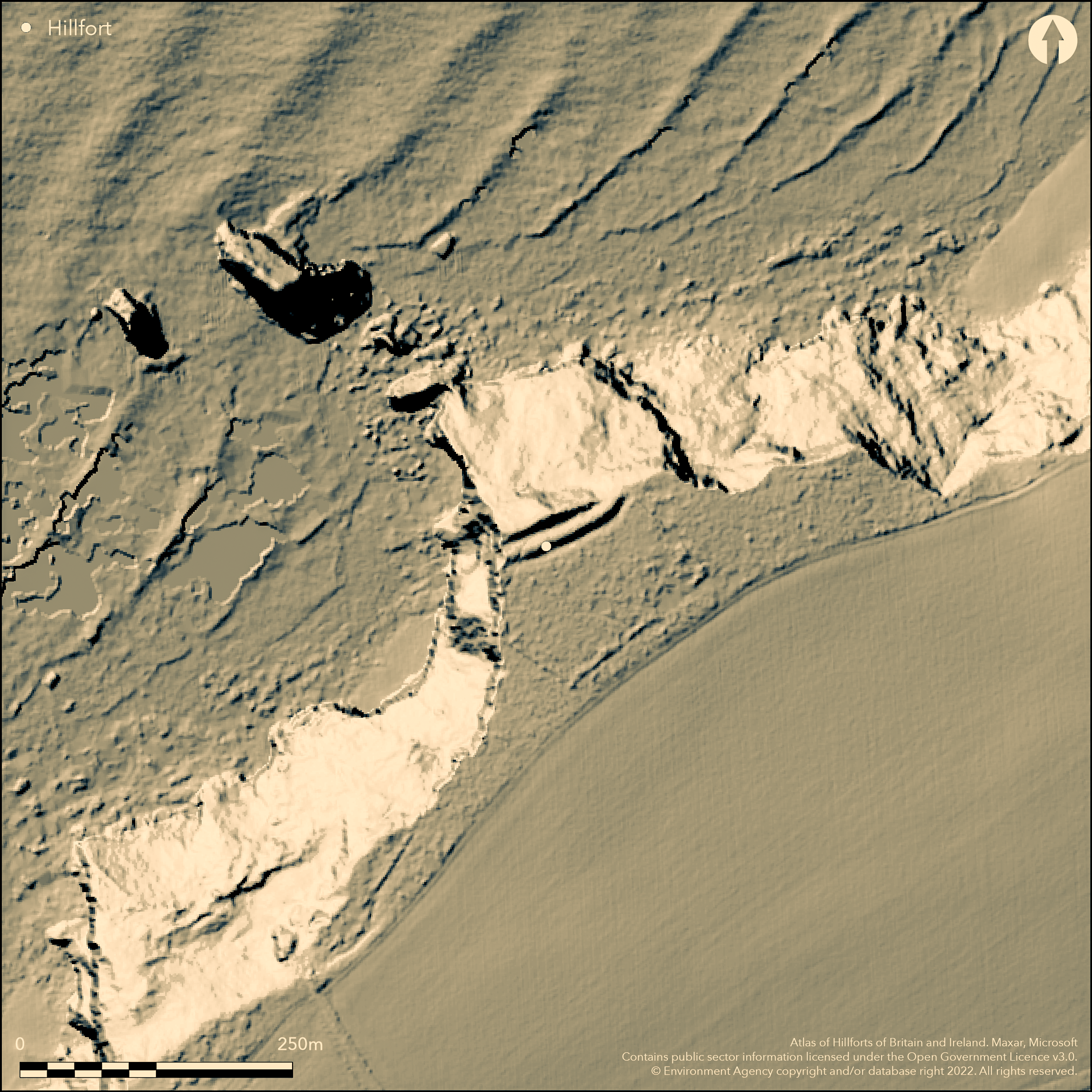
LiDAR 1m DTM Hillshade
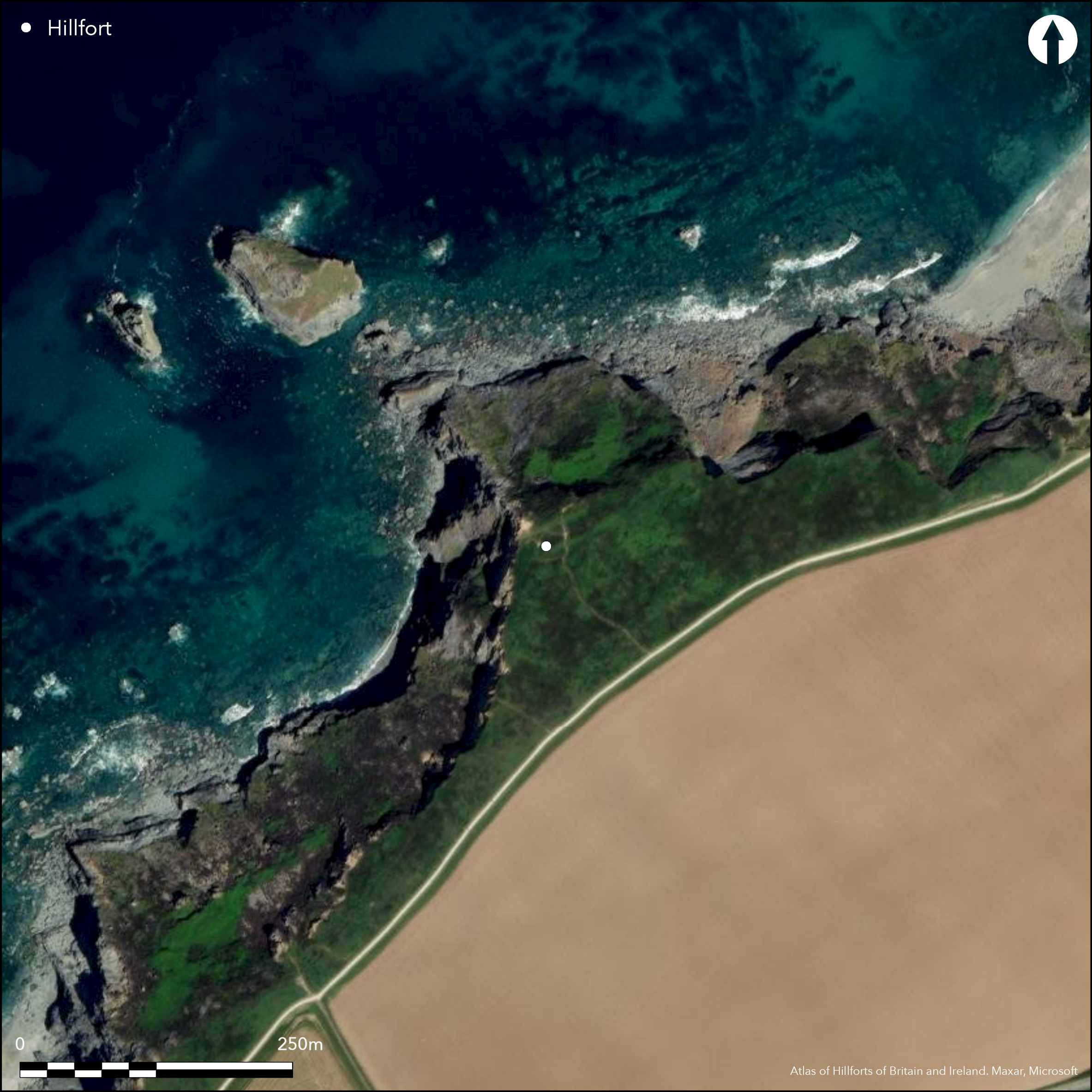
Satellite Imagery
LiDAR 1m DTM Hillshade
Satellite Imagery
Scroll left/right to view further images.
HER: Cornwall and Scilly MCO6539 (26605)
NMR: SW 64 SW 6 (426191)
SM: 1004390
NGR: SW6347843965
X: 163478 Y: 43965 (OSGB36)
Much eroded promontory fort sited on edge of prominent NNW-facing sloping coastal cliff known as Carvannel Downs, overlooking Basset's Cove, Illogan. Now survives only as part of double rampart, of earth and stones, measuring to 85m and 71m long and averaging 2.3m in height enclosing 0.8ha. Formerly massive. Partially buried ditches at up to 2m wide and 1.5m deep. No trace of entrance - probably lost. Later medieval or post medieval field utilises prehistoric ramparts. Extending S from main defences as large rectangular, earth banked enclosure, N side formed by outer line of the earthworks. The banks, to 1m in height with a shallow ditch visible at intervals on outside, but may be continuous. First references to the cliff castle are found in 1530 and 1635. Rest of site lost to large scale cliff erosion. Visited by W. Borlase in the mid-18th century and his report shows it to have been in a similar condition to now. Crane' possibly a corruption of 'car (ker) hen', 'old fort or abandoned fort'. The inner ditch, known as the 'Bowling Green'. Geophysical survey in 2013 - no details. Fragment of early Iron Age SW 'B' type pottery allegedly found on the site. Rocky coastal grassland. On 1st Ed. OS map (1879-86).
Citizen Science: ✗
Reliability of Data: Confirmed
Reliability of Interpretation: Confirmed
X: -592117 Y: 6489363 (EPSG: 3857)
Longitude: -5.319075733104031 Latitude: 50.24815452579282 (EPSG:4326)
Country: England
Current County or Unitary Authority: Cornwall
Historic County: Cornwall
Current Parish/Community/Council/Townland: Illogan
Much coastal erosion and only part survives. On Heritage at Risk Register (2015).
| Extant | ✓ |
| Cropmark | ✗ |
| Likely Destroyed | ✓ |
Rocky coastal grassland.
| Woodland | ✗ |
| Commercial Forestry Plantation | ✗ |
| Parkland | ✗ |
| Pasture (Grazing) | ✗ |
| Arable | ✗ |
| Scrub/Bracken | ✗ |
| Bare Outcrop | ✗ |
| Heather/Moorland | ✗ |
| Heath | ✗ |
| Built-up | ✗ |
| Coastal Grassland | ✓ |
| Other | ✗ |
Part of much eroded promontory fort (aka cliff castle) sited on edge of prominent NNW-facing sloping coastal cliff known as Carvannel Downs, overlooking Basset's Cove, Illogan.
| Contour Fort | ✗ |
| Partial Contour Fort | ✗ |
| Promontory Fort | ✓ |
| Hillslope Fort | ✗ |
| Level Terrain Fort | ✗ |
| Marsh Fort | ✗ |
| Multiple Enclosure Fort | ✗ |
Coastal headland location with sea cliffs
| Hilltop | ✗ |
| Coastal Promontory | ✓ |
| Inland Promontory | ✗ |
| Valley Bottom | ✗ |
| Knoll/Hillock/Outcrop | ✗ |
| Ridge | ✗ |
| Cliff/Plateau-edge/Scarp | ✗ |
| Hillslope | ✗ |
| Lowland | ✗ |
| Spur | ✗ |
Dominant Topographic Feature: NNW-facing sloping coastal cliff.
| North | ✗ |
| Northeast | ✗ |
| East | ✗ |
| Southeast | ✗ |
| South | ✗ |
| Southwest | ✗ |
| West | ✗ |
| Northwest | ✓ |
| Level | ✗ |
Altitude: 79.0m
N/A
Possibly Iron Age - pottery fragment allegedly found.
Reliability: C - Low
| Pre 1200BC | ✗ |
| 1200BC - 800BC | ✗ |
| 800BC - 400BC | ✗ |
| 400BC - AD50 | ✓ |
| AD50 - AD400 | ✗ |
| AD400 - AD 800 | ✗ |
| Post AD800 | ✗ |
| Unknown | ✗ |
| Pre Hillfort: | None |
| Post Hillfort: | None |
| Artefactual: | None |
First references found in 1530 and 1635 when 'Castelle Cliff' mentioned in connection with a wreck coast nearby. Mentioned as 'Coombe Castelle' by John Leland 18th century. Visited by W. Borlase in the mid-18th century. Mention by R. Thomas in newspaper 1851. On 1st Ed. OS map (1879-86). Field investigation Ordnance Survey 1970. Desk assessment Tehidy Country Park - Cornwall Archaeological Unit 2011. Geophysical survey, part of Unlocking Our Coastal Heritage project - ArchaeoPhysica 2013. Mapped by NMP - no date.
| Other (1851): | Mention by R. Thomas in newspaper. |
| Other (1970): | Field investigation OS. |
| Other (2011): | Desk assessment Tehidy Country Park - Cornwall Archaeological Unit. |
| Geophysical Survey (2013): | Unlocking Our Coastal Heritage project - ArchaeoPhysica. |
| Excavation (2013): | Unlocking our coastal heritage project |
| 1st Identified Written Reference (None): | Ancient mentions - no details. |
| 1st Identified Map Depiction (None): | OS map. |
| Other (None): | Mention by John Leland. |
| Other (None): | Visited by W. Borlase in the mid-18th century |
| Other (None): | Mapped by NMP. |
Geophysical survey - no details. Fragment of early Iron Age SW 'B' type pottery allegedly found on the site.
None
| None | ✓ |
| Spring | ✗ |
| Stream | ✗ |
| Pool | ✗ |
| Flush | ✗ |
| Well | ✗ |
| Other | ✗ |
None
| No Known Features | ✓ |
| Round Stone Structures | ✗ |
| Rectangular Stone Structures | ✗ |
| Curvilinear Platforms | ✗ |
| Other Roundhouse Evidence | ✗ |
| Pits | ✗ |
| Quarry Hollows | ✗ |
| Other | ✗ |
None
| No Known Excavation | ✓ |
| Pits | ✗ |
| Postholes | ✗ |
| Roundhouses | ✗ |
| Rectangular Structures | ✗ |
| Roads/Tracks | ✗ |
| Quarry Hollows | ✗ |
| Other | ✗ |
| Nothing Found | ✗ |
Survey - no details.
| No Known Geophysics | ✗ |
| Pits | ✗ |
| Roundhouses | ✗ |
| Rectangular Structures | ✗ |
| Roads/Tracks | ✗ |
| Quarry Hollows | ✗ |
| Other | ✓ |
| Nothing Found | ✗ |
Fragment of early Iron Age SW 'B' type pottery allegedly found on the site.
| No Known Finds | ✗ |
| Pottery | ✓ |
| Metal | ✗ |
| Metalworking | ✗ |
| Human Bones | ✗ |
| Animal Bones | ✗ |
| Lithics | ✗ |
| Environmental | ✗ |
| Other | ✗ |
None
| APs Not Checked | ✓ |
| None | ✗ |
| Roundhouses | ✗ |
| Rectangular Structures | ✗ |
| Pits | ✗ |
| Postholes | ✗ |
| Roads/Tracks | ✗ |
| Other | ✗ |
No trace of entrance - probably lost.
| 0: | None |
| 2: | None |
Guard Chambers: ✗
Chevaux de Frise: ✗
Now survives only as part of double rampart, of earth and stones, measuring to 85m and 71m long and averaging 2.3m in height. Partially buried ditches at up to 2m wide and 1.5m deep. Formerly massive.
| Area 1: | 0.8ha. |
| Total: | 0.8ha. |
Total Footprint Area: Noneha.
None
| ✗ | None |
| ✗ | None |
| NE Quadrant: | 0 |
| SE Quadrant: | 2 |
| SW Quadrant: | 2 |
| NW Quadrant: | 0 |
| Total: | 2 |
| Partial Univallate | ✗ |
| Univallate | ✗ |
| Partial Bivallate | ✓ |
| Bivallate | ✗ |
| Partial Multivallate | ✗ |
| Multivallate | ✗ |
| Unknown | ✗ |
| Partial Univallate | ✗ |
| Univallate | ✗ |
| Partial Bivallate | ✗ |
| Bivallate | ✗ |
| Partial Multivallate | ✗ |
| Multivallate | ✗ |
None
| None | ✗ |
| Earthen Bank | ✓ |
| Stone Wall | ✗ |
| Rubble | ✓ |
| Wall-walk | ✗ |
| Evidence of Timber | ✗ |
| Vitrification | ✗ |
| Other Burning | ✗ |
| Palisade | ✗ |
| Counter Scarp Bank | ✗ |
| Berm | ✗ |
| Unfinished | ✗ |
| Other | ✗ |
None
| None | ✗ |
| Earthen Bank | ✗ |
| Stone Wall | ✗ |
| Murus Duplex | ✗ |
| Timber-framed | ✗ |
| Timber-laced | ✗ |
| Vitrification | ✗ |
| Other Burning | ✗ |
| Palisade | ✗ |
| Counter Scarp Bank | ✗ |
| Berm | ✗ |
| Unfinished | ✗ |
| No Known Excavation | ✓ |
| Other | ✗ |
| ✗ | None |
| ✓ | Partially buried ditches up to 2m wide and 1.5m deep. |
Number of Ditches: 2
| ✗ | None |
Borlase, W. 1754. Antiquities Historical and Monumental of the County of Cornwall, 313.
Borlase, W. 1769. The antiquities of Cornwall, London: W. Bowyer and J. Nichols.
Parkes C. 2011. Tehidy Park, Illogan, Cornwall: archaeological assessment, Unpublished Cornwall Archaeological Unit Report No 11R065, Cornwall County Council.
Roseveare M. J. and Roseveare A. C. K. 2013. Crane Castle, Illogan, Cornwall: geophysical survey report, Unpublished survey report, ArchaeoPhysica.
Tangye, N. 1971. Earthworks in the Parish of Illogan, Cornish Archaeol, 10, 37-48.
Toulmin Smith, L (Ed). 1907. The Itinerary of John Leland.
Thomas, A.C. 1965. Coast and cliff names of Gwithian and the North Cliffs, J Royal Inst Cornwall, 5, 1, 12-36.
Thomas, N. 1995. Godrevy and the North Cliffs- an archaeological assessment, Unpublished Historic Environment Service report, 1995R001.
Thomas, R. 1851. Letters to the West Briton, At CSL, Redruth, No 33.
Atlas of Hillforts:
Wikidata:
This work is licensed under CC BY-SA 4.0

 and should be cited as:
Lock, Gary and Ralston, Ian. 2024. Atlas of Hillforts of Britain and Ireland. Available at: https://hillforts.arch.ox.ac.uk
Document Version 1.1