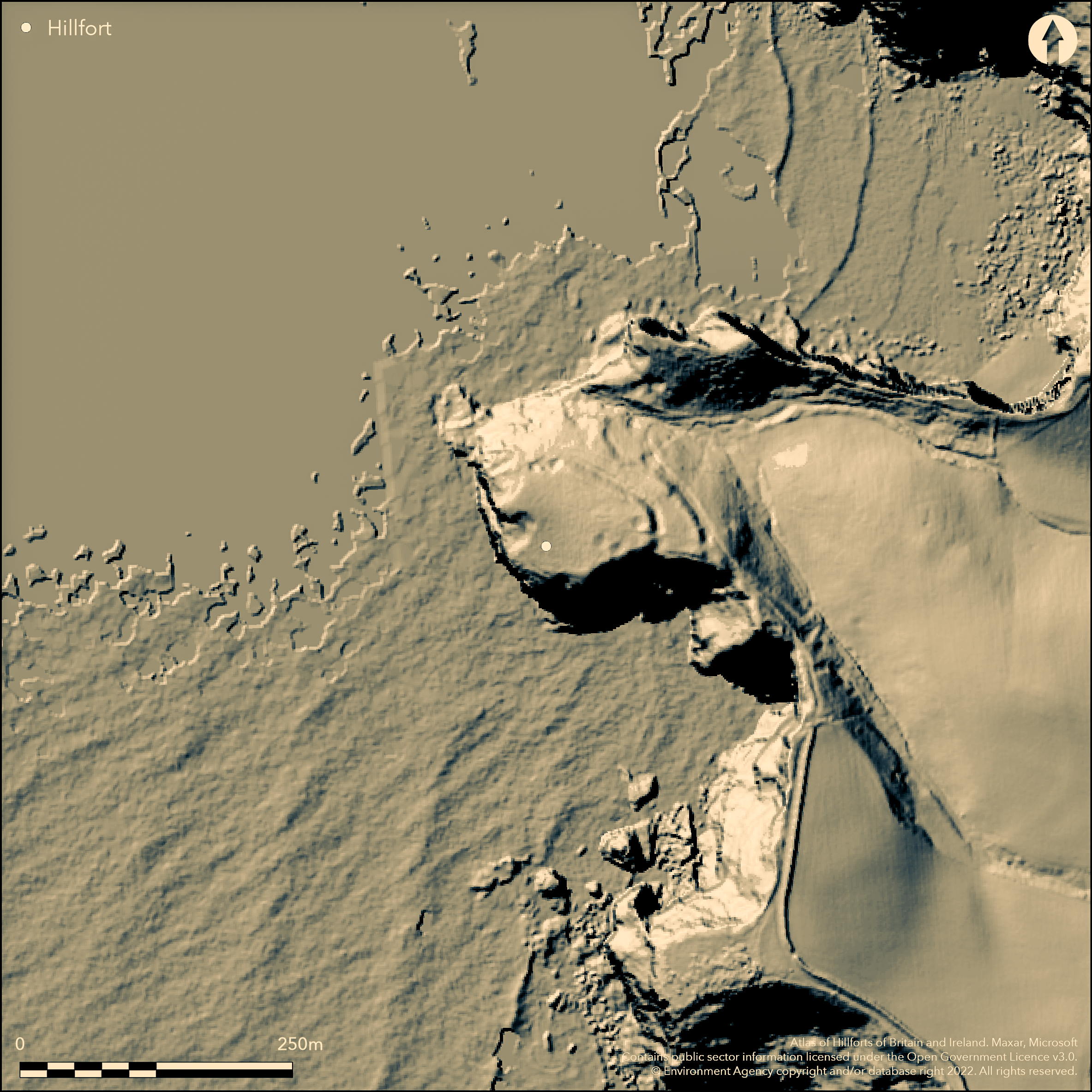
LiDAR 1m DTM Hillshade
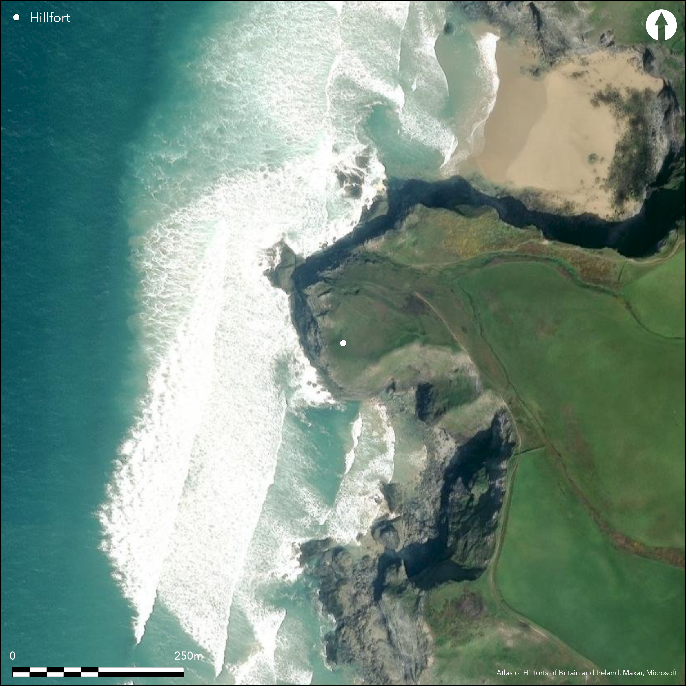
Satellite Imagery
LiDAR 1m DTM Hillshade
Satellite Imagery
Scroll left/right to view further images.
HER: Cornwall and Scilly MCO6550 (21942)
NMR: SW 86 NW 4 (429281)
SM: 1021004
NGR: SW 8415 6647
X: 184150 Y: 66470 (OSGB36)
Complex promontory fort located on Griffin's Point headland promontory projecting W into Atlantic N of Watergate Bay. On S cliffs high, exposed, and precipitous. Stream valley almost surrounds landward E side. Steep descent to landward NE side. Encloses 0.7ha. Multiple ramparts and external ditches, slight works, two only terraces formed by scarping. Two ramparts visible, outer merging with natural slope before cliff top on N. Concentric on NE, but diverge towards S some 15m apart. Between these slight counterscarp thrown up in digging out inner ditch, with linear hollow outside associated with formation of outer rampart. To NE, further rampart and ditch extend downslope from outer concentric rampart to natural rock outcrop above the stream. W of this, outer concentric rampart and counterscarp within merge together, these then merging into the natural slope (inner rampart continues to cliff edge on NW). Ramparts c. 5m wide and c. 3.5m high outside and 0.9m within. Towards N, largely formed by cutting into the natural slope. External ditches 3m-5m wide, mostly visible as slightly concave shelves, or depressions up to 0.3m deep, but to 1.5m deep in places, notably on a 25m long section of inner ditch N of entrance, towards S. Entrance gap on SE towards cliff edge passing through inner earthwork, running across ditch on causeway 3m wide. Interior level area inside entrance. Beyond, moderate slopes to cliffs on N and W. Possible quarry pits or hut sites. Platform N of entrance, with slight bank 2m wide around W side, possibly remains of front wall. Possible outwork protecting entrance and possible early rampart on S 2m-3m from cliff edge. Variety of construction suggests unfinished or phased. Bronze Age barrow. Good condition under coastal grassland, although some ground lost to the sea, particularly to the S where cliffs high, exposed, and precipitous. Undated. On 1st Ed. OS map (1881).
Citizen Science: ✗
Reliability of Data: Confirmed
Reliability of Interpretation: Confirmed
X: -561324 Y: 6526006 (EPSG: 3857)
Longitude: -5.042462186091123 Latitude: 50.458182404869646 (EPSG:4326)
Country: England
Current County or Unitary Authority: Cornwall
Historic County: Cornwall
Current Parish/Community/Council/Townland: Mawgan-in-Pydar
Good condition, although some ground lost to the sea, particularly to the S where cliffs high, exposed, and precipitous.
| Extant | ✓ |
| Cropmark | ✗ |
| Likely Destroyed | ✓ |
Coastal grassland and rock outcrops. Mined.
| Woodland | ✗ |
| Commercial Forestry Plantation | ✗ |
| Parkland | ✗ |
| Pasture (Grazing) | ✗ |
| Arable | ✗ |
| Scrub/Bracken | ✗ |
| Bare Outcrop | ✗ |
| Heather/Moorland | ✗ |
| Heath | ✗ |
| Built-up | ✗ |
| Coastal Grassland | ✓ |
| Other | ✓ |
Promontory fort (aka cliff castle) located on Griffin's Point, a headland promontory projecting W into the Atlantic N of Watergate Bay. On S cliffs high, exposed, and precipitous. Stream valley almost surrounds landward E side. Steep descent to landward NE side.
| Contour Fort | ✗ |
| Partial Contour Fort | ✗ |
| Promontory Fort | ✓ |
| Hillslope Fort | ✗ |
| Level Terrain Fort | ✗ |
| Marsh Fort | ✗ |
| Multiple Enclosure Fort | ✗ |
Coastal headland location and sea cliffs
| Hilltop | ✗ |
| Coastal Promontory | ✓ |
| Inland Promontory | ✗ |
| Valley Bottom | ✗ |
| Knoll/Hillock/Outcrop | ✗ |
| Ridge | ✗ |
| Cliff/Plateau-edge/Scarp | ✗ |
| Hillslope | ✗ |
| Lowland | ✗ |
| Spur | ✗ |
Dominant Topographic Feature: Coastal headland
| North | ✗ |
| Northeast | ✗ |
| East | ✗ |
| Southeast | ✗ |
| South | ✗ |
| Southwest | ✓ |
| West | ✗ |
| Northwest | ✗ |
| Level | ✗ |
Altitude: 50.0m
N/A
None.
Reliability: D - None
| Pre 1200BC | ✗ |
| 1200BC - 800BC | ✗ |
| 800BC - 400BC | ✗ |
| 400BC - AD50 | ✗ |
| AD50 - AD400 | ✗ |
| AD400 - AD 800 | ✗ |
| Post AD800 | ✗ |
| Unknown | ✓ |
| Pre Hillfort: | Bronze Age barrow. |
| Post Hillfort: | Area mined. |
First recorded 1849. On 1st Ed. OS map (1881). Field investigation Ordnance Survey 1969. Bre-Pen, Mawgan Porth: a rapid archaeological and historic landscape assessment. Cornwall County Council, 1999.
| 1st Identified Written Reference (1849): | First recorded. |
| 1st Identified Map Depiction (1881): | OS map. |
| Other (1969): | Field investigation OS. |
| Other (1999): | Bre-Pen, Mawgan Porth: a rapid archaeological and historic landscape assessment. Cornwall County Council. |
Three circular depressions within defences to SE, one against rampart, c. 0.5 metres deep and c. 8m across and two W of this, on the shoulder of the more level ground, could be quarry pits or hut sites. Bronze Age barrow.
None
| None | ✓ |
| Spring | ✗ |
| Stream | ✗ |
| Pool | ✗ |
| Flush | ✗ |
| Well | ✗ |
| Other | ✗ |
Three circular depressions within defences to SE, one against rampart, c. 0.5 metres deep and c. 8m across and two W of this, on the shoulder of the more level ground, could be quarry pits or hut sites. Bronze Age barrow.
| No Known Features | ✗ |
| Round Stone Structures | ✗ |
| Rectangular Stone Structures | ✗ |
| Curvilinear Platforms | ✓ |
| Other Roundhouse Evidence | ✗ |
| Pits | ✗ |
| Quarry Hollows | ✓ |
| Other | ✓ |
None
| No Known Excavation | ✓ |
| Pits | ✗ |
| Postholes | ✗ |
| Roundhouses | ✗ |
| Rectangular Structures | ✗ |
| Roads/Tracks | ✗ |
| Quarry Hollows | ✗ |
| Other | ✗ |
| Nothing Found | ✗ |
None
| No Known Geophysics | ✓ |
| Pits | ✗ |
| Roundhouses | ✗ |
| Rectangular Structures | ✗ |
| Roads/Tracks | ✗ |
| Quarry Hollows | ✗ |
| Other | ✗ |
| Nothing Found | ✗ |
None
| No Known Finds | ✓ |
| Pottery | ✗ |
| Metal | ✗ |
| Metalworking | ✗ |
| Human Bones | ✗ |
| Animal Bones | ✗ |
| Lithics | ✗ |
| Environmental | ✗ |
| Other | ✗ |
None
| APs Not Checked | ✓ |
| None | ✗ |
| Roundhouses | ✗ |
| Rectangular Structures | ✗ |
| Pits | ✗ |
| Postholes | ✗ |
| Roads/Tracks | ✗ |
| Other | ✗ |
Entrance gap on SE towards cliff edge where passes through inner earthwork, running across ditch on causeway 3m wide. Possible outwork protecting entrance.
| 1: | Entrance adjacent to cliff face. |
| 2: | None |
Guard Chambers: ✗
Chevaux de Frise: ✗
| 1. Simple Gap (South east): | Causewayed. |
| 1. Outworks (South east): | Possible outwork protecting entrance. |
Landward NE side multiple ramparts with external ditches. Two ramparts visible, outer merging with natural slope before cliff top on N. Concentric on the NE, but diverge towards the S some 15m apart. Between these is slight counterscarp thrown up in digging out inner ditch, with linear hollow outside associated with formation of outer rampart. To NE, further rampart and ditch extend downslope from outer concentric rampart to natural rock outcrop above the stream. W of this, outer concentric rampart and counterscarp within merge together, these then merge into the natural slope (the inner rampart continues to the cliff edge on the NW). Ramparts c. 5m wide and c. 3.5m high outside and 0.9m within. Towards N, largely formed by cutting into the natural slope. External ditches 3m-5m wide, mostly visible as slightly concave shelves, or depressions up to 0.3m deep, but to 1.5m deep in places, notably on a 25m long section of the inner ditch N of entrance, towards the S. This variety suggests possibly unfinished or phased.
| Area 1: | 0.7ha. |
| Total: | 0.7ha. |
Total Footprint Area: Noneha.
None
| ✓ | Variety of construction suggests unfinished or phased, but no specific details. |
| ✗ | None |
| NE Quadrant: | 3 |
| SE Quadrant: | 0 |
| SW Quadrant: | 0 |
| NW Quadrant: | 0 |
| Total: | 3 |
| Partial Univallate | ✗ |
| Univallate | ✗ |
| Partial Bivallate | ✗ |
| Bivallate | ✗ |
| Partial Multivallate | ✓ |
| Multivallate | ✗ |
| Unknown | ✗ |
| Partial Univallate | ✗ |
| Univallate | ✗ |
| Partial Bivallate | ✗ |
| Bivallate | ✗ |
| Partial Multivallate | ✗ |
| Multivallate | ✗ |
Variety of construction suggests unfinished or phased. Interesting counterscarps. Use of rock outcrops.
| None | ✗ |
| Earthen Bank | ✓ |
| Stone Wall | ✓ |
| Rubble | ✓ |
| Wall-walk | ✗ |
| Evidence of Timber | ✗ |
| Vitrification | ✗ |
| Other Burning | ✗ |
| Palisade | ✗ |
| Counter Scarp Bank | ✓ |
| Berm | ✗ |
| Unfinished | ✓ |
| Other | ✗ |
None
| None | ✗ |
| Earthen Bank | ✗ |
| Stone Wall | ✗ |
| Murus Duplex | ✗ |
| Timber-framed | ✗ |
| Timber-laced | ✗ |
| Vitrification | ✗ |
| Other Burning | ✗ |
| Palisade | ✗ |
| Counter Scarp Bank | ✗ |
| Berm | ✗ |
| Unfinished | ✗ |
| No Known Excavation | ✓ |
| Other | ✗ |
| ✗ | None |
| ✓ | External ditches. |
Number of Ditches: 3
| ✗ | None |
Cole, R. 1999. Bre-Pen, Mawgan Porth: a rapid archaeological and historic landscape assessment. Unpublished assessment and evaluation report, Cornwall Archaeological Unit, Cornwall County Council.
Cotton, M.A. 1958-9. Cornish Cliff Castles, Proc West Cornwall Fld Club, 2, 3, 119.
Johnson, N. and Rose, P. 1982. Defended settlement in Cornwall - an illustrated discussion, In ed. D. Miles, The Romano-British countryside: Studies in rural settlement and economy, BAR Brit Ser 103, 151-207.
Henderson, C. 1930. A Survey of Cornwall, CPRE report, Thompson, WH (ed), CH 9, 57.
Nankivall, F. 1962. The principal antiquities of the Newquay-Padstow District, Cornwall Archaeol Soc Field Guide 7.
Sheppard, P.A. 1978. St Mawgan Checklist, Cornish Archaeol, 17, 119.
Atlas of Hillforts:
Wikidata:
This work is licensed under CC BY-SA 4.0

 and should be cited as:
Lock, Gary and Ralston, Ian. 2024. Atlas of Hillforts of Britain and Ireland. Available at: https://hillforts.arch.ox.ac.uk
Document Version 1.1