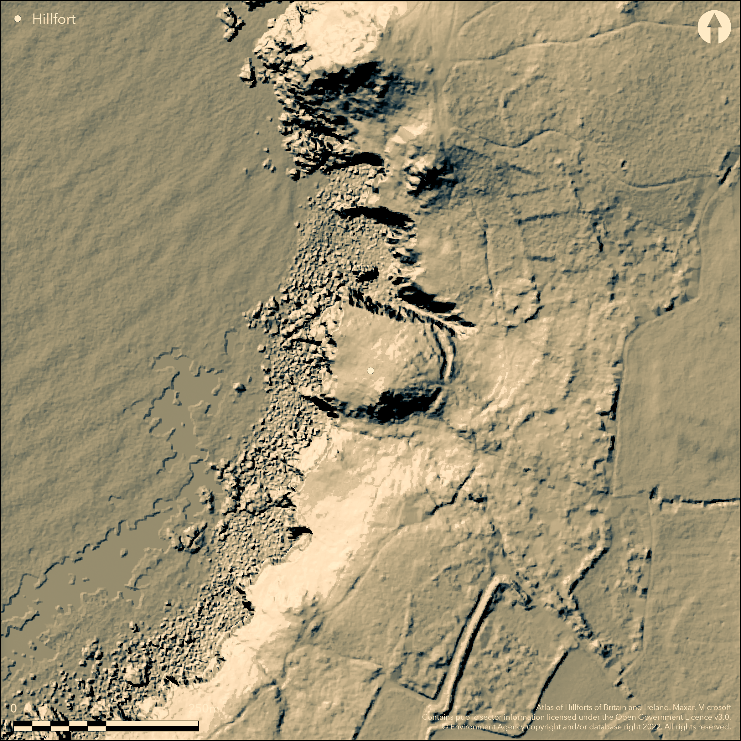
LiDAR 1m DTM Hillshade
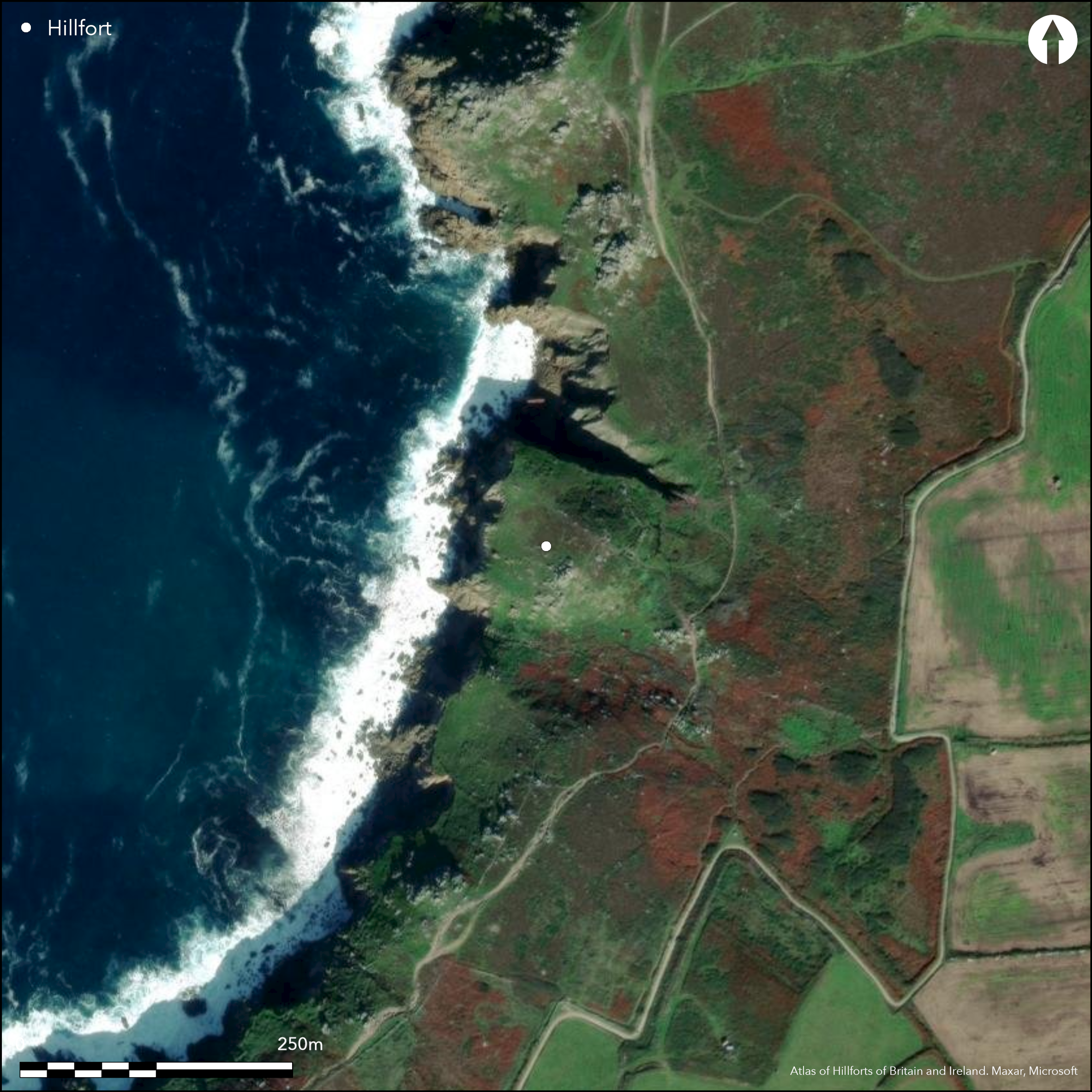
Satellite Imagery
LiDAR 1m DTM Hillshade
Satellite Imagery
Scroll left/right to view further images.
HER: Cornwall and Scilly MCO6558 (16009)
NMR: SW 32 NW 1 (421208)
SM: 1006757
NGR: SW34762577
X: 134760 Y: 25770 (OSGB36)
Promontory fort sited on small W-facing headland overlooking Gamper Bay at Mayon Cliff, Sennon and overlooking Castle Zawn cove to N. Steep sea cliffs on N and W, S side boulder strewn slope drops steeply to stream. Rampart with ditch and counterscarp bank on E cut off headland and enclose c. 1ha of steep rocky interior with little flat surface for hut platforms and none found. Rampart has massive stone wall up to 60m long, 3.7m wide and 1.5m high with rock-cut ditch measuring to 2.4m deep and counterscarp of up to 2m high. Well-preserved and impressive, splayed, gateway entrance on E, lined with stone, and containing later post medieval shelter. Ramparts partially overlie earlier field system and integrate earlier lynchet into defensive line. Outer ditch possibly built after inner rampart wall and up-cast material used to construct counterscarp bank. Excavated by Crofts in 1939 and 1949, then by National Trust in 1985 with trenches through defences found stone rampart with ditch, inner and outer bank revetted with granite blocks. Iron Age pottery found. Possible Late Bronze Age or even Neolithic origins, with occupation from Iron Age through to Romano-British period or even later. Coastal grassland and bare rock. Good condition despite coastal erosion. On Ist Ed. OS map (1876-78).
Citizen Science: ✗
Reliability of Data: Confirmed
Reliability of Interpretation: Confirmed
X: -635454 Y: 6458870 (EPSG: 3857)
Longitude: -5.708382194992915 Latitude: 50.07266698907037 (EPSG:4326)
Country: England
Current County or Unitary Authority: Cornwall
Historic County: Cornwall
Current Parish/Community/Council/Townland: Sennen
Good condition despite coastal erosion.
| Extant | ✓ |
| Cropmark | ✗ |
| Likely Destroyed | ✗ |
Coastal grassland and bare rock. Later post-medieval shelter.
| Woodland | ✗ |
| Commercial Forestry Plantation | ✗ |
| Parkland | ✗ |
| Pasture (Grazing) | ✗ |
| Arable | ✗ |
| Scrub/Bracken | ✗ |
| Bare Outcrop | ✗ |
| Heather/Moorland | ✗ |
| Heath | ✗ |
| Built-up | ✗ |
| Coastal Grassland | ✓ |
| Other | ✓ |
Excavated promontory fort (aka cliff castle) sited on small W-facing headland overlooking Gamper Bay at Mayon Cliff and overlooking Castle Zawn cove to N. Steep sea cliffs on N and W, S side boulder strewn slope drops steeply to stream.
| Contour Fort | ✗ |
| Partial Contour Fort | ✗ |
| Promontory Fort | ✓ |
| Hillslope Fort | ✗ |
| Level Terrain Fort | ✗ |
| Marsh Fort | ✗ |
| Multiple Enclosure Fort | ✗ |
Coastal headland and sea cliffs of north-west facing promontory with sea cliffs to west nd north and south to steep rocky stream
| Hilltop | ✗ |
| Coastal Promontory | ✓ |
| Inland Promontory | ✗ |
| Valley Bottom | ✗ |
| Knoll/Hillock/Outcrop | ✗ |
| Ridge | ✗ |
| Cliff/Plateau-edge/Scarp | ✗ |
| Hillslope | ✗ |
| Lowland | ✗ |
| Spur | ✗ |
Dominant Topographic Feature: Coastal headland
| North | ✗ |
| Northeast | ✗ |
| East | ✗ |
| Southeast | ✗ |
| South | ✗ |
| Southwest | ✗ |
| West | ✓ |
| Northwest | ✗ |
| Level | ✗ |
Altitude: 54.0m
N/A
Site first described by Edmonds 1845-50. Findings reinterpreted by Quinnell who suggested possibly Iron Age through to Romano-British period and possibly to medieval. Built between 800 BC and 400 BC. Also suggested late Bronze Age or even Neolithic origins. Early Iron Age pottery.
Reliability: B - Medium
| Pre 1200BC | ✗ |
| 1200BC - 800BC | ✗ |
| 800BC - 400BC | ✓ |
| 400BC - AD50 | ✓ |
| AD50 - AD400 | ✓ |
| AD400 - AD 800 | ✗ |
| Post AD800 | ✗ |
| Unknown | ✗ |
| Pre Hillfort: | None |
| Post Hillfort: | None |
| Artefactual: | Some early Iron Age pottery. |
| Other: | Various suggestions of dating and origin. |
On 1840's Tithe Map as 'The Castle'. On Ist Ed. OS map (1876-78). First described by Edmonds in 1845-50. Partial excavations 1939 and 1948 by C.B. Crofts, West Cornwall Field Club. Field investigation Ordnance Survey 1969, 1985. Excavation and survey by National Trust 1985. Watching Brief Cornwall County Council 1994. Measured survey RCHME 1996.
| Excavation (1985): | Excavation by NT. |
| Other (1985): | Survey by NT. |
| Other (1994): | Watching Brief Cornwall County Council. |
| Earthwork Survey (1996): | Measured survey RCHME |
| 1st Identified Map Depiction (None): | Tithe Map. |
| 1st Identified Written Reference (None): | First described by Edmonds - no details. |
| Other (None): | OS map. |
| Excavation (None): | Partial excavations by C.B. Crofts, West Cornwall Field Club. |
| Other (None): | Field investigation OS. |
Little flat surface for hut platforms and none found. Evidence for the occupation of the interior. Partial excavations 1939 and 1949 by West Cornwall Field Club produced evidence for the occupation of the interior, including layers of charcoal and burnt material, together with sherds of Iron Age pottery and medieval glass-marked wares.
None
| None | ✓ |
| Spring | ✗ |
| Stream | ✗ |
| Pool | ✗ |
| Flush | ✗ |
| Well | ✗ |
| Other | ✗ |
Little flat surface for hut platforms and none found.
| No Known Features | ✓ |
| Round Stone Structures | ✗ |
| Rectangular Stone Structures | ✗ |
| Curvilinear Platforms | ✗ |
| Other Roundhouse Evidence | ✗ |
| Pits | ✗ |
| Quarry Hollows | ✗ |
| Other | ✗ |
Evidence for the occupation of the interior.
| No Known Excavation | ✗ |
| Pits | ✗ |
| Postholes | ✗ |
| Roundhouses | ✗ |
| Rectangular Structures | ✗ |
| Roads/Tracks | ✗ |
| Quarry Hollows | ✗ |
| Other | ✓ |
| Nothing Found | ✗ |
None
| No Known Geophysics | ✓ |
| Pits | ✗ |
| Roundhouses | ✗ |
| Rectangular Structures | ✗ |
| Roads/Tracks | ✗ |
| Quarry Hollows | ✗ |
| Other | ✗ |
| Nothing Found | ✗ |
Partial excavations 1939 and 1949 by West Cornwall Field Club produced evidence for the occupation of the interior, including layers of charcoal and burnt material, together with sherds of Iron Age pottery and medieval glass-marked wares.
| No Known Finds | ✗ |
| Pottery | ✓ |
| Metal | ✗ |
| Metalworking | ✗ |
| Human Bones | ✗ |
| Animal Bones | ✗ |
| Lithics | ✗ |
| Environmental | ✓ |
| Other | ✓ |
None
| APs Not Checked | ✓ |
| None | ✗ |
| Roundhouses | ✗ |
| Rectangular Structures | ✗ |
| Pits | ✗ |
| Postholes | ✗ |
| Roads/Tracks | ✗ |
| Other | ✗ |
Well-preserved and impressive, splayed, gateway entrance, 3.7m long on E, with causeway, and lined with stone 'curtain walls' and roadway, rammed hard with earth and stone, and containing later post medieval shelter. Sited off centre.
| 1: | None |
| 2: | None |
Guard Chambers: ✗
Chevaux de Frise: ✗
| 1. Other Forms (East): | Splayed, causewayed, gateway entrance. Sited off centre. |
Rampart with ditch and counterscarp bank on E cut off headland and enclose c. 1ha of steep rocky interior with little flat surface for hut platforms and none found. Rampart has a massive stone wall up to 60m long, 3.7m wide and 1.5m high with rock-cut ditch measuring to 2.4m deep and counterscarp of up to 2m high. Defences partially overlie earlier field system and integrate earlier lynchet into defensive line. Outer ditch possibly built after inner defensive rampart wall and up-cast material used to construct counterscarp bank. Excavated in 1939, 1948 and 1985. Latter by NT with trenches through defences found stone rampart with ditch, inner and outer bank revetted with granite blocks.
| Area 1: | 1.0ha. |
| Total: | 1.0ha. |
Total Footprint Area: Noneha.
None
| ✗ | None |
| ✗ | None |
| NE Quadrant: | 1 |
| SE Quadrant: | 1 |
| SW Quadrant: | 0 |
| NW Quadrant: | 0 |
| Total: | 1 |
| Partial Univallate | ✓ |
| Univallate | ✗ |
| Partial Bivallate | ✗ |
| Bivallate | ✗ |
| Partial Multivallate | ✗ |
| Multivallate | ✗ |
| Unknown | ✗ |
| Partial Univallate | ✗ |
| Univallate | ✗ |
| Partial Bivallate | ✗ |
| Bivallate | ✗ |
| Partial Multivallate | ✗ |
| Multivallate | ✗ |
Massive stone wall with large uprights and natural outcrop. Counterscarp to 2m high.
| None | ✗ |
| Earthen Bank | ✗ |
| Stone Wall | ✓ |
| Rubble | ✗ |
| Wall-walk | ✗ |
| Evidence of Timber | ✗ |
| Vitrification | ✗ |
| Other Burning | ✗ |
| Palisade | ✗ |
| Counter Scarp Bank | ✓ |
| Berm | ✗ |
| Unfinished | ✗ |
| Other | ✓ |
Excavated in 1939, 1948 and 1985. Latter by NT with trenches through defences found stone rampart with ditch, inner and outer bank revetted with granite blocks.
| None | ✗ |
| Earthen Bank | ✗ |
| Stone Wall | ✓ |
| Murus Duplex | ✗ |
| Timber-framed | ✗ |
| Timber-laced | ✗ |
| Vitrification | ✗ |
| Other Burning | ✗ |
| Palisade | ✗ |
| Counter Scarp Bank | ✗ |
| Berm | ✗ |
| Unfinished | ✗ |
| No Known Excavation | ✗ |
| Other | ✓ |
| ✗ | None |
| ✓ | Rock-cut ditch measuring to 2.4m deep and counterscarp of up to 2m high. |
Number of Ditches: 1
| ✗ | None |
Blight, J.T. 1864. The cliff-castle at Mean, J Royal Inst Cornwall, 1 and 2, 8-11.
Cotton, M.A. 1958-9. Cornish Cliff Castles, Proc West Cornwall Fld Club, 2, 3, 119.
Crofts, C.B. 1949. Interim report of 1939 and 1948 seasons' excavations at Maen Castle, Cornwall, West Cornwall Field Club, Marazion.
Crofts, C.B. 1954-5. Maen Castle, Sennen: the excavation of an Early Iron Age promontory fort, Proc West Cornwall Fld Club 1, 3, 98-115.
Edmonds, R. 1848. On the Hill-Castles and Cliff-Castles of Penzance, Trans Penzance Natur Hist and Antiq Soc, 1, 341.
Hencken, H.O. 1932. The Archaeology of Cornwall and Scilly, 124.
Herring, PC. 1986. Mayon and Trevescan Cliffs, unpublished report copy At CAU, Vol 2, 28-34.
Herring P. 1994. Repair to Maen Castle, Sennen, Cornwall. Unpublished assessment and evaluation report, Cornwall Archaeological Unit, Cornwall County Council.
Johnson, N. and Rose, P. 1982. Defended settlement in Cornwall - an illustrated discussion, In ed. D. Miles, The Romano-British countryside: Studies in rural settlement and economy, BAR Brit Ser 103, 151-207.
Russell, V. 1971. West Penwith Survey, 39.
Tithe Award. 1840s. Sennen. Field No 152.
Atlas of Hillforts:
Wikidata:
This work is licensed under CC BY-SA 4.0

 and should be cited as:
Lock, Gary and Ralston, Ian. 2024. Atlas of Hillforts of Britain and Ireland. Available at: https://hillforts.arch.ox.ac.uk
Document Version 1.1