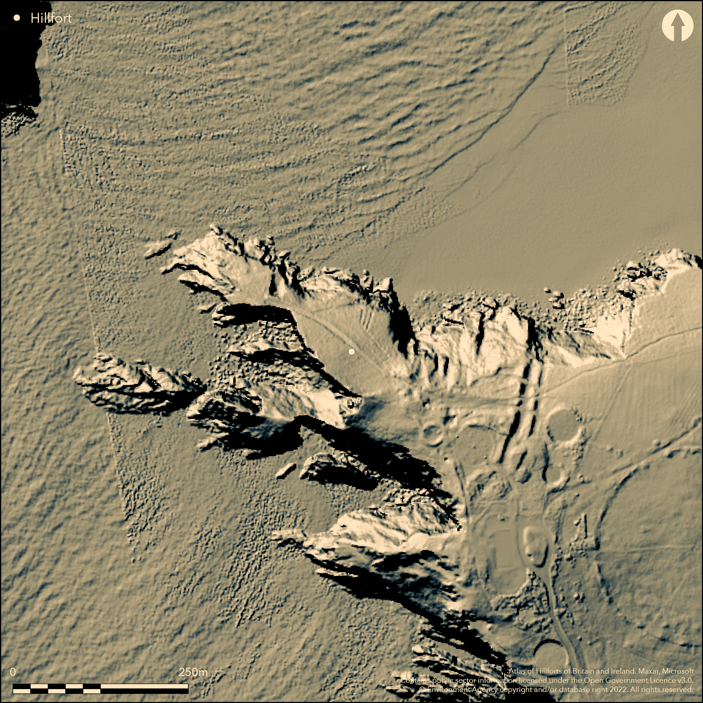
LiDAR 1m DTM Hillshade
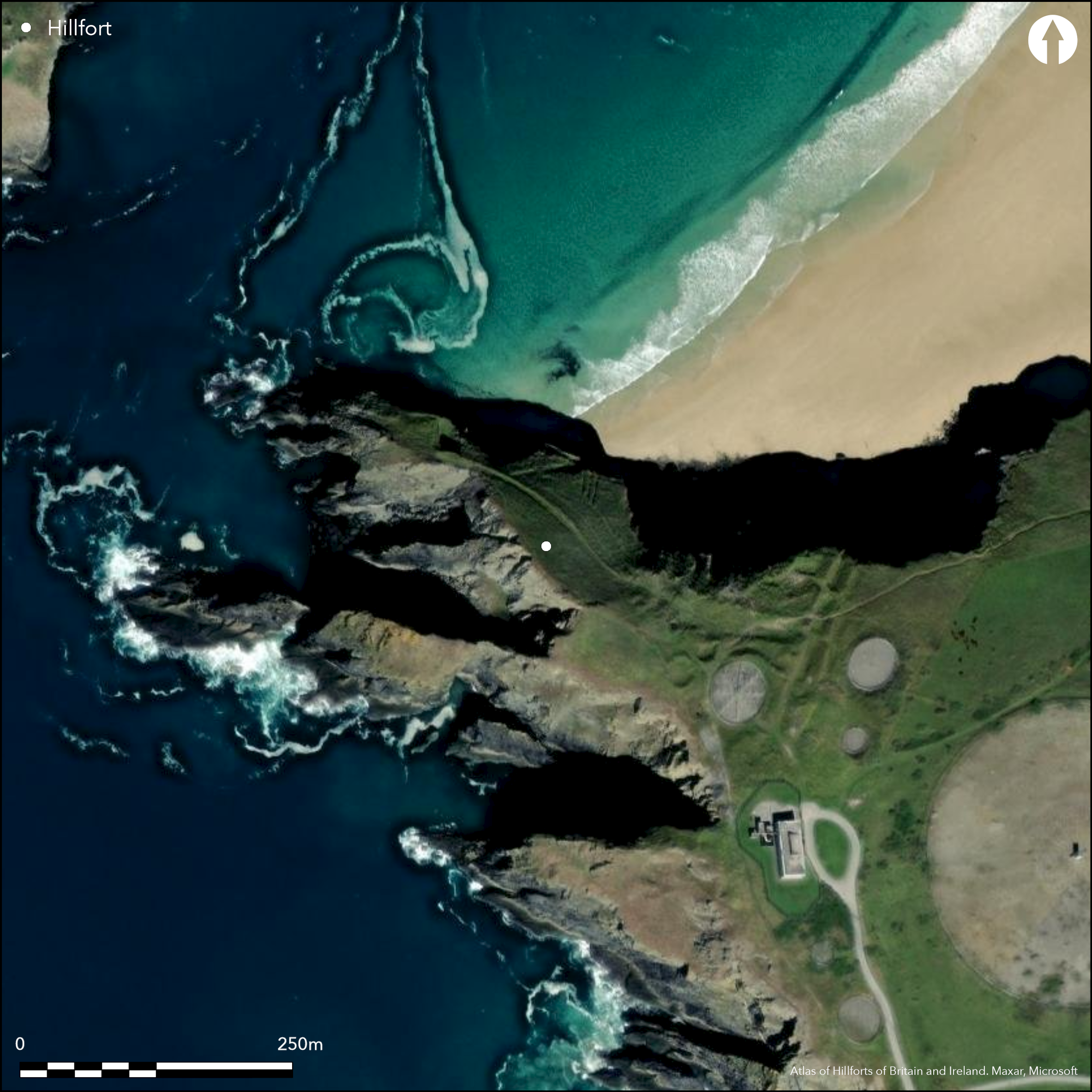
Satellite Imagery
LiDAR 1m DTM Hillshade
Satellite Imagery
Scroll left/right to view further images.
HER: Cornwall and Scilly MCO6562-65 (19692)
NMR: SW 75 NE 19 (428150)
SM: 1016991
NGR: SW758591
X: 175800 Y: 59100 (OSGB36)
Promontory fort located on NW-facing headland of Penhale Point, jutting out from coastline dividing Holywell Bay to N from Perran Bay to S, with commanding views in all directions. Site later incorporated into 19th century Wheal Golden lead mine, thus much destruction by mining and later installation of military radar station to SE. Sheer cliffs on seaward side and double line of landward ramparts, plus rock-cut ditches and counterscarp bank, running from cliff to cliff across neck of promontory from small cove to S to steep slope on NE enclosing 1ha. Two closely-spaced ramparts have different construction techniques, although each with rock-cut ditches. Inner rampart mostly of large rubble stones, may originally formed bank with stone front revetment; c. 2m high and 0.9m wide and partly fronted by outer ditch 1.5m deep and c. 7m. wide. Gap in rampart at centre, where outer ditch missing, possibly original inner entrance. Outer rampart of finely broken stone, c. 1m high and 6m wide, with outer ditch c. 5m in width and 0.8m deep. Partly obscuring ramparts where meet S cliff edge is 19th century cinder dump, possibly site of original entrance. Four visible breaches in ramparts, most probably mining access. Excavation in part of interior in 1983, in advance of radar installations, found remains of roundhouse of later Iron Age/Romano-British occupation date (CEU 1986; Smith 1988). Limited excavation of defences also. Mining waste, and other installations, probably originates from the sinking of at least three shafts, widespread, including horse-operated windlass (whim-gin) with diameter of 18m just behind the ramparts and reservoir. On OS map (1973-74). Much destruction.
Citizen Science: ✗
Reliability of Data: Confirmed
Reliability of Interpretation: Confirmed
X: -573909 Y: 6513896 (EPSG: 3857)
Longitude: -5.1555128119098335 Latitude: 50.38886960611343 (EPSG:4326)
Country: England; None
Current County or Unitary Authority: Cornwall
Historic County: Cornwall
Current Parish/Community/Council/Townland: Perranzabuloe; Cubert
Much destruction by mining and installation of military radar station to SE and later incorporated into 19th century Wheal Golden lead mine.
| Extant | ✓ |
| Cropmark | ✗ |
| Likely Destroyed | ✓ |
Scrub and rough coastal grass, bare rock and built upon surfaces. Installations on site.
| Woodland | ✗ |
| Commercial Forestry Plantation | ✗ |
| Parkland | ✗ |
| Pasture (Grazing) | ✗ |
| Arable | ✗ |
| Scrub/Bracken | ✓ |
| Bare Outcrop | ✗ |
| Heather/Moorland | ✗ |
| Heath | ✗ |
| Built-up | ✓ |
| Coastal Grassland | ✓ |
| Other | ✓ |
Promontory fort (aka cliff castle) on NW-facing headland of Penhale Point, which juts out from coastline dividing Holywell Bay to the N from Perran Bay to S, with commanding views in all directions. Sheer sea cliffs on seaward side.
| Contour Fort | ✗ |
| Partial Contour Fort | ✗ |
| Promontory Fort | ✓ |
| Hillslope Fort | ✗ |
| Level Terrain Fort | ✗ |
| Marsh Fort | ✗ |
| Multiple Enclosure Fort | ✗ |
Coastal headland and sea cliffs location running from a small cove to the south to a steep slope on the norh-east
| Hilltop | ✗ |
| Coastal Promontory | ✓ |
| Inland Promontory | ✗ |
| Valley Bottom | ✗ |
| Knoll/Hillock/Outcrop | ✗ |
| Ridge | ✗ |
| Cliff/Plateau-edge/Scarp | ✗ |
| Hillslope | ✗ |
| Lowland | ✗ |
| Spur | ✗ |
Dominant Topographic Feature: Coastal headland.
| North | ✗ |
| Northeast | ✗ |
| East | ✗ |
| Southeast | ✗ |
| South | ✗ |
| Southwest | ✗ |
| West | ✗ |
| Northwest | ✓ |
| Level | ✗ |
Altitude: 50.0m
Close to Parish boundary
Boundary Type: Parish/Townland
Two C14 dates from hut gave date of occupation somewhere in period 101 BC-AD 88.
Reliability: B - Medium
| Pre 1200BC | ✗ |
| 1200BC - 800BC | ✗ |
| 800BC - 400BC | ✗ |
| 400BC - AD50 | ✓ |
| AD50 - AD400 | ✓ |
| AD400 - AD 800 | ✗ |
| Post AD800 | ✗ |
| Unknown | ✗ |
| Pre Hillfort: | None |
| Post Hillfort: | None |
| C14: | In hut interior. |
First described by R. Thomas in newspaper 1851. Plan by H.M. Whitley 1883. On OS map (1973-74). 1970 measured survey field observation - no details. Survey and evaluation excavation by CCRA 1983. Excavations in advance of radar installation 1983 - G.H. Smith, Cornwall County Archaeology Unit.
| 1st Identified Written Reference (1851): | First described by R. Thomas in newspaper. |
| Other (1883): | Plan by H.M. Whitley. |
| Other (1970): | Measured survey field observation |
| Excavation (1983): | G.H. Smith, Cornwall County Archaeology Unit. |
| Other (1983): | Measured Survey and evaluation G.H. Smith, Cornwall County Archaeology Unit. |
| Excavation (1983): | Survey and evaluation excavation by CCRA. |
| 1st Identified Map Depiction (None): | OS map |
Circular house, diameter 6m excavated. Comprised of stone-faced wall bank with internal ring of five postholes, (diameter 3m), enclosing circular room with diameter of 6.2m and single entrance. Central hearth and possible storage pit provided evidence of occupation within hut. No other evidence of contemporary occupation recorded, probably destroyed by later mining activity. Pottery sherds from single vessel from within and outside house. Southern Western Decorated Vessel, of later Iron Age, well-preserved probably representing last phase of occupation. Pottery and C14vdates obtained from roundhouse give date range from 101 BC-AD 88 for occupation. During excavations two concentrations of flint scatters; Mesolithic blade microliths and some Neolithic examples.
None
| None | ✓ |
| Spring | ✗ |
| Stream | ✗ |
| Pool | ✗ |
| Flush | ✗ |
| Well | ✗ |
| Other | ✗ |
None
| No Known Features | ✓ |
| Round Stone Structures | ✗ |
| Rectangular Stone Structures | ✗ |
| Curvilinear Platforms | ✗ |
| Other Roundhouse Evidence | ✗ |
| Pits | ✗ |
| Quarry Hollows | ✗ |
| Other | ✗ |
A circular house, with diameter 6m excavated. Comprised of stone-faced wall bank with internal ring of five postholes, (diameter 3m), enclosing circular room with diameter of 6.2m and single entrance. Central hearth and possible storage pit provided evidence of occupation within hut. No other evidence of contemporary occupation was recorded, probably destroyed by later mining activity.
| No Known Excavation | ✗ |
| Pits | ✓ |
| Postholes | ✓ |
| Roundhouses | ✓ |
| Rectangular Structures | ✗ |
| Roads/Tracks | ✗ |
| Quarry Hollows | ✗ |
| Other | ✓ |
| Nothing Found | ✗ |
None
| No Known Geophysics | ✓ |
| Pits | ✗ |
| Roundhouses | ✗ |
| Rectangular Structures | ✗ |
| Roads/Tracks | ✗ |
| Quarry Hollows | ✗ |
| Other | ✗ |
| Nothing Found | ✗ |
Pottery sherds from single vessel from within and outside house. Southern Western Decorated Vessel, of later Iron Age, well preserved probably representing last phase of occupation. The pottery and C14 dates obtained from the roundhouse give a date range from 101 BC-AD 88 for occupation. During excavations two concentrations of flint scatters. From Area 1 dominated by Mesolithic blade microliths, Area 2 contained some Neolithic examples.
| No Known Finds | ✗ |
| Pottery | ✓ |
| Metal | ✗ |
| Metalworking | ✗ |
| Human Bones | ✗ |
| Animal Bones | ✗ |
| Lithics | ✓ |
| Environmental | ✗ |
| Other | ✗ |
None
| APs Not Checked | ✓ |
| None | ✗ |
| Roundhouses | ✗ |
| Rectangular Structures | ✗ |
| Pits | ✗ |
| Postholes | ✗ |
| Roads/Tracks | ✗ |
| Other | ✗ |
Various theories, but original entrance not determined. Partly obscuring ramparts where meet S cliff edge is 19th century cinder dump, possibly site of original entrance. Limited excavation of the defences found that inner ditch between the two ramparts not continuous and that a causeway occupied part of this space. This suggests an offset entrance, which, when compared to known examples of this type of monument, would represent an advance in design implying very late Iron Age date for its construction. Four visible breaches in ramparts probably mining access.
| 4: | Four visible breaches in ramparts have probably mining access. |
| 2: | Various theories, but original entrance not determined. |
Guard Chambers: ✗
Chevaux de Frise: ✗
| 1. Oblique (South): | Possible offset with causeway. Theory only. |
Protected by sheer cliffs on seaward side and by double line of landward defences plus rock-cut ditches and a counterscarp bank running from cliff to cliff across neck of the promontory from a small cove to the S to a steep slope on NE. The two close-spaced ramparts have different construction techniques, although each with rock-cut ditches. Inner rampart mostly of large rubble stones, may originally formed bank with stone front revetment; c. 2m high and 0.9m wide and partly fronted by outer ditch 1.5m deep and c. 7m. wide. Gap in the rampart at centre, where outer ditch is missing, possibly original inner entrance. Outer dump rampart of finely broken stone, c. 1m high and 6m wide, with outer ditch c. 5m in width and 0.8m deep.
| Area 1: | 1.0ha. |
| Total: | 1.0ha. |
Total Footprint Area: Noneha.
None
| ✗ | None |
| ✗ | None |
| NE Quadrant: | 0 |
| SE Quadrant: | 2 |
| SW Quadrant: | 0 |
| NW Quadrant: | 0 |
| Total: | 2 |
| Partial Univallate | ✗ |
| Univallate | ✗ |
| Partial Bivallate | ✓ |
| Bivallate | ✗ |
| Partial Multivallate | ✗ |
| Multivallate | ✗ |
| Unknown | ✗ |
| Partial Univallate | ✗ |
| Univallate | ✗ |
| Partial Bivallate | ✗ |
| Bivallate | ✗ |
| Partial Multivallate | ✗ |
| Multivallate | ✗ |
Inner rampart mostly of large rubble stones, may originally formed bank with stone front revetment. Outer rampart of finely broken stone. Counterscarp runs from cliff to cliff.
| None | ✗ |
| Earthen Bank | ✗ |
| Stone Wall | ✓ |
| Rubble | ✓ |
| Wall-walk | ✗ |
| Evidence of Timber | ✗ |
| Vitrification | ✗ |
| Other Burning | ✗ |
| Palisade | ✗ |
| Counter Scarp Bank | ✓ |
| Berm | ✗ |
| Unfinished | ✗ |
| Other | ✗ |
The two close-spaced ramparts have different construction techniques, although each with rock-cut ditches. Inner rampart mostly of large rubble stones, may originally formed bank with stone front revetment; c. 2m high and 0.9m wide and partly fronted by outer ditch 1.5m deep and c. 7m. wide. Gap in the rampart at centre, where outer ditch is missing, possibly original inner entrance. Outer rampart of finely broken stone of dump construction, c. 1m high and 6m wide, with outer ditch c. 5m in width and 0.8m deep.
| None | ✗ |
| Earthen Bank | ✗ |
| Stone Wall | ✓ |
| Murus Duplex | ✗ |
| Timber-framed | ✗ |
| Timber-laced | ✗ |
| Vitrification | ✗ |
| Other Burning | ✗ |
| Palisade | ✗ |
| Counter Scarp Bank | ✗ |
| Berm | ✗ |
| Unfinished | ✗ |
| No Known Excavation | ✗ |
| Other | ✓ |
| ✗ | None |
| ✓ | Rock-cut ditches, outer probably recut. Limited excavation of the defences found that inner ditch between the two ramparts not continuous. |
Number of Ditches: 2
| ✗ | None |
Central Excavation Unit 1986. Preservation by record: work of CEU 1975-85/42, Cornwall County Archaeology Unit, Cornwall County Council.
Cotton, M.A. 1958-9. Cornish Cliff Castles, Proc West Cornwall Fld Club, 2, 3, 119.
Johnson, N. and Rose, P. 1982. Defended settlement in Cornwall - an illustrated discussion, In ed. D. Miles, The Romano-British countryside: Studies in rural settlement and economy, BAR Brit Ser 103, 151-207.
Smith, G.G. 1984. Penhale coastal promontory fort Perranzabuloe, 1983, Cornish Archaeol, 23, 180.
Smith G.H. 1988. Excavation of the Iron Age cliff promontory fort and of Mesolithic and neolithic flint working areas at Penhale Point, Holywell Bay, near Newquay, 1983, Cornish Archaeol, 27, 171-99.
Thomas, R. 1851. Letters to the West Briton, At CSL, Redruth, No 40.
Whitley, H.M. 1881-83. Note on paper read by H.M. Whitley on Cliff Castles in Perranzabuloe and Crantock, J Royal Inst Cornwall, 7, 288-293, plan.
Atlas of Hillforts:
Wikidata:
This work is licensed under CC BY-SA 4.0

 and should be cited as:
Lock, Gary and Ralston, Ian. 2024. Atlas of Hillforts of Britain and Ireland. Available at: https://hillforts.arch.ox.ac.uk
Document Version 1.1