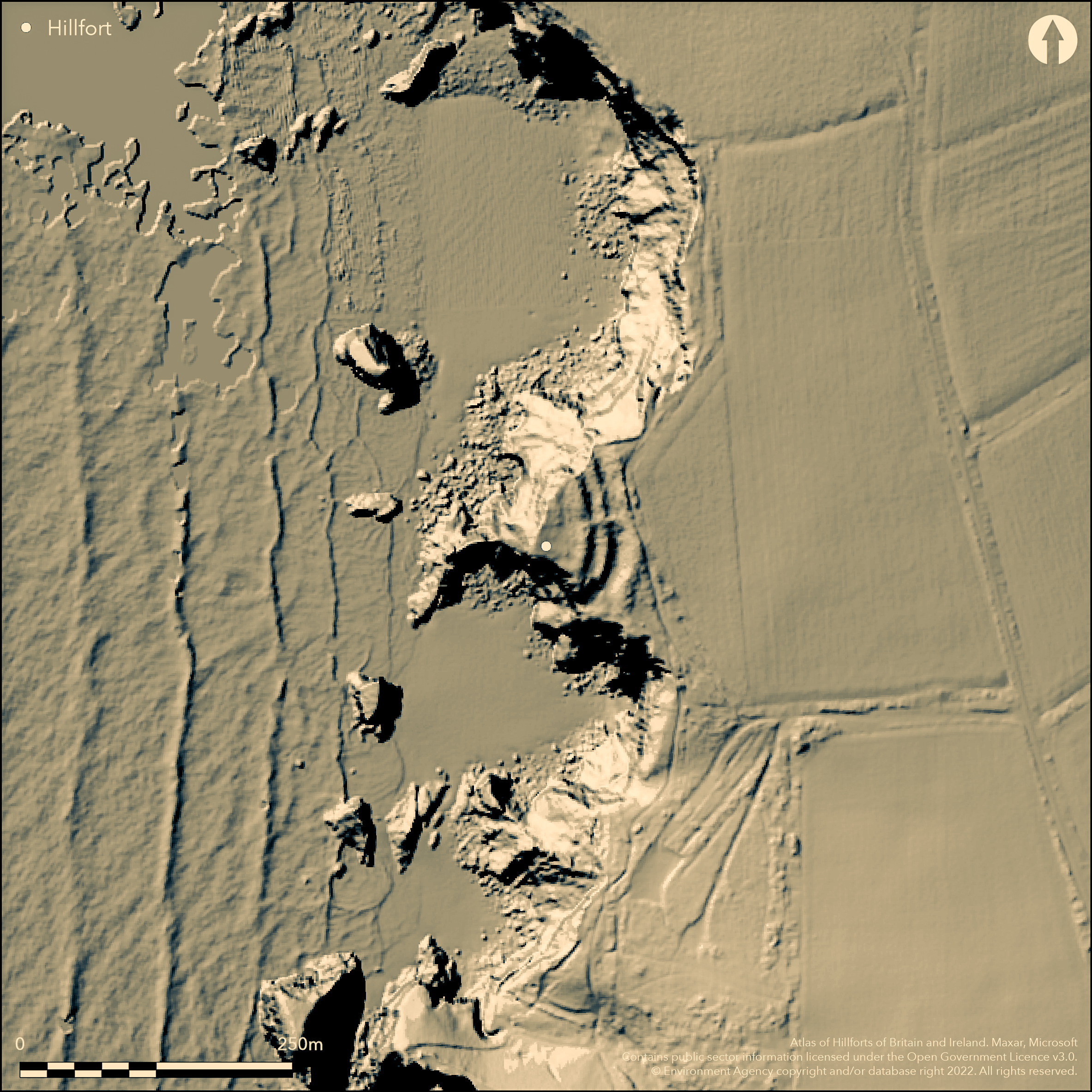
LiDAR 1m DTM Hillshade
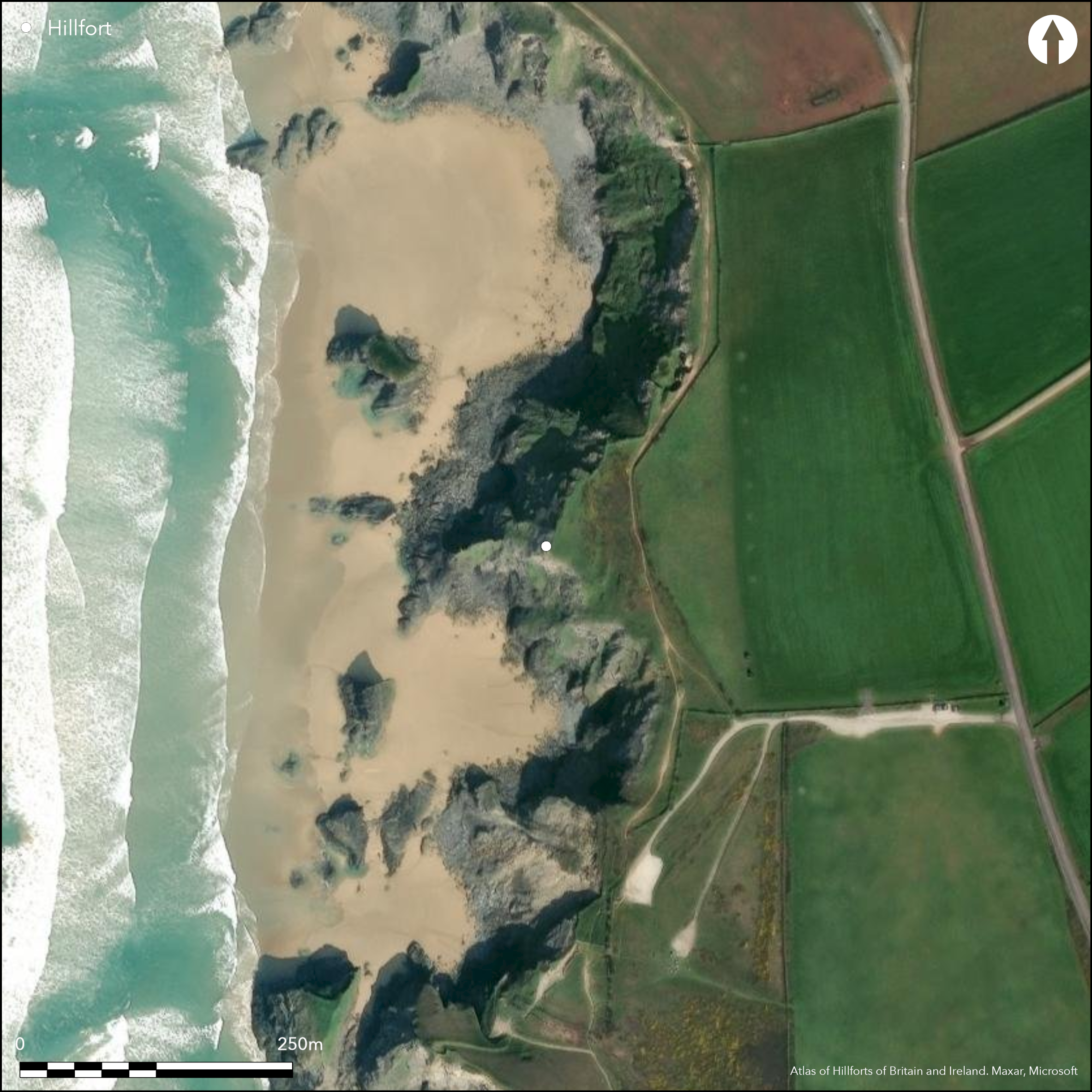
Satellite Imagery
LiDAR 1m DTM Hillshade
Satellite Imagery
Scroll left/right to view further images.
HER: Cornwall and Scilly MCO6571 (21931)
NMR: SW 86 NW 3 (429278)
SM: 1021006
NGR: SW 8492 6965
X: 184915 Y: 69646 (OSGB36)
Bivallate and much eroded promontory fort located on promontory projecting W into the Atlantic N of Mawgan Porth, 550m SW of Bedruthan. Level and moderately sloping undulating interior to W with high sea cliffs with a narrow ridge projecting seaward below. Irregular outline reflect line of cliffs. Site c. 200m across N-S and 75m E-W, enclosing 0.3ha. Despite erosion impressive ramparts and ditch. On landward side two concentric ramparts, each with external ditch, running N-S across neck of promontory with slight outward curve, visible as rounded banks of earth and stone with possible use of large ground and basal facing stones. Banks 4m-5m wide and 1m-1.5m high. Two ditches both have flatish bases, but differ in proportions. Inner to W c. 6m-7m wide and 1m deep. Outer ditch to 9m-10m across, and 2m to 3.5m deep. For some 20m towards its S end, sides of outer ditch are formed of exposed, steep faces of cut bedrock. Entrance runs E-W through the centre of its enclosing earthworks, passing over the ditches on a causeway 4m-7m wide and around 0.7m-1m high. Coastal grassland and bare rock. Undated. On 1st Ed. OS map (1881).
Citizen Science: ✗
Reliability of Data: Confirmed
Reliability of Interpretation: Confirmed
X: -560330 Y: 6531044 (EPSG: 3857)
Longitude: -5.033526589162737 Latitude: 50.48698598897918 (EPSG:4326)
Country: England
Current County or Unitary Authority: Cornwall
Historic County: Cornwall
Current Parish/Community/Council/Townland: St Eval
Much of interior lost by the sea erosion which is continuing, but despite erosion impressive ramparts and ditch. On Heritage at Risk Register (2015).
| Extant | ✓ |
| Cropmark | ✗ |
| Likely Destroyed | ✓ |
Coastal grassland and bare rock.
| Woodland | ✗ |
| Commercial Forestry Plantation | ✗ |
| Parkland | ✗ |
| Pasture (Grazing) | ✗ |
| Arable | ✗ |
| Scrub/Bracken | ✗ |
| Bare Outcrop | ✗ |
| Heather/Moorland | ✗ |
| Heath | ✗ |
| Built-up | ✗ |
| Coastal Grassland | ✓ |
| Other | ✗ |
Bivallate and much eroded promontory fort (aka cliff castle) located on promontory projecting W into the Atlantic N of Mawgan Porth. Level and moderately sloping interior with high sea cliffs with a narrow ridge projecting seaward below.
| Contour Fort | ✗ |
| Partial Contour Fort | ✗ |
| Promontory Fort | ✓ |
| Hillslope Fort | ✗ |
| Level Terrain Fort | ✗ |
| Marsh Fort | ✗ |
| Multiple Enclosure Fort | ✗ |
Coastal headland location with sea cliffs
| Hilltop | ✗ |
| Coastal Promontory | ✓ |
| Inland Promontory | ✗ |
| Valley Bottom | ✗ |
| Knoll/Hillock/Outcrop | ✗ |
| Ridge | ✗ |
| Cliff/Plateau-edge/Scarp | ✗ |
| Hillslope | ✗ |
| Lowland | ✗ |
| Spur | ✗ |
Dominant Topographic Feature: Coastal headland
| North | ✗ |
| Northeast | ✗ |
| East | ✗ |
| Southeast | ✗ |
| South | ✗ |
| Southwest | ✗ |
| West | ✓ |
| Northwest | ✗ |
| Level | ✗ |
Altitude: 65.0m
N/A
None.
Reliability: D - None
| Pre 1200BC | ✗ |
| 1200BC - 800BC | ✗ |
| 800BC - 400BC | ✗ |
| 400BC - AD50 | ✗ |
| AD50 - AD400 | ✗ |
| AD400 - AD 800 | ✗ |
| Post AD800 | ✗ |
| Unknown | ✓ |
| Pre Hillfort: | None |
| Post Hillfort: | None |
On 1st Ed. OS map (1881). First recorded 1849 - no details. Investigation Ministry of Works 1951. Field investigation Ordnance Survey 1979. Other investigations in 1970's and 1980's - no details.
| 1st Identified Written Reference (1849): | No details. |
| 1st Identified Map Depiction (1881): | OS map. |
| Other (1951): | Investigation Ministry of Works. |
| Other (1979): | Field investigation OS. |
| Other (None): | Investigations - no details. |
None.
None
| None | ✓ |
| Spring | ✗ |
| Stream | ✗ |
| Pool | ✗ |
| Flush | ✗ |
| Well | ✗ |
| Other | ✗ |
None
| No Known Features | ✓ |
| Round Stone Structures | ✗ |
| Rectangular Stone Structures | ✗ |
| Curvilinear Platforms | ✗ |
| Other Roundhouse Evidence | ✗ |
| Pits | ✗ |
| Quarry Hollows | ✗ |
| Other | ✗ |
None
| No Known Excavation | ✓ |
| Pits | ✗ |
| Postholes | ✗ |
| Roundhouses | ✗ |
| Rectangular Structures | ✗ |
| Roads/Tracks | ✗ |
| Quarry Hollows | ✗ |
| Other | ✗ |
| Nothing Found | ✗ |
None
| No Known Geophysics | ✓ |
| Pits | ✗ |
| Roundhouses | ✗ |
| Rectangular Structures | ✗ |
| Roads/Tracks | ✗ |
| Quarry Hollows | ✗ |
| Other | ✗ |
| Nothing Found | ✗ |
None
| No Known Finds | ✓ |
| Pottery | ✗ |
| Metal | ✗ |
| Metalworking | ✗ |
| Human Bones | ✗ |
| Animal Bones | ✗ |
| Lithics | ✗ |
| Environmental | ✗ |
| Other | ✗ |
None
| APs Not Checked | ✓ |
| None | ✗ |
| Roundhouses | ✗ |
| Rectangular Structures | ✗ |
| Pits | ✗ |
| Postholes | ✗ |
| Roads/Tracks | ✗ |
| Other | ✗ |
Possible original entrance runs E-W through the centre of banks, passing over the ditches on a causeway 4m-7m wide and around 0.7m-1m high.
| 1: | None |
| 2: | None |
Guard Chambers: ✗
Chevaux de Frise: ✗
| 1. Simple Gap (West): | Causewayed entrance. |
Despite erosion impressive ramparts and ditch. On landward side two concentric ramparts, each with external ditch, running N-S across neck of promontory with slight outward curve, visible as rounded banks of earth and stone with possible use of large ground and basal facing stones. Banks 4m-5m wide and 1m-1.5m high. Two ditches both have flatish bases, but differ in proportions. Inner to W c. 6m-7m wide and 1m deep. Outer ditch to 9m-10m across, and 2m to 3.5m deep. For some 20m towards its S end, sides of outer ditch are formed of exposed, steep faces of cut bedrock.
| Area 1: | 0.3ha. |
| Total: | 0.3ha. |
Total Footprint Area: Noneha.
None
| ✗ | None |
| ✗ | None |
| NE Quadrant: | 2 |
| SE Quadrant: | 2 |
| SW Quadrant: | 0 |
| NW Quadrant: | 0 |
| Total: | 2 |
| Partial Univallate | ✗ |
| Univallate | ✗ |
| Partial Bivallate | ✓ |
| Bivallate | ✗ |
| Partial Multivallate | ✗ |
| Multivallate | ✗ |
| Unknown | ✗ |
| Partial Univallate | ✗ |
| Univallate | ✗ |
| Partial Bivallate | ✗ |
| Bivallate | ✗ |
| Partial Multivallate | ✗ |
| Multivallate | ✗ |
Earth and stone banks, with stone revetment on inner bank.
| None | ✗ |
| Earthen Bank | ✓ |
| Stone Wall | ✓ |
| Rubble | ✓ |
| Wall-walk | ✗ |
| Evidence of Timber | ✗ |
| Vitrification | ✗ |
| Other Burning | ✗ |
| Palisade | ✗ |
| Counter Scarp Bank | ✗ |
| Berm | ✗ |
| Unfinished | ✗ |
| Other | ✗ |
None
| None | ✗ |
| Earthen Bank | ✗ |
| Stone Wall | ✗ |
| Murus Duplex | ✗ |
| Timber-framed | ✗ |
| Timber-laced | ✗ |
| Vitrification | ✗ |
| Other Burning | ✗ |
| Palisade | ✗ |
| Counter Scarp Bank | ✗ |
| Berm | ✗ |
| Unfinished | ✗ |
| No Known Excavation | ✓ |
| Other | ✗ |
| ✗ | None |
| ✓ | Ditches, c. 100m long in a very good condition, |
Number of Ditches: 2
| ✗ | None |
Cotton, M.A. 1958-9. Cornish Cliff Castles, Proc West Cornwall Fld Club, 2, 3, 119.
Henderson, C. 1914. Notebooks of Parochial Antiquities, Unpublished MS At RIC. Vol III, 89.
Henderson, C. 1930. A Survey of Cornwall, CPRE. Thompson, W.H. (ed).,CH 9, 57.
Johnson, N. and Rose, P. 1982. Defended settlement in Cornwall - an illustrated discussion, In ed. D. Miles, The Romano-British countryside: Studies in rural settlement and economy, BAR Brit Ser 103, 151-207.
Nankivall, F. 1962. The principal antiquities of the Newquay-Padstow District, Cornwall Archaeol Soc Field Guide 7.
Pattison, S.R. 1849. On Some Earth-Works Near Newquay, on The North Coast of Cornwall, Annual Report of the Royal Institution of Cornwall, 31, 36.
Polsue, J. ed. 1867-72. Lake's Parochial History of Cornwall, Vol 1, 374.
Atlas of Hillforts:
Wikidata:
This work is licensed under CC BY-SA 4.0

 and should be cited as:
Lock, Gary and Ralston, Ian. 2024. Atlas of Hillforts of Britain and Ireland. Available at: https://hillforts.arch.ox.ac.uk
Document Version 1.1