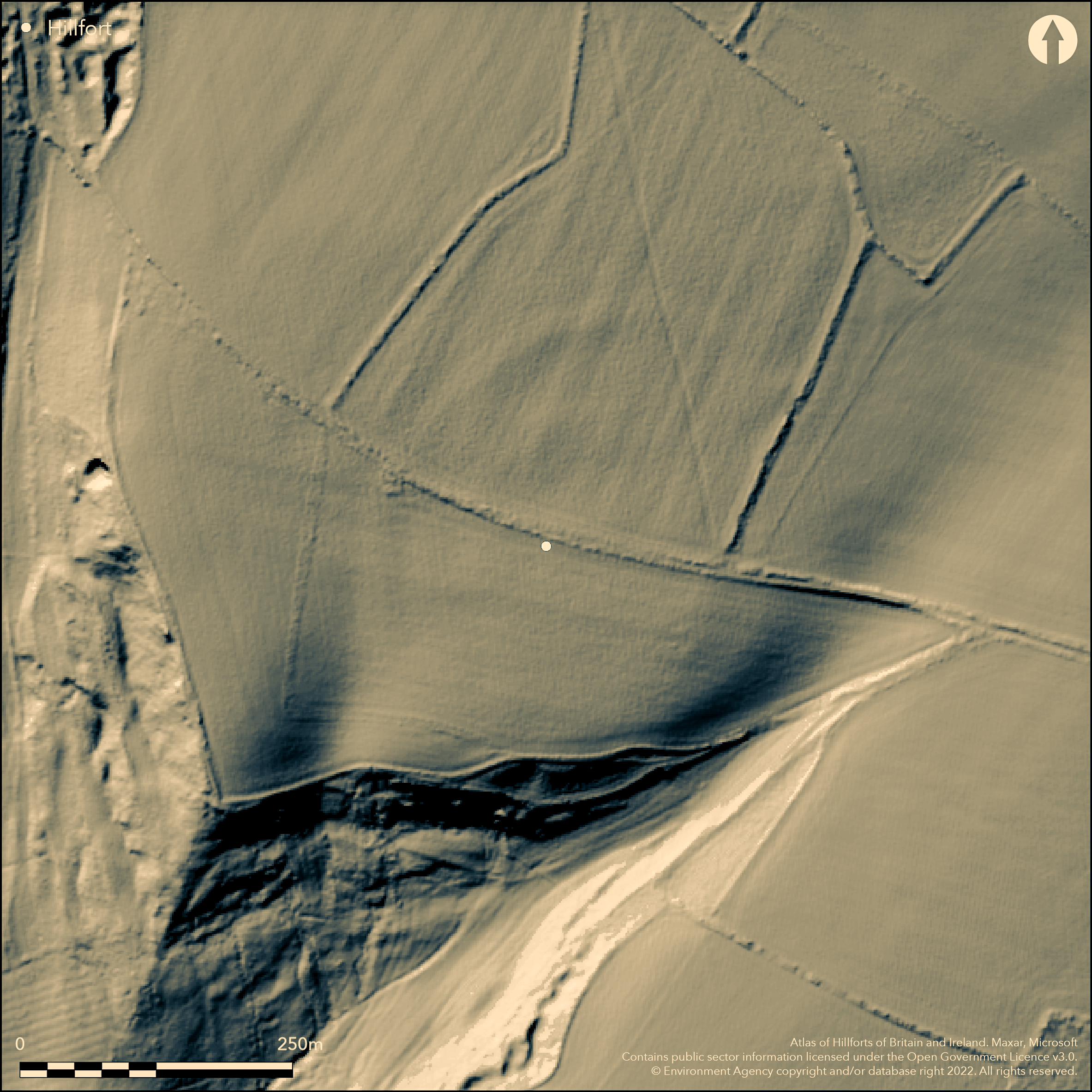
LiDAR 1m DTM Hillshade
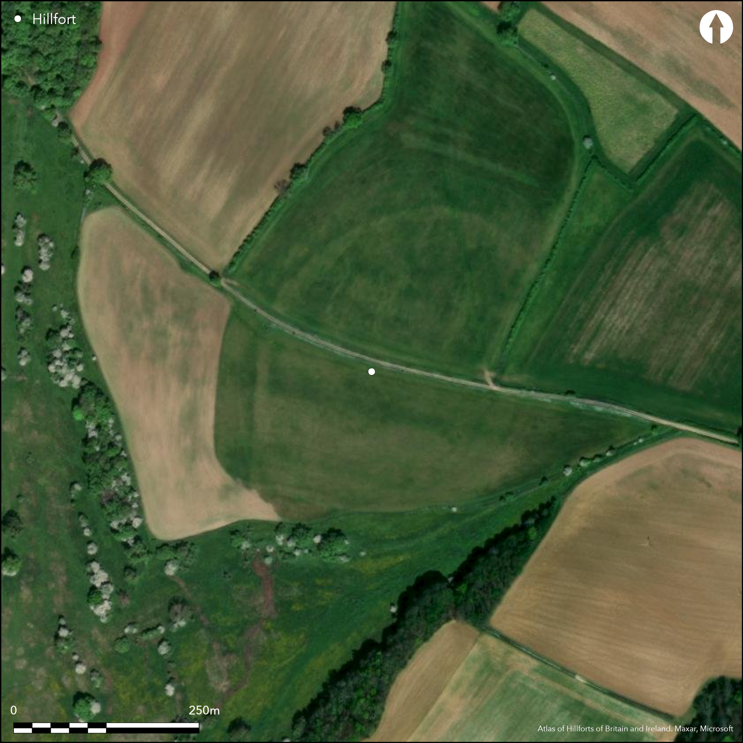
Satellite Imagery
LiDAR 1m DTM Hillshade
Satellite Imagery
Scroll left/right to view further images.
HER: Gloucestershire 4684 (None)
NMR: SO 90 NE 25 (117102)
SM: 1003448
NGR: SO995093
X: 399590 Y: 209380 (OSGB36)
Bivallate, partial contour hillfort located on SW-facing spur on the shoulder of the Great Oolite ridge at headwaters of River Churn in S Cotswolds, now recognised only as cropmarks as ploughed out. N half of site flat, whilst S half drops slightly. Measures 410m E-W and 265m N-S, enclosing 4.0ha. Site difficult to interpret and some slight indentations on surface remain. Banks and ditches around the S half possibly destroyed in Roman period. Ditch still visible on N and W as c. 12m wide and nearly 1m deep depression below low spread bank. E side of fort probably on line of field wall. Probable entrances to NE and SW. High status Romano-British villa located within to S. Small excavations in 1982, 1984-5 and geophysical survey 1988 and 2006. E ramparts and trackway approaching NE corner excavated 1982-3. Entrance causeway across inner and outer ditches located, cut by shallower ditch in the late Iron Age. Evidence of a gate structure. Inner ditch later than outer, Both infilled during Claudio-Neronian period (AD 43-68) and limestone slab roadway laid over gateway. Finds included seven spit shaped currency bars from outer ditch and fragments of coin mould. Several phases of Romano-British building uncovered and 1985 excavations in N half showed E part of Romano-British villa, first located 1983. Earliest occupation of site Iron Age occupation layer and three storage pits, backfilled around mid 1st century AD and simple 'strip' type villa erected on site between c. AD 50 -70; later developed and destroyed by fire end of 3rd century AD. Animal bone suggests regime change from cattle to cattle sheep/goat and pig to 2nd century AD. Chance finds of intaglios 1st-2nd century AD. Possible annexe to SW. Rubbish or storage pits across interior and some outside. Some of larger and squarer structure examples possibly sunken floored buildings. Small area of hard standing and possible 4m square building. Site possibly part of larger Bagendon complex.
Citizen Science: ✗
Reliability of Data: Confirmed
Reliability of Interpretation: Confirmed
X: -223458 Y: 6760991 (EPSG: 3857)
Longitude: -2.007361372277327 Latitude: 51.78303827574313 (EPSG:4326)
Country: England
Current County or Unitary Authority: Gloucestershire
Historic County: Gloucestershire
Current Parish/Community/Council/Townland: North Cerney
Destroyed. Now recognised as cropmarks as ploughed-out. Some slight indentations remain on the surface. Trackway extends though centre of site.
| Extant | ✓ |
| Cropmark | ✓ |
| Likely Destroyed | ✓ |
None
| Woodland | ✗ |
| Commercial Forestry Plantation | ✗ |
| Parkland | ✗ |
| Pasture (Grazing) | ✓ |
| Arable | ✗ |
| Scrub/Bracken | ✗ |
| Bare Outcrop | ✗ |
| Heather/Moorland | ✗ |
| Heath | ✗ |
| Built-up | ✗ |
| Coastal Grassland | ✗ |
| Other | ✗ |
Bivallate partial contour hillfort, now recognised only as cropmarks as ploughed out, located on SW-facing spur on the shoulder of the Great Oolite ridge at headwaters of River Churn in S Cotswolds.
| Contour Fort | ✗ |
| Partial Contour Fort | ✓ |
| Promontory Fort | ✗ |
| Hillslope Fort | ✗ |
| Level Terrain Fort | ✗ |
| Marsh Fort | ✗ |
| Multiple Enclosure Fort | ✗ |
Northern half of site nearly flat with southern part dropping slightly to a small spur on the shoulder of the Great Oolite ridge
| Hilltop | ✗ |
| Coastal Promontory | ✗ |
| Inland Promontory | ✗ |
| Valley Bottom | ✗ |
| Knoll/Hillock/Outcrop | ✗ |
| Ridge | ✗ |
| Cliff/Plateau-edge/Scarp | ✗ |
| Hillslope | ✗ |
| Lowland | ✗ |
| Spur | ✓ |
Dominant Topographic Feature: Spur
| North | ✗ |
| Northeast | ✗ |
| East | ✗ |
| Southeast | ✗ |
| South | ✗ |
| Southwest | ✓ |
| West | ✗ |
| Northwest | ✗ |
| Level | ✓ |
Altitude: 220.0m
N/A
Currency bars and pottery indicate late Iron Age to Romano-British occupation.
Reliability: B - Medium
| Pre 1200BC | ✗ |
| 1200BC - 800BC | ✗ |
| 800BC - 400BC | ✗ |
| 400BC - AD50 | ✓ |
| AD50 - AD400 | ✓ |
| AD400 - AD 800 | ✗ |
| Post AD800 | ✗ |
| Unknown | ✗ |
| Pre Hillfort: | None |
| Post Hillfort: | None |
| Artefactual: | None |
Small excavations in 1982, 1984-5 by S.D. Trow. Aerial photograph interpretation, RCHME, AP Primary Recording Project, 1992-96. Geophysical survey 1988 and 2006. Aerial photograph interpretation Gloucestershire County Council Cotswold Hills (S Cotswolds) NMP.
| Geophysical Survey (1988): | None |
| Geophysical Survey (2006): | T. Moore. |
| Excavation (None): | S.D. Trow. |
| Other (None): | RCHME, AP Primary Recording Project, |
| Other (None): | Aerial photograph interpretation Gloucestershire County Council Cotswold Hills (S Cotswolds) NMP. |
Rubbish or storage pits across interior and some outside. Some of larger and squarer examples possibly sunken floored buildings. Small area of hard standing and possible 4m square building. Several phases of Romano-British building uncovered and 1985 excavations in N half showed E part of Romano-British villa, first located 1983. Possible roundhouse, defined by penannular bank, perhaps the remains of stone wall, 6m in diameter. Finds of pottery, mostly 3rd and 4th century, include Oxfordshire mortaria and colour-coated ware, with one or two pieces of Samian. Hoard of currency bars found in ditch. Animal bone suggested change from cattle to cattle sheep/goat and pig to 2nd century AD. Chance finds of intaglios 1st-2nd century AD.
None
| None | ✓ |
| Spring | ✗ |
| Stream | ✗ |
| Pool | ✗ |
| Flush | ✗ |
| Well | ✗ |
| Other | ✗ |
None
| No Known Features | ✓ |
| Round Stone Structures | ✗ |
| Rectangular Stone Structures | ✗ |
| Curvilinear Platforms | ✗ |
| Other Roundhouse Evidence | ✗ |
| Pits | ✗ |
| Quarry Hollows | ✗ |
| Other | ✗ |
Several phases of Romano-British building uncovered and 1985 excavations in N half showed E part of Romano-British villa, first located 1983. Earliest occupation of site Iron Age occupation layer and 3 storage pits, backfilled around the mid c. mid 1st century AD and a simple 'strip' type villa erected on the site between c AD 50 - 70; later developed and destroyed by fire end of 3rd century AD.
| No Known Excavation | ✗ |
| Pits | ✓ |
| Postholes | ✗ |
| Roundhouses | ✓ |
| Rectangular Structures | ✗ |
| Roads/Tracks | ✓ |
| Quarry Hollows | ✗ |
| Other | ✓ |
| Nothing Found | ✗ |
Rubbish or storage pits across interior and some outside. Some of larger and squarer examples possibly sunken floored buildings. Small area of hard standing and possible 4m square building.
| No Known Geophysics | ✗ |
| Pits | ✓ |
| Roundhouses | ✗ |
| Rectangular Structures | ✗ |
| Roads/Tracks | ✗ |
| Quarry Hollows | ✗ |
| Other | ✓ |
| Nothing Found | ✗ |
Finds of pottery, mostly 3rd and 4th century, include Oxfordshire mortaria and colour-coated ware, with one or two pieces of Samian. Hoard of currency bars found in ditch. Animal bone suggested change from cattle to cattle sheep/goat and pig to 2nd century AD. Chance finds of intaglios 1st-2nd century AD.
| No Known Finds | ✗ |
| Pottery | ✓ |
| Metal | ✓ |
| Metalworking | ✗ |
| Human Bones | ✗ |
| Animal Bones | ✓ |
| Lithics | ✗ |
| Environmental | ✗ |
| Other | ✗ |
None
| APs Not Checked | ✓ |
| None | ✗ |
| Roundhouses | ✗ |
| Rectangular Structures | ✗ |
| Pits | ✗ |
| Postholes | ✗ |
| Roads/Tracks | ✗ |
| Other | ✗ |
Two opposing entrances. NE entrance obscured by field boundaries, but possibly has trackway extending from it, shown by pair of linear drainage ditches for 87m E-W. Trackway possibly joins medieval trackway. SW entrance has curvilinear boundary ditch extending towards NW, giving hillfort appearance of antenna enclosure.
| 2: | None |
| 2: | None |
Guard Chambers: ✗
Chevaux de Frise: ✗
| 1. Simple Gap (North east): | Obscured by field boundaries. |
| 2. Simple Gap (South west): | Obscured by field boundaries. |
| 2. Outworks (South west): | Curvilinear boundary ditch. |
Site difficult to interpret and some slight indentations on surface remain. Banks and ditches around the S half possibly destroyed in Roman period. Double ditch still visible on N and W as c. 12m wide and nearly 1m deep depression below low spread bank. East side of fort probably on line of field wall.
| Area 1: | 4.0ha. |
| Total: | 4.0ha. |
Total Footprint Area: Noneha.
None
| ✗ | None |
| ✓ | Quadrants estimated and suggested by ditches. |
| NE Quadrant: | 2 |
| SE Quadrant: | 2 |
| SW Quadrant: | 2 |
| NW Quadrant: | 2 |
| Total: | 2 |
| Partial Univallate | ✗ |
| Univallate | ✗ |
| Partial Bivallate | ✗ |
| Bivallate | ✓ |
| Partial Multivallate | ✗ |
| Multivallate | ✗ |
| Unknown | ✗ |
| Partial Univallate | ✗ |
| Univallate | ✗ |
| Partial Bivallate | ✗ |
| Bivallate | ✗ |
| Partial Multivallate | ✗ |
| Multivallate | ✗ |
None
| None | ✗ |
| Earthen Bank | ✓ |
| Stone Wall | ✗ |
| Rubble | ✗ |
| Wall-walk | ✗ |
| Evidence of Timber | ✗ |
| Vitrification | ✗ |
| Other Burning | ✗ |
| Palisade | ✗ |
| Counter Scarp Bank | ✗ |
| Berm | ✗ |
| Unfinished | ✗ |
| Other | ✗ |
E defences and trackway approaching the NE corner excavated 1982-3. Entrance causeway across inner and outer ditches located cut by shallower ditch in the late Iron Age. Evidence of a gate structure. Inner ditch later than outer, Both infilled during Claudio-Neronian period (AD 43-68) and limestone slab roadway laid over gateway.
| None | ✗ |
| Earthen Bank | ✗ |
| Stone Wall | ✗ |
| Murus Duplex | ✗ |
| Timber-framed | ✗ |
| Timber-laced | ✗ |
| Vitrification | ✗ |
| Other Burning | ✗ |
| Palisade | ✗ |
| Counter Scarp Bank | ✗ |
| Berm | ✗ |
| Unfinished | ✗ |
| No Known Excavation | ✗ |
| Other | ✓ |
| ✗ | None |
| ✓ | Ditch still visible on N and W as c. 12m wide and nearly 1m deep depression below low spread bank. |
Number of Ditches: 2
| ✓ | Possible annexe to SW. |
Moore, T. 2006. Gradiometry at 'Ditches', North Cerney, Gloucestershire, Unpublished Interim Report for English Heritage.
Trow, S.D. 1988. Excavations at Ditches Hillfort, North Cerney, Gloucestershire, Trans Bristol Glos Archaeol Soc, 106, 19-85.
Trow, S.D. James, S. and Moore, T. 2009. Becoming Roman, being Gallic, staying British. Research and excavations at Ditches Hillfort and Villa 1984-2006, Oxford: Oxbow.
Atlas of Hillforts:
Wikidata:
This work is licensed under CC BY-SA 4.0

 and should be cited as:
Lock, Gary and Ralston, Ian. 2024. Atlas of Hillforts of Britain and Ireland. Available at: https://hillforts.arch.ox.ac.uk
Document Version 1.1