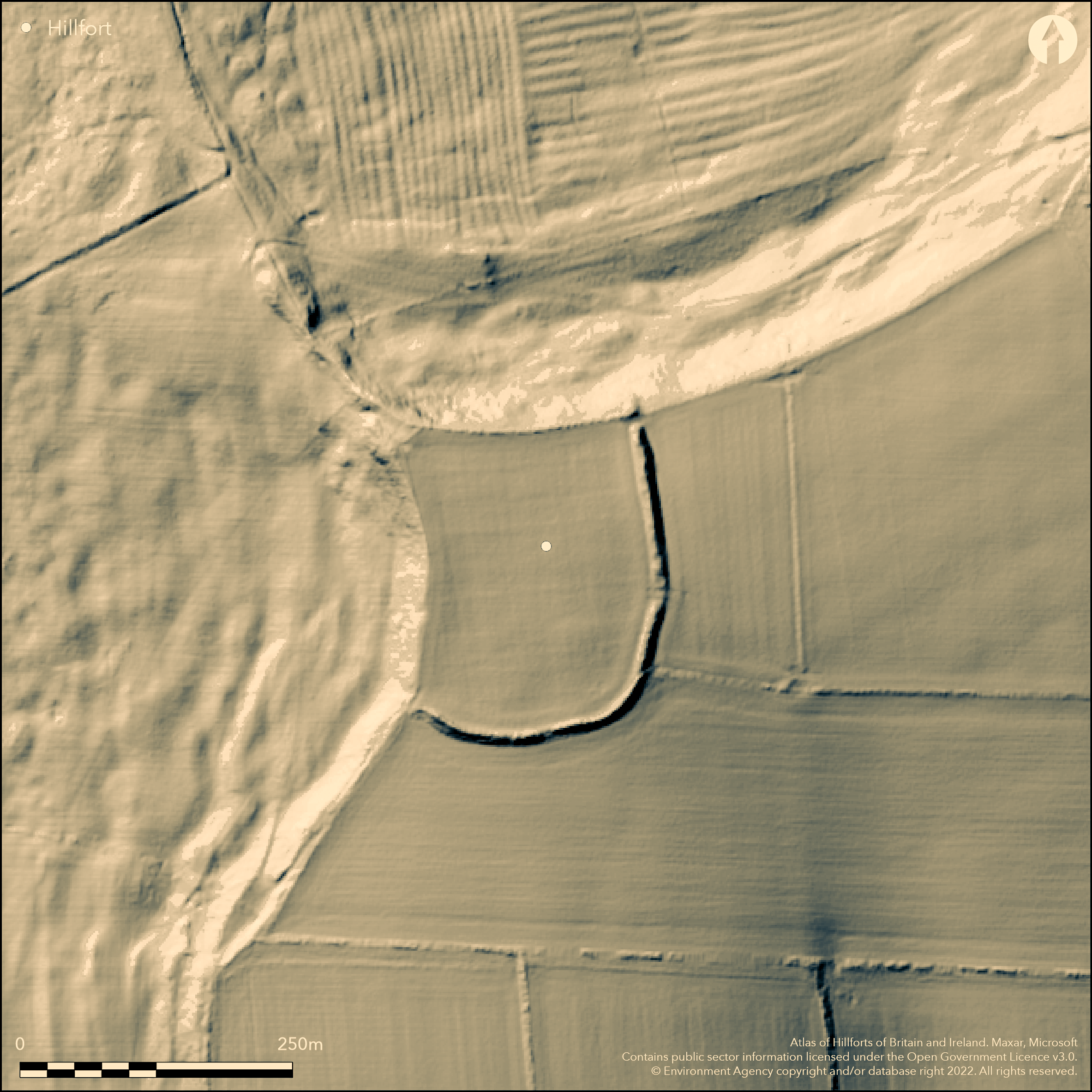
LiDAR 1m DTM Hillshade
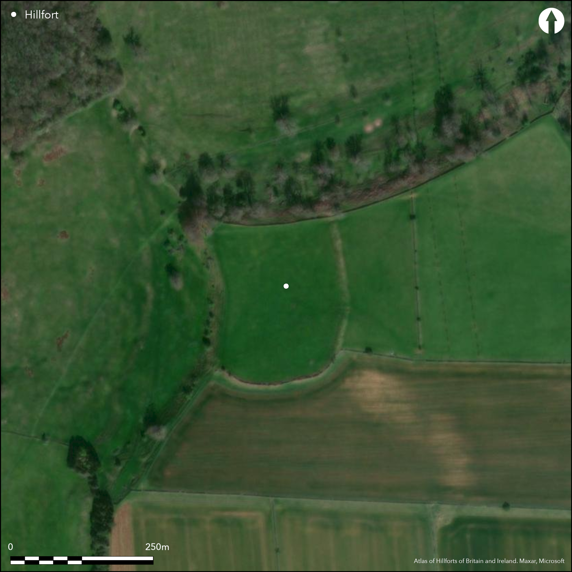
Satellite Imagery
LiDAR 1m DTM Hillshade
Satellite Imagery
Scroll left/right to view further images.
HER: Gloucestershire 45 (None)
NMR: SP 02 NE 1 (327715)
SM: 1003319
NGR: SP064299
X: 406400 Y: 229900 (OSGB36)
Sub-rectangular, univallate, inland promontory fort located on W Cotswold scarp edge above streams running to River Isbourne on W and River Windrush on E. Steep surrounding slopes to N and W, moderate to E and S on top of promontory. Site measures 169m long by 131m wide, orientated N-S, enclosing 2.2ha. On S and E c. 5m high, 7-9m wide rampart. On N and W defined by slopes. Outer ditch levelled except for short length to N. Possible SW entrance (disputed), where c. 12m gap between end of bank and edge of escarpment, with another possible NW entrance with hollow way. Low scarp continuing line of bank across the gap probably natural feature. Dry-stone revetting visible on outer face of rampart. Chance finds of 'Duck stamped' pottery, similar to that from Bredon Hill, coins of Severus and Aurelius, and flint arrowheads. Fire-reddened stones visible in outer face of bank and in field well on bank E of entrance. S bank narrower and field wall along its top. E bank damaged by animals repeatedly passing through break in the bank. Good state generally. On 1st Ed. OS map (1884).
Citizen Science: ✓
Reliability of Data: Confirmed
Reliability of Interpretation: Confirmed
X: -212427 Y: 6794251 (EPSG: 3857)
Longitude: -1.9082661318895946 Latitude: 51.967499568096244 (EPSG:4326)
Country: England; None
Current County or Unitary Authority: Gloucestershire
Historic County: Gloucestershire
Current Parish/Community/Council/Townland: Temple Guiting; Stanway
Outer ditch levelled apart from N end, but generally good condition. E bank damaged by animals repeatedly passing through break in the bank.
| Extant | ✓ |
| Cropmark | ✗ |
| Likely Destroyed | ✗ |
None
| Woodland | ✗ |
| Commercial Forestry Plantation | ✗ |
| Parkland | ✗ |
| Pasture (Grazing) | ✓ |
| Arable | ✗ |
| Scrub/Bracken | ✗ |
| Bare Outcrop | ✗ |
| Heather/Moorland | ✗ |
| Heath | ✗ |
| Built-up | ✗ |
| Coastal Grassland | ✗ |
| Other | ✗ |
Sub-rectangular, univallate, inland promontory fort located on W Cotswold scarp edge above streams running to River Isbourne on W and River Windrush on E.
| Contour Fort | ✗ |
| Partial Contour Fort | ✗ |
| Promontory Fort | ✓ |
| Hillslope Fort | ✗ |
| Level Terrain Fort | ✗ |
| Marsh Fort | ✗ |
| Multiple Enclosure Fort | ✗ |
Located on westerly slopes above a steep re-entrant valley
| Hilltop | ✗ |
| Coastal Promontory | ✗ |
| Inland Promontory | ✓ |
| Valley Bottom | ✗ |
| Knoll/Hillock/Outcrop | ✗ |
| Ridge | ✗ |
| Cliff/Plateau-edge/Scarp | ✗ |
| Hillslope | ✗ |
| Lowland | ✗ |
| Spur | ✗ |
Dominant Topographic Feature: Spur promontory.
| North | ✗ |
| Northeast | ✗ |
| East | ✗ |
| Southeast | ✗ |
| South | ✗ |
| Southwest | ✗ |
| West | ✗ |
| Northwest | ✗ |
| Level | ✓ |
Altitude: 269.0m
N ramparts in Stanway parish.
Boundary Type: Parish/Townland
Chance finds of Iron Age 'duck-stamped' pottery similar to that from Bredon Hill gives some dating evidence, even if slight.
Reliability: C - Low
| Pre 1200BC | ✗ |
| 1200BC - 800BC | ✗ |
| 800BC - 400BC | ✗ |
| 400BC - AD50 | ✓ |
| AD50 - AD400 | ✗ |
| AD400 - AD 800 | ✗ |
| Post AD800 | ✗ |
| Unknown | ✗ |
| Pre Hillfort: | None |
| Post Hillfort: | None |
| Artefactual: | Iron Age 'Duck stamped' pottery. |
Reference G.B. Witts 1883. On 1st Ed. OS map (1884). Geophysical survey A. J. Marshall 2002. Some reinstatemment of rampart erosion, Gloucestershire Archaeological Service, 2002. Watching Brief, Corinium Museum, Cirencester, 2002. Aerial photograph interpretation, English Heritage Gloucestershire NMP (N Cotswolds and Forest of Dean), 2002-2006.
| 1st Identified Written Reference (1883): | G.B. Witts. |
| 1st Identified Map Depiction (1884): | None |
| Other (1970): | Visited by Hillfort Study Group |
| Geophysical Survey (2002): | A. J. Marshall. |
| Other (2002): | Reinstatemment of rampart erosion, Gloucestershire Archaeological Service, 2002. |
| Other (2002): | Watching Brief, Corinium Museum, Cirencester. |
| Other (None): | Aerial photograph interpretation, English Heritage. |
Chance finds of 'Duck stamped' pottery, similar to that from Bredon Hill, coins of Severus and Aurelius, and flint arrowheads. Fire Geophysics 2002 showed NE part of site possibly used for rubbish disposal, and possible sub-enclosures in interior suggest habitation areas and plots.
Field well on bank E of entrance. Springs downslope.
| None | ✗ |
| Spring | ✗ |
| Stream | ✗ |
| Pool | ✗ |
| Flush | ✗ |
| Well | ✓ |
| Other | ✗ |
None
| No Known Features | ✓ |
| Round Stone Structures | ✗ |
| Rectangular Stone Structures | ✗ |
| Curvilinear Platforms | ✗ |
| Other Roundhouse Evidence | ✗ |
| Pits | ✗ |
| Quarry Hollows | ✗ |
| Other | ✗ |
None
| No Known Excavation | ✓ |
| Pits | ✗ |
| Postholes | ✗ |
| Roundhouses | ✗ |
| Rectangular Structures | ✗ |
| Roads/Tracks | ✗ |
| Quarry Hollows | ✗ |
| Other | ✗ |
| Nothing Found | ✗ |
Geophysics 2002 showed NE part of site possibly used for rubbish disposal, and possible sub-enclosures in interior suggest habitation areas and plots.
| No Known Geophysics | ✗ |
| Pits | ✗ |
| Roundhouses | ✗ |
| Rectangular Structures | ✗ |
| Roads/Tracks | ✗ |
| Quarry Hollows | ✗ |
| Other | ✓ |
| Nothing Found | ✗ |
Chance finds of 'Duck stamped' pottery, similar to that from Bredon Hill, coins of Severus and Aurelius, and flint arrowheads.
| No Known Finds | ✗ |
| Pottery | ✓ |
| Metal | ✗ |
| Metalworking | ✗ |
| Human Bones | ✗ |
| Animal Bones | ✗ |
| Lithics | ✗ |
| Environmental | ✗ |
| Other | ✗ |
None
| APs Not Checked | ✓ |
| None | ✗ |
| Roundhouses | ✗ |
| Rectangular Structures | ✗ |
| Pits | ✗ |
| Postholes | ✗ |
| Roads/Tracks | ✗ |
| Other | ✗ |
Possible SW entrance (disputed), where c. 12m gap between end of bank and edge of escarpment, with another possible NW entrance with hollow way. Gap through E bank modern animal damage.
| 3: | Gap through E bank modern animal damage. |
| 2: | None |
Guard Chambers: ✗
Chevaux de Frise: ✗
| 1. Simple Gap (South west): | Entrance disputed. |
| 2. Hollow Way (North west): | None |
On S and E c. 5m high, 7-9m wide rampart. On N and W defined by slopes. Outer ditch levelled except for short length to N.Dry-stone revetting. Fire-reddened stones visible in outer face of bank and in field well on bank E of entrance.
| Area 1: | 2.2ha. |
| Total: | 2.2ha. |
Total Footprint Area: Noneha.
None
| ✗ | None |
| ✗ | None |
| NE Quadrant: | 1 |
| SE Quadrant: | 1 |
| SW Quadrant: | 0 |
| NW Quadrant: | 0 |
| Total: | 1 |
| Partial Univallate | ✓ |
| Univallate | ✗ |
| Partial Bivallate | ✗ |
| Bivallate | ✗ |
| Partial Multivallate | ✗ |
| Multivallate | ✗ |
| Unknown | ✗ |
| Partial Univallate | ✗ |
| Univallate | ✗ |
| Partial Bivallate | ✗ |
| Bivallate | ✗ |
| Partial Multivallate | ✗ |
| Multivallate | ✗ |
Dry-stone revetting. Fire-reddened stones visible in outer face of bank and in field well on bank E of entrance.
| None | ✗ |
| Earthen Bank | ✗ |
| Stone Wall | ✓ |
| Rubble | ✗ |
| Wall-walk | ✗ |
| Evidence of Timber | ✗ |
| Vitrification | ✗ |
| Other Burning | ✓ |
| Palisade | ✗ |
| Counter Scarp Bank | ✗ |
| Berm | ✗ |
| Unfinished | ✗ |
| Other | ✓ |
None
| None | ✗ |
| Earthen Bank | ✗ |
| Stone Wall | ✗ |
| Murus Duplex | ✗ |
| Timber-framed | ✗ |
| Timber-laced | ✗ |
| Vitrification | ✗ |
| Other Burning | ✗ |
| Palisade | ✗ |
| Counter Scarp Bank | ✗ |
| Berm | ✗ |
| Unfinished | ✗ |
| No Known Excavation | ✓ |
| Other | ✗ |
| ✗ | None |
| ✓ | Outer ditch levelled except for short length to N. |
Number of Ditches: 1
| ✗ | None |
Burrow, E.J. 1919: The ancient entrenchments and camps of Gloucestershire, Cheltenham: Author, 42-3.
Derham, K. 2002. Archaeological recording at Beckbury Camp, Temple Guiting, Unpublished report Gloucestershire Archaeological Service, Gloucestershire County Council.
Marshall, A. 2002. Report of geophysical survey undertaken at Beckbury Camp, Temple Guiting. Unpublished report, Author.
RCHME 1976. Ancient and historical monuments in the County of Gloucestershire, Vol. I: Iron Age and Romano- British monuments in Gloucestershire Cotswolds, London: HMSO, 116b.
Russel, N. 2002. The Gloucestershire Monument Management Scheme 2001-02. Site report Beckbury Camp. Unpublished report Gloucestershire Archaeological Service, Gloucestershire County Council.
Stoertz C. 2012. The North Cotswolds: a highlight report for the National Mapping Programme, Report No 17-2012.Centre for Archaeology.
Witts, G.B. 1883. Archaeological handbook of the County of Gloucestershire, Cheltenham: Norman Brothers, 4-5.
Atlas of Hillforts:
Wikidata:
This work is licensed under CC BY-SA 4.0

 and should be cited as:
Lock, Gary and Ralston, Ian. 2024. Atlas of Hillforts of Britain and Ireland. Available at: https://hillforts.arch.ox.ac.uk
Document Version 1.1