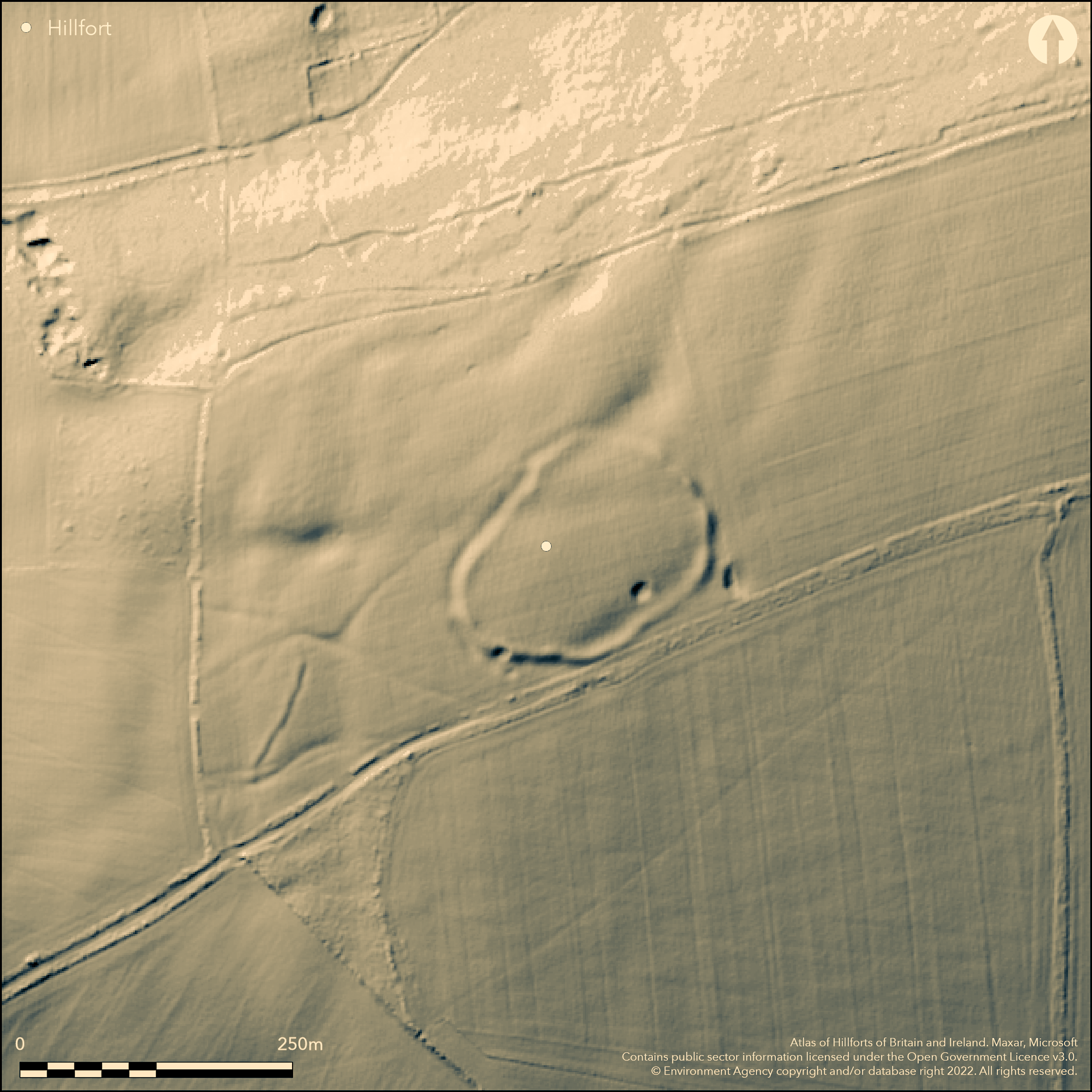
LiDAR 1m DTM Hillshade
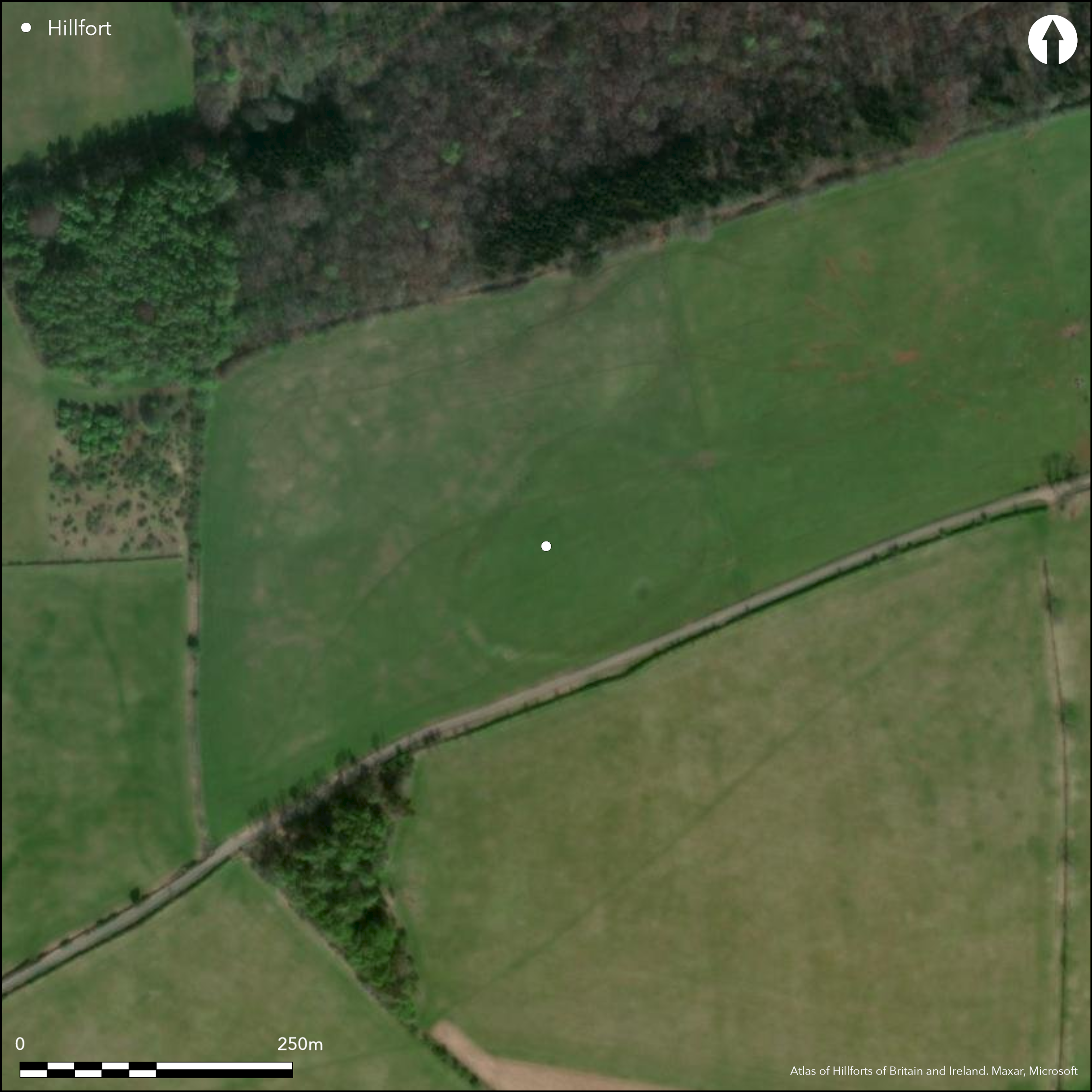
Satellite Imagery
LiDAR 1m DTM Hillshade
Satellite Imagery
Scroll left/right to view further images.
HER: Gloucestershire 50 (None)
NMR: SP 02 SW 6 (327968)
SM: 1004838
NGR: SP046243
X: 404660 Y: 224340 (OSGB36)
Univallate, partial contour hillfort located on W-facing Inferior Oolite ridge of N Cotswolds, W of Rood Gate, at headwaters of River Isbourne to W and River Windrush to E. Very steep surrounding slopes and re-entrant to N (wooded), steep to W and S, moderate along ridge to E. Oval enclosed area measuring 137m by 104m, 2.5ha. Single interrupted bank, to c. 10m wide and to nearly 1m high above interior, and to 2m above disturbed outer ditch on W, to 9m wide. Possible variations in construction around whole circuit, as S and SW sides seem incomplete, where stretches of irregular-sized ditch separated by causeways and steps. On S broad low rampart seemingly thrown up for c. 85m from internal scooping. Interior slightly domed. Gap, c. 37m wide, above the re-entrant on N, shows no sign of former closure and continuation of the earthwork across confirmed by faint scarp visible; clear on St Joseph AP ACQ16. Geophysical survey 1995 of interior, rampart and ditch in SE quadrant found buried features, including internal ditch, concentric with bank, E entrance gap, pits and interior divisions possibly contemporary with earthwork. Possible late Bronze Age/early Iron Age settlement date conjectured. Linear banks to NE may represent trackway, possibly associated with settlement. Probable medieval or post-medieval quarries within. On 1st Ed. OS map (1884).
Citizen Science: ✗
Reliability of Data: Confirmed
Reliability of Interpretation: Confirmed
X: -215255 Y: 6785227 (EPSG: 3857)
Longitude: -1.93366708530619 Latitude: 51.91752682425175 (EPSG:4326)
Country: England
Current County or Unitary Authority: Gloucestershire
Historic County: Gloucestershire
Current Parish/Community/Council/Townland: Sudeley
Site denuded by past ploughing and variations in construction, but now in general good condition under pasture. Two probably medieval or post-medieval small quarries within and 8m to SE of the site and larger quarry 65m to N. Triangulation point marked on 1884 map sited on SW bank, now removed.
| Extant | ✓ |
| Cropmark | ✗ |
| Likely Destroyed | ✗ |
Quarries.
| Woodland | ✗ |
| Commercial Forestry Plantation | ✗ |
| Parkland | ✗ |
| Pasture (Grazing) | ✓ |
| Arable | ✗ |
| Scrub/Bracken | ✗ |
| Bare Outcrop | ✗ |
| Heather/Moorland | ✗ |
| Heath | ✗ |
| Built-up | ✗ |
| Coastal Grassland | ✗ |
| Other | ✓ |
Univallate, partial contour hillfort located on W-facing Inferior Oolite ridge of N Cotswolds, W of Rood Gate, at headwaters of River Isbourne to W and River Windrush to E.
| Contour Fort | ✗ |
| Partial Contour Fort | ✓ |
| Promontory Fort | ✗ |
| Hillslope Fort | ✗ |
| Level Terrain Fort | ✗ |
| Marsh Fort | ✗ |
| Multiple Enclosure Fort | ✗ |
Not strong site but on ridge top generally level with surrounding landat the headwaters of Beesmoor Brook
| Hilltop | ✗ |
| Coastal Promontory | ✗ |
| Inland Promontory | ✗ |
| Valley Bottom | ✗ |
| Knoll/Hillock/Outcrop | ✗ |
| Ridge | ✓ |
| Cliff/Plateau-edge/Scarp | ✗ |
| Hillslope | ✗ |
| Lowland | ✗ |
| Spur | ✓ |
Dominant Topographic Feature: Spur ridge
| North | ✗ |
| Northeast | ✗ |
| East | ✗ |
| Southeast | ✗ |
| South | ✗ |
| Southwest | ✗ |
| West | ✗ |
| Northwest | ✓ |
| Level | ✗ |
Altitude: 282.0m
N/A
Possibly late Bronze Age or early Iron Age - conjecture only
Reliability: D - None
| Pre 1200BC | ✗ |
| 1200BC - 800BC | ✗ |
| 800BC - 400BC | ✗ |
| 400BC - AD50 | ✗ |
| AD50 - AD400 | ✗ |
| AD400 - AD 800 | ✗ |
| Post AD800 | ✗ |
| Unknown | ✓ |
| Pre Hillfort: | None |
| Post Hillfort: | None |
On 1st Ed. OS map (1884). Complete geophysical (resistivity) survey 1995. Aerial photograph interpretation, English Heritage Gloucestershire NMP (N Cotswolds and Forest of Dean), 2002-2006.
| 1st Identified Written Reference (1883): | W.G. Witts reference. |
| 1st Identified Map Depiction (1884): | OS map. |
| Geophysical Survey (None): | A. Marshall. |
| Other (None): | Aerial photograph interpretation, English Heritage. |
Geophysical survey 1995 of interior, rampart and ditch in SE quadrant found buried features, including internal ditch, concentric with the bank, E entrance gap, pits and interior divisions possibly contemporary with the earthwork.
None
| None | ✓ |
| Spring | ✗ |
| Stream | ✗ |
| Pool | ✗ |
| Flush | ✗ |
| Well | ✗ |
| Other | ✗ |
None
| No Known Features | ✓ |
| Round Stone Structures | ✗ |
| Rectangular Stone Structures | ✗ |
| Curvilinear Platforms | ✗ |
| Other Roundhouse Evidence | ✗ |
| Pits | ✗ |
| Quarry Hollows | ✗ |
| Other | ✗ |
None
| No Known Excavation | ✓ |
| Pits | ✗ |
| Postholes | ✗ |
| Roundhouses | ✗ |
| Rectangular Structures | ✗ |
| Roads/Tracks | ✗ |
| Quarry Hollows | ✗ |
| Other | ✗ |
| Nothing Found | ✗ |
Geophysical survey 1995 of interior, rampart and ditch in SE quadrant found buried features, including internal ditch, concentric with the bank, E entrance gap, pits and interior divisions possibly contemporary with the earthwork.
| No Known Geophysics | ✗ |
| Pits | ✓ |
| Roundhouses | ✗ |
| Rectangular Structures | ✗ |
| Roads/Tracks | ✗ |
| Quarry Hollows | ✓ |
| Other | ✓ |
| Nothing Found | ✗ |
None
| No Known Finds | ✓ |
| Pottery | ✗ |
| Metal | ✗ |
| Metalworking | ✗ |
| Human Bones | ✗ |
| Animal Bones | ✗ |
| Lithics | ✗ |
| Environmental | ✗ |
| Other | ✗ |
None
| APs Not Checked | ✓ |
| None | ✗ |
| Roundhouses | ✗ |
| Rectangular Structures | ✗ |
| Pits | ✗ |
| Postholes | ✗ |
| Roads/Tracks | ✗ |
| Other | ✗ |
Indeterminate entrance, but resistivity survey indicates E gap.
| 1: | None |
| 2: | None |
Guard Chambers: ✗
Chevaux de Frise: ✗
| 1. Simple Gap (East): | Resistivity survey indicates E gap. |
Single interrupted bank, to c. 10m wide and to nearly 1m high above interior, and to 2m above disturbed outer ditch on W, to 9m wide. Possible variations in construction around whole circuit, as S and SW sides seem incomplete, where stretches of irregular-sized ditch separated by causeways and steps. On S broad low rampart seemingly thrown up for c. 85.0m from internal scooping. Interior slightly domed. Gap, c. 37m wide, above the re-entrant on N, shows no sign of former closure and continuation of the earthwork across is confirmed by faint scarp visible on the ground, clear on St Joseph AP ACQ16.
| Area 1: | 2.5ha. |
| Total: | 2.5ha. |
Total Footprint Area: Noneha.
None
| ✗ | None |
| ✓ | None |
| NE Quadrant: | 1 |
| SE Quadrant: | 1 |
| SW Quadrant: | 1 |
| NW Quadrant: | 1 |
| Total: | 1 |
| Partial Univallate | ✗ |
| Univallate | ✓ |
| Partial Bivallate | ✗ |
| Bivallate | ✗ |
| Partial Multivallate | ✗ |
| Multivallate | ✗ |
| Unknown | ✗ |
| Partial Univallate | ✗ |
| Univallate | ✗ |
| Partial Bivallate | ✗ |
| Bivallate | ✗ |
| Partial Multivallate | ✗ |
| Multivallate | ✗ |
None
| None | ✗ |
| Earthen Bank | ✓ |
| Stone Wall | ✗ |
| Rubble | ✗ |
| Wall-walk | ✗ |
| Evidence of Timber | ✗ |
| Vitrification | ✗ |
| Other Burning | ✗ |
| Palisade | ✗ |
| Counter Scarp Bank | ✗ |
| Berm | ✗ |
| Unfinished | ✗ |
| Other | ✗ |
None
| None | ✗ |
| Earthen Bank | ✗ |
| Stone Wall | ✗ |
| Murus Duplex | ✗ |
| Timber-framed | ✗ |
| Timber-laced | ✗ |
| Vitrification | ✗ |
| Other Burning | ✗ |
| Palisade | ✗ |
| Counter Scarp Bank | ✗ |
| Berm | ✗ |
| Unfinished | ✗ |
| No Known Excavation | ✓ |
| Other | ✗ |
| ✗ | None |
| ✓ | Ditch disturbed and visible on W; probably completed around circuit. Possible variations in construction around whole circuit, as S and SW sides seem incomplete, where stretches of irregular-sized ditch separated by causeways and steps. |
Number of Ditches: 1
| ✗ | None |
Marshall, A. 1996 Trans Bristol Gloucestershire Archaeol Soc., 114; 170-185.
Marshall, A. 2002 SUMMARY OF GEOPHYSICAL SURVEY UNDERTAKEN AT ROEL HILLFORT, SUDELEY, GLOS. Unpublished.
RCHME 1976. Ancient and historical monuments in the County of Gloucestershire, Vol. I: Iron Age and Romano- British monuments in Gloucestershire Cotswolds, London: HMSO, 112b.
Small F. et al 2006. The Forest of Dean Mapping Project, Gloucestershire: a report for the National Mapping Programme, Report No 28-2006, Centre for Archaeology.
Stoertz C. 2012. The North Cotswolds: a highlight report for the National Mapping Programme, Report No 17-2012.Centre for Archaeology.
Atlas of Hillforts:
Wikidata:
This work is licensed under CC BY-SA 4.0

 and should be cited as:
Lock, Gary and Ralston, Ian. 2024. Atlas of Hillforts of Britain and Ireland. Available at: https://hillforts.arch.ox.ac.uk
Document Version 1.1