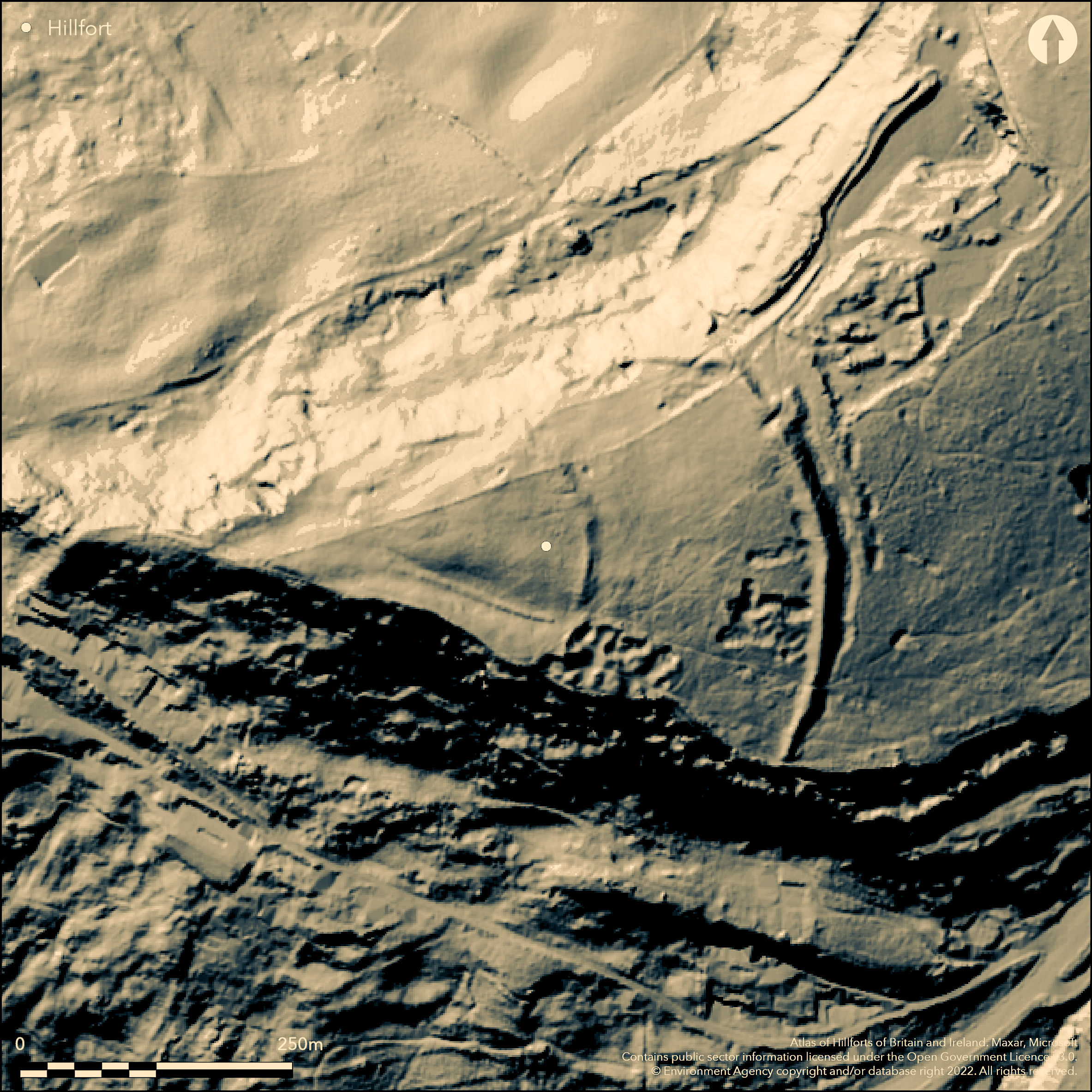
LiDAR 1m DTM Hillshade
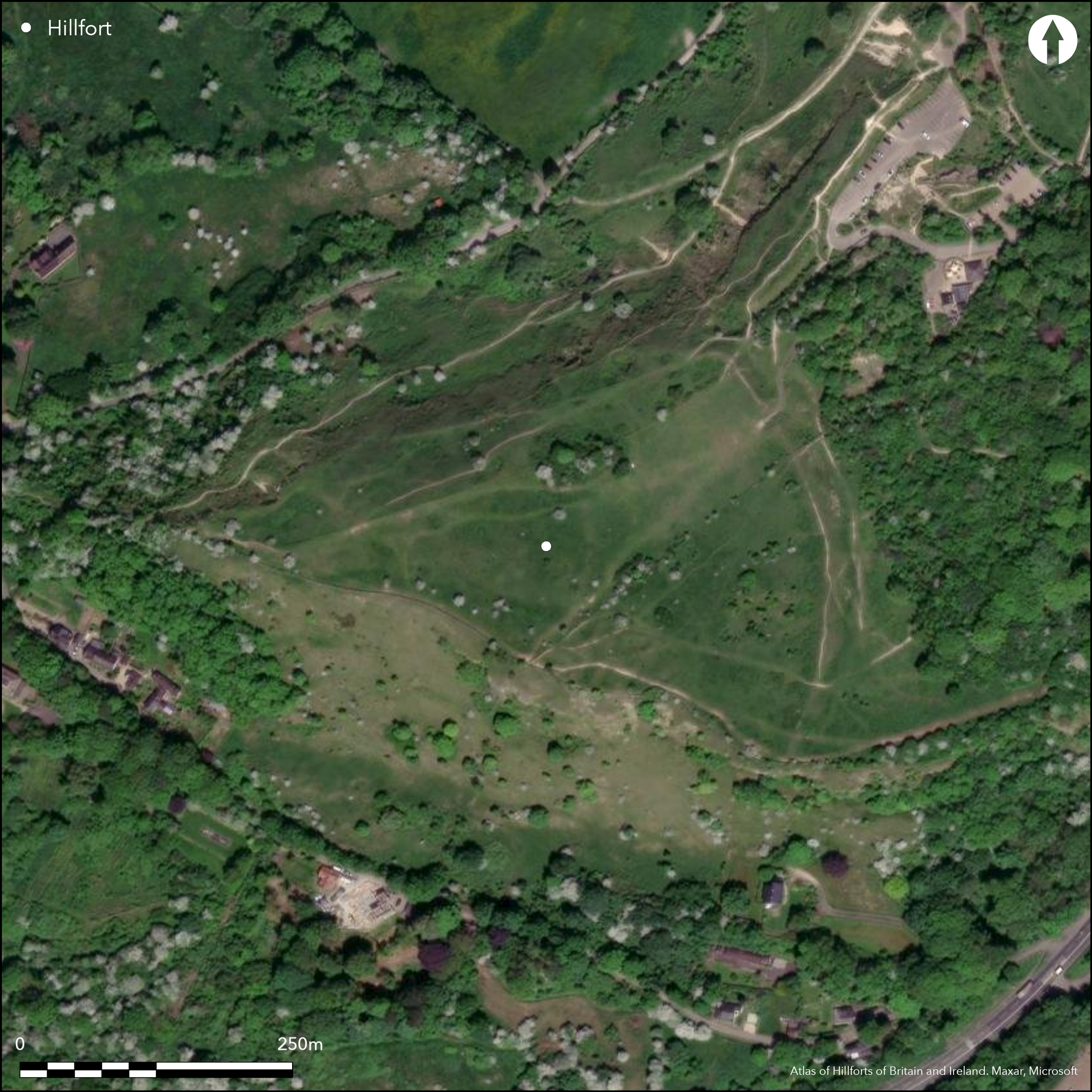
Satellite Imagery
LiDAR 1m DTM Hillshade
Satellite Imagery
Scroll left/right to view further images.
HER: Gloucestershire 170 (None)
NMR: SO 91 NW 44 (982133)
SM: 1003586
NGR: SO927161
X: 392700 Y: 216100 (OSGB36)
Important, excavated promontory fort located on a W-facing Cotswold spur overlooking vale and Gloucester to E. Very steep surrounding slopes on N, W and S, moderate along ridge to E. Single bank and ditch cuts off the promontory in curving line N-S, encloses 3.85ha. Excavations by P. Dixon 1969-93 found evidence of earlier causewayed enclosure and Neolithic settlement and phased construction of hillfort with three phases of timber-laced ramparts and dry-stone wall facing, E ramparts dating from early Iron Age. Earliest phase (Phase 2) of timber-laced ramparts enclosing rows of rectangular buildings, with clusters of small square buildings, possibly 7th century BC. On flat approach and W tip of hill, ramparts with regular pattern of timber internal uprights, horizontal timber lacing. Elsewhere diminished in width and height to become dry-stone wall. Whether this continuous around promontory unknown because of landslips and quarrying. More substantial defences on W interpreted by Dixon as unfinished site. Later hillfort burnt and deliberately slighted. In Phase 3a some refortification of ramparts for 75m N-S of entrance, possibly first stage of reoccupation. Phase 3b intermittent reconstruction of entrance with large out-turned hornwork and solid stone bastions at gate, expansion of ditch to E, and digging of second ring of ditches outside main rampart. Neither completed. This ramparts enclosed settlement of roundhouses on different alignment to the previous settlement of 5th century BC. One larger round house (diameter of 15m) sited just inside entrance. As Phase 2 hillfort, all destroyed by fire and site abandoned. In Phase 3c, later Iron Age unenclosed occupation within old ramparts. Hornwork at NE entrance in third re-modelling phase. Pottery and metal working evidence. On 1st Ed. OS map (1884).
Citizen Science: ✓
Reliability of Data: Confirmed
Reliability of Interpretation: Confirmed
X: -234593 Y: 6771861 (EPSG: 3857)
Longitude: -2.1073851355972417 Latitude: 51.84341013697907 (EPSG:4326)
Country: England; None
Current County or Unitary Authority: Gloucestershire
Historic County: Gloucestershire
Current Parish/Community/Council/Townland: Badgeworth; Coberley
Country Park use and well managed. Former quarrying ceased 1960's. Visitor centre.
| Extant | ✓ |
| Cropmark | ✗ |
| Likely Destroyed | ✗ |
Quarrying. SSSI.
| Woodland | ✗ |
| Commercial Forestry Plantation | ✗ |
| Parkland | ✗ |
| Pasture (Grazing) | ✓ |
| Arable | ✗ |
| Scrub/Bracken | ✗ |
| Bare Outcrop | ✗ |
| Heather/Moorland | ✗ |
| Heath | ✗ |
| Built-up | ✗ |
| Coastal Grassland | ✗ |
| Other | ✓ |
Important, excavated promontory fort located on a W-facing Cotswold spur overlooking vale and Gloucester to E. Very steep surrounding slopes on N, W and S, moderate along ridge to E.
| Contour Fort | ✗ |
| Partial Contour Fort | ✗ |
| Promontory Fort | ✓ |
| Hillslope Fort | ✗ |
| Level Terrain Fort | ✗ |
| Marsh Fort | ✗ |
| Multiple Enclosure Fort | ✗ |
Located on a western facing Cotswold spur
| Hilltop | ✗ |
| Coastal Promontory | ✗ |
| Inland Promontory | ✓ |
| Valley Bottom | ✗ |
| Knoll/Hillock/Outcrop | ✗ |
| Ridge | ✗ |
| Cliff/Plateau-edge/Scarp | ✗ |
| Hillslope | ✗ |
| Lowland | ✗ |
| Spur | ✓ |
Dominant Topographic Feature: Spur
| North | ✗ |
| Northeast | ✗ |
| East | ✗ |
| Southeast | ✗ |
| South | ✗ |
| Southwest | ✗ |
| West | ✗ |
| Northwest | ✗ |
| Level | ✓ |
Altitude: 267.0m
Boundary Type: Parish/Townland
Phased construction early to late Iron Age based on excavation and artefacts.
Reliability: B - Medium
| Pre 1200BC | ✗ |
| 1200BC - 800BC | ✗ |
| 800BC - 400BC | ✓ |
| 400BC - AD50 | ✓ |
| AD50 - AD400 | ✗ |
| AD400 - AD 800 | ✗ |
| Post AD800 | ✗ |
| Unknown | ✗ |
| Pre Hillfort: | None |
| Post Hillfort: | None |
| Artefactual: | None |
Cotteswold Naturalists Field Club visit 1881. On 1st Ed. OS map (1884). Undocumented excavation by E.M. Clifford 1952; excavations by P. Dixon 1969-93. Management survey, Gloucestershire County Council, 1993.
| Other (1881): | Cotteswold Naturalists Field Club visit. |
| 1st Identified Map Depiction (1884): | None |
| Excavation (1952): | E.M. Clifford. |
| Other (1970): | Visited by Hillfort Study Group |
| Other (1993): | Management survey, Gloucestershire County Council. |
| Excavation (None): | P. Dixon. |
Postholes, roundhouses and rectangular structures from excavation. Neolithic sherds. Local pottery of early and late Iron Age date. Briquetage from Droitwich. Metalworking evidence.
None
| None | ✓ |
| Spring | ✗ |
| Stream | ✗ |
| Pool | ✗ |
| Flush | ✗ |
| Well | ✗ |
| Other | ✗ |
None
| No Known Features | ✓ |
| Round Stone Structures | ✗ |
| Rectangular Stone Structures | ✗ |
| Curvilinear Platforms | ✗ |
| Other Roundhouse Evidence | ✗ |
| Pits | ✗ |
| Quarry Hollows | ✗ |
| Other | ✗ |
None
| No Known Excavation | ✗ |
| Pits | ✗ |
| Postholes | ✓ |
| Roundhouses | ✓ |
| Rectangular Structures | ✓ |
| Roads/Tracks | ✗ |
| Quarry Hollows | ✗ |
| Other | ✗ |
| Nothing Found | ✗ |
None
| No Known Geophysics | ✓ |
| Pits | ✗ |
| Roundhouses | ✗ |
| Rectangular Structures | ✗ |
| Roads/Tracks | ✗ |
| Quarry Hollows | ✗ |
| Other | ✗ |
| Nothing Found | ✗ |
Neolithic sherds. Local pottery of early and late Iron Age date. Briquetage from Droitwich.
| No Known Finds | ✗ |
| Pottery | ✓ |
| Metal | ✗ |
| Metalworking | ✓ |
| Human Bones | ✗ |
| Animal Bones | ✗ |
| Lithics | ✗ |
| Environmental | ✗ |
| Other | ✗ |
None
| APs Not Checked | ✓ |
| None | ✗ |
| Roundhouses | ✗ |
| Rectangular Structures | ✗ |
| Pits | ✗ |
| Postholes | ✗ |
| Roads/Tracks | ✗ |
| Other | ✗ |
Notable stone-built barbican entrance on NE.
| 1: | None |
| 2: | None |
Guard Chambers: ✗
Chevaux de Frise: ✗
| 1. Barbican (North east): | Fine stone-built barbican entrance |
Single bank and ditch cuts off the promontory in curving line N-S. Three phases of timber-laced ramparts and dry-stone wall facing.
| Area 1: | 3.85ha. |
| Total: | 3.85ha. |
Total Footprint Area: Noneha.
None
| ✓ | Three phases of timber-laced ramparts and dry-stone wall facing. |
| ✗ | None |
| NE Quadrant: | 1 |
| SE Quadrant: | 1 |
| SW Quadrant: | 0 |
| NW Quadrant: | 0 |
| Total: | 1 |
| Partial Univallate | ✓ |
| Univallate | ✗ |
| Partial Bivallate | ✗ |
| Bivallate | ✗ |
| Partial Multivallate | ✗ |
| Multivallate | ✗ |
| Unknown | ✗ |
| Partial Univallate | ✗ |
| Univallate | ✗ |
| Partial Bivallate | ✗ |
| Bivallate | ✗ |
| Partial Multivallate | ✗ |
| Multivallate | ✗ |
None
| None | ✗ |
| Earthen Bank | ✓ |
| Stone Wall | ✗ |
| Rubble | ✗ |
| Wall-walk | ✗ |
| Evidence of Timber | ✗ |
| Vitrification | ✗ |
| Other Burning | ✗ |
| Palisade | ✗ |
| Counter Scarp Bank | ✗ |
| Berm | ✗ |
| Unfinished | ✗ |
| Other | ✗ |
Three phases of timber-laced ramparts and dry-stone wall facing. More substantial defences on W interpreted by Dixon as unfinished site.
| None | ✗ |
| Earthen Bank | ✗ |
| Stone Wall | ✓ |
| Murus Duplex | ✗ |
| Timber-framed | ✗ |
| Timber-laced | ✓ |
| Vitrification | ✗ |
| Other Burning | ✗ |
| Palisade | ✗ |
| Counter Scarp Bank | ✗ |
| Berm | ✓ |
| Unfinished | ✓ |
| No Known Excavation | ✗ |
| Other | ✗ |
| ✗ | None |
| ✓ | None |
Number of Ditches: 1
| ✗ | None |
Clifford, E.M. 1964. An enclosure on Crickley Hill, Gloucestershire, Trans Bristol Gloucestershire Archaeol Soc, 83, 40-8.
Dixon, P. 1976. Crickley Hill, 1969-1972, in ed D.W. Harding , Hillforts. Later prehistoric earthworks in Britain and Ireland, London: Academic Press, 162-176.
Dixon, P. 1994. Crickley Hill, volume 1 : the hillfort defences.
Dixon, P. 1988. The Neolithic settlements on Crickley Hill, In eds Burgess, C., Topping, P., Mordant, C. and Maddison, M., Enclosures and defences in the Neolithic of western Europe, Bar British Series.
Dixon, P. and Borne, P. 1977. Crickley Hill and Gloucestershire prehistory, Gloucester: Gloucestershire County Council.
Guilbert, G. C. 1975. Planned hillfort interiors, Proc Prehist Soc, 41, 209, 211, 219.
RCHME 1976. Ancient and historical monuments in the County of Gloucestershire, Vol. I: Iron Age and Romano- British monuments in Gloucestershire Cotswolds, London: HMSO, 5.
Savage, R. 1988. Village, Fortress, Shrine: Crickley Hill, Gloucestershire, 3500BC - AD500, Gloucester: Crickley Hill Archaeol Trust.
Atlas of Hillforts:
Wikidata:
This work is licensed under CC BY-SA 4.0

 and should be cited as:
Lock, Gary and Ralston, Ian. 2024. Atlas of Hillforts of Britain and Ireland. Available at: https://hillforts.arch.ox.ac.uk
Document Version 1.1