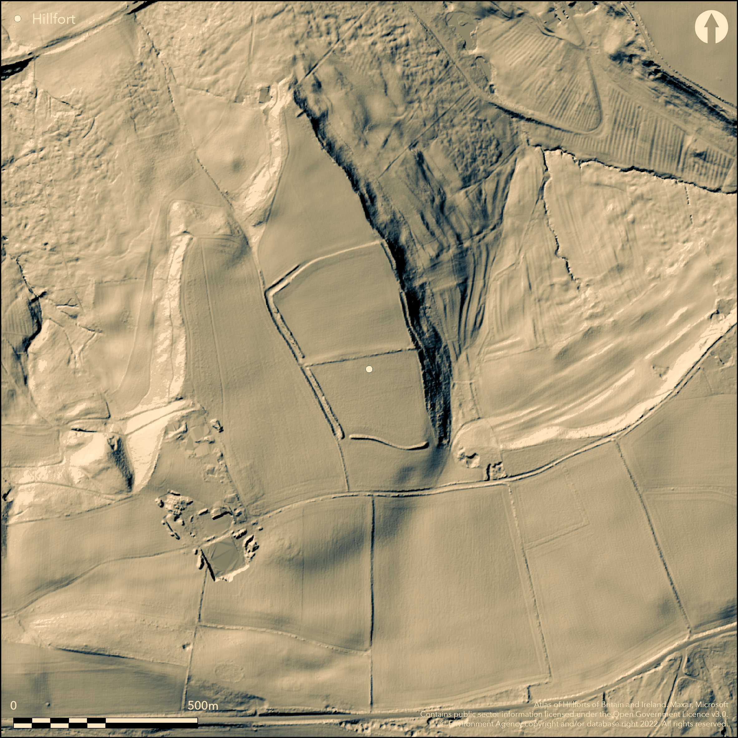
LiDAR 1m DTM Hillshade
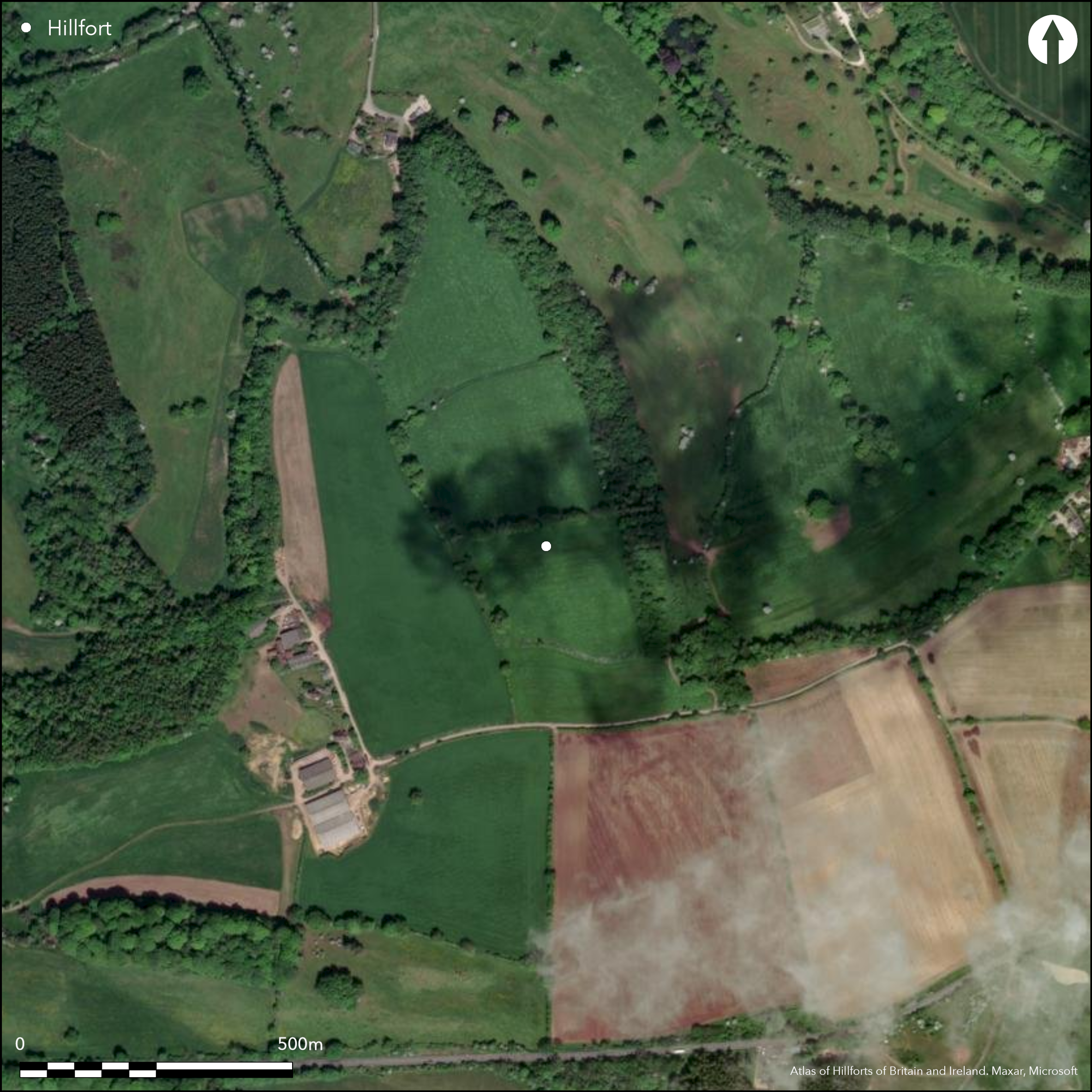
Satellite Imagery
LiDAR 1m DTM Hillshade
Satellite Imagery
Scroll left/right to view further images.
HER: Gloucestershire 176 (None)
NMR: SO 91 NE 6 (117383)
SM: 1018170
NGR: SO998191
X: 399860 Y: 219100 (OSGB36)
Slight sub-rectangular, univallate, partial contour hillfort located on NW-facing spur above bend of River Chelt in S Cotswolds. Steep surrounding slopes to N, E and W, moderate along spur ridge on S. Site slopes gently to NW. Single rampart SW, S and NW sides with outer ditch. Encloses 6.0ha. Best seen on SW where bank to 8m wide and 1.5m high, with ditch now used as trackway 7.5m wide and 1.4m deep. On part of MW low counterscarp bank, but for most of side ploughed out and now only low scarp. On S only traces of ditch and now buried feature. On NE site follows contours of the steep sided spur, with a possible medieval trackway alongside, 9m wide, and possibly site of earlier ditch. Original entrance possibly on SE corner, but significant gaps around site. Samian and medieval pottery chance finds. Site damaged by long standing ploughing, probably over centuries.and not excavated. On 1st Ed. OS map (1884).
Citizen Science: ✓
Reliability of Data: Confirmed
Reliability of Interpretation: Confirmed
X: -223023 Y: 6776732 (EPSG: 3857)
Longitude: -2.003454015201758 Latitude: 51.870432397944626 (EPSG:4326)
Country: England
Current County or Unitary Authority: Gloucestershire
Historic County: Gloucestershire
Current Parish/Community/Council/Townland: Dowdeswell
Interior ploughed in past and ramparts damaged apart from part of SW side. Ditch filled up on S, seemingly slipped downhill E. Interior ploughing, perhaps since medieval times, resulting indivision of site into two parts.
| Extant | ✓ |
| Cropmark | ✗ |
| Likely Destroyed | ✗ |
E side obscured by trees. Trees surround lower slopes of spur.
| Woodland | ✓ |
| Commercial Forestry Plantation | ✗ |
| Parkland | ✗ |
| Pasture (Grazing) | ✓ |
| Arable | ✗ |
| Scrub/Bracken | ✗ |
| Bare Outcrop | ✗ |
| Heather/Moorland | ✗ |
| Heath | ✗ |
| Built-up | ✗ |
| Coastal Grassland | ✗ |
| Other | ✗ |
Slight sub-rectangular, univallate, partial contour hillfort located on NW-facing spur above bend of River Chelt in S Cotswolds.
| Contour Fort | ✗ |
| Partial Contour Fort | ✓ |
| Promontory Fort | ✗ |
| Hillslope Fort | ✗ |
| Level Terrain Fort | ✗ |
| Marsh Fort | ✗ |
| Multiple Enclosure Fort | ✗ |
Located on a north-west facing spur above the valley of the River Chelt
| Hilltop | ✗ |
| Coastal Promontory | ✗ |
| Inland Promontory | ✗ |
| Valley Bottom | ✗ |
| Knoll/Hillock/Outcrop | ✗ |
| Ridge | ✗ |
| Cliff/Plateau-edge/Scarp | ✗ |
| Hillslope | ✗ |
| Lowland | ✗ |
| Spur | ✓ |
Dominant Topographic Feature: Spur
| North | ✗ |
| Northeast | ✗ |
| East | ✗ |
| Southeast | ✗ |
| South | ✗ |
| Southwest | ✗ |
| West | ✗ |
| Northwest | ✓ |
| Level | ✗ |
Altitude: 215.0m
N/A
Unknown, possible Romano-British or later use based on surface pottery finds.
Reliability: D - None
| Pre 1200BC | ✗ |
| 1200BC - 800BC | ✗ |
| 800BC - 400BC | ✗ |
| 400BC - AD50 | ✗ |
| AD50 - AD400 | ✗ |
| AD400 - AD 800 | ✗ |
| Post AD800 | ✗ |
| Unknown | ✓ |
| Pre Hillfort: | None |
| Post Hillfort: | Samian and medieval pottery found. |
In Dowdswell Court Book, Jan 1660. On 1st Ed. OS map (1884). Aerial photograph interpretation, Gloucestershire County Council: Cotswolds Hills (S. Cotswolds) NMP, 2007-2010. Watching Brief, Gloucestershire County Council 2011.
| 1st Identified Written Reference (1660): | Dowdswell Court Book. |
| 1st Identified Map Depiction (1884): | OS map. |
| Other (2011): | Watching Brief, Gloucestershire County Council 2011. |
| Other (None): | Gloucestershire County Council: Cotswolds Hills (S. Cotswolds) NMP, |
Chance scatter of Romano-British pottery, including Samian probably 2nd century AD, particularly in N half of site. Some medieval sherds from S half. Finds in Gloucester City Museum.
None
| None | ✓ |
| Spring | ✗ |
| Stream | ✗ |
| Pool | ✗ |
| Flush | ✗ |
| Well | ✗ |
| Other | ✗ |
None
| No Known Features | ✓ |
| Round Stone Structures | ✗ |
| Rectangular Stone Structures | ✗ |
| Curvilinear Platforms | ✗ |
| Other Roundhouse Evidence | ✗ |
| Pits | ✗ |
| Quarry Hollows | ✗ |
| Other | ✗ |
None
| No Known Excavation | ✓ |
| Pits | ✗ |
| Postholes | ✗ |
| Roundhouses | ✗ |
| Rectangular Structures | ✗ |
| Roads/Tracks | ✗ |
| Quarry Hollows | ✗ |
| Other | ✗ |
| Nothing Found | ✗ |
None
| No Known Geophysics | ✓ |
| Pits | ✗ |
| Roundhouses | ✗ |
| Rectangular Structures | ✗ |
| Roads/Tracks | ✗ |
| Quarry Hollows | ✗ |
| Other | ✗ |
| Nothing Found | ✗ |
Chance scatter of Romano-British pottery, including Samian probably 2nd century AD, particularly in N half of site. Some medieval sherds from S half. Finds in Gloucester City Museum.
| No Known Finds | ✗ |
| Pottery | ✓ |
| Metal | ✗ |
| Metalworking | ✗ |
| Human Bones | ✗ |
| Animal Bones | ✗ |
| Lithics | ✗ |
| Environmental | ✗ |
| Other | ✗ |
None
| APs Not Checked | ✓ |
| None | ✗ |
| Roundhouses | ✗ |
| Rectangular Structures | ✗ |
| Pits | ✗ |
| Postholes | ✗ |
| Roads/Tracks | ✗ |
| Other | ✗ |
Original entrance possibly on SE corner, but significant gaps in NE, SE, SW quadrants.
| 4: | Significant gaps in NE, SE, SW quadrants. |
| 2: | None |
Guard Chambers: ✗
Chevaux de Frise: ✗
| 1. Simple Gap (South east): | None |
Single rampart SW, S and NW sides with outer ditch. Best seen on SW where bank to 8m wide and 1.5m high, with ditch now used as trackway 7.5m wide and 1.4m deep. On pasrt of MW low counterscarp bank, but for most of side ploughed out and now only low scarp. On S only traces of ditch and now buried feature. On NE site follows contours of the steep sided spur, with a possible medieval trackway alongside, 9m wide, and possibly site of earlier ditch.
| Area 1: | 6.0ha. |
| Total: | 6.0ha. |
Total Footprint Area: Noneha.
None
| ✗ | None |
| ✓ | Significant gaps on NE, SE and SW quadrants. |
| NE Quadrant: | 1 |
| SE Quadrant: | 1 |
| SW Quadrant: | 1 |
| NW Quadrant: | 1 |
| Total: | 1 |
| Partial Univallate | ✗ |
| Univallate | ✓ |
| Partial Bivallate | ✗ |
| Bivallate | ✗ |
| Partial Multivallate | ✗ |
| Multivallate | ✗ |
| Unknown | ✗ |
| Partial Univallate | ✗ |
| Univallate | ✗ |
| Partial Bivallate | ✗ |
| Bivallate | ✗ |
| Partial Multivallate | ✗ |
| Multivallate | ✗ |
None
| None | ✗ |
| Earthen Bank | ✓ |
| Stone Wall | ✗ |
| Rubble | ✗ |
| Wall-walk | ✗ |
| Evidence of Timber | ✗ |
| Vitrification | ✗ |
| Other Burning | ✗ |
| Palisade | ✗ |
| Counter Scarp Bank | ✓ |
| Berm | ✗ |
| Unfinished | ✗ |
| Other | ✗ |
None
| None | ✗ |
| Earthen Bank | ✗ |
| Stone Wall | ✗ |
| Murus Duplex | ✗ |
| Timber-framed | ✗ |
| Timber-laced | ✗ |
| Vitrification | ✗ |
| Other Burning | ✗ |
| Palisade | ✗ |
| Counter Scarp Bank | ✗ |
| Berm | ✗ |
| Unfinished | ✗ |
| No Known Excavation | ✓ |
| Other | ✗ |
| ✗ | None |
| ✓ | Ditch filled up on S, seemingly slipped downhill E. Buried feature in part. |
Number of Ditches: 1
| ✗ | None |
Anon 1660, Dowdswell Court Book, Jan 1660, 1.
Saville, A. ed 1984. Archaeology in Gloucestershire from earliest hunters to the industrial age: essays dedicated to Helen O'Neil and the late Elsie Clifford, 165.
Atlas of Hillforts:
Wikidata:
This work is licensed under CC BY-SA 4.0

 and should be cited as:
Lock, Gary and Ralston, Ian. 2024. Atlas of Hillforts of Britain and Ireland. Available at: https://hillforts.arch.ox.ac.uk
Document Version 1.1