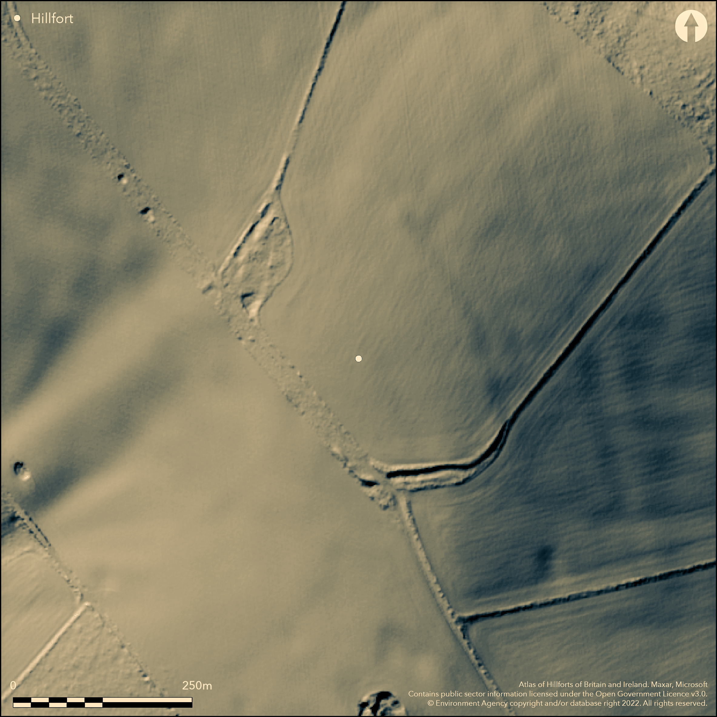
LiDAR 1m DTM Hillshade
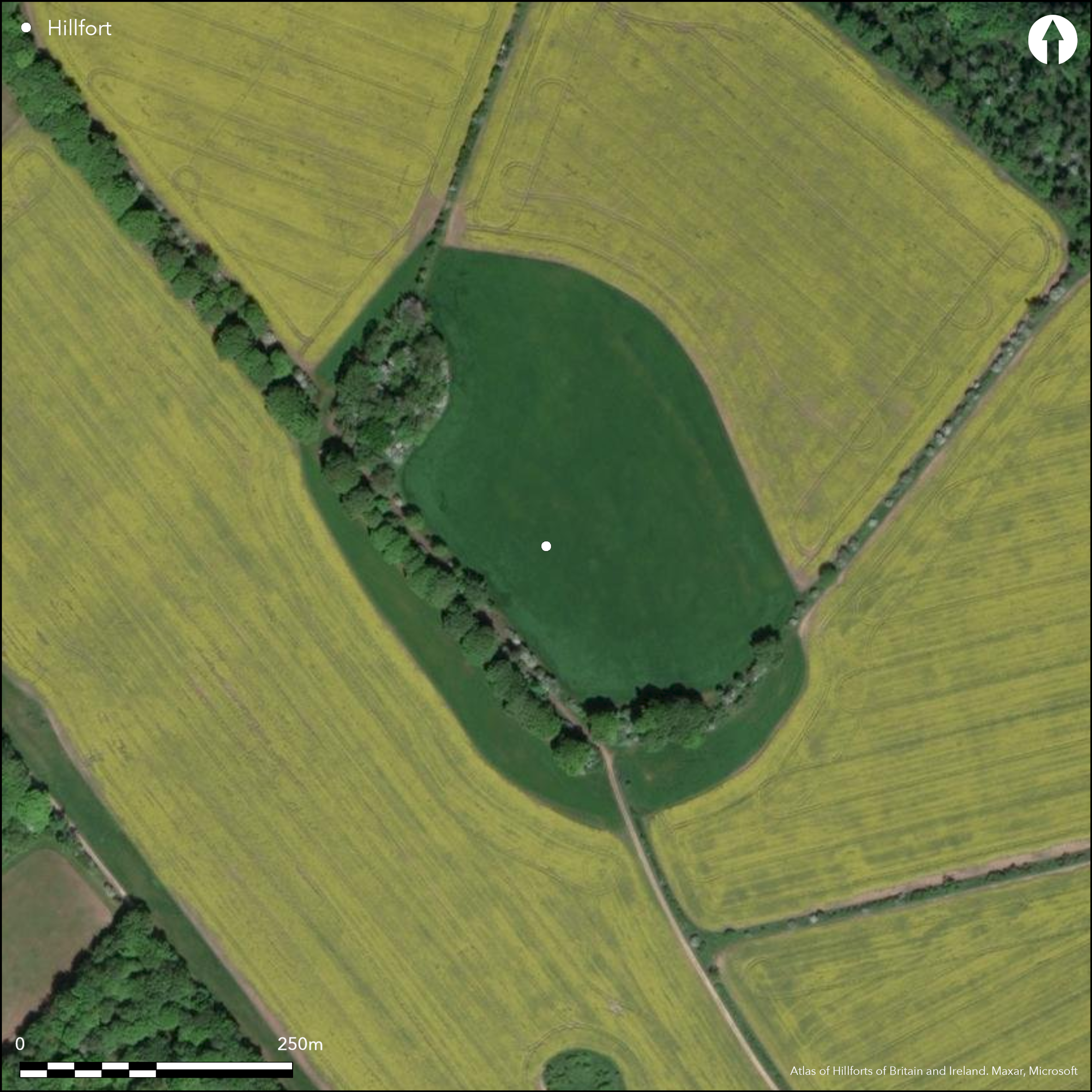
Satellite Imagery
LiDAR 1m DTM Hillshade
Satellite Imagery
Scroll left/right to view further images.
HER: Gloucestershire 177 (None)
NMR: SO 91 NE 14 (14969)
SM: 1018167
NGR: SO989149
X: 398970 Y: 214960 (OSGB36)
Partial contour hillfort located on SE-facing spur above confluence of River Churn and Hilcot Brook to SE in S Cotswolds. Surrounding slopes steep to E (stream re-entrant on NE), steep to W (stream re-entrant on W), moderate between two re-entrants to N on spur ridge. Encloses 3.2ha. Bank on NE, E, S and SW, c. 7m in width and nearly 1m high on S with ditch c. 5m wide and nearly 1m deep. Scarp nearly 1m high on E. At NE angle ditch seen as band of dark soil with slight outer scarp, mostly ploughed out. SW entrance, between overlapping bank ends, probably original; wide gap on NE, affected by derelict reservoir, also possible entrance at N end where slight out turned end of the bank visible. Mostly ploughed out to NE and SW and ditch infilled. No excavations. On 1st Ed. OS map (1884).
Citizen Science: ✓
Reliability of Data: Confirmed
Reliability of Interpretation: Confirmed
X: -224461 Y: 6770023 (EPSG: 3857)
Longitude: -2.016367315377285 Latitude: 51.8332081240468 (EPSG:4326)
Country: England
Current County or Unitary Authority: Gloucestershire
Historic County: Gloucestershire
Current Parish/Community/Council/Townland: Colesbourne
Domed interior and site mostly ploughed out to NE and SW and ditch infilled. Dense vegetation in places and affected by a reservoir and track to NW. On Heritage at Risk Register (2015).
| Extant | ✓ |
| Cropmark | ✗ |
| Likely Destroyed | ✗ |
Mercombe Wood surrounds spur to N. and W.
| Woodland | ✗ |
| Commercial Forestry Plantation | ✗ |
| Parkland | ✗ |
| Pasture (Grazing) | ✓ |
| Arable | ✗ |
| Scrub/Bracken | ✗ |
| Bare Outcrop | ✗ |
| Heather/Moorland | ✗ |
| Heath | ✗ |
| Built-up | ✗ |
| Coastal Grassland | ✗ |
| Other | ✗ |
Partial contour hillfort located on SE-facing spur above confluence of River Churn and Hilcot Brook to SE in S Cotswolds. Slightly sloping to SE.
| Contour Fort | ✗ |
| Partial Contour Fort | ✓ |
| Promontory Fort | ✗ |
| Hillslope Fort | ✗ |
| Level Terrain Fort | ✗ |
| Marsh Fort | ✗ |
| Multiple Enclosure Fort | ✗ |
Located on a south-east hillslope spur dominating the confluence of the River Churn and Hilcot Brook
| Hilltop | ✗ |
| Coastal Promontory | ✗ |
| Inland Promontory | ✗ |
| Valley Bottom | ✗ |
| Knoll/Hillock/Outcrop | ✗ |
| Ridge | ✗ |
| Cliff/Plateau-edge/Scarp | ✗ |
| Hillslope | ✗ |
| Lowland | ✗ |
| Spur | ✓ |
Dominant Topographic Feature: Spur
| North | ✗ |
| Northeast | ✗ |
| East | ✗ |
| Southeast | ✓ |
| South | ✗ |
| Southwest | ✗ |
| West | ✗ |
| Northwest | ✗ |
| Level | ✗ |
Altitude: 260.0m
N/A
None
Reliability: D - None
| Pre 1200BC | ✗ |
| 1200BC - 800BC | ✗ |
| 800BC - 400BC | ✗ |
| 400BC - AD50 | ✗ |
| AD50 - AD400 | ✗ |
| AD400 - AD 800 | ✗ |
| Post AD800 | ✗ |
| Unknown | ✓ |
| Pre Hillfort: | None |
| Post Hillfort: | None |
On 1st Ed. OS map (1884). Aerial photograph interpretation, Gloucestershire County Council: Cotswolds Hills (S. Cotswolds) NMP, 2007-2010. 2014 geophysical survey, ADS Grey Lit. Library, OASIS ref: archaeol20-189452.
| 1st Identified Map Depiction (1884): | OS map. |
| Geophysical Survey (2014): | Archaeological Surveys Ltd |
| Other (None): | Gloucestershire County Council: Cotswolds Hills (S. Cotswolds) NMP. |
None
None
| None | ✓ |
| Spring | ✗ |
| Stream | ✗ |
| Pool | ✗ |
| Flush | ✗ |
| Well | ✗ |
| Other | ✗ |
None
| No Known Features | ✓ |
| Round Stone Structures | ✗ |
| Rectangular Stone Structures | ✗ |
| Curvilinear Platforms | ✗ |
| Other Roundhouse Evidence | ✗ |
| Pits | ✗ |
| Quarry Hollows | ✗ |
| Other | ✗ |
None
| No Known Excavation | ✓ |
| Pits | ✗ |
| Postholes | ✗ |
| Roundhouses | ✗ |
| Rectangular Structures | ✗ |
| Roads/Tracks | ✗ |
| Quarry Hollows | ✗ |
| Other | ✗ |
| Nothing Found | ✗ |
None
| No Known Geophysics | ✓ |
| Pits | ✗ |
| Roundhouses | ✗ |
| Rectangular Structures | ✗ |
| Roads/Tracks | ✗ |
| Quarry Hollows | ✗ |
| Other | ✗ |
| Nothing Found | ✗ |
None
| No Known Finds | ✓ |
| Pottery | ✗ |
| Metal | ✗ |
| Metalworking | ✗ |
| Human Bones | ✗ |
| Animal Bones | ✗ |
| Lithics | ✗ |
| Environmental | ✗ |
| Other | ✗ |
None
| APs Not Checked | ✓ |
| None | ✗ |
| Roundhouses | ✗ |
| Rectangular Structures | ✗ |
| Pits | ✗ |
| Postholes | ✗ |
| Roads/Tracks | ✗ |
| Other | ✗ |
SW entrance, between overlapping bank ends, probably original; wide gap on NE, affected by derelict reservoir, also possible entrance at N end where slight out-turned end of the bank visible.
| 3: | None |
| 2: | None |
Guard Chambers: ✗
Chevaux de Frise: ✗
| 1. Over-lapping (South west): | Between overlapping bank ends. |
| 2. Simple Gap (North east): | Wide gap on NE, affected by derelict reservoir, |
| 3. Out-turned (North): | Possible entrance at N end where slight out-turned end of the bank visible. |
Bank on NE, E, S and SW, c. 7m in width and nearly 1m high on S with ditch c. 5m wide and nearly 1m deep. Scarp nearly 1m high on E. At NE angle ditch seen as band of dark soil with slight outer scarp.
| Area 1: | 3.2ha. |
| Total: | 3.2ha. |
Total Footprint Area: Noneha.
None
| ✗ | None |
| ✓ | Wide gap on NE. |
| NE Quadrant: | 1 |
| SE Quadrant: | 1 |
| SW Quadrant: | 1 |
| NW Quadrant: | 1 |
| Total: | 1 |
| Partial Univallate | ✗ |
| Univallate | ✓ |
| Partial Bivallate | ✗ |
| Bivallate | ✗ |
| Partial Multivallate | ✗ |
| Multivallate | ✗ |
| Unknown | ✗ |
| Partial Univallate | ✗ |
| Univallate | ✗ |
| Partial Bivallate | ✗ |
| Bivallate | ✗ |
| Partial Multivallate | ✗ |
| Multivallate | ✗ |
None
| None | ✗ |
| Earthen Bank | ✓ |
| Stone Wall | ✗ |
| Rubble | ✗ |
| Wall-walk | ✗ |
| Evidence of Timber | ✗ |
| Vitrification | ✗ |
| Other Burning | ✗ |
| Palisade | ✗ |
| Counter Scarp Bank | ✗ |
| Berm | ✗ |
| Unfinished | ✗ |
| Other | ✗ |
None
| None | ✗ |
| Earthen Bank | ✗ |
| Stone Wall | ✗ |
| Murus Duplex | ✗ |
| Timber-framed | ✗ |
| Timber-laced | ✗ |
| Vitrification | ✗ |
| Other Burning | ✗ |
| Palisade | ✗ |
| Counter Scarp Bank | ✗ |
| Berm | ✗ |
| Unfinished | ✗ |
| No Known Excavation | ✓ |
| Other | ✗ |
| ✗ | None |
| ✓ | At NE angle ditch seen as band of dark soil with slight outer scarp. |
Number of Ditches: 1
| ✗ | None |
RCHME 1976. Ancient and historical monuments in the County of Gloucestershire, Vol. I: Iron Age and Romano- British monuments in Gloucestershire Cotswolds, London: HMSO, 34-5.
Saville, A. ed 1984. Archaeology in Gloucestershire from earliest hunters to the industrial age: essays dedicated to Helen O'Neil and the late Elsie Clifford, 165.
Atlas of Hillforts:
Wikidata:
This work is licensed under CC BY-SA 4.0

 and should be cited as:
Lock, Gary and Ralston, Ian. 2024. Atlas of Hillforts of Britain and Ireland. Available at: https://hillforts.arch.ox.ac.uk
Document Version 1.1