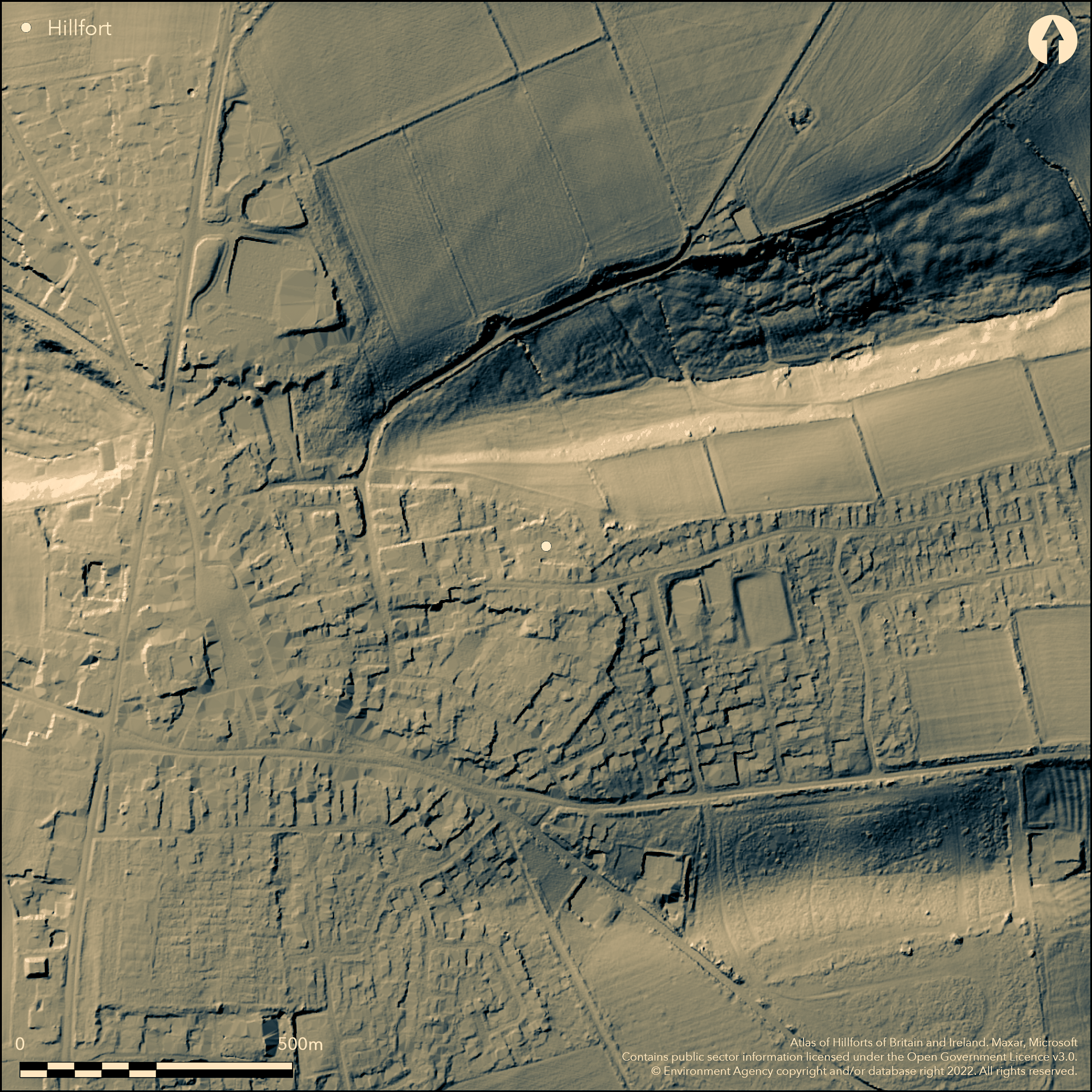
LiDAR 1m DTM Hillshade
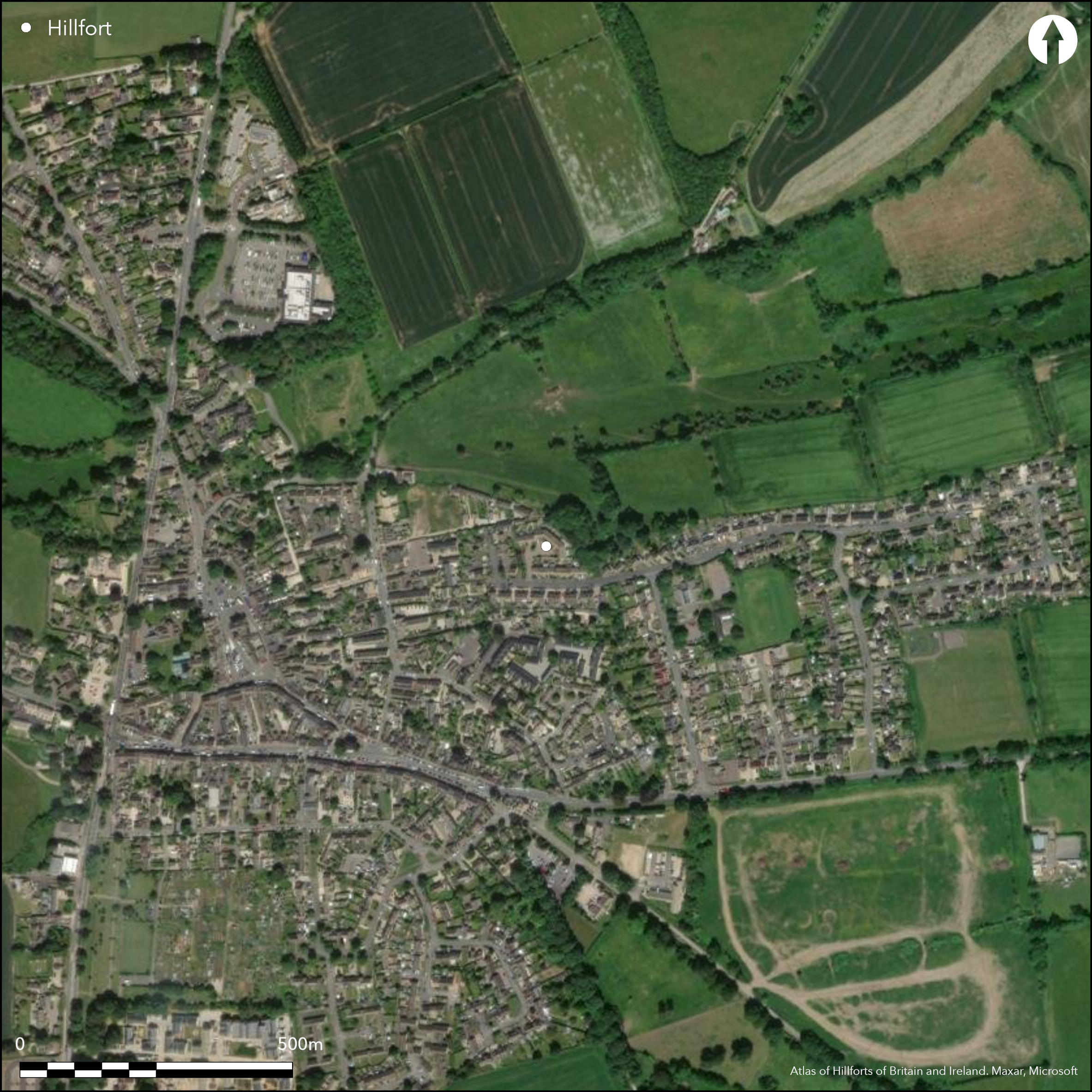
Satellite Imagery
LiDAR 1m DTM Hillshade
Satellite Imagery
Scroll left/right to view further images.
HER: Gloucestershire 239 (None)
NMR: SP 12 NE 32 (330170)
SM: 1017341
NGR: SP195259
X: 419500 Y: 225900 (OSGB36)
Probable large contour hillfort, much affected by present Stow-on-the-Wold development, situated on top of hill immediately to NE of Stow-on-the-Wold. On NE side, section of the enclosure visible as modern wall surmounting earthwork bank of c 20m across and 2m high, running between Well Lane and Shepherds Way. Topography and shape of modern property boundaries suggest site possibly once covered 12ha as oval enclosure. Small excavations and watching briefs confirm presence. Excavation at Parson's Corner 1972 found undated ditch, thought prehistoric, in vicinity of the burh and possibly associated with it. Work by Parry and Edmondson 1991-1992 found two further ditches, of defensive proportions, one with C14 dating dug during mid-Bronze Age; possibly stretches of same feature of 1972 excavation. Different stretches of same feature. 2001 Watching Brief found no archaeological deposits. Enclosure suggested since mid-19th century, based on place name `Maethelgeres Byrig' recorded in Saxon Charter AD 714.
Citizen Science: ✗
Reliability of Data: Confirmed
Reliability of Interpretation: Confirmed
X: -191226 Y: 6787701 (EPSG: 3857)
Longitude: -1.7178118004071523 Latitude: 51.93123327081969 (EPSG:4326)
Country: England
Current County or Unitary Authority: Gloucestershire
Historic County: Gloucestershire
Current Parish/Community/Council/Townland: Stow-on-the-Wold
Virtually destroyed by development, apart from some indication on NE side where modern wall surmounts earthwork bank of c. 20m across and 2m high between Well Lane and Shepherds Way.
| Extant | ✓ |
| Cropmark | ✗ |
| Likely Destroyed | ✓ |
Under Stow-on-the-Wold development.
| Woodland | ✗ |
| Commercial Forestry Plantation | ✗ |
| Parkland | ✗ |
| Pasture (Grazing) | ✗ |
| Arable | ✗ |
| Scrub/Bracken | ✗ |
| Bare Outcrop | ✗ |
| Heather/Moorland | ✗ |
| Heath | ✗ |
| Built-up | ✓ |
| Coastal Grassland | ✗ |
| Other | ✗ |
Possible large contour hillfort, much affected by the present Stow-on-the-Wold development, situated on top of hill immediately to NE of Stow-on-the-Wold.
| Contour Fort | ✓ |
| Partial Contour Fort | ✗ |
| Promontory Fort | ✗ |
| Hillslope Fort | ✗ |
| Level Terrain Fort | ✗ |
| Marsh Fort | ✗ |
| Multiple Enclosure Fort | ✗ |
Sited on the tip of a Cotswold spur above the River Dikler to the west and River Evenlode to the east
| Hilltop | ✓ |
| Coastal Promontory | ✗ |
| Inland Promontory | ✗ |
| Valley Bottom | ✗ |
| Knoll/Hillock/Outcrop | ✗ |
| Ridge | ✗ |
| Cliff/Plateau-edge/Scarp | ✗ |
| Hillslope | ✗ |
| Lowland | ✗ |
| Spur | ✗ |
Dominant Topographic Feature: Hill top
| North | ✗ |
| Northeast | ✗ |
| East | ✗ |
| Southeast | ✗ |
| South | ✗ |
| Southwest | ✗ |
| West | ✗ |
| Northwest | ✗ |
| Level | ✓ |
Altitude: 220.0m
N/A
Probable Iron Age occupation, but excavation also shows earlier ditch, C14 dated to middle Bronze Age.
Reliability: B - Medium
| Pre 1200BC | ✗ |
| 1200BC - 800BC | ✓ |
| 800BC - 400BC | ✓ |
| 400BC - AD50 | ✓ |
| AD50 - AD400 | ✗ |
| AD400 - AD 800 | ✗ |
| Post AD800 | ✗ |
| Unknown | ✗ |
| Pre Hillfort: | None |
| Post Hillfort: | None |
| C14: | Ditch dated to middle Bronze Age. |
Excavation Parson's Corner H.E. O'Neil 1972. Excavation at doctor's surgery C. Parry and G. Edmondson, 1994. Well Lane. Watching Brief Well Lane surgery extension, 2001.
| Excavation (1972): | H.E. O'Neil. |
| Excavation (1994): | C. Parry and G. Edmondson. |
| Other (2001): | Watching Brief, Cotswold Archaeological Trust. |
None
None
| None | ✓ |
| Spring | ✗ |
| Stream | ✗ |
| Pool | ✗ |
| Flush | ✗ |
| Well | ✗ |
| Other | ✗ |
None
| No Known Features | ✓ |
| Round Stone Structures | ✗ |
| Rectangular Stone Structures | ✗ |
| Curvilinear Platforms | ✗ |
| Other Roundhouse Evidence | ✗ |
| Pits | ✗ |
| Quarry Hollows | ✗ |
| Other | ✗ |
None
| No Known Excavation | ✓ |
| Pits | ✗ |
| Postholes | ✗ |
| Roundhouses | ✗ |
| Rectangular Structures | ✗ |
| Roads/Tracks | ✗ |
| Quarry Hollows | ✗ |
| Other | ✗ |
| Nothing Found | ✗ |
None
| No Known Geophysics | ✓ |
| Pits | ✗ |
| Roundhouses | ✗ |
| Rectangular Structures | ✗ |
| Roads/Tracks | ✗ |
| Quarry Hollows | ✗ |
| Other | ✗ |
| Nothing Found | ✗ |
None
| No Known Finds | ✓ |
| Pottery | ✗ |
| Metal | ✗ |
| Metalworking | ✗ |
| Human Bones | ✗ |
| Animal Bones | ✗ |
| Lithics | ✗ |
| Environmental | ✗ |
| Other | ✗ |
None
| APs Not Checked | ✓ |
| None | ✗ |
| Roundhouses | ✗ |
| Rectangular Structures | ✗ |
| Pits | ✗ |
| Postholes | ✗ |
| Roads/Tracks | ✗ |
| Other | ✗ |
None recorded.
| 0: | None |
| 2: | None |
Guard Chambers: ✗
Chevaux de Frise: ✗
On NE side, possible section of the enclosure visible as modern wall surmounting earthwork bank of c 20m across and 2m high, running between Well Lane and Shepherds Way. Topography and shape of modern property boundaries suggest site possibly once possibly covered 12ha as oval enclosure.
| Area 1: | 12.0ha. |
| Total: | 12.0ha. |
Total Footprint Area: Noneha.
None
| ✗ | Site area only estimated. |
| ✗ | Site virtually destroyed. |
| NE Quadrant: | 0 |
| SE Quadrant: | 0 |
| SW Quadrant: | 0 |
| NW Quadrant: | 0 |
| Total: | 0 |
| Partial Univallate | ✗ |
| Univallate | ✗ |
| Partial Bivallate | ✗ |
| Bivallate | ✗ |
| Partial Multivallate | ✗ |
| Multivallate | ✗ |
| Unknown | ✓ |
| Partial Univallate | ✗ |
| Univallate | ✗ |
| Partial Bivallate | ✗ |
| Bivallate | ✗ |
| Partial Multivallate | ✗ |
| Multivallate | ✗ |
Earthen bank on NE.
| None | ✗ |
| Earthen Bank | ✓ |
| Stone Wall | ✗ |
| Rubble | ✗ |
| Wall-walk | ✗ |
| Evidence of Timber | ✗ |
| Vitrification | ✗ |
| Other Burning | ✗ |
| Palisade | ✗ |
| Counter Scarp Bank | ✗ |
| Berm | ✗ |
| Unfinished | ✗ |
| Other | ✗ |
Excavations found evidence of ditches.
| None | ✗ |
| Earthen Bank | ✗ |
| Stone Wall | ✗ |
| Murus Duplex | ✗ |
| Timber-framed | ✗ |
| Timber-laced | ✗ |
| Vitrification | ✗ |
| Other Burning | ✗ |
| Palisade | ✗ |
| Counter Scarp Bank | ✗ |
| Berm | ✗ |
| Unfinished | ✗ |
| No Known Excavation | ✗ |
| Other | ✓ |
| ✗ | None |
| ✓ | Ditch(s) found in excavations. |
Number of Ditches: 1
| ✗ | None |
Leech, R. 1981. Historic towns in Gloucestershire: archaeology and planning. Committee for Rescue Archaeology in Avon, Gloucestershire and Somerset, Surveys No 1 (1975) - No 6 (1983) No 3, 79.
Morton R. 2001. Well Lane Surgery Extension, Stow Camp, Stow-on-the-Wold, Gloucestershire: archaeological watching brief, Report No 01013, Cotswold Archaeological Trust.
Parry, C. and Edmondson, G. 1995. Note, Trans Bristol Gloucestershire Archaeol Soc 113, 203.
RCHME 1976. Ancient and historical monuments in the County of Gloucestershire, Vol. I: Iron Age and Romano- British monuments in Gloucestershire Cotswolds, London: HMSO, 111b.
Atlas of Hillforts:
Wikidata:
This work is licensed under CC BY-SA 4.0

 and should be cited as:
Lock, Gary and Ralston, Ian. 2024. Atlas of Hillforts of Britain and Ireland. Available at: https://hillforts.arch.ox.ac.uk
Document Version 1.1