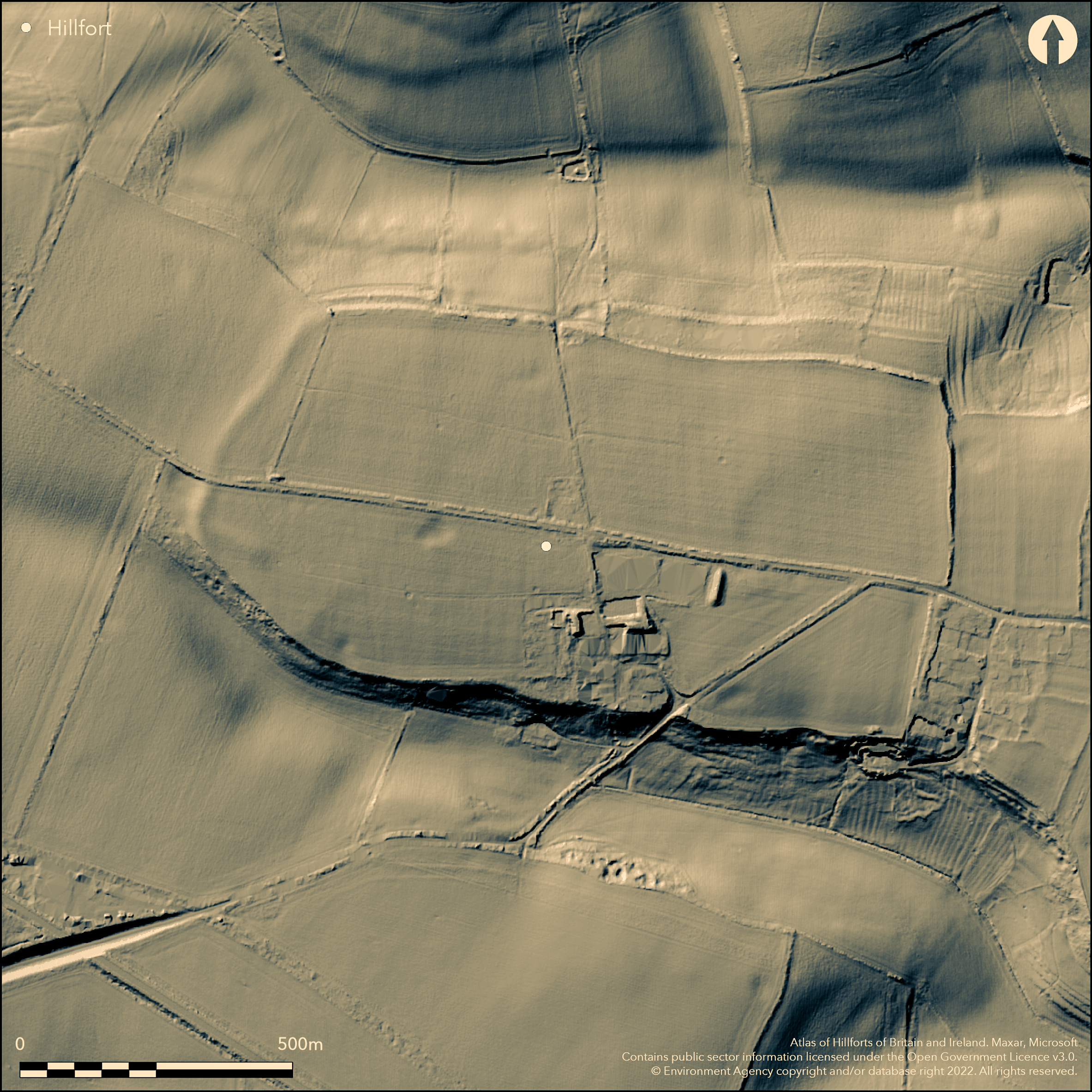
LiDAR 1m DTM Hillshade
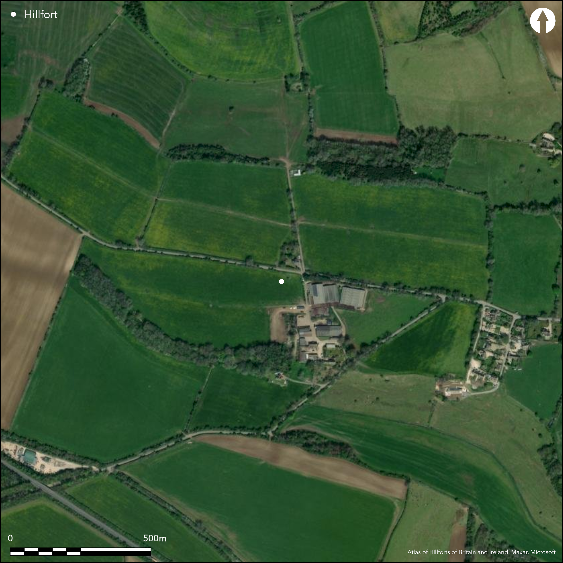
Satellite Imagery
LiDAR 1m DTM Hillshade
Satellite Imagery
Scroll left/right to view further images.
HER: Gloucestershire 273 (None)
NMR: SP 11 NW11 (329935)
SM: 1003355
NGR: SP127155
X: 412700 Y: 215500 (OSGB36)
Large, roughly rectangular, multivallate promontory hillfort located between steep re-entant valleys above River Leach to W and Sherborne Brook to E, W of village of Farmington. Much affected by farm buildings and roads and ploughed down W end. Measures c. 890m E-W and 520m N-S, encloses 22ha. W and E sides defined by banks set along extremities of slight rise. N and S defined by edges of promontory with scarping. Scarping on S extends for c, 270m from SW corner. On N low bank set on terrace beneath scarp edge, possibly originally natural feature modified by later scarping, probably when trees planted on regular, scarped slopes above and below. W bank under plough, but c. 1.3m high externally and 0.3m high internally. E bank c. 1m high and 8.0m wide, topped by field wall. Internal slope damaged or destroyed by ploughing. S of road bank almost destroyed by development. Ditches only now as cropmarks. Innermost bank of W rampart visible as slight earthwork on 2006 aerial photographs. Original entrances, now used by modern roads, possibly gap near centre of E bank and hollow-way in S scarp. Excavations in NW corner of Hospital Field 1977 in advance of farmbuilding (Saville and Ellison 1983). Features showed late Iron Age occupation with 3 probable four-post structures. Also pit (possibly Roman), ditch and gully excavated. Pit contained incomplete semi-crouched inhumation suggesting mutilation. Little dating evidence , but Iron Age pottery found. Neolithic long barrow in SW corner and Romano British settlement in NE corner. On 1st Ed. OS map (1884). .
Citizen Science: ✗
Reliability of Data: Confirmed
Reliability of Interpretation: Confirmed
X: -202278 Y: 6770873 (EPSG: 3857)
Longitude: -1.8170911576988849 Latitude: 51.83792227098422 (EPSG:4326)
Country: England; None
Current County or Unitary Authority: Gloucestershire
Historic County: Gloucestershire
Current Parish/Community/Council/Townland: Northleach with Eastington; Farmington
Mutilated with plough and building damage. Short lengths of N and S ramparts visible as scarp edges, with NE corner of hillfort. Remainder of enclosing banks, ditches and scarps hidden from aerial view by trees, field boundaries and modern housing.
| Extant | ✓ |
| Cropmark | ✗ |
| Likely Destroyed | ✗ |
None
| Woodland | ✓ |
| Commercial Forestry Plantation | ✗ |
| Parkland | ✗ |
| Pasture (Grazing) | ✓ |
| Arable | ✗ |
| Scrub/Bracken | ✗ |
| Bare Outcrop | ✗ |
| Heather/Moorland | ✗ |
| Heath | ✗ |
| Built-up | ✓ |
| Coastal Grassland | ✗ |
| Other | ✗ |
Large, roughly rectangular, multivallate promontory hillfort located between steep re-entant valleys above River Leach to W and Sherborne Brook to E, W of village of Farmington.
| Contour Fort | ✗ |
| Partial Contour Fort | ✗ |
| Promontory Fort | ✓ |
| Hillslope Fort | ✗ |
| Level Terrain Fort | ✗ |
| Marsh Fort | ✗ |
| Multiple Enclosure Fort | ✗ |
Located at the headwaters of the Sherborne Brook, a tributary of the River Windrush between re-entrant valleys
| Hilltop | ✗ |
| Coastal Promontory | ✗ |
| Inland Promontory | ✓ |
| Valley Bottom | ✗ |
| Knoll/Hillock/Outcrop | ✗ |
| Ridge | ✗ |
| Cliff/Plateau-edge/Scarp | ✗ |
| Hillslope | ✗ |
| Lowland | ✗ |
| Spur | ✗ |
Dominant Topographic Feature: Spur promontory.
| North | ✗ |
| Northeast | ✗ |
| East | ✗ |
| Southeast | ✗ |
| South | ✗ |
| Southwest | ✗ |
| West | ✗ |
| Northwest | ✗ |
| Level | ✓ |
Altitude: 190.0m
Boundary Type: Parish/Townland
Excavation and geophysical survey revealed Iron Age and Romano British occupation and Iron Age pottery found. Neolithic long barrow in SW corner.
Reliability: B - Medium
| Pre 1200BC | ✗ |
| 1200BC - 800BC | ✗ |
| 800BC - 400BC | ✓ |
| 400BC - AD50 | ✓ |
| AD50 - AD400 | ✗ |
| AD400 - AD 800 | ✗ |
| Post AD800 | ✗ |
| Unknown | ✗ |
| Pre Hillfort: | None |
| Post Hillfort: | None |
| Artefactual: | None |
On 1st Ed. OS map (1884). Magnetic survey and watching briefs and small excavation in advance of building, A.Saville, Corinium Museum 1977. Aerial photograph interpretation RCHME Primary Record Project 1992-96. geophysical survey, A. Marshall 1996. Evaluation, Cotswold Archaeology, 1998. Geophysical survey, A. Marshall 2002. Aerial photograph interpretation, Gloucestershire County Council: Cotswolds Hills (S. Cotswolds) NMP, 2007-2010.
| 1st Identified Map Depiction (1884): | OS map. |
| Excavation (1977): | A. Saville. |
| Geophysical Survey (1996): | A. Marshall |
| Other (1998): | Cotswold Archaeology |
| Geophysical Survey (2002): | A. Marshall. |
| Other (None): | Aerial photograph interpretation RCHME |
| Other (None): | Aerial photograph interpretation, Gloucestershire County Council: Cotswolds Hills (S. Cotswolds) NMP. |
Excavations in NW corner of Hospital Field 1977 in advance of farmbuilding. Features showed late Iron Age occupation with 3 probable 4-post structures. Also pit (possibly Roman), ditch and gully excavated. Pit contained incomplete semi-crouched inhumation suggesting mutilation. Little dating evidence , but Iron Age pottery found. Geophysics undertaken has found evidence of interior structures and other features.
None
| None | ✓ |
| Spring | ✗ |
| Stream | ✗ |
| Pool | ✗ |
| Flush | ✗ |
| Well | ✗ |
| Other | ✗ |
None
| No Known Features | ✓ |
| Round Stone Structures | ✗ |
| Rectangular Stone Structures | ✗ |
| Curvilinear Platforms | ✗ |
| Other Roundhouse Evidence | ✗ |
| Pits | ✗ |
| Quarry Hollows | ✗ |
| Other | ✗ |
Excavations in NW corner of Hospital Field 1977 in advance of farmbuilding. Features showed late Iron Age occupation with 3 probable 4-post structures. Also pit (possibly Roman), ditch and gully excavated.
| No Known Excavation | ✗ |
| Pits | ✓ |
| Postholes | ✗ |
| Roundhouses | ✗ |
| Rectangular Structures | ✓ |
| Roads/Tracks | ✗ |
| Quarry Hollows | ✗ |
| Other | ✓ |
| Nothing Found | ✗ |
Geophysics undertaken has found evidence of interior structures and other features.
| No Known Geophysics | ✗ |
| Pits | ✗ |
| Roundhouses | ✗ |
| Rectangular Structures | ✗ |
| Roads/Tracks | ✗ |
| Quarry Hollows | ✗ |
| Other | ✓ |
| Nothing Found | ✗ |
Pit contained incomplete semi-crouched inhumation suggesting mutilation. Little dating evidence , but Iron Age pottery found.
| No Known Finds | ✗ |
| Pottery | ✓ |
| Metal | ✗ |
| Metalworking | ✗ |
| Human Bones | ✓ |
| Animal Bones | ✗ |
| Lithics | ✗ |
| Environmental | ✗ |
| Other | ✗ |
None
| APs Not Checked | ✓ |
| None | ✗ |
| Roundhouses | ✗ |
| Rectangular Structures | ✗ |
| Pits | ✗ |
| Postholes | ✗ |
| Roads/Tracks | ✗ |
| Other | ✗ |
Original entrances, now used by modern roads, possibly gap near centre of E bank and hollow way in S scarp.
| 2: | None |
| 2: | None |
Guard Chambers: ✗
Chevaux de Frise: ✗
| 1. Simple Gap (East): | None |
| 2. Hollow Way (South): | None |
W and E sides defined by banks set along extremities of slight rise. N and S defined by edges of promontory with scarping. Scarping on S extends for c, 270m from SW corner. On N low bank set on a terrace beneath scarp edge, possibly originally natural feature modified by later scarping, probably when trees planted on regular, scarped slopes above and below. W bank under plough, but c. 1.3m high externally and 0.3m high internally. E bank c. 1m high and 8.0m wide, topped by field wall. Internal slope damaged or destroyed by ploughing. S of road bank almost destroyed by development. Ditches only now as cropmarks. Innermost bank of W rampart visible as slight earthwork on 2006 aerial photographs.
| Area 1: | 22.0ha. |
| Total: | 22.0ha. |
Total Footprint Area: Noneha.
None
| ✗ | None |
| ✓ | Ploughed down W end possibly multivallate - no details. |
| NE Quadrant: | 1 |
| SE Quadrant: | 1 |
| SW Quadrant: | 1 |
| NW Quadrant: | 1 |
| Total: | 1 |
| Partial Univallate | ✗ |
| Univallate | ✓ |
| Partial Bivallate | ✗ |
| Bivallate | ✗ |
| Partial Multivallate | ✗ |
| Multivallate | ✗ |
| Unknown | ✗ |
| Partial Univallate | ✗ |
| Univallate | ✗ |
| Partial Bivallate | ✗ |
| Bivallate | ✗ |
| Partial Multivallate | ✗ |
| Multivallate | ✗ |
None
| None | ✗ |
| Earthen Bank | ✓ |
| Stone Wall | ✗ |
| Rubble | ✗ |
| Wall-walk | ✗ |
| Evidence of Timber | ✗ |
| Vitrification | ✗ |
| Other Burning | ✗ |
| Palisade | ✗ |
| Counter Scarp Bank | ✗ |
| Berm | ✗ |
| Unfinished | ✗ |
| Other | ✗ |
Bank not sectioned.
| None | ✗ |
| Earthen Bank | ✗ |
| Stone Wall | ✗ |
| Murus Duplex | ✗ |
| Timber-framed | ✗ |
| Timber-laced | ✗ |
| Vitrification | ✗ |
| Other Burning | ✗ |
| Palisade | ✗ |
| Counter Scarp Bank | ✗ |
| Berm | ✗ |
| Unfinished | ✗ |
| No Known Excavation | ✓ |
| Other | ✗ |
| ✗ | None |
| ✓ | Ditches visible only as cropmarks. |
Number of Ditches: 1
| ✗ | None |
Marshall, A. 1996. ARCHAEOLOGICAL ASSESSMENT OF A POTENTIAL DEVELOPMENT AREA WITHIN FARMINGTON NORBURY HILLFORT NORTHLEACH WITH EASINGTON.
Marshall, A. 1996 Northleach long barrow and Norbury Camp. Trans Bristol Gloucestershire Archaeol Soc,114; 170-185.
Marshall, A. J. 2003. SUMMARY OF GEOPHYSICAL SURVEY UNDERTAKEN AT NORBURY HILLFORT, NORTHLEACH WITH EASINGTON, GLOS, Unpublished.
RCHME 1976. Ancient and historical monuments in the County of Gloucestershire, Vol. I: Iron Age and Romano- British monuments in Gloucestershire Cotswolds, London: HMSO, 87-8.
Saville, A. and Ellison, A. 1983. Uley Bury and Norbury hillforts: rescue excavations at two Gloucestershire Iron Age sites. Bristol: Western Archaeological Trust.
Witts, G.B. 1883. Archaeological handbook of the County of Gloucestershire, Cheltenham: Norman Brothers, 37, 72.
Atlas of Hillforts:
Wikidata:
This work is licensed under CC BY-SA 4.0

 and should be cited as:
Lock, Gary and Ralston, Ian. 2024. Atlas of Hillforts of Britain and Ireland. Available at: https://hillforts.arch.ox.ac.uk
Document Version 1.1