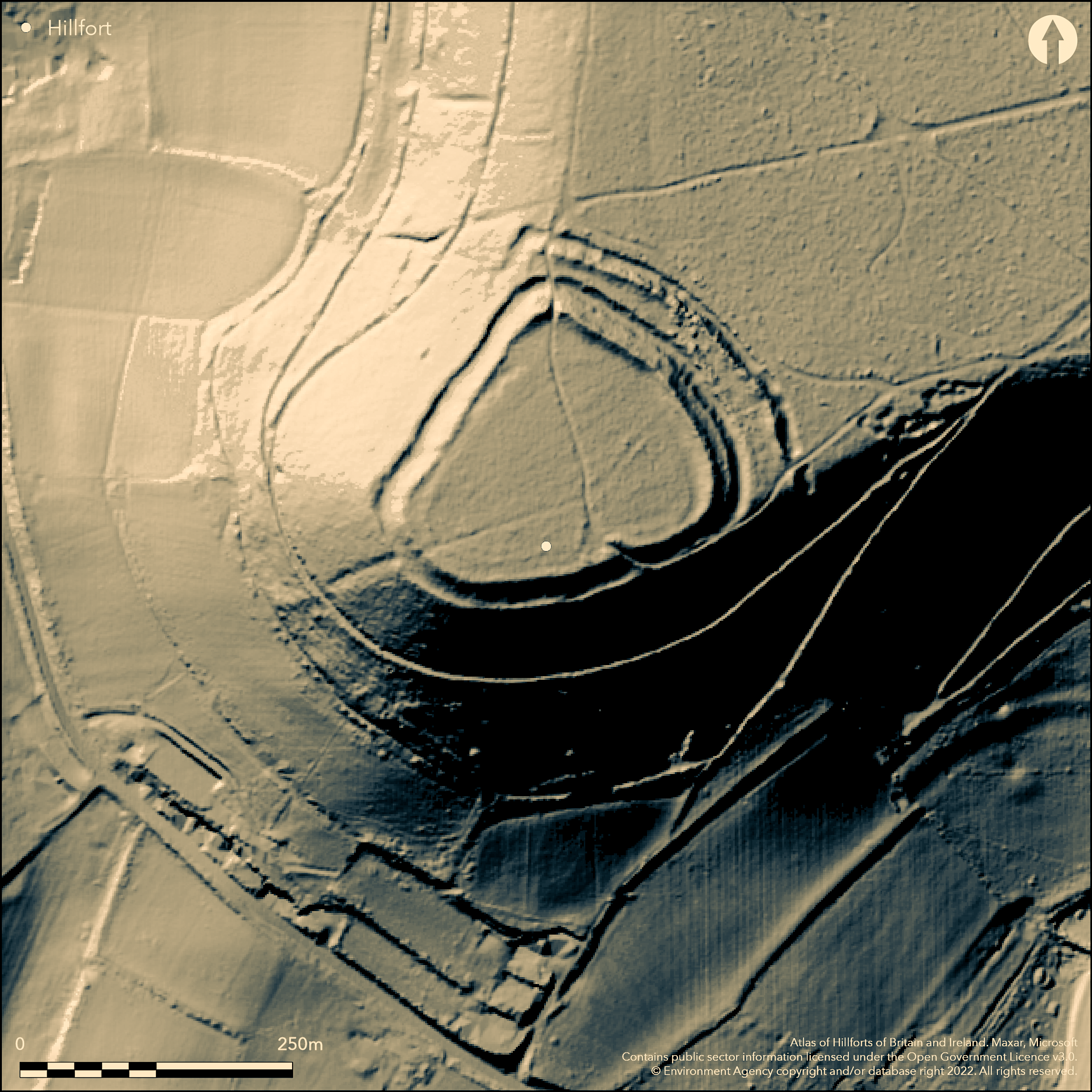
LiDAR 1m DTM Hillshade
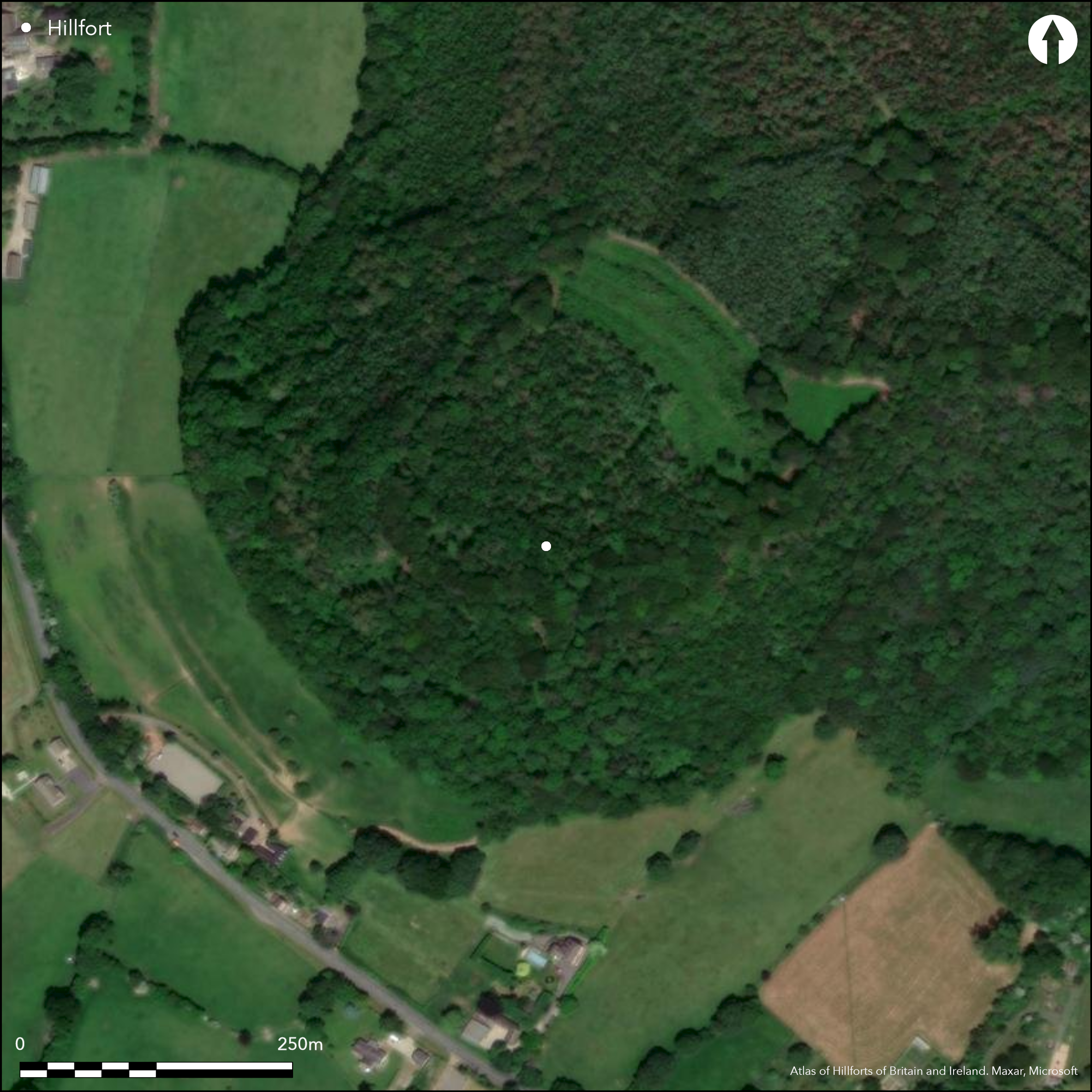
Satellite Imagery
LiDAR 1m DTM Hillshade
Satellite Imagery
Scroll left/right to view further images.
HER: Gloucestershire 318 (None)
NMR: ST 79 SW 7 (205380)
SM: 1002133
NGR: ST747948
X: 374700 Y: 194800 (OSGB36)
Roughly triangular partial contour fort, located at SW end of steep sided spur of the S Cotswold escarpment above streams flowing into Little Avon River to W. Steep surrounding slopes to S, W and NW, moderate along spur ridge to NE. Steep re-entrant to SE. Bivallate on NE, where outerwork of glacis bank and ditch cuts the spur NW-SE 4m-30m from inner ditch with ends resting on scarp edges. This rampart, c. 7.6m wide and 1.5m high, with external ditch 6m wide and just over 1m deep. Inner defences on NE consist of a rampart 15m wide and 3m high separated by berm 2.4m wide from an external ditch 14m wide and 2.4m deep, with slight counterscarp bank. Univallate to rest of site above the scarp. On NW and SE sides rampart sits on edge of spur 6m above ditch which, still with counterscarp bank, drops from N corner to follow ledge as far as entrance on SE side. NW face crowned by slight breastwork. Outer rampart encloses c. 3.2ha, inner 2ha. Possible two phased construction. Chance finds of Bronze Age metalwork. Well preserved in dense woodland with no excavations. On 1st Ed. OS map (1882).
Citizen Science: ✓
Reliability of Data: Confirmed
Reliability of Interpretation: Confirmed
X: -263506 Y: 6737333 (EPSG: 3857)
Longitude: -2.3671102699287783 Latitude: 51.651371390752004 (EPSG:4326)
Country: England
Current County or Unitary Authority: Gloucestershire
Historic County: Gloucestershire
Current Parish/Community/Council/Townland: North Nibley
Dense woodland has conserved the site. In 1976 virtually untouched. Tree covered in 1977. Some mountain bike problems. Track passes through site from SE entrance through, probably modern, NW gap.
| Extant | ✓ |
| Cropmark | ✗ |
| Likely Destroyed | ✗ |
Dense woodland.
| Woodland | ✓ |
| Commercial Forestry Plantation | ✗ |
| Parkland | ✗ |
| Pasture (Grazing) | ✗ |
| Arable | ✗ |
| Scrub/Bracken | ✗ |
| Bare Outcrop | ✗ |
| Heather/Moorland | ✗ |
| Heath | ✗ |
| Built-up | ✗ |
| Coastal Grassland | ✗ |
| Other | ✗ |
Roughly triangular partial contour fort, located at SW end of steep sided spur of the S Cotswold escarpment above streams flowing onto Little Avon River to W.
| Contour Fort | ✗ |
| Partial Contour Fort | ✓ |
| Promontory Fort | ✗ |
| Hillslope Fort | ✗ |
| Level Terrain Fort | ✗ |
| Marsh Fort | ✗ |
| Multiple Enclosure Fort | ✗ |
Located on the south-western end of a steep Cotswold spur
| Hilltop | ✗ |
| Coastal Promontory | ✗ |
| Inland Promontory | ✓ |
| Valley Bottom | ✗ |
| Knoll/Hillock/Outcrop | ✗ |
| Ridge | ✗ |
| Cliff/Plateau-edge/Scarp | ✗ |
| Hillslope | ✗ |
| Lowland | ✗ |
| Spur | ✓ |
Dominant Topographic Feature: Spur
| North | ✗ |
| Northeast | ✗ |
| East | ✗ |
| Southeast | ✗ |
| South | ✗ |
| Southwest | ✓ |
| West | ✗ |
| Northwest | ✗ |
| Level | ✗ |
Altitude: 200.0m
N/A
Bronze saw piece chance find may slightly pre-date the Penard phase (c. 1200 BC); possibly suggesting early occupation of site, but conjecture.
Reliability: D - None
| Pre 1200BC | ✗ |
| 1200BC - 800BC | ✗ |
| 800BC - 400BC | ✗ |
| 400BC - AD50 | ✗ |
| AD50 - AD400 | ✗ |
| AD400 - AD 800 | ✗ |
| Post AD800 | ✗ |
| Unknown | ✓ |
| Pre Hillfort: | Bronze saw piece of c. 1200 BC may indicate pre-hillfort activity rather than initial occupation. |
| Post Hillfort: | None |
Name 'Brackenbury Ditches' appears first only on OS map 1882. Survey of 1830 named it 'Blackenbury Ditches', but about 1630 it was known as 'Becketsbury'; no longer used. Survey of 1830 - no details. On 1st Ed. OS map (1882). Geophysical, topographical and ecological surveys for management, Cotswold Archaeological Trust, 1990. Management trenches cut by Gloucestershire County Council 2011 - no details.
| 1st Identified Written Reference (1630): | Site called 'Bracketsbury' - no details. |
| Other (1830): | Survey - no details. |
| 1st Identified Map Depiction (1882): | OS map. |
| Geophysical Survey (1990): | Cotswold Archaeological Trust. |
| Excavation (2011): | Gloucestershire County Council. |
Supposed "pit-dwellings" to the NE are due to solifluxion. Geophysical survey 1990 - no details. Bronze tanged dagger (or spearhead) and bronze saw piece chance finds 1904. Saw possibly c. 1200 BC.
None recorded on site but from SE entrance hollow-way, c. nearly 1m deep leads down slope to spring.
| None | ✓ |
| Spring | ✗ |
| Stream | ✗ |
| Pool | ✗ |
| Flush | ✗ |
| Well | ✗ |
| Other | ✗ |
Supposed "pit-dwellings" to the NE are due to solifluxion.
| No Known Features | ✓ |
| Round Stone Structures | ✗ |
| Rectangular Stone Structures | ✗ |
| Curvilinear Platforms | ✗ |
| Other Roundhouse Evidence | ✗ |
| Pits | ✗ |
| Quarry Hollows | ✗ |
| Other | ✗ |
None
| No Known Excavation | ✓ |
| Pits | ✗ |
| Postholes | ✗ |
| Roundhouses | ✗ |
| Rectangular Structures | ✗ |
| Roads/Tracks | ✗ |
| Quarry Hollows | ✗ |
| Other | ✗ |
| Nothing Found | ✗ |
Geophysical survey 1990 - no details.
| No Known Geophysics | ✗ |
| Pits | ✗ |
| Roundhouses | ✗ |
| Rectangular Structures | ✗ |
| Roads/Tracks | ✗ |
| Quarry Hollows | ✗ |
| Other | ✓ |
| Nothing Found | ✗ |
Bronze tanged dagger (or spearhead) and bronze saw piece chance finds 1904.
| No Known Finds | ✗ |
| Pottery | ✗ |
| Metal | ✓ |
| Metalworking | ✗ |
| Human Bones | ✗ |
| Animal Bones | ✗ |
| Lithics | ✗ |
| Environmental | ✗ |
| Other | ✗ |
None
| APs Not Checked | ✓ |
| None | ✗ |
| Roundhouses | ✗ |
| Rectangular Structures | ✗ |
| Pits | ✗ |
| Postholes | ✗ |
| Roads/Tracks | ✗ |
| Other | ✗ |
Stronger defences across neck of plateau with gap through outer bank at S end leading to a staggered entrance 6m wide half-way along SE side of fort. From this entrance hollow way about nearly 1m deep leads down slope to a spring. Several low causeways in its ditch suggest that it was either poorly completed or unfinished. Possibly another hollow-way leads up to NW side, but probably modern.
| 2: | Possibly hollow way leads up to NW side, but probably modern. |
| 2: | Gap near S end of outerwork leads to SE entrance 6m wide. Causeways could indicate unfinished. |
Guard Chambers: ✗
Chevaux de Frise: ✗
| 1. Hollow Way (South east): | Entrance staggered. Several low causeways in ditch suggest that it was either poorly completed or unfinished. |
| 1. Over-lapping (South east): | Staggered entrance. |
Bivallate on NE, where outerwork of glacis bank and ditch cuts the spur NW-SE 4m-30m from inner ditch with ends resting on the scarp edges. This rampart, c. 7.6m wide and 1.5m high, with external ditch 6m wide and just over 1m deep. Inner defences on NE consist of a rampart 15m wide and 3m high separated by berm 2.4m wide from an external ditch 14m wide and 2.4m deep, with slight counterscarp bank. Univallate to rest of site above the scarp. On NW and SE sides rampart sits on edge of the spur 6m above the ditch which, still with a counterscarp bank, drops from N corner to follow a ledge as far as the entrance on SE side. NW face crowned by slight breastwork. Outer rampart encloses c. 3.2ha, inner 2ha.
| Area 1: | 2.0ha. |
| Area 2: | 3.2ha. |
| Total: | 3.2ha. |
Total Footprint Area: 3.2ha.
None
| ✓ | Possible two phased construstion. Outer rampart encloses c. 3.2ha, inner 2ha. |
| ✓ | None |
| NE Quadrant: | 2 |
| SE Quadrant: | 1 |
| SW Quadrant: | 1 |
| NW Quadrant: | 1 |
| Total: | 2 |
| Partial Univallate | ✓ |
| Univallate | ✗ |
| Partial Bivallate | ✓ |
| Bivallate | ✗ |
| Partial Multivallate | ✗ |
| Multivallate | ✗ |
| Unknown | ✗ |
| Partial Univallate | ✗ |
| Univallate | ✓ |
| Partial Bivallate | ✗ |
| Bivallate | ✗ |
| Partial Multivallate | ✗ |
| Multivallate | ✗ |
NW face crowned by slight breastwork. Several low causeways in ditch suggest that SE entrance was either poorly completed or unfinished.
| None | ✗ |
| Earthen Bank | ✓ |
| Stone Wall | ✗ |
| Rubble | ✗ |
| Wall-walk | ✗ |
| Evidence of Timber | ✗ |
| Vitrification | ✗ |
| Other Burning | ✗ |
| Palisade | ✗ |
| Counter Scarp Bank | ✓ |
| Berm | ✓ |
| Unfinished | ✓ |
| Other | ✓ |
None
| None | ✗ |
| Earthen Bank | ✗ |
| Stone Wall | ✗ |
| Murus Duplex | ✗ |
| Timber-framed | ✗ |
| Timber-laced | ✗ |
| Vitrification | ✗ |
| Other Burning | ✗ |
| Palisade | ✗ |
| Counter Scarp Bank | ✗ |
| Berm | ✗ |
| Unfinished | ✗ |
| No Known Excavation | ✓ |
| Other | ✗ |
| ✗ | None |
| ✓ | Two ditches to NE, one elsewhere. |
Number of Ditches: 2
| ✗ | None |
Lindley, E.S. 1957. Brackenbury Ditches, Trans Bristol Gloucestershire Archaeol Soc, 76, 150-56.
RCHME 1976. Ancient and historical monuments in the County of Gloucestershire, Vol. I: Iron Age and Romano- British monuments in Gloucestershire Cotswolds, London: HMSO, 86-7.
Saville, A. 1984. Archaeology in Gloucestershire, Cheltenham: Cheltenham Art Gallery and Museums, 123.
Verey, D. 1970. Gloucestershire I: the Cotswolds, The Buildings of England, London: Penguin Books, 345.
Atlas of Hillforts:
Wikidata:
This work is licensed under CC BY-SA 4.0

 and should be cited as:
Lock, Gary and Ralston, Ian. 2024. Atlas of Hillforts of Britain and Ireland. Available at: https://hillforts.arch.ox.ac.uk
Document Version 1.1