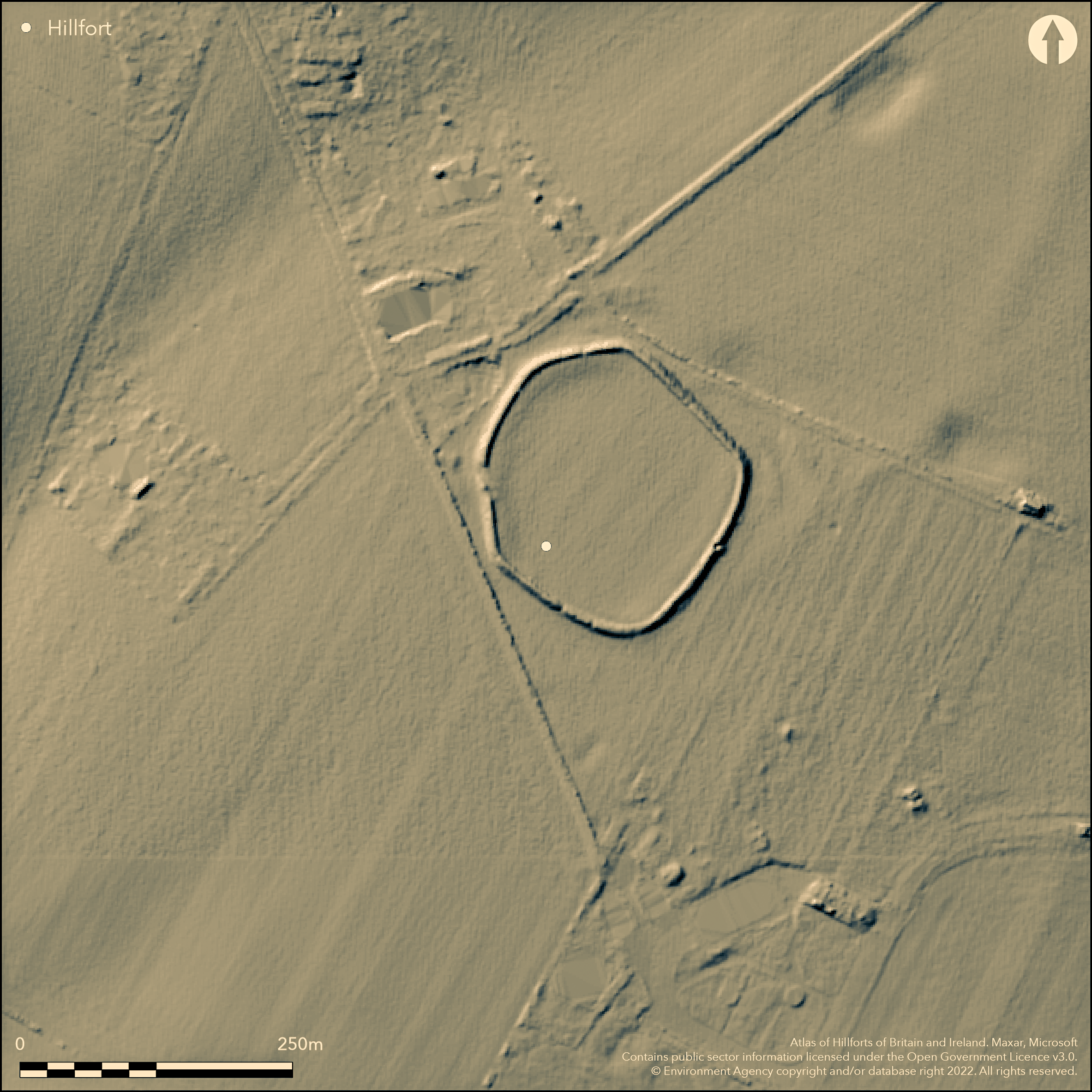
LiDAR 1m DTM Hillshade
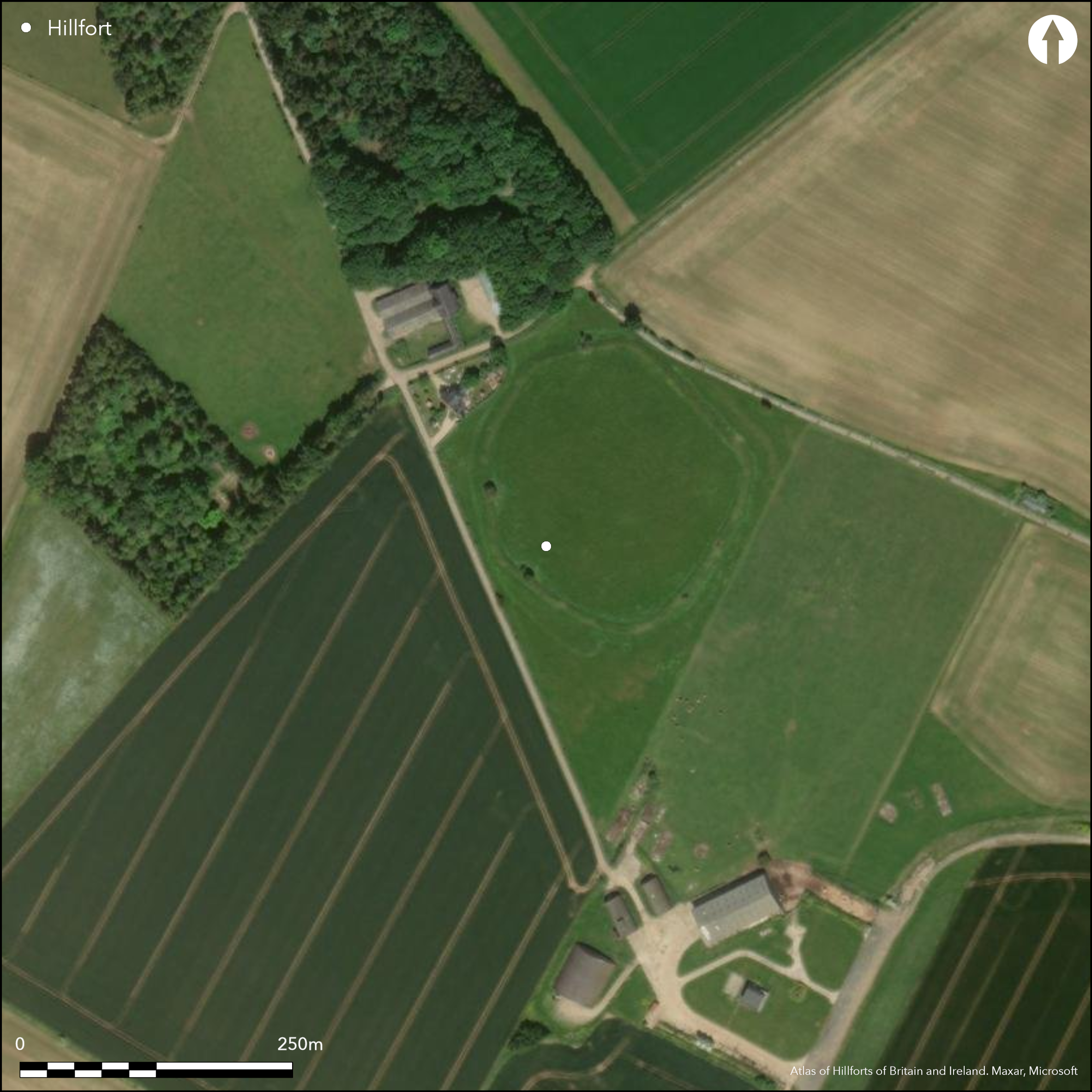
Satellite Imagery
LiDAR 1m DTM Hillshade
Satellite Imagery
Scroll left/right to view further images.
HER: Gloucestershire 332 (None)
NMR: SP 11 SE 3 (330012)
SM: 1003323
NGR: SP181123
X: 418100 Y: 212300 (OSGB36)
Univallate, nearly circular, contour hillfort located on highest point in area above River Leach to W on S Cotswold scarp. Sited in generally level area in position of no great strength. Possibly multivallate in past on basis of aerial photographic and antiquarian evidence, but plough damage for many years rendered site univallate. Single stony rampart with average outer height of 1.5m, and inner height of 0.9m, encloses 1.2ha. Ditch now buried feature but can be traced for a short distance around E angle of bank. Bank and ditch to NE plough levelled in before 1983. Ditch almost gone by 1914. Level interior raised 0.6m above exterior. Air photography confirms presence of outer ditch visible as cropmark and slight earthwork extending from N side around to E side of site. Entrance to W possibly out-turned. Geophysics shows scattered circular huts and pits with lines suggesting internal division and sub-enclosures. Further work in extra-mural area to S, found large clusters of pits. Possible metal working slag found 2009. On 1st Ed. OS map (1882). No excavation, no dating.
Citizen Science: ✓
Reliability of Data: Confirmed
Reliability of Interpretation: Confirmed
X: -193572 Y: 6765664 (EPSG: 3857)
Longitude: -1.738882439369696 Latitude: 51.809002908733405 (EPSG:4326)
Country: England
Current County or Unitary Authority: Gloucestershire
Historic County: Gloucestershire
Current Parish/Community/Council/Townland: Windrush
Plough and cattle damage for many years. Bank and ditch to NE plough levelled before 1983. Ditch almost gone 1914. Possibly multivallate in past.
| Extant | ✓ |
| Cropmark | ✗ |
| Likely Destroyed | ✗ |
None
| Woodland | ✗ |
| Commercial Forestry Plantation | ✗ |
| Parkland | ✗ |
| Pasture (Grazing) | ✓ |
| Arable | ✗ |
| Scrub/Bracken | ✗ |
| Bare Outcrop | ✗ |
| Heather/Moorland | ✗ |
| Heath | ✗ |
| Built-up | ✗ |
| Coastal Grassland | ✗ |
| Other | ✗ |
Univallate, nearly circular, contour hillfort located on the highest point in the area above River Leach to W on the S Cotswold scarp.
| Contour Fort | ✓ |
| Partial Contour Fort | ✗ |
| Promontory Fort | ✗ |
| Hillslope Fort | ✗ |
| Level Terrain Fort | ✗ |
| Marsh Fort | ✗ |
| Multiple Enclosure Fort | ✗ |
Located on Cotswold downland above the River Windrush to the north-east
| Hilltop | ✓ |
| Coastal Promontory | ✗ |
| Inland Promontory | ✗ |
| Valley Bottom | ✗ |
| Knoll/Hillock/Outcrop | ✗ |
| Ridge | ✗ |
| Cliff/Plateau-edge/Scarp | ✗ |
| Hillslope | ✗ |
| Lowland | ✗ |
| Spur | ✗ |
Dominant Topographic Feature: Hill top
| North | ✗ |
| Northeast | ✗ |
| East | ✗ |
| Southeast | ✗ |
| South | ✗ |
| Southwest | ✗ |
| West | ✗ |
| Northwest | ✗ |
| Level | ✓ |
Altitude: 180.0m
N/A
None
Reliability: D - None
| Pre 1200BC | ✗ |
| 1200BC - 800BC | ✗ |
| 800BC - 400BC | ✗ |
| 400BC - AD50 | ✗ |
| AD50 - AD400 | ✗ |
| AD400 - AD 800 | ✗ |
| Post AD800 | ✗ |
| Unknown | ✓ |
| Pre Hillfort: | None |
| Post Hillfort: | None |
Identified with the round camp at Winderedge, south of Sherborne (Windrush occurs as Wyndridge in a document of 1590), which John Aubrey (17th century) describes as being 160 paces diameter, enclosing 6 acres with "the works double", ploughed up on the S and E sides. By Playne's time (19th century) only a single bank and ditch remained, and by 1914 the ditch had virtually disappeared. On 1st Ed. OS map (1882). Magnetometer survey of entire site including the interior, defences and outermost margins (2.93ha in total area), A.J. Marshall 1995. Magnetic suceptibility survey, A.J. Marshall 2002. AML geophysics 1988, 1989.
| 1st Identified Written Reference (1590): | Windrush occurs as Wyndridge in a document - no details. |
| Geophysical Survey (1988): | AML |
| Geophysical Survey (1989): | AML |
| Geophysical Survey (1995): | A.J. Marshall. |
| Geophysical Survey (2002): | A.J. Marshall. |
| Other (None): | Aubrey reference. |
| Other (None): | Playne reference. |
Geophysics shows scattered circular huts and pits with lines suggesting internal division and sub-enclosures. Further work in extra-mural area to S, found large clusters of pits. Possible metal working slag found 2009.
None
| None | ✓ |
| Spring | ✗ |
| Stream | ✗ |
| Pool | ✗ |
| Flush | ✗ |
| Well | ✗ |
| Other | ✗ |
None
| No Known Features | ✓ |
| Round Stone Structures | ✗ |
| Rectangular Stone Structures | ✗ |
| Curvilinear Platforms | ✗ |
| Other Roundhouse Evidence | ✗ |
| Pits | ✗ |
| Quarry Hollows | ✗ |
| Other | ✗ |
None
| No Known Excavation | ✓ |
| Pits | ✗ |
| Postholes | ✗ |
| Roundhouses | ✗ |
| Rectangular Structures | ✗ |
| Roads/Tracks | ✗ |
| Quarry Hollows | ✗ |
| Other | ✗ |
| Nothing Found | ✗ |
Scattered circular huts and pits with lines suggesting internal division and sub-enclosures. Further work in extra-mural area to S, found large clusters of pits.
| No Known Geophysics | ✗ |
| Pits | ✓ |
| Roundhouses | ✓ |
| Rectangular Structures | ✗ |
| Roads/Tracks | ✗ |
| Quarry Hollows | ✗ |
| Other | ✓ |
| Nothing Found | ✗ |
Possible metal working slag found 2009.
| No Known Finds | ✗ |
| Pottery | ✗ |
| Metal | ✗ |
| Metalworking | ✓ |
| Human Bones | ✗ |
| Animal Bones | ✗ |
| Lithics | ✗ |
| Environmental | ✗ |
| Other | ✗ |
None
| APs Not Checked | ✓ |
| None | ✗ |
| Roundhouses | ✗ |
| Rectangular Structures | ✗ |
| Pits | ✗ |
| Postholes | ✗ |
| Roads/Tracks | ✗ |
| Other | ✗ |
Entrance on W damaged, consisting of 9m gap break possibly out-turned on S side.
| 1: | None |
| 2: | None |
Guard Chambers: ✗
Chevaux de Frise: ✗
| 1. Out-turned (West): | 9m gap break possibly out-turned on S side. |
Possibly multivallate in past on the basis of aerial photographic and antiquarian evidence, but plough damage for many years rendered site univallate. Single stony rampart with average outer height of 1.5m, and inner height of 0.9m. Ditch now buried feature but can be traced for a short distance around E angle of bank. Bank and ditch to NE plough levelled in before 1983. Ditch almost gone by 1914. Level interior raised 0.6m above the exterior. Air photography confirms the presence of outer ditch visible as cropmark and slight earthwork extending from the N side around to E side of the hillfort.
| Area 1: | 1.2ha. |
| Total: | 1.2ha. |
Total Footprint Area: Noneha.
None
| ✗ | None |
| ✓ | None |
| NE Quadrant: | 1 |
| SE Quadrant: | 1 |
| SW Quadrant: | 1 |
| NW Quadrant: | 1 |
| Total: | 1 |
| Partial Univallate | ✗ |
| Univallate | ✓ |
| Partial Bivallate | ✗ |
| Bivallate | ✗ |
| Partial Multivallate | ✗ |
| Multivallate | ✗ |
| Unknown | ✗ |
| Partial Univallate | ✗ |
| Univallate | ✗ |
| Partial Bivallate | ✗ |
| Bivallate | ✗ |
| Partial Multivallate | ✗ |
| Multivallate | ✗ |
None
| None | ✗ |
| Earthen Bank | ✓ |
| Stone Wall | ✗ |
| Rubble | ✓ |
| Wall-walk | ✗ |
| Evidence of Timber | ✗ |
| Vitrification | ✗ |
| Other Burning | ✗ |
| Palisade | ✗ |
| Counter Scarp Bank | ✗ |
| Berm | ✗ |
| Unfinished | ✗ |
| Other | ✗ |
None
| None | ✗ |
| Earthen Bank | ✗ |
| Stone Wall | ✗ |
| Murus Duplex | ✗ |
| Timber-framed | ✗ |
| Timber-laced | ✗ |
| Vitrification | ✗ |
| Other Burning | ✗ |
| Palisade | ✗ |
| Counter Scarp Bank | ✗ |
| Berm | ✗ |
| Unfinished | ✗ |
| No Known Excavation | ✓ |
| Other | ✗ |
| ✗ | None |
| ✓ | Ditch almost gone. |
Number of Ditches: 1
| ✗ | None |
Aubrey, J. 17th century. Monumenta Britannica, John Aubrey (1626-97), parts one and two, edited by John Fowles, annotated by Rodney Legg 1980.
Camden, W., enlarged by Richard Gough 1806. Britannia: or , a chronological description of the flourishing kingdoms of England, Scotland and Island and the islands adjacent; from the earliest antiquity.
Marshall, A. 1996 Trans Bristol Gloucestershire Archaeol Soc., 114; 170-185.
Marshall, A J. 2002. SUMMARY OF GEOPHYSICAL SURVEY UNDERTAKEN AT WINDRUSH HILLFORT, WINDRUSH, GLOS. Unpublished.
RCHME 1976. Ancient and historical monuments in the County of Gloucestershire, Vol. I: Iron Age and Romano- British monuments in Gloucestershire Cotswolds, London: HMSO, 130.
Verey, D. 1970. Gloucestershire I: the Cotswolds, The Buildings of England, London: Penguin Books, 480.
Atlas of Hillforts:
Wikidata:
This work is licensed under CC BY-SA 4.0

 and should be cited as:
Lock, Gary and Ralston, Ian. 2024. Atlas of Hillforts of Britain and Ireland. Available at: https://hillforts.arch.ox.ac.uk
Document Version 1.1