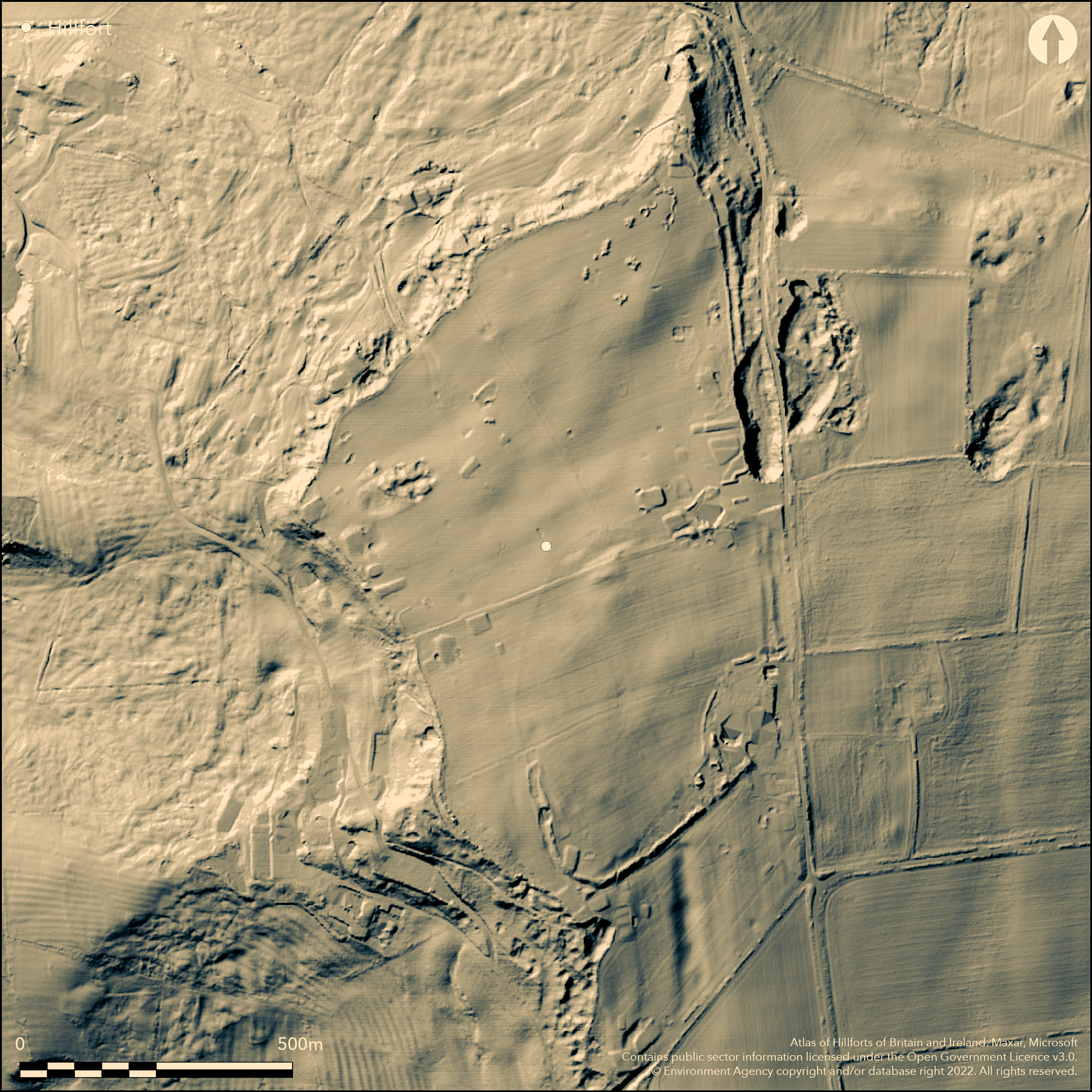
LiDAR 1m DTM Hillshade
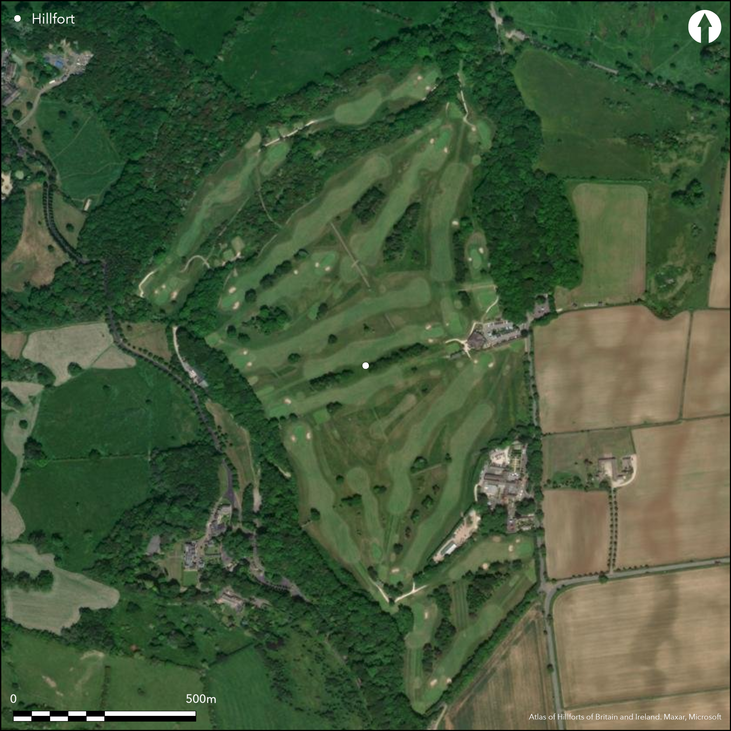
Satellite Imagery
LiDAR 1m DTM Hillshade
Satellite Imagery
Scroll left/right to view further images.
HER: Gloucestershire 333 (None)
NMR: SP 13 NW 9 (330616)
SM: 1003815; 1003327
NGR: SP117383
X: 411700 Y: 238300 (OSGB36)
Large, partial contour, part bivallate, hillfort located on N-facing Cotswold spur of Willersey Hill. Encloses 28ha. Steep surrounding slopes to N and W, moderate to E and S along spur ridge. Two banks and ditch to W and single bank and ditch to S and E, strong in places. Seemingly, natural defence on N, but here traces of bank suggested, but much disturbed by quarrying and slumping makes interpretation difficult. Two close-set banks with ditch between Inner bank, set along highest part of summit of hill to SW, rises to nearly 1m above interior and just over 2m above present surface at bottom of ditch. Outer bank stands c. 1m above exterior with outer ditch not visible. S defined only by inner bank, to nearly 2m high and skirting head of narrow combe. Bivallate E side drops N from summit down a slope. Possible ditch inside rampart on SE. Original entrances cannot be identified. Iron Age pottery found in 1987 with human bone and flints. Geophysical survey and small-scale excavation (no details). Undated inhumations and other features located outside enclosed area. Neolitihc long barrow in interior. Much reduced by cultivation and construction of golf course (Broadway Golf Club). On 1st Ed. OS map (1885).
Citizen Science: ✗
Reliability of Data: Confirmed
Reliability of Interpretation: Confirmed
X: -203808 Y: 6807893 (EPSG: 3857)
Longitude: -1.8308358540597531 Latitude: 52.04293720274214 (EPSG:4326)
Country: England; None
Current County or Unitary Authority: Gloucestershire; Worcestershire
Historic County: Gloucestershire; Worcestershire
Current Parish/Community/Council/Townland: Willersey; Broadway
By 1875 much reduced by cultivation. Damaged by golf course construction in 1970's, especially to outer E bank and SW corner, and quarrying.
| Extant | ✓ |
| Cropmark | ✗ |
| Likely Destroyed | ✗ |
Golf course (Broadway Golf Club) and quarrying.
| Woodland | ✗ |
| Commercial Forestry Plantation | ✗ |
| Parkland | ✓ |
| Pasture (Grazing) | ✗ |
| Arable | ✗ |
| Scrub/Bracken | ✗ |
| Bare Outcrop | ✗ |
| Heather/Moorland | ✗ |
| Heath | ✗ |
| Built-up | ✗ |
| Coastal Grassland | ✗ |
| Other | ✓ |
Large partial contour , part bivallate, hillfort located on N-facing Cotswold spur of Willersey Hill
| Contour Fort | ✗ |
| Partial Contour Fort | ✓ |
| Promontory Fort | ✗ |
| Hillslope Fort | ✗ |
| Level Terrain Fort | ✗ |
| Marsh Fort | ✗ |
| Multiple Enclosure Fort | ✗ |
Escarpment of hill gives steep natural defence to the north
| Hilltop | ✗ |
| Coastal Promontory | ✗ |
| Inland Promontory | ✗ |
| Valley Bottom | ✗ |
| Knoll/Hillock/Outcrop | ✗ |
| Ridge | ✗ |
| Cliff/Plateau-edge/Scarp | ✗ |
| Hillslope | ✗ |
| Lowland | ✗ |
| Spur | ✓ |
Dominant Topographic Feature: Spur
| North | ✗ |
| Northeast | ✗ |
| East | ✗ |
| Southeast | ✗ |
| South | ✗ |
| Southwest | ✗ |
| West | ✗ |
| Northwest | ✓ |
| Level | ✗ |
Altitude: 260.0m
Located within Gloucestershire (Cotswold District and Willersey Parish) and Worcestershire (Wychavon District and Broadway Parish.)
Boundary Type: County
Surface finds of middle Iron Age pottery in Cheltenham Museum.
Reliability: C - Low
| Pre 1200BC | ✗ |
| 1200BC - 800BC | ✗ |
| 800BC - 400BC | ✗ |
| 400BC - AD50 | ✓ |
| AD50 - AD400 | ✗ |
| AD400 - AD 800 | ✗ |
| Post AD800 | ✗ |
| Unknown | ✗ |
| Pre Hillfort: | None |
| Post Hillfort: | None |
| Artefactual: | None |
In Aubrey's Monumenta Britannica (1665-1693). Reference by S. Rudder 1779. On 1st Ed. OS map (1885). Watching Brief 1978. Excavation J. Wills, 1987, Watching Brief, G. Walker 1990 (no details). Geophysical survey Stratascan 1997. Air Photograph Interpretation English Heritage: Gloucestershire NMP (North Cotswolds and Forest of Dean) 2002-2006.
| 1st Identified Map Depiction (1885): | OS map. |
| Other (1978): | Watching Brief. |
| Excavation (1987): | J.Wills. |
| Other (1990): | G. Walker. |
| Geophysical Survey (1997): | Stratascan. |
| 1st Identified Written Reference (None): | None |
| Other (None): | English Heritage. |
Survey of five areas of proposed woodland planting within hillfort showed evidence for continuation of ramparts to N of hotel and possible settlement site in NW corner. Middle Iron Age pottery found with human bone and flints.
None
| None | ✓ |
| Spring | ✗ |
| Stream | ✗ |
| Pool | ✗ |
| Flush | ✗ |
| Well | ✗ |
| Other | ✗ |
None
| No Known Features | ✓ |
| Round Stone Structures | ✗ |
| Rectangular Stone Structures | ✗ |
| Curvilinear Platforms | ✗ |
| Other Roundhouse Evidence | ✗ |
| Pits | ✗ |
| Quarry Hollows | ✗ |
| Other | ✗ |
None
| No Known Excavation | ✗ |
| Pits | ✗ |
| Postholes | ✗ |
| Roundhouses | ✗ |
| Rectangular Structures | ✗ |
| Roads/Tracks | ✗ |
| Quarry Hollows | ✗ |
| Other | ✗ |
| Nothing Found | ✓ |
Survey of five areas of proposed woodland planting within hillfort showed evidence for continuation of ramparts to N of hotel and possible settlement site in NW corner.
| No Known Geophysics | ✗ |
| Pits | ✗ |
| Roundhouses | ✗ |
| Rectangular Structures | ✗ |
| Roads/Tracks | ✗ |
| Quarry Hollows | ✗ |
| Other | ✓ |
| Nothing Found | ✗ |
Middle Iron Age pottery found with human bone and flints.
| No Known Finds | ✗ |
| Pottery | ✓ |
| Metal | ✗ |
| Metalworking | ✗ |
| Human Bones | ✓ |
| Animal Bones | ✗ |
| Lithics | ✓ |
| Environmental | ✗ |
| Other | ✗ |
None
| APs Not Checked | ✓ |
| None | ✗ |
| Roundhouses | ✗ |
| Rectangular Structures | ✗ |
| Pits | ✗ |
| Postholes | ✗ |
| Roads/Tracks | ✗ |
| Other | ✗ |
Original entrances cannot be identified.
| 0: | None |
| 2: | None |
Guard Chambers: ✗
Chevaux de Frise: ✗
Two banks and ditch to W and single bank and ditch to S and E, strong in places. Seemingly, natural defence on N, but here traces of bank have been suggested, but much disturbed by quarrying and slumping makes interpretation difficult. Two close-set banks with ditch between Inner bank, set along highest part of summit of hill to SW, rises to nearly 1m above interior and just over 2m above present surface at bottom of ditch. Outer bank stands c. 1m above exterior with outer ditch not visible. S defined only by inner bank, to nearly 2m high and skirting head of a narrow combe. Bivallate E side drops N from summit down a slope. Possible ditch inside rampart on SE.
| Area 1: | 28.0ha. |
| Total: | 28.0ha. |
Total Footprint Area: Noneha.
None
| ✗ | None |
| ✓ | None |
| NE Quadrant: | 1 |
| SE Quadrant: | 1 |
| SW Quadrant: | 2 |
| NW Quadrant: | 2 |
| Total: | 2 |
| Partial Univallate | ✓ |
| Univallate | ✗ |
| Partial Bivallate | ✓ |
| Bivallate | ✗ |
| Partial Multivallate | ✗ |
| Multivallate | ✗ |
| Unknown | ✗ |
| Partial Univallate | ✗ |
| Univallate | ✗ |
| Partial Bivallate | ✗ |
| Bivallate | ✗ |
| Partial Multivallate | ✗ |
| Multivallate | ✗ |
None
| None | ✗ |
| Earthen Bank | ✓ |
| Stone Wall | ✗ |
| Rubble | ✗ |
| Wall-walk | ✗ |
| Evidence of Timber | ✗ |
| Vitrification | ✗ |
| Other Burning | ✗ |
| Palisade | ✗ |
| Counter Scarp Bank | ✗ |
| Berm | ✗ |
| Unfinished | ✗ |
| Other | ✗ |
Excavation in advance of construction of golf clubhouse 1987 revealed substantial boundary ditch 3.3m wide and 1.3m deep. This was of two phases, thought to represent N side of an inner enclosure visible on aerial photographs. Finds from ditch few, but included fragments of shell-tempered pottery.
| None | ✗ |
| Earthen Bank | ✗ |
| Stone Wall | ✗ |
| Murus Duplex | ✗ |
| Timber-framed | ✗ |
| Timber-laced | ✗ |
| Vitrification | ✗ |
| Other Burning | ✗ |
| Palisade | ✗ |
| Counter Scarp Bank | ✗ |
| Berm | ✗ |
| Unfinished | ✗ |
| No Known Excavation | ✗ |
| Other | ✓ |
| ✗ | None |
| ✓ | None |
Number of Ditches: 2
| ✗ | None |
Barker P.P. 1997. GEOPHYSICAL SURVEY AT BROADWAY GOLF CLUB, BROADWAY, WORCESTERSHIRE, STRATASCAN 1210.
RCHME 1976. Ancient and historical monuments in the County of Gloucestershire, Vol. I: Iron Age and Romano- British monuments in Gloucestershire Cotswolds, London: HMSO, 107.
Rudder, S. 1779. A new history of Gloucestershire, Cirencester: Author, 823.
Stoertz, C. 2012. The North Cotswolds: a highlight report for the National Mapping Programme, Report No 17-2012, Centre for Archaeology.
Atlas of Hillforts:
Wikidata:
This work is licensed under CC BY-SA 4.0

 and should be cited as:
Lock, Gary and Ralston, Ian. 2024. Atlas of Hillforts of Britain and Ireland. Available at: https://hillforts.arch.ox.ac.uk
Document Version 1.1