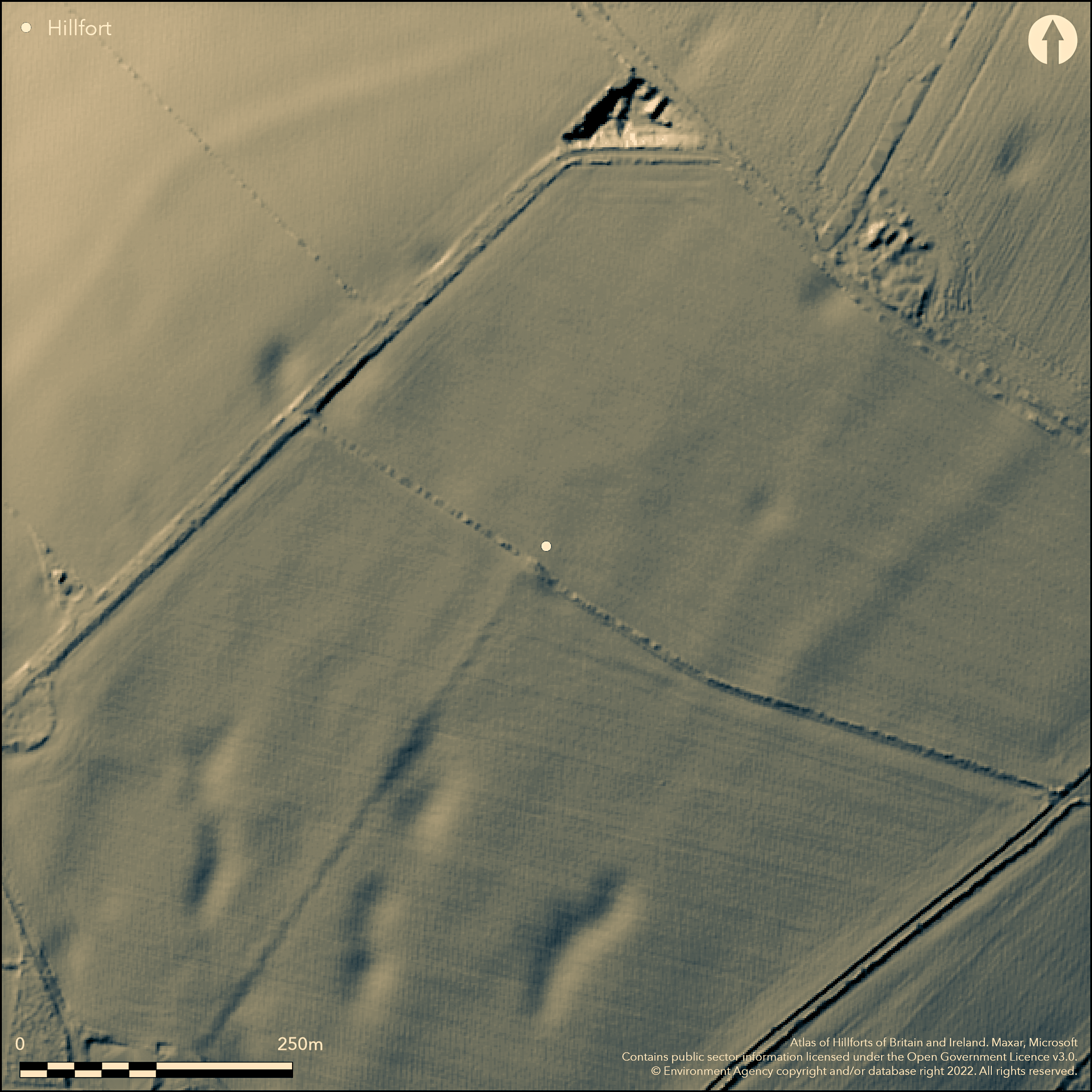
LiDAR 1m DTM Hillshade
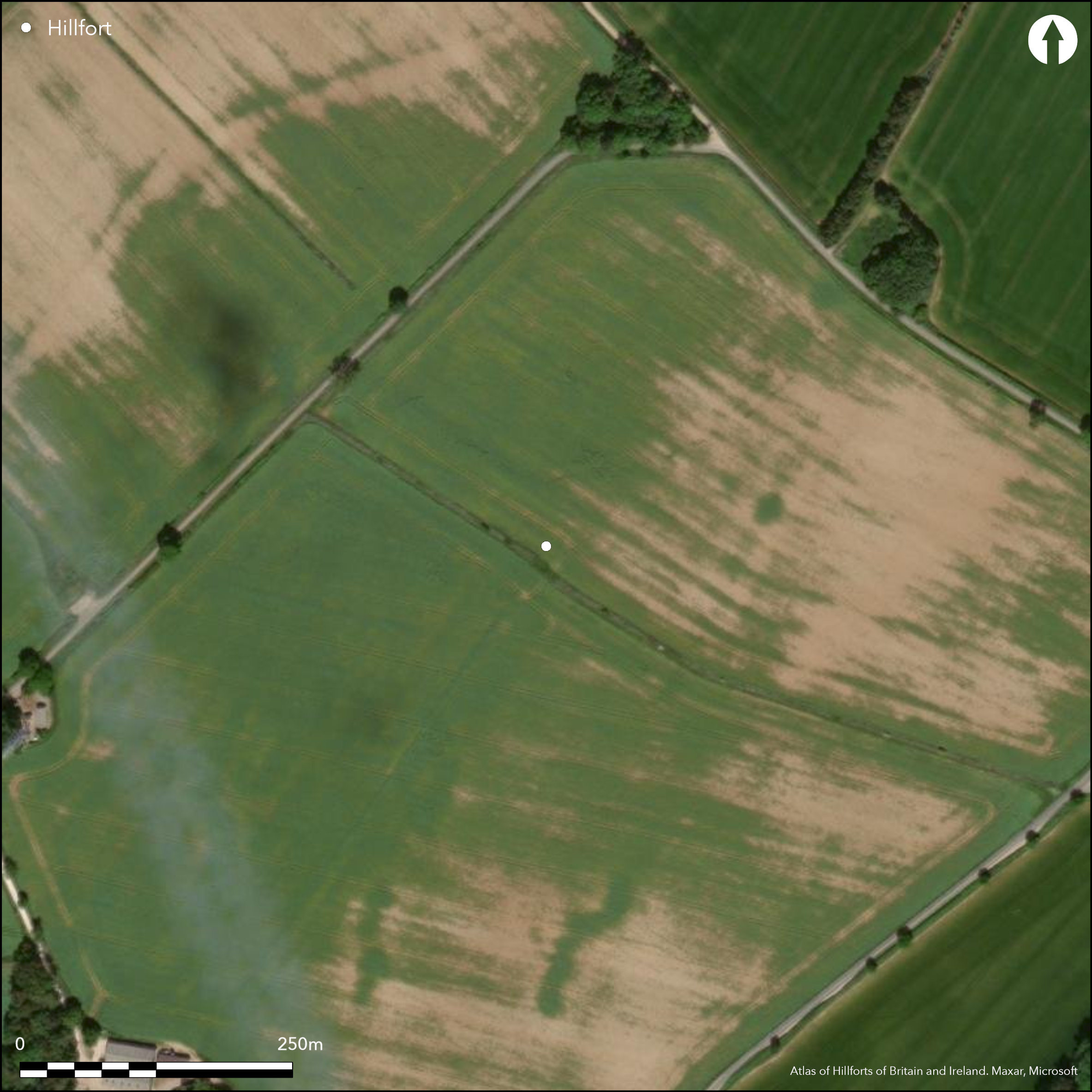
Satellite Imagery
LiDAR 1m DTM Hillshade
Satellite Imagery
Scroll left/right to view further images.
HER: Gloucestershire 358 (None)
NMR: SP 22 SW 1 (332646)
SM: 1003342
NGR: SP205230
X: 420500 Y: 223000 (OSGB36)
Formerly circular possible univallate partial contour hillfort located on NW-facing spur of Cotswold escarpment above streams flowing into River Evenlode on E and streams flowing into River Dikler to W. Steep surrounding slopes on all side apart from moderate on spur ridge to SW. N and NW sides, once visible, now almost ploughed out. No trace of ditch visible, but can be seen on aerial photographs on N, SE, S, NW. Not possible to establish the original enclosed area. Very narrow ditch, possibly palisade trench, visible within perimeter along N side and the interrupted E and S. NW side on the OS 2" MSS of 1816, but by mid 19th century site almost gone. Surviving traces of bank 9m wide, under 0.3m high for c. 713m in arable fields along N and NW sides of hill only. No evidence of rampart in 1975 Watching Brief (Saville 1978). Because of discontinuous ditches has been suggested as outer circuit of causewayed enclosure with inner some way to NW, however, these features now thought of geological origin. But the exact nature of the site has been questioned, possible hillfort or Neolithic enclosure.
Citizen Science: ✗
Reliability of Data: Confirmed
Reliability of Interpretation: Unconfirmed
X: -189626 Y: 6782989 (EPSG: 3857)
Longitude: -1.7034397035838444 Latitude: 51.90512394504583 (EPSG:4326)
Country: England
Current County or Unitary Authority: Gloucestershire
Historic County: Gloucestershire
Current Parish/Community/Council/Townland: Icomb
Nearly destroyed by ploughing. Traces of bank 9m wide by under 0.3m high for c. 713m in arable fields along N and NW sides of hill only.
| Extant | ✓ |
| Cropmark | ✓ |
| Likely Destroyed | ✓ |
None
| Woodland | ✗ |
| Commercial Forestry Plantation | ✗ |
| Parkland | ✗ |
| Pasture (Grazing) | ✓ |
| Arable | ✗ |
| Scrub/Bracken | ✗ |
| Bare Outcrop | ✗ |
| Heather/Moorland | ✗ |
| Heath | ✗ |
| Built-up | ✗ |
| Coastal Grassland | ✗ |
| Other | ✗ |
Formerly circular univallate partial contour hillfort located on NE-facing spur of Cotswold escarpment above streams flowing into River Evenlode on E and streams flowing into River Dikler to W.
| Contour Fort | ✗ |
| Partial Contour Fort | ✓ |
| Promontory Fort | ✗ |
| Hillslope Fort | ✗ |
| Level Terrain Fort | ✗ |
| Marsh Fort | ✗ |
| Multiple Enclosure Fort | ✗ |
Sited on east facing slopes on Icomb Hill, prominent above the River Evenlode valley
| Hilltop | ✗ |
| Coastal Promontory | ✗ |
| Inland Promontory | ✗ |
| Valley Bottom | ✗ |
| Knoll/Hillock/Outcrop | ✗ |
| Ridge | ✗ |
| Cliff/Plateau-edge/Scarp | ✗ |
| Hillslope | ✗ |
| Lowland | ✗ |
| Spur | ✓ |
Dominant Topographic Feature: Spur
| North | ✗ |
| Northeast | ✓ |
| East | ✗ |
| Southeast | ✗ |
| South | ✗ |
| Southwest | ✗ |
| West | ✗ |
| Northwest | ✗ |
| Level | ✗ |
Altitude: 230.0m
N/A
Possible Iron Age pottery chance finds.
Reliability: D - None
| Pre 1200BC | ✗ |
| 1200BC - 800BC | ✗ |
| 800BC - 400BC | ✗ |
| 400BC - AD50 | ✗ |
| AD50 - AD400 | ✗ |
| AD400 - AD 800 | ✗ |
| Post AD800 | ✗ |
| Unknown | ✓ |
| Pre Hillfort: | Linear dyke of possible later prehistoric date located on hill-top and flints found. |
| Post Hillfort: | None |
On I. Taylor map of Gloucestershire 1777. First reference 1803 - no details. Late 18th century map shows site as irregular oval enclosure. (Possibly as delineated on the Record 6" map). NW side on the OS 2" MSS of 1816. Watching briefs1975. RCHME survey 1997.
| 1st Identified Map Depiction (1777): | I. Taylor map of Gloucestershire. |
| 1st Identified Written Reference (1803): | No details. |
| Other (1816): | OS 2" MSS. |
| Other (1975): | Watching Brief. |
| Other (1997): | RCHME survey |
| Other (None): | Possibly as delineated on the Record 6" map |
Three featureless sherds of coarse handmade pottery, found over E end of bank (in Glos City Museum).
None
| None | ✓ |
| Spring | ✗ |
| Stream | ✗ |
| Pool | ✗ |
| Flush | ✗ |
| Well | ✗ |
| Other | ✗ |
None
| No Known Features | ✓ |
| Round Stone Structures | ✗ |
| Rectangular Stone Structures | ✗ |
| Curvilinear Platforms | ✗ |
| Other Roundhouse Evidence | ✗ |
| Pits | ✗ |
| Quarry Hollows | ✗ |
| Other | ✗ |
None
| No Known Excavation | ✓ |
| Pits | ✗ |
| Postholes | ✗ |
| Roundhouses | ✗ |
| Rectangular Structures | ✗ |
| Roads/Tracks | ✗ |
| Quarry Hollows | ✗ |
| Other | ✗ |
| Nothing Found | ✗ |
None
| No Known Geophysics | ✓ |
| Pits | ✗ |
| Roundhouses | ✗ |
| Rectangular Structures | ✗ |
| Roads/Tracks | ✗ |
| Quarry Hollows | ✗ |
| Other | ✗ |
| Nothing Found | ✗ |
Three featureless sherds of coarse handmade pottery, found over E end of bank (in Glos City Museum). Flints chance finds.
| No Known Finds | ✗ |
| Pottery | ✓ |
| Metal | ✗ |
| Metalworking | ✗ |
| Human Bones | ✗ |
| Animal Bones | ✗ |
| Lithics | ✗ |
| Environmental | ✗ |
| Other | ✗ |
None
| APs Not Checked | ✓ |
| None | ✗ |
| Roundhouses | ✗ |
| Rectangular Structures | ✗ |
| Pits | ✗ |
| Postholes | ✗ |
| Roads/Tracks | ✗ |
| Other | ✗ |
Entrances destroyed, but possible E entrance, type not certain. Burrow (1919) suggested entrance flanked by large stones - no details.
| 0: | None |
| 2: | None |
Guard Chambers: ✗
Chevaux de Frise: ✗
| 1. Simple Gap (East): | Type not certain. Simple gap default. |
N and NW sides, once visible, now almost ploughed out. No trace of ditch visible, but can be seen on aerial photographs on N, SE, S, NW. Very narrow ditch, possibly palisade trench, visible within perimeter along N side and the interrupted E and S. Surviving traces of bank 9m wide by under 0.3m high for c. 713m in arable fields along N and NW sides of hill only.
| Area 1: | Noneha. |
| Total: | Noneha. |
Total Footprint Area: Noneha.
None
| ✗ | Area not defined. |
| ✗ | None |
| NE Quadrant: | 1 |
| SE Quadrant: | 0 |
| SW Quadrant: | 0 |
| NW Quadrant: | 1 |
| Total: | 1 |
| Partial Univallate | ✓ |
| Univallate | ✗ |
| Partial Bivallate | ✗ |
| Bivallate | ✗ |
| Partial Multivallate | ✗ |
| Multivallate | ✗ |
| Unknown | ✗ |
| Partial Univallate | ✗ |
| Univallate | ✗ |
| Partial Bivallate | ✗ |
| Bivallate | ✗ |
| Partial Multivallate | ✗ |
| Multivallate | ✗ |
Very narrow ditch, possibly palisade trench, visible within perimeter along N side and the interrupted E and S. NW.
| None | ✗ |
| Earthen Bank | ✓ |
| Stone Wall | ✗ |
| Rubble | ✗ |
| Wall-walk | ✗ |
| Evidence of Timber | ✗ |
| Vitrification | ✗ |
| Other Burning | ✗ |
| Palisade | ✓ |
| Counter Scarp Bank | ✗ |
| Berm | ✗ |
| Unfinished | ✗ |
| Other | ✗ |
None
| None | ✗ |
| Earthen Bank | ✗ |
| Stone Wall | ✗ |
| Murus Duplex | ✗ |
| Timber-framed | ✗ |
| Timber-laced | ✗ |
| Vitrification | ✗ |
| Other Burning | ✗ |
| Palisade | ✗ |
| Counter Scarp Bank | ✗ |
| Berm | ✗ |
| Unfinished | ✗ |
| No Known Excavation | ✓ |
| Other | ✗ |
| ✗ | None |
| ✓ | No trace of ditch on the ground, but can be seen on aerial photographs on N, SE, S, NW. Now buried feature. |
Number of Ditches: 1
| ✗ | None |
Burrow, E.J. 1919.The ancient entrenchments and camps of Gloucestershire, Cheltenham: E.J. Burrow, 96.
RCHME 1976. Ancient and historical monuments in the County of Gloucestershire, Vol. I: Iron Age and Romano- British monuments in Gloucestershire Cotswolds, London: HMSO, 66-7.
Saville, A. 1978. Excavations at Icomb Hill, Trans Bristol Gloucestershire Archaeol Soc, 96, 27-31.
Witts, G.B. 1883. Archaeological handbook of the County of Gloucestershire, Cheltenham: Norman Brothers, 27-8.
Atlas of Hillforts:
Wikidata:
This work is licensed under CC BY-SA 4.0

 and should be cited as:
Lock, Gary and Ralston, Ian. 2024. Atlas of Hillforts of Britain and Ireland. Available at: https://hillforts.arch.ox.ac.uk
Document Version 1.1