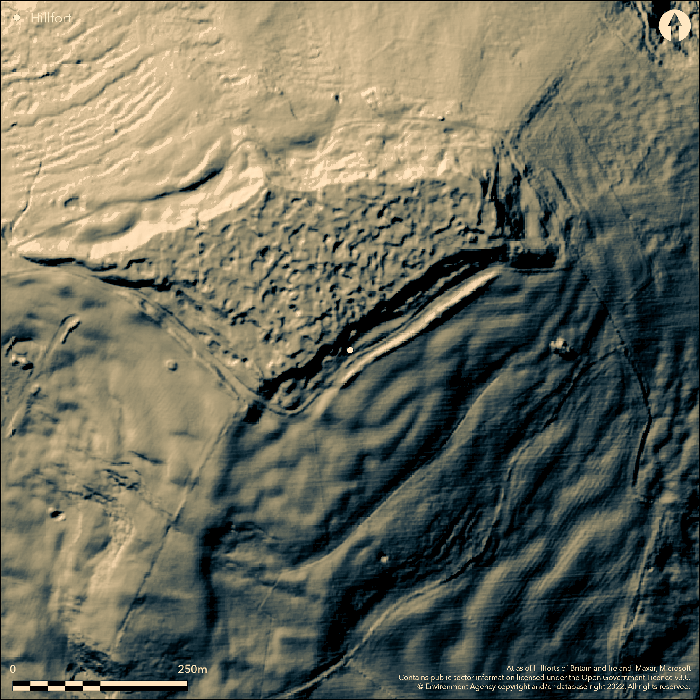
LiDAR 1m DTM Hillshade
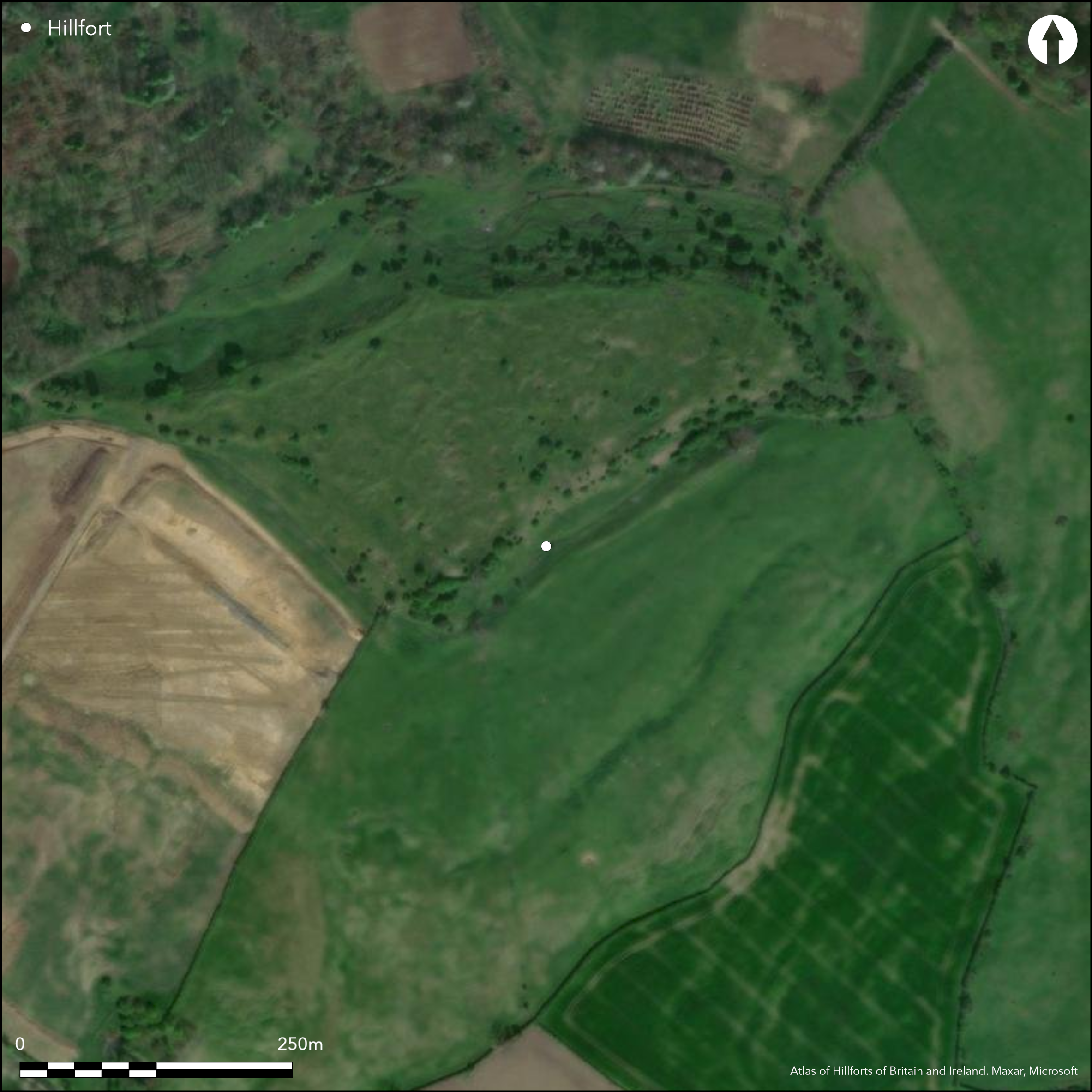
Satellite Imagery
LiDAR 1m DTM Hillshade
Satellite Imagery
Scroll left/right to view further images.
HER: Gloucestershire 426 (None)
NMR: SO 93 Se 5 (11792)
SM: 1004873
NGR: SO973313
X: 397300 Y: 231300 (OSGB36)
Possible, but disputed, contour hillfort sited on summit of prominent Oxenton Hill on Oolitic Limestone of the Cotswold scarp N of Cleeve Hill. Inner part of site formed by the small outcrop of Oolitic limestone, c. 135m by 210m. Any vestiges of enclosure probably obliterated by extensive quarrying, and veracity as a hillfort much disputed. Enclosed area possibly 2.8ha. Possibly just a natural feature made incoherent by quarrying, or, as aerial photographs possibly indicate, earthworks of scarps and banks on the SE and SW sides, which, although mutilated by quarrying, could form defensive coherent linear features. Clearly, considerable activity on the hill, at least since Iron Age. In 1932 T.G.E. Powell excavated a nearly 2m high 'mound' in interior and fragments of Hallstatt and mid La Tene pottery found, now in Cheltenham Museum. Iron Age 'duck stamped' pottery also found in limited excavations, now in Birmingham City Museum. Much Iron Age pottery in rabbit scrapes. Two round barrows suggested, but also questioned. There is an all-round scarp, with, on SE and SW, strong banks, but no ditches, to c. 3m high, of uncertain origin; could be natural outcrop, c. 6m below, with extensive quarrying immediately downhill. To extreme W The Knoll forms a long bank-like ridge cut into by quarries. A possible hillfort or some form of unenclosed settlement. On 1st Ed. OS map (1884-5).
Citizen Science: ✓
Reliability of Data: Unconfirmed
Reliability of Interpretation: Unconfirmed
X: -227174 Y: 6796531 (EPSG: 3857)
Longitude: -2.040735915886216 Latitude: 51.98011553982284 (EPSG:4326)
Country: England; None
Current County or Unitary Authority: Gloucestershire
Historic County: Gloucestershire
Current Parish/Community/Council/Townland: Oxenton; Alderton
Much quarrying and general damage.
| Extant | ✓ |
| Cropmark | ✗ |
| Likely Destroyed | ✓ |
Upland pasture/moorland and scrub. Quarrying.
| Woodland | ✗ |
| Commercial Forestry Plantation | ✗ |
| Parkland | ✗ |
| Pasture (Grazing) | ✓ |
| Arable | ✗ |
| Scrub/Bracken | ✓ |
| Bare Outcrop | ✗ |
| Heather/Moorland | ✓ |
| Heath | ✗ |
| Built-up | ✗ |
| Coastal Grassland | ✗ |
| Other | ✓ |
Contour hillfort sited on summit of prominent Oxenton Hill on Oolitic Limestone of the Cotswold scarp N of Cleeve Hill.
| Contour Fort | ✓ |
| Partial Contour Fort | ✗ |
| Promontory Fort | ✗ |
| Hillslope Fort | ✗ |
| Level Terrain Fort | ✗ |
| Marsh Fort | ✗ |
| Multiple Enclosure Fort | ✗ |
Located on a steep scarrp of Oolitic Limestone
| Hilltop | ✓ |
| Coastal Promontory | ✗ |
| Inland Promontory | ✗ |
| Valley Bottom | ✗ |
| Knoll/Hillock/Outcrop | ✗ |
| Ridge | ✗ |
| Cliff/Plateau-edge/Scarp | ✗ |
| Hillslope | ✗ |
| Lowland | ✗ |
| Spur | ✗ |
Dominant Topographic Feature: Hill top
| North | ✗ |
| Northeast | ✗ |
| East | ✗ |
| Southeast | ✗ |
| South | ✗ |
| Southwest | ✗ |
| West | ✗ |
| Northwest | ✗ |
| Level | ✓ |
Altitude: 223.0m
Boundary Type: Parish/Townland
In 1932 T.G.E. Powell excavated a nearly 2m high mound in the interior and fragments of Hallstatt and mid La Tene pottery found, now in Cheltenham Museum; including 'duck-stamped' pottery.
Reliability: B - Medium
| Pre 1200BC | ✗ |
| 1200BC - 800BC | ✗ |
| 800BC - 400BC | ✓ |
| 400BC - AD50 | ✓ |
| AD50 - AD400 | ✗ |
| AD400 - AD 800 | ✗ |
| Post AD800 | ✗ |
| Unknown | ✗ |
| Pre Hillfort: | None |
| Post Hillfort: | None |
| Artefactual: | Pottery evidence. |
On 1st Ed. OS map (1884-5). Exvcavation, T.G.E. Powell, 1932. Aerial photograph interpretation, RCHME Primary Record Project, 1992-96. Aerial photograph interpretation, English Heritage Cotswolds NMP (N Cotswolds and Forest of Dean), 2002-2006.
| Excavation (1932): | T.G.E. Powell |
| 1st Identified Map Depiction (None): | OS map. |
| Other (None): | Aerial photograph interpretation, RCHME Primary Record Project. |
| Other (None): | Aerial photograph interpretation, English Heritage Cotswolds NMP (N Cotswolds and Forest of Dean). |
In 1932 T.G.E. Powell excavated a nearly 2m high 'mound' in the interior and fragments of Hallstatt and mid La Tene pottery found, now in Cheltenham Museum. Iron Age 'duck stamped' pottery also found in limited excavations, now in Birmingham City Museum. Briquetage salt containers, bone pin and a bone point have also found in the Oxenton Collection in Cheltenham Museum. Much quarry damage to interior mitigates against interpretation.
None
| None | ✓ |
| Spring | ✗ |
| Stream | ✗ |
| Pool | ✗ |
| Flush | ✗ |
| Well | ✗ |
| Other | ✗ |
Much quarry damage to interior mitigates against interpretation.
| No Known Features | ✓ |
| Round Stone Structures | ✗ |
| Rectangular Stone Structures | ✗ |
| Curvilinear Platforms | ✗ |
| Other Roundhouse Evidence | ✗ |
| Pits | ✗ |
| Quarry Hollows | ✗ |
| Other | ✗ |
None
| No Known Excavation | ✗ |
| Pits | ✗ |
| Postholes | ✗ |
| Roundhouses | ✗ |
| Rectangular Structures | ✗ |
| Roads/Tracks | ✗ |
| Quarry Hollows | ✗ |
| Other | ✗ |
| Nothing Found | ✓ |
None
| No Known Geophysics | ✓ |
| Pits | ✗ |
| Roundhouses | ✗ |
| Rectangular Structures | ✗ |
| Roads/Tracks | ✗ |
| Quarry Hollows | ✗ |
| Other | ✗ |
| Nothing Found | ✗ |
In 1932 T.G.E. Powell excavated a nearly 2m high mound in the interior and fragments of Hallstatt and mid La Tene pottery found, now in Cheltenham Museum. Iron Age 'duck stamped' pottery also found in limited excavations, now in Birmingham City Museum. Briquetage salt containers, bone pin and a bone point have also found in the Oxenton Collection in Cheltenham Museum.
| No Known Finds | ✗ |
| Pottery | ✓ |
| Metal | ✗ |
| Metalworking | ✗ |
| Human Bones | ✗ |
| Animal Bones | ✓ |
| Lithics | ✗ |
| Environmental | ✗ |
| Other | ✗ |
Much quarry damage to interior mitigates against interpretation.
| APs Not Checked | ✗ |
| None | ✓ |
| Roundhouses | ✗ |
| Rectangular Structures | ✗ |
| Pits | ✗ |
| Postholes | ✗ |
| Roads/Tracks | ✗ |
| Other | ✗ |
No entrance recorded.
| 0: | None |
| 2: | None |
Guard Chambers: ✗
Chevaux de Frise: ✗
Any vestiges of an enclosure have probably been obliterated by the extensive quarrying of the site, and its veracity as a hillfort is much disputed. Possibly just a natural feature made incoherent by quarrying, or, as aerial photographs possibly indicate, earthworks of scarps and banks on the SE and SW sides, which, although mutilated by quarrying, could form defensive coherent linear features.
| Area 1: | 2.8ha. |
| Total: | 2.8ha. |
Total Footprint Area: Noneha.
None
| ✗ | None |
| ✗ | All round scarp, but banks on SE and SW possible from aerial photographs.. |
| NE Quadrant: | 0 |
| SE Quadrant: | 1 |
| SW Quadrant: | 1 |
| NW Quadrant: | 0 |
| Total: | 1 |
| Partial Univallate | ✓ |
| Univallate | ✗ |
| Partial Bivallate | ✗ |
| Bivallate | ✗ |
| Partial Multivallate | ✗ |
| Multivallate | ✗ |
| Unknown | ✗ |
| Partial Univallate | ✗ |
| Univallate | ✗ |
| Partial Bivallate | ✗ |
| Bivallate | ✗ |
| Partial Multivallate | ✗ |
| Multivallate | ✗ |
None
| None | ✓ |
| Earthen Bank | ✗ |
| Stone Wall | ✗ |
| Rubble | ✗ |
| Wall-walk | ✗ |
| Evidence of Timber | ✗ |
| Vitrification | ✗ |
| Other Burning | ✗ |
| Palisade | ✗ |
| Counter Scarp Bank | ✗ |
| Berm | ✗ |
| Unfinished | ✗ |
| Other | ✗ |
None
| None | ✗ |
| Earthen Bank | ✗ |
| Stone Wall | ✗ |
| Murus Duplex | ✗ |
| Timber-framed | ✗ |
| Timber-laced | ✗ |
| Vitrification | ✗ |
| Other Burning | ✗ |
| Palisade | ✗ |
| Counter Scarp Bank | ✗ |
| Berm | ✗ |
| Unfinished | ✗ |
| No Known Excavation | ✓ |
| Other | ✗ |
| ✗ | None |
| ✗ | None |
Number of Ditches: 0
| ✗ | None |
Saville, A. 1984. Archaeology in Gloucestershire, Cheltenham: Cheltenham Art Gallery and Museums, 157, 166.
Stoertz, C. 2012. The North Cotswolds: a highlight report for the National Mapping Programme, Report No 17, Centre for Archaeology.
Witts, G.B. 1883. Archaeological handbook of the County of Gloucestershire, Cheltenham: Norman Brothers, 40, 104.
Atlas of Hillforts:
Wikidata:
This work is licensed under CC BY-SA 4.0

 and should be cited as:
Lock, Gary and Ralston, Ian. 2024. Atlas of Hillforts of Britain and Ireland. Available at: https://hillforts.arch.ox.ac.uk
Document Version 1.1