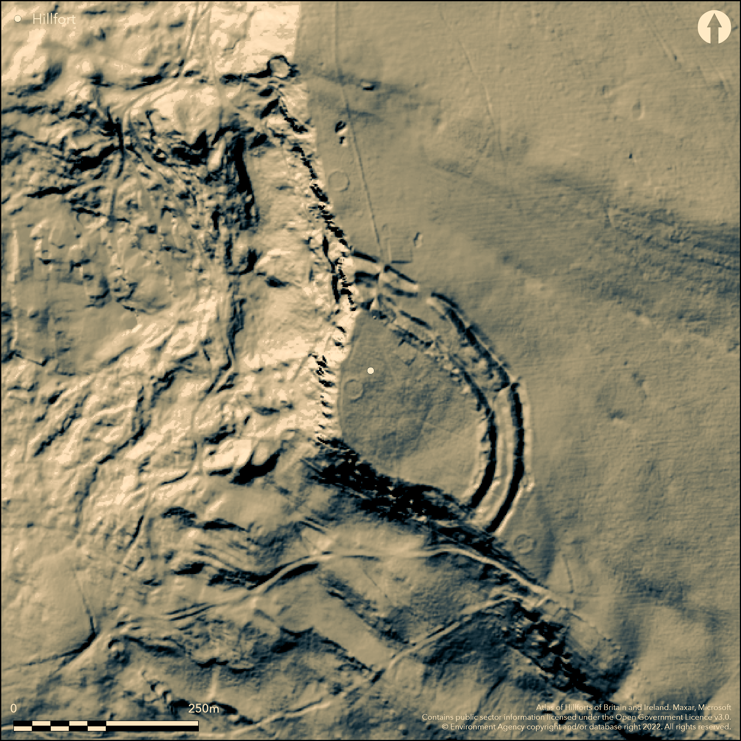
LiDAR 1m DTM Hillshade
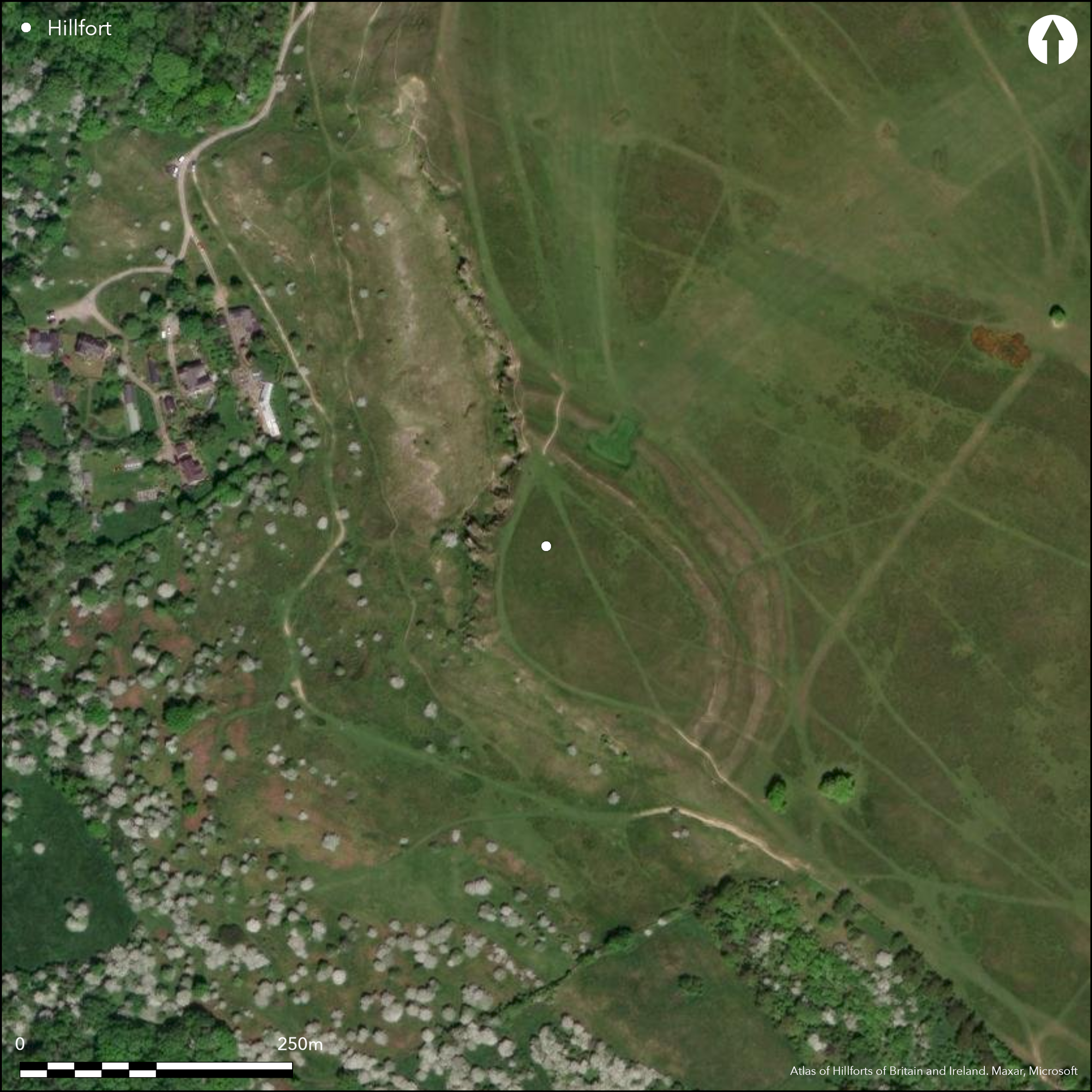
Satellite Imagery
LiDAR 1m DTM Hillshade
Satellite Imagery
Scroll left/right to view further images.
HER: Gloucestershire 437 (None)
NMR: SO 92 NE 13 (117630)
SM: 1002132
NGR: SO984255
X: 398450 Y: 225500 (OSGB36)
Bivallate hill-fort located on plateau-edge of Cleeve Cloud enclosing c. 1.2ha. Ramparts formed by two series of bank and outer ditch, enclosing slight promontory of gently sloping ground to their SW, extending for c. 100m up to partly quarried scarp edge of Inferior Oolite above Cheltenham. Very steep slopes to W and S, moderate on plateau to E and NE. Banks and ditches disturbed by quarrying, and to N outer defences cut through to make a golf course. Banks and ditches c. 9m across, banks standing 2.5m-3m above ditches. Berm separates inner ditch from outer bank c. 9m wide in disturbed area S of a golf green; elsewhere half this width or less. Banked circle on cliff-edge inside fort and another outside to N, c. 15m across, probably of recent, perhaps post-medieval tree rings and not buildings as previously thought. Rectangular platform abutting inner bank c. 30m from N end probably recent; use unknown. No entrance survives. Duck-stamped early Iron Age rim sherds in Cheltenham Museum, date and circumstances of discovery is unknown. On 1st Ed. OS map (1884).
Citizen Science: ✓
Reliability of Data: Confirmed
Reliability of Interpretation: Confirmed
X: -225307 Y: 6787112 (EPSG: 3857)
Longitude: -2.0239641602242475 Latitude: 51.92797263288043 (EPSG:4326)
Country: England
Current County or Unitary Authority: Gloucestershire
Historic County: Gloucestershire
Current Parish/Community/Council/Townland: Southam
Damaged by quarrying and affected by golf course.
| Extant | ✓ |
| Cropmark | ✗ |
| Likely Destroyed | ✗ |
Pasture and scrub. Golf course lies immediately to NE of fort with one of the holes immediately adjacent to outer ditch. Quarrying.
| Woodland | ✗ |
| Commercial Forestry Plantation | ✗ |
| Parkland | ✗ |
| Pasture (Grazing) | ✓ |
| Arable | ✗ |
| Scrub/Bracken | ✓ |
| Bare Outcrop | ✗ |
| Heather/Moorland | ✗ |
| Heath | ✗ |
| Built-up | ✗ |
| Coastal Grassland | ✗ |
| Other | ✓ |
Bivallate hill-fort located on p[lateau-edge of Cleeve Cloud enclosing c. 1.2ha. Ramparts formed by two series of bank and outer ditch, enclosing slight promontory of gently sloping ground to their SW, extending for c. 100m up to partly quarried scarp edge of Inferior Oolite above Cheltenham.
| Contour Fort | ✗ |
| Partial Contour Fort | ✗ |
| Promontory Fort | ✗ |
| Hillslope Fort | ✗ |
| Level Terrain Fort | ✓ |
| Marsh Fort | ✗ |
| Multiple Enclosure Fort | ✗ |
Located on the ridge of Cleeve Cloud at 300m, the land sloping to the west to the steep quarry edge
| Hilltop | ✗ |
| Coastal Promontory | ✗ |
| Inland Promontory | ✗ |
| Valley Bottom | ✗ |
| Knoll/Hillock/Outcrop | ✗ |
| Ridge | ✗ |
| Cliff/Plateau-edge/Scarp | ✓ |
| Hillslope | ✗ |
| Lowland | ✗ |
| Spur | ✗ |
Dominant Topographic Feature: Plateau edge
| North | ✗ |
| Northeast | ✗ |
| East | ✗ |
| Southeast | ✗ |
| South | ✗ |
| Southwest | ✓ |
| West | ✗ |
| Northwest | ✗ |
| Level | ✗ |
Altitude: 300.0m
N/A
'Duck-stamped' early Iron Age rim sherds in Cheltenham Museum. Date and circumstances of discovery is unknown, but probably from eroding edge of defences where cut by former quarrying of scarp face.
Reliability: C - Low
| Pre 1200BC | ✗ |
| 1200BC - 800BC | ✗ |
| 800BC - 400BC | ✓ |
| 400BC - AD50 | ✗ |
| AD50 - AD400 | ✗ |
| AD400 - AD 800 | ✗ |
| Post AD800 | ✗ |
| Unknown | ✗ |
| Pre Hillfort: | None |
| Post Hillfort: | None |
| Artefactual: | None |
On 1st Ed. OS map (1884). RCHME aerial photograph interpretation 1992-96. Aerial photograph interpretation English Heritage; Gloucestershire NMP (N Cotswolds and Forest of Dean). 2011 erosion measures by Gloucestershire County Council, 2002-06.
| 1st Identified Map Depiction (1884): | OS map. |
| Other (1970): | Visited by Hillfort Study Group |
| Other (None): | RCHME aerial photograph interpretation |
| Other (None): | Aerial photograph interpretation English Heritage. |
None
None
| None | ✓ |
| Spring | ✗ |
| Stream | ✗ |
| Pool | ✗ |
| Flush | ✗ |
| Well | ✗ |
| Other | ✗ |
None
| No Known Features | ✓ |
| Round Stone Structures | ✗ |
| Rectangular Stone Structures | ✗ |
| Curvilinear Platforms | ✗ |
| Other Roundhouse Evidence | ✗ |
| Pits | ✗ |
| Quarry Hollows | ✗ |
| Other | ✗ |
None
| No Known Excavation | ✓ |
| Pits | ✗ |
| Postholes | ✗ |
| Roundhouses | ✗ |
| Rectangular Structures | ✗ |
| Roads/Tracks | ✗ |
| Quarry Hollows | ✗ |
| Other | ✗ |
| Nothing Found | ✗ |
None
| No Known Geophysics | ✓ |
| Pits | ✗ |
| Roundhouses | ✗ |
| Rectangular Structures | ✗ |
| Roads/Tracks | ✗ |
| Quarry Hollows | ✗ |
| Other | ✗ |
| Nothing Found | ✗ |
None
| No Known Finds | ✓ |
| Pottery | ✗ |
| Metal | ✗ |
| Metalworking | ✗ |
| Human Bones | ✗ |
| Animal Bones | ✗ |
| Lithics | ✗ |
| Environmental | ✗ |
| Other | ✗ |
None
| APs Not Checked | ✓ |
| None | ✗ |
| Roundhouses | ✗ |
| Rectangular Structures | ✗ |
| Pits | ✗ |
| Postholes | ✗ |
| Roads/Tracks | ✗ |
| Other | ✗ |
No entrance survives.
| 0: | None |
| 2: | Entrances destroyed |
Guard Chambers: ✗
Chevaux de Frise: ✗
Ramparts formed by two series of bank and outer ditch, enclosing slight promontory of gently sloping ground to their SW, extending for c. 100m up to partly quarried scarp edge of Inferior Ooolite above Cheltenham. Very steep slopes to W and S, moderate on plateau to E and NE. Banks and ditches disturbed by quarrying, and to N outer defences cut through to make a golf course. Banks and ditches c. 9m across, banks standing 2.5m-3m above ditches. Berm separates inner ditch from outer bank c. 9m wide in disturbed area S of a golf green; elsewhere half this width or less.
| Area 1: | 1.2ha. |
| Total: | 1.2ha. |
Total Footprint Area: Noneha.
None
| ✗ | None |
| ✗ | None |
| NE Quadrant: | 2 |
| SE Quadrant: | 2 |
| SW Quadrant: | 0 |
| NW Quadrant: | 2 |
| Total: | 2 |
| Partial Univallate | ✗ |
| Univallate | ✗ |
| Partial Bivallate | ✓ |
| Bivallate | ✗ |
| Partial Multivallate | ✗ |
| Multivallate | ✗ |
| Unknown | ✗ |
| Partial Univallate | ✗ |
| Univallate | ✗ |
| Partial Bivallate | ✗ |
| Bivallate | ✗ |
| Partial Multivallate | ✗ |
| Multivallate | ✗ |
None
| None | ✗ |
| Earthen Bank | ✓ |
| Stone Wall | ✗ |
| Rubble | ✗ |
| Wall-walk | ✗ |
| Evidence of Timber | ✗ |
| Vitrification | ✗ |
| Other Burning | ✗ |
| Palisade | ✗ |
| Counter Scarp Bank | ✗ |
| Berm | ✗ |
| Unfinished | ✗ |
| Other | ✗ |
None
| None | ✗ |
| Earthen Bank | ✗ |
| Stone Wall | ✗ |
| Murus Duplex | ✗ |
| Timber-framed | ✗ |
| Timber-laced | ✗ |
| Vitrification | ✗ |
| Other Burning | ✗ |
| Palisade | ✗ |
| Counter Scarp Bank | ✗ |
| Berm | ✗ |
| Unfinished | ✗ |
| No Known Excavation | ✓ |
| Other | ✗ |
| ✗ | None |
| ✓ | None |
Number of Ditches: 2
| ✗ | None |
RCHME 1976. Ancient and historical monuments in the County of Gloucestershire, Vol. I: Iron Age and Romano- British monuments in Gloucestershire Cotswolds, London: HMSO, 106b.
Stoertz, C. 2012. The North Cotswolds: a highlight report for the National Mapping Programme, Report No 17-2012, Centre for Archaeology.
Witts, G.B. 1883. Archaeological handbook of the County of Gloucestershire, Cheltenham: Norman Brothers, 12.
Atlas of Hillforts:
Wikidata:
This work is licensed under CC BY-SA 4.0

 and should be cited as:
Lock, Gary and Ralston, Ian. 2024. Atlas of Hillforts of Britain and Ireland. Available at: https://hillforts.arch.ox.ac.uk
Document Version 1.1