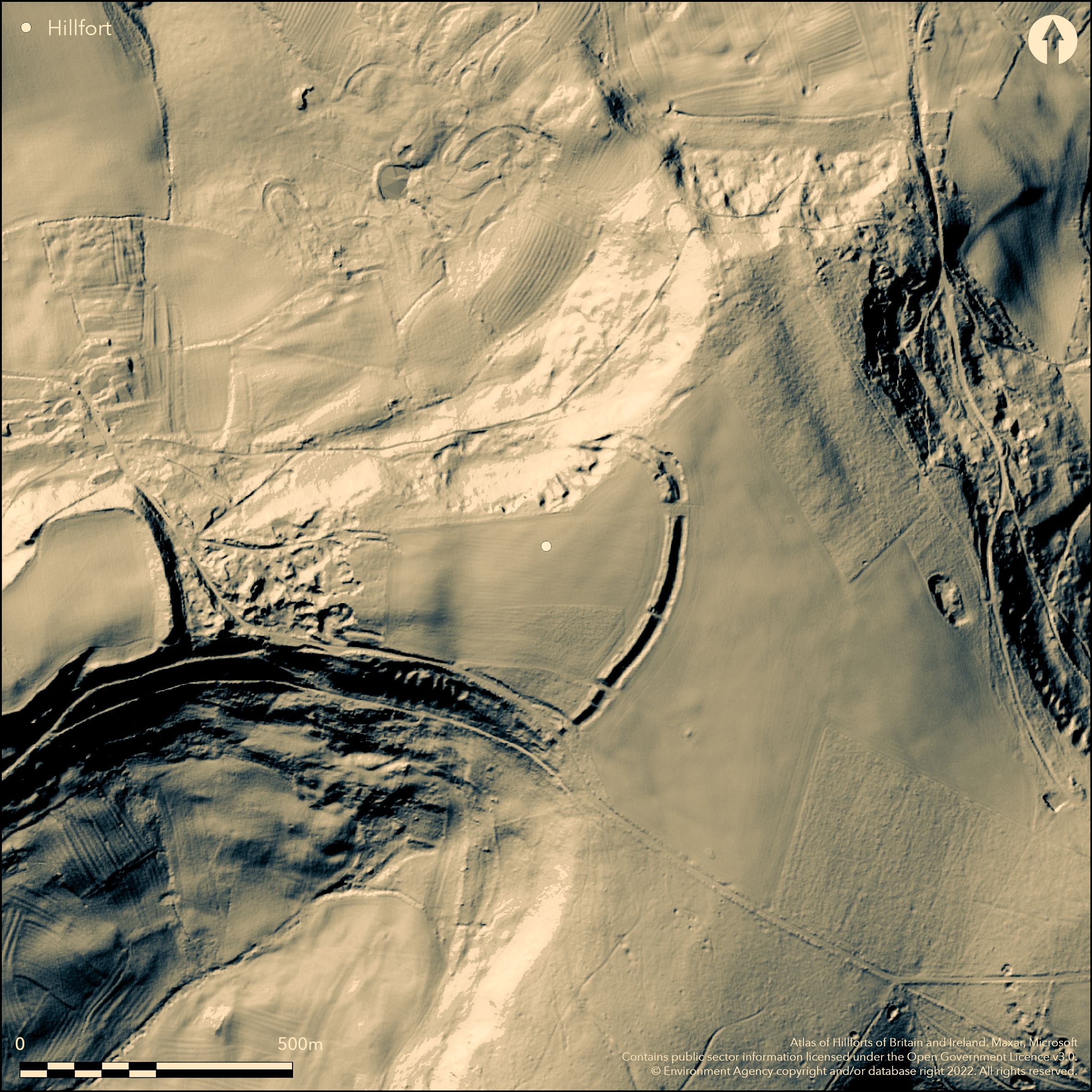
LiDAR 1m DTM Hillshade
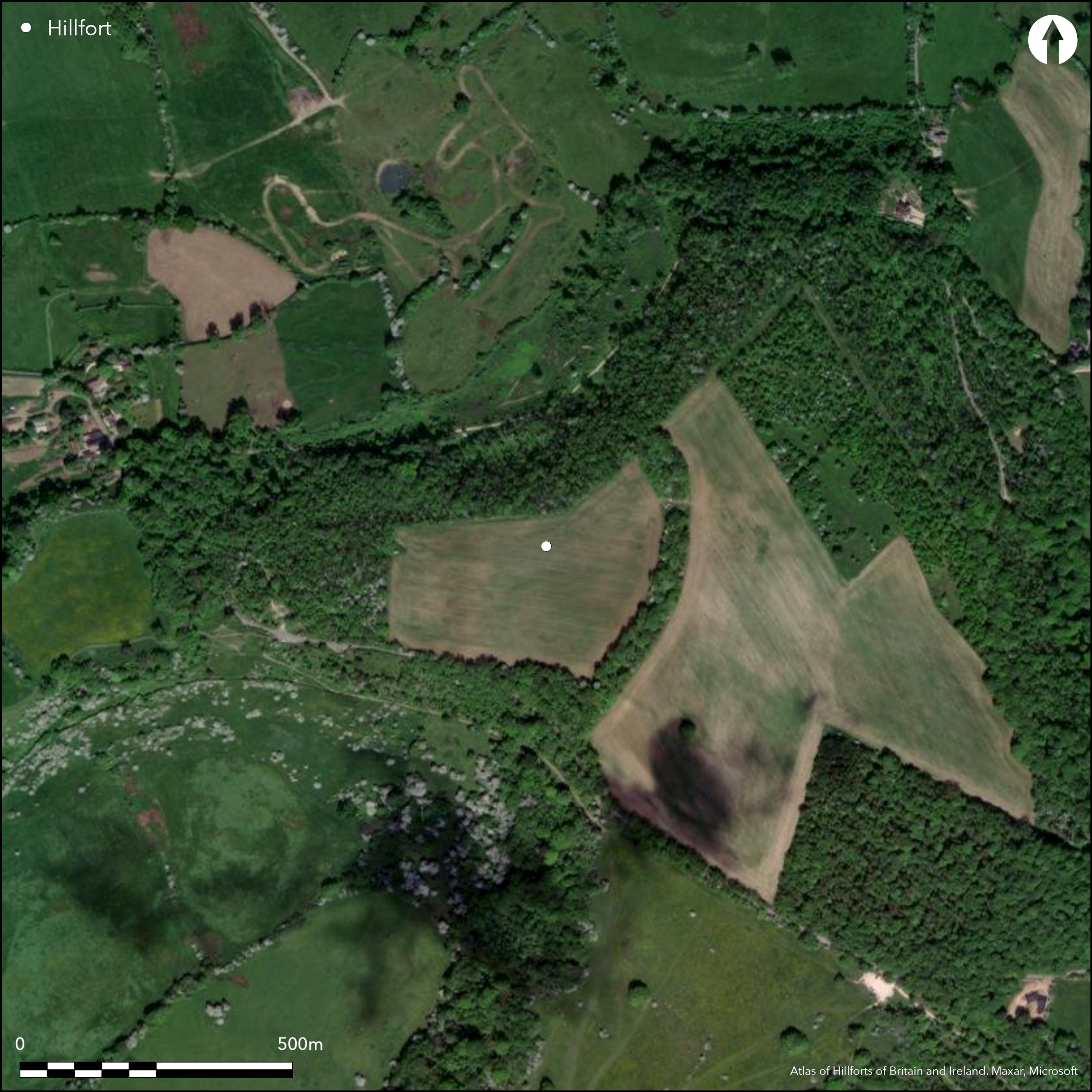
Satellite Imagery
LiDAR 1m DTM Hillshade
Satellite Imagery
Scroll left/right to view further images.
HER: Gloucestershire 439 (None)
NMR: SO 86 NW 1 (114937)
SM: 1004861
NGR: SO828091
X: 382800 Y: 209100 (OSGB36)
Little known promontory hillfort sited on typical W Cotswolds spur of Oolitic Limestone, 576m E of Haresfield Hill Camp (Atlas number 0763), with which it has (perhaps erroneously), been connected. Very steep surrounding slopes to N and S stream re-entrant valley. Moderate slopes to E on spur ridge. Encloses 10ha. Single bank with outer ditch crosses neck of spur. Bank, 14m wide and 2m high, of glacis construction externally, has ledge and to 3m wide along inner side; the ditch is 12m wide and 2m deep. Slope from bank to ditch lengthened at N end, where ditch runs into a gully and bank curves away along edge of the scarp. Four gaps in bank, 6m to 24m wide, have corresponding causeways in ditch. Hollow-way enters N end of ditch through gully. Some sherds of featureless hand-made pottery, found in field to W of the bank, now in Gloucester City Museum. Section by Playne (19th century no details) indicates that bank had a small internal ditch. On 1st Ed. OS map (1885).
Citizen Science: ✗
Reliability of Data: Confirmed
Reliability of Interpretation: Confirmed
X: -250551 Y: 6760490 (EPSG: 3857)
Longitude: -2.250741075211065 Latitude: 51.78025360007445 (EPSG:4326)
Country: England; None
Current County or Unitary Authority: Gloucestershire
Historic County: Gloucestershire
Current Parish/Community/Council/Townland: Haresfield; Standish
Plough and quarry damage. Site now generally well-defined and in reasonable condition, but suffers scrub and tree growth. 2010 unauthorised quarrying in area already disturbed.
| Extant | ✓ |
| Cropmark | ✗ |
| Likely Destroyed | ✗ |
Wooded on N, S, W, bank of trees on E. Quarrying.
| Woodland | ✗ |
| Commercial Forestry Plantation | ✗ |
| Parkland | ✗ |
| Pasture (Grazing) | ✓ |
| Arable | ✗ |
| Scrub/Bracken | ✗ |
| Bare Outcrop | ✗ |
| Heather/Moorland | ✗ |
| Heath | ✗ |
| Built-up | ✗ |
| Coastal Grassland | ✗ |
| Other | ✓ |
Little known promontory hillfort sited on typical W Cotswolds spur of Oolitic Limestone, 576m E of Haresfield Hill Camp (Atlas No 0763).
| Contour Fort | ✗ |
| Partial Contour Fort | ✗ |
| Promontory Fort | ✓ |
| Hillslope Fort | ✗ |
| Level Terrain Fort | ✗ |
| Marsh Fort | ✗ |
| Multiple Enclosure Fort | ✗ |
Located on a typical western Cotswold spur of Oolitic Limestone
| Hilltop | ✗ |
| Coastal Promontory | ✗ |
| Inland Promontory | ✓ |
| Valley Bottom | ✗ |
| Knoll/Hillock/Outcrop | ✗ |
| Ridge | ✗ |
| Cliff/Plateau-edge/Scarp | ✗ |
| Hillslope | ✗ |
| Lowland | ✗ |
| Spur | ✓ |
Dominant Topographic Feature: Spur
| North | ✗ |
| Northeast | ✗ |
| East | ✗ |
| Southeast | ✗ |
| South | ✗ |
| Southwest | ✗ |
| West | ✗ |
| Northwest | ✗ |
| Level | ✓ |
Altitude: 240.0m
Boundary Type: Parish/Townland
None
Reliability: D - None
| Pre 1200BC | ✗ |
| 1200BC - 800BC | ✗ |
| 800BC - 400BC | ✗ |
| 400BC - AD50 | ✗ |
| AD50 - AD400 | ✗ |
| AD400 - AD 800 | ✗ |
| Post AD800 | ✗ |
| Unknown | ✓ |
| Pre Hillfort: | None |
| Post Hillfort: | None |
On 1st Ed. OS map (1885). G.F. Playne excavated a section 19th century - no details. The name Estbury (1509) probably refers to hillfort.
| 1st Identified Written Reference (1509): | No details. |
| 1st Identified Map Depiction (1885): | OS map. |
| Other (1970): | Visit by Hillfort Study Group |
| Excavation (None): | G.F. Playne section. |
Some sherds of featureless hand-made pottery, found in field to W of the bank, now in Gloucester City Museum.
None
| None | ✓ |
| Spring | ✗ |
| Stream | ✗ |
| Pool | ✗ |
| Flush | ✗ |
| Well | ✗ |
| Other | ✗ |
None
| No Known Features | ✓ |
| Round Stone Structures | ✗ |
| Rectangular Stone Structures | ✗ |
| Curvilinear Platforms | ✗ |
| Other Roundhouse Evidence | ✗ |
| Pits | ✗ |
| Quarry Hollows | ✗ |
| Other | ✗ |
None
| No Known Excavation | ✓ |
| Pits | ✗ |
| Postholes | ✗ |
| Roundhouses | ✗ |
| Rectangular Structures | ✗ |
| Roads/Tracks | ✗ |
| Quarry Hollows | ✗ |
| Other | ✗ |
| Nothing Found | ✗ |
None
| No Known Geophysics | ✓ |
| Pits | ✗ |
| Roundhouses | ✗ |
| Rectangular Structures | ✗ |
| Roads/Tracks | ✗ |
| Quarry Hollows | ✗ |
| Other | ✗ |
| Nothing Found | ✗ |
Some sherds of featureless hand-made pottery, found in field to W of the bank, now in Gloucester City Museum.
| No Known Finds | ✗ |
| Pottery | ✓ |
| Metal | ✗ |
| Metalworking | ✗ |
| Human Bones | ✗ |
| Animal Bones | ✗ |
| Lithics | ✗ |
| Environmental | ✗ |
| Other | ✗ |
None
| APs Not Checked | ✓ |
| None | ✗ |
| Roundhouses | ✗ |
| Rectangular Structures | ✗ |
| Pits | ✗ |
| Postholes | ✗ |
| Roads/Tracks | ✗ |
| Other | ✗ |
Four gaps in bank, 6m to 24m wide, have corresponding causeways in ditch. Hollow-way enters N end of ditch through gully. Only two of gaps to the E possibly original, central one probably modern. Doubt whether the S gap, just N of roadway, is original or not; possibly not. Holloway which enters ditch does not appear to be contemporary with the hillfort.
| 4: | None |
| 2: | Four gaps with causeways and hollow way, but only two original. |
Guard Chambers: ✗
Chevaux de Frise: ✗
| 1. Simple Gap (North east): | Causewayed. |
| 2. Simple Gap (South east): | Causewayed. |
Bank, 14m wide and 2m high, of glacis construction externally, has ledgeand to 3m wide along inner side; the ditch is 12m wide and 2m deep. Slope from bank to ditch lengthened at N end, where ditch runs into a gully and bank curves away along edge of the scarp.
| Area 1: | 10.0ha. |
| Total: | 10.0ha. |
Total Footprint Area: Noneha.
None
| ✗ | None |
| ✗ | None |
| NE Quadrant: | 1 |
| SE Quadrant: | 0 |
| SW Quadrant: | 0 |
| NW Quadrant: | 1 |
| Total: | 1 |
| Partial Univallate | ✓ |
| Univallate | ✗ |
| Partial Bivallate | ✗ |
| Bivallate | ✗ |
| Partial Multivallate | ✗ |
| Multivallate | ✗ |
| Unknown | ✗ |
| Partial Univallate | ✗ |
| Univallate | ✗ |
| Partial Bivallate | ✗ |
| Bivallate | ✗ |
| Partial Multivallate | ✗ |
| Multivallate | ✗ |
None
| None | ✗ |
| Earthen Bank | ✓ |
| Stone Wall | ✗ |
| Rubble | ✗ |
| Wall-walk | ✗ |
| Evidence of Timber | ✗ |
| Vitrification | ✗ |
| Other Burning | ✗ |
| Palisade | ✗ |
| Counter Scarp Bank | ✗ |
| Berm | ✗ |
| Unfinished | ✗ |
| Other | ✗ |
Section by Playne (19th century no details) indicates that bank had small internal ditch.
| None | ✗ |
| Earthen Bank | ✗ |
| Stone Wall | ✗ |
| Murus Duplex | ✗ |
| Timber-framed | ✗ |
| Timber-laced | ✗ |
| Vitrification | ✗ |
| Other Burning | ✗ |
| Palisade | ✗ |
| Counter Scarp Bank | ✗ |
| Berm | ✗ |
| Unfinished | ✗ |
| No Known Excavation | ✗ |
| Other | ✓ |
| ✗ | None |
| ✓ | None |
Number of Ditches: 1
| ✗ | None |
RCHME 1976. Ancient and historical monuments in the County of Gloucestershire, Vol. I: Iron Age and Romano- British monuments in Gloucestershire Cotswolds, London: HMSO, 64a.
Atlas of Hillforts:
Wikidata:
This work is licensed under CC BY-SA 4.0

 and should be cited as:
Lock, Gary and Ralston, Ian. 2024. Atlas of Hillforts of Britain and Ireland. Available at: https://hillforts.arch.ox.ac.uk
Document Version 1.1