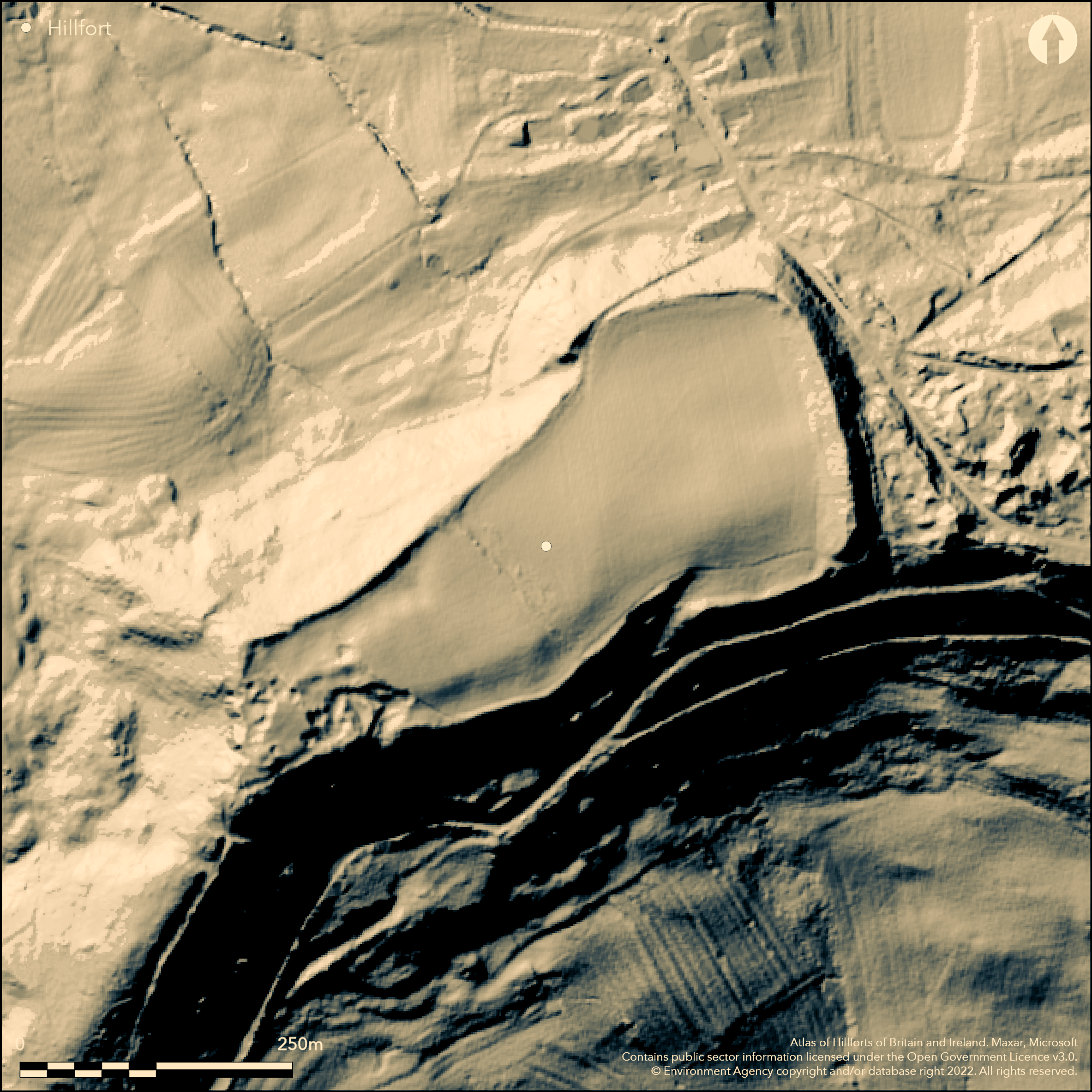
LiDAR 1m DTM Hillshade
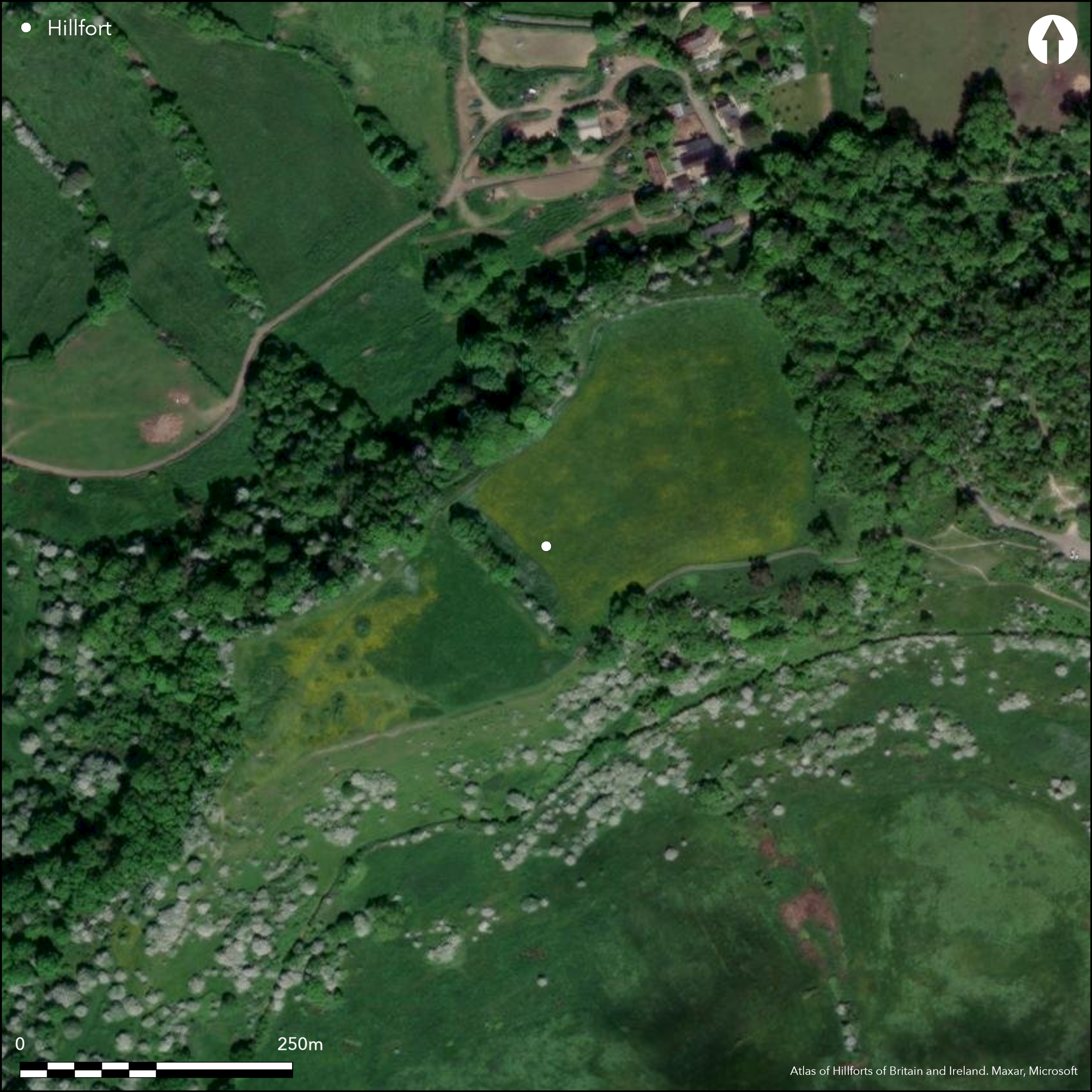
Satellite Imagery
LiDAR 1m DTM Hillshade
Satellite Imagery
Scroll left/right to view further images.
HER: Gloucestershire 440 (None)
NMR: SO 80 NW 17 (114975)
SM: 1004861
NGR: SO822090
X: 382200 Y: 209000 (OSGB36)
Partial contour hillfort sited in a typical W Cotswolds location at the end of a W-facing spur on Haresfield Beacon, directly to the W of The Bulwarks hillfort (Atlas number 0762). Very steep slopes to SE, S and NW. E moderate on ridge of spur leading to The Bulwarks. Enclosing 4.0ha. Bank to 9m wide and 1.2m high along scarp edge on N and S. On E bank rises to follow crest of natural ridge above a gully. No ditch is in evidence. Tip of spur at W extremity of spur disturbed and formerly site of a beacon. Five entrances approached by hollow-ways and terrace-ways, but break in bank at SE angle probably modern. Roman and few Iron Age surface finds. The lack of a ditch has caused the site to be questioned although there are substantive ramparts. On 1st Ed. OS map (1885).
Citizen Science: ✗
Reliability of Data: Confirmed
Reliability of Interpretation: Unconfirmed
X: -251519 Y: 6760324 (EPSG: 3857)
Longitude: -2.259433148747367 Latitude: 51.77933561822317 (EPSG:4326)
Country: England; None
Current County or Unitary Authority: Gloucestershire
Historic County: Gloucestershire
Current Parish/Community/Council/Townland: Haresfield; Standish
Extensive past quarrying has obliterated all surface features. Site now in pasture and arable use. Animal poaching problem. Tip of spur at W extremity of spur disturbed and formerly site of a beacon.
| Extant | ✓ |
| Cropmark | ✗ |
| Likely Destroyed | ✓ |
Pasture and arable use. Quarrying.
| Woodland | ✗ |
| Commercial Forestry Plantation | ✗ |
| Parkland | ✗ |
| Pasture (Grazing) | ✓ |
| Arable | ✓ |
| Scrub/Bracken | ✗ |
| Bare Outcrop | ✗ |
| Heather/Moorland | ✗ |
| Heath | ✗ |
| Built-up | ✓ |
| Coastal Grassland | ✗ |
| Other | ✓ |
Partial contour hillfort sited in a typical W Cotswolds location at the end of a W-facing spur on Haresfield Beacon, directly to the W of The Bulwarks hillfort (HER 439).
| Contour Fort | ✗ |
| Partial Contour Fort | ✓ |
| Promontory Fort | ✗ |
| Hillslope Fort | ✗ |
| Level Terrain Fort | ✗ |
| Marsh Fort | ✗ |
| Multiple Enclosure Fort | ✗ |
Typical western Cotswolds location at the end of a spur on Haresfield Beacon
| Hilltop | ✗ |
| Coastal Promontory | ✗ |
| Inland Promontory | ✗ |
| Valley Bottom | ✗ |
| Knoll/Hillock/Outcrop | ✗ |
| Ridge | ✗ |
| Cliff/Plateau-edge/Scarp | ✗ |
| Hillslope | ✗ |
| Lowland | ✗ |
| Spur | ✓ |
Dominant Topographic Feature: Spur
| North | ✗ |
| Northeast | ✗ |
| East | ✗ |
| Southeast | ✗ |
| South | ✗ |
| Southwest | ✗ |
| West | ✗ |
| Northwest | ✗ |
| Level | ✓ |
Altitude: 217.0m
Boundary Type: Parish/Townland
None
Reliability: D - None
| Pre 1200BC | ✗ |
| 1200BC - 800BC | ✗ |
| 800BC - 400BC | ✗ |
| 400BC - AD50 | ✗ |
| AD50 - AD400 | ✗ |
| AD400 - AD 800 | ✗ |
| Post AD800 | ✗ |
| Unknown | ✓ |
| Pre Hillfort: | None |
| Post Hillfort: | Possible occupation of during the Roman period (C. Parry survey 1994-95), but no specific detail. |
On 1st Ed. OS map (1885). Survey C. Parry, Gloucestershire County Council for National Trust, 1994-95. Aerial photograph interpretation RCHME, 1992-96. 1994-95. 2010 geophysical survey found a possible platform and walls.
| 1st Identified Map Depiction (1885): | OS map. |
| Geophysical Survey (2010): | No details. |
| Other (None): | Watching Briefs. |
| Other (None): | RCHME Primary Project. |
| Other (None): | C. Parry, Gloucestershire County Council for National Trust. |
2010 geophysical survey found a possible platform and walls. Part of saddle- quern found in E of interior (in Gloucester Museum). Potsherd of bead rim vessel of Iron Age date, with a fabric tempered with limestone grits found in upcast of molehill. Romano-British and Roman artefacts chance finds and 1837 Roman coin hoard.
None
| None | ✓ |
| Spring | ✗ |
| Stream | ✗ |
| Pool | ✗ |
| Flush | ✗ |
| Well | ✗ |
| Other | ✗ |
None
| No Known Features | ✓ |
| Round Stone Structures | ✗ |
| Rectangular Stone Structures | ✗ |
| Curvilinear Platforms | ✗ |
| Other Roundhouse Evidence | ✗ |
| Pits | ✗ |
| Quarry Hollows | ✗ |
| Other | ✗ |
None
| No Known Excavation | ✓ |
| Pits | ✗ |
| Postholes | ✗ |
| Roundhouses | ✗ |
| Rectangular Structures | ✗ |
| Roads/Tracks | ✗ |
| Quarry Hollows | ✗ |
| Other | ✗ |
| Nothing Found | ✗ |
2010 geophysical survey found a possible platform and walls.
| No Known Geophysics | ✗ |
| Pits | ✗ |
| Roundhouses | ✗ |
| Rectangular Structures | ✗ |
| Roads/Tracks | ✗ |
| Quarry Hollows | ✗ |
| Other | ✓ |
| Nothing Found | ✗ |
Part of saddle- quern found in E of interior (in Gloucester Museum). Potsherd of bead rim vessel of Iron Age date, with a fabric tempered with limestone grits found in upcast of molehill. Romano-British and Roman artefacts chance finds and 1837 Roman coin hoard.
| No Known Finds | ✗ |
| Pottery | ✓ |
| Metal | ✗ |
| Metalworking | ✗ |
| Human Bones | ✗ |
| Animal Bones | ✗ |
| Lithics | ✗ |
| Environmental | ✗ |
| Other | ✓ |
None
| APs Not Checked | ✓ |
| None | ✗ |
| Roundhouses | ✗ |
| Rectangular Structures | ✗ |
| Pits | ✗ |
| Postholes | ✗ |
| Roads/Tracks | ✗ |
| Other | ✗ |
Original entrances cannot be determined. There are five entrances approached by hollow-ways and terrace-ways, but any possible entrance can also be shown to coincide with tracks coming onto the hill from medieval and later occupation in the valleys below. Break in bank at SE angle probably modern.
| 5: | None |
| 2: | Cannot be determined. |
Guard Chambers: ✗
Chevaux de Frise: ✗
Bank to 9m wide and 1.2m high along scarp edge on N and S. On E bank rises to follow crest of natural ridge above a gully. No ditch is in evidence.
| Area 1: | 4.0ha. |
| Total: | 4.0ha. |
Total Footprint Area: Noneha.
None
| ✗ | None |
| ✗ | None |
| NE Quadrant: | 1 |
| SE Quadrant: | 1 |
| SW Quadrant: | 1 |
| NW Quadrant: | 1 |
| Total: | 1 |
| Partial Univallate | ✗ |
| Univallate | ✓ |
| Partial Bivallate | ✗ |
| Bivallate | ✗ |
| Partial Multivallate | ✗ |
| Multivallate | ✗ |
| Unknown | ✗ |
| Partial Univallate | ✗ |
| Univallate | ✗ |
| Partial Bivallate | ✗ |
| Bivallate | ✗ |
| Partial Multivallate | ✗ |
| Multivallate | ✗ |
None
| None | ✗ |
| Earthen Bank | ✓ |
| Stone Wall | ✗ |
| Rubble | ✗ |
| Wall-walk | ✗ |
| Evidence of Timber | ✗ |
| Vitrification | ✗ |
| Other Burning | ✗ |
| Palisade | ✗ |
| Counter Scarp Bank | ✗ |
| Berm | ✗ |
| Unfinished | ✗ |
| Other | ✗ |
None
| None | ✗ |
| Earthen Bank | ✗ |
| Stone Wall | ✗ |
| Murus Duplex | ✗ |
| Timber-framed | ✗ |
| Timber-laced | ✗ |
| Vitrification | ✗ |
| Other Burning | ✗ |
| Palisade | ✗ |
| Counter Scarp Bank | ✗ |
| Berm | ✗ |
| Unfinished | ✗ |
| No Known Excavation | ✓ |
| Other | ✗ |
| ✗ | None |
| ✗ | No ditch in evidence. |
Number of Ditches: 0
| ✗ | None |
RCHME 1976. Ancient and historical monuments in the County of Gloucestershire, Vol. I: Iron Age and Romano- British monuments in Gloucestershire Cotswolds, London: HMSO, 622-64.
Atlas of Hillforts:
Wikidata:
This work is licensed under CC BY-SA 4.0

 and should be cited as:
Lock, Gary and Ralston, Ian. 2024. Atlas of Hillforts of Britain and Ireland. Available at: https://hillforts.arch.ox.ac.uk
Document Version 1.1