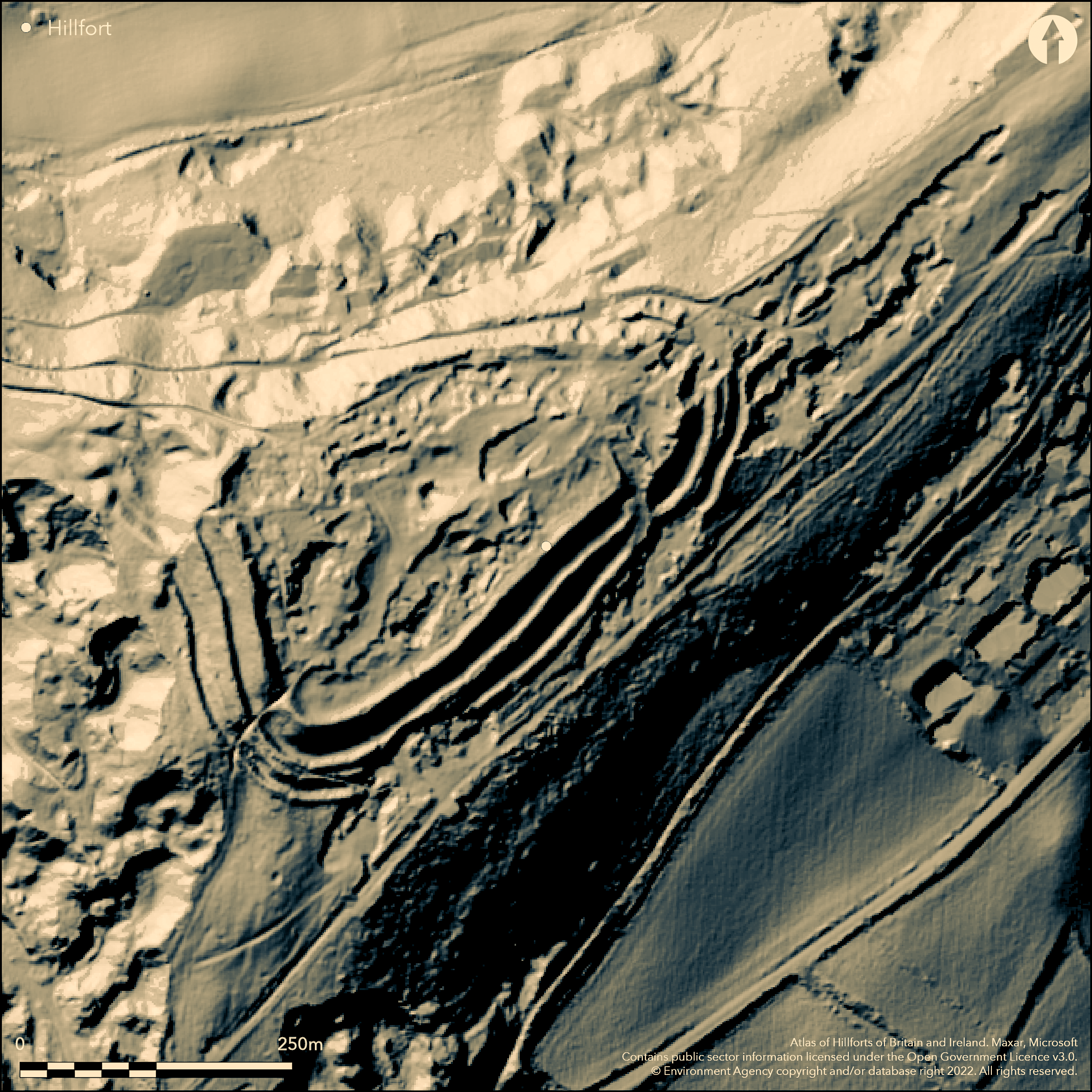
LiDAR 1m DTM Hillshade
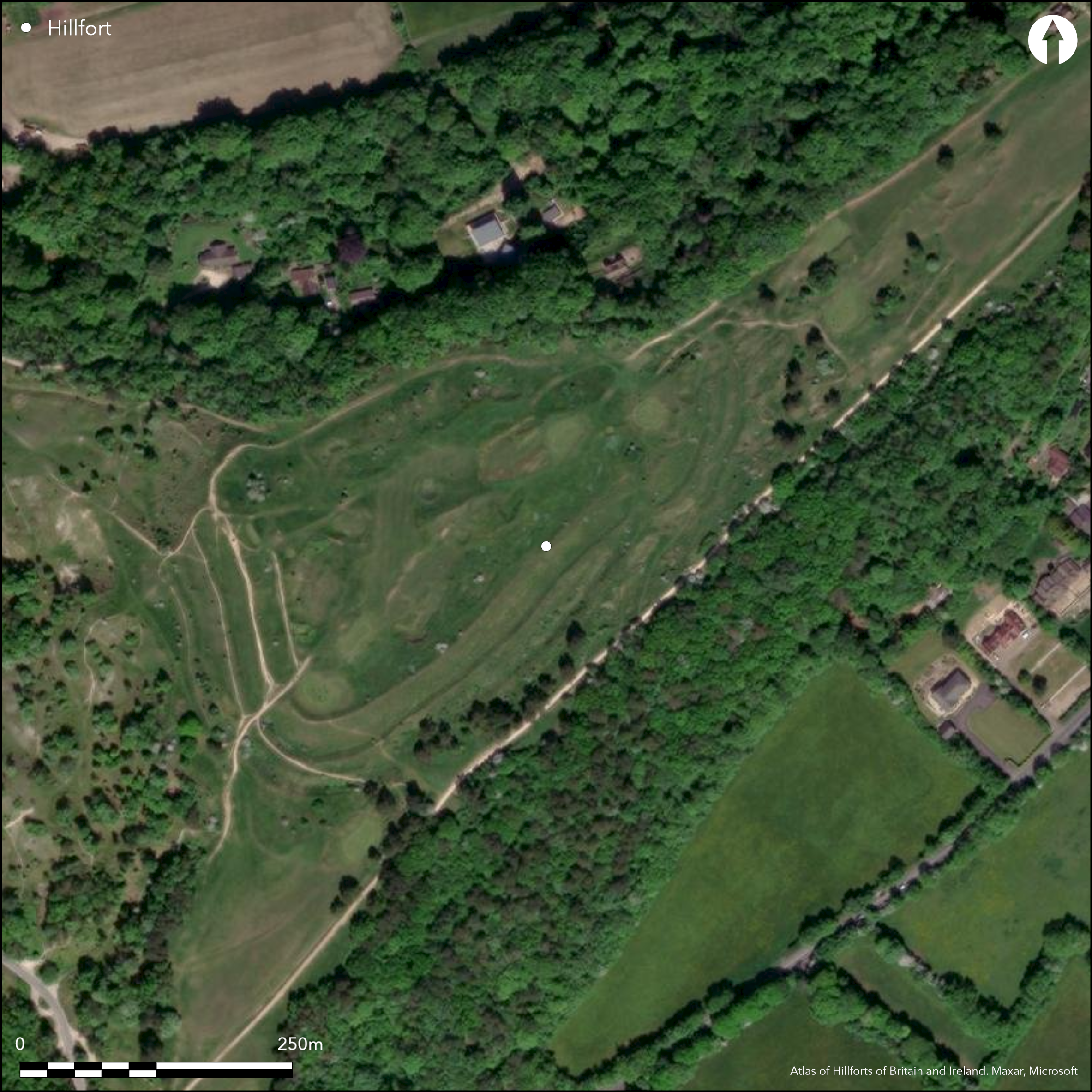
Satellite Imagery
LiDAR 1m DTM Hillshade
Satellite Imagery
Scroll left/right to view further images.
HER: Gloucestershire 442 (None)
NMR: SO 81 SE 12 (115542)
SM: 1004865
NGR: SO870121
X: 387000 Y: 212100 (OSGB36)
Sub-triangular, partial contour hillfort sited on SW-facing spur at W limit of Cotswold Hills escarpment, high above River Severn to SW. Steep to very steep surrounding slopes apart from moderate along ridge to NE. Enclosing 1.9ha. Two closely-set banks and two ditches with counterscarp on W, S and E sides. Heavy quarrying on N makes detail difficult to ascertain, but there are indications of at least one bank and ditch still visible augmenting the very steep natural slopes. Berm part way down outer rampart. Best on W, E, less on S, all following contours. Four gaps, but SW, NW and E possibly have medieval connotations and quarry access. Possible original inturned entrance on SE and possibly on NW. Painswick Golf Club on E. Rusty sword and spearheads found c. 1749 and Roman coins at various times. C. 1921 Iron Age pottery, bronze harp-shaped fibula (circa 200 BC) and some 3rd century AD red and black pottery found near site. Small-scale excavation and watching briefs. On 1st Ed. OS map (1883-84).
Citizen Science: ✗
Reliability of Data: Confirmed
Reliability of Interpretation: Confirmed
X: -243787 Y: 6765365 (EPSG: 3857)
Longitude: -2.1899735173306305 Latitude: 51.80734111484415 (EPSG:4326)
Country: England; None
Current County or Unitary Authority: Gloucestershire
Historic County: Gloucestershire
Current Parish/Community/Council/Townland: Painswick; Upton St Leonards
Much affected by quarrying and Painswick Golf Club occupies E part.
| Extant | ✓ |
| Cropmark | ✗ |
| Likely Destroyed | ✓ |
Golf course in part and quarrying.
| Woodland | ✗ |
| Commercial Forestry Plantation | ✗ |
| Parkland | ✗ |
| Pasture (Grazing) | ✓ |
| Arable | ✗ |
| Scrub/Bracken | ✗ |
| Bare Outcrop | ✗ |
| Heather/Moorland | ✗ |
| Heath | ✗ |
| Built-up | ✗ |
| Coastal Grassland | ✗ |
| Other | ✓ |
Partial contour hillfort sited on W-facing spur at W limit of Cotswold Hills escarpment, high above River Severn to SW.
| Contour Fort | ✗ |
| Partial Contour Fort | ✓ |
| Promontory Fort | ✗ |
| Hillslope Fort | ✗ |
| Level Terrain Fort | ✗ |
| Marsh Fort | ✗ |
| Multiple Enclosure Fort | ✗ |
Typical elevated location at western limit of Cotswold hills escarpment
| Hilltop | ✗ |
| Coastal Promontory | ✗ |
| Inland Promontory | ✗ |
| Valley Bottom | ✗ |
| Knoll/Hillock/Outcrop | ✗ |
| Ridge | ✗ |
| Cliff/Plateau-edge/Scarp | ✗ |
| Hillslope | ✗ |
| Lowland | ✗ |
| Spur | ✓ |
Dominant Topographic Feature: Spur
| North | ✗ |
| Northeast | ✗ |
| East | ✗ |
| Southeast | ✗ |
| South | ✗ |
| Southwest | ✗ |
| West | ✗ |
| Northwest | ✗ |
| Level | ✓ |
Altitude: 283.0m
Boundary Type: Parish/Townland
Mid Iron Age date suggested by HER as no other Gloucestershire fort has such three lines of closely spaced defences and most Gloucestershire hillforts seem abandoned before onset of late Iron Age.
Reliability: C - Low
| Pre 1200BC | ✗ |
| 1200BC - 800BC | ✗ |
| 800BC - 400BC | ✗ |
| 400BC - AD50 | ✓ |
| AD50 - AD400 | ✗ |
| AD400 - AD 800 | ✗ |
| Post AD800 | ✗ |
| Unknown | ✗ |
| Pre Hillfort: | None |
| Post Hillfort: | None |
| Morphology/Earthwork/Typology: | None |
In Aubrey's Monumenta Britannica (1665-1693). S. Rudder reference 1779. Camden's Britannia reference 1806. On 1st Ed. OS map (1883-84). Management survey, Gloucestershire County Council, 1995. Small excavation as part of Watching Brief during erosion repairs 2005. Other Watching Briefs 2003, 2006. Survey and management plan, 2001 - no details.
| Other (1806): | Camden's Britannia reference. |
| Other (1970): | Visited by Hillfort Study Group |
| Other (1995): | Management survey, Gloucestershire County Council. |
| Other (2001): | Survey and management plan, no details. |
| Excavation (2005): | Small excavation as part of Watching Brief during erosion repairs. |
| 1st Identified Written Reference (None): | None |
| 1st Identified Map Depiction (None): | OS map |
| Other (None): | Watching Briefs. |
Roman-British pruning hook in Gloucester Museum. Rusty sword and spearheads found c. 1749 and Roman coins at various times. C. 1921 Iron Age pottery, bronze harp-shaped fibula (circa 200 BC) and some 3rd century AD red and black pottery found near site.
Well suggested in interior, but probably quarrying hollow.
| None | ✓ |
| Spring | ✗ |
| Stream | ✗ |
| Pool | ✗ |
| Flush | ✗ |
| Well | ✗ |
| Other | ✗ |
None
| No Known Features | ✓ |
| Round Stone Structures | ✗ |
| Rectangular Stone Structures | ✗ |
| Curvilinear Platforms | ✗ |
| Other Roundhouse Evidence | ✗ |
| Pits | ✗ |
| Quarry Hollows | ✗ |
| Other | ✗ |
None
| No Known Excavation | ✗ |
| Pits | ✗ |
| Postholes | ✗ |
| Roundhouses | ✗ |
| Rectangular Structures | ✗ |
| Roads/Tracks | ✗ |
| Quarry Hollows | ✗ |
| Other | ✗ |
| Nothing Found | ✓ |
None
| No Known Geophysics | ✓ |
| Pits | ✗ |
| Roundhouses | ✗ |
| Rectangular Structures | ✗ |
| Roads/Tracks | ✗ |
| Quarry Hollows | ✗ |
| Other | ✗ |
| Nothing Found | ✗ |
Roman-British pruning hook in Gloucester Museum. Rusty sword and spearheads found c. 1749 and Roman coins at various times. C. 1921 Iron Age pottery, bronze harp-shaped fibula (circa 200 BC) and some 3rd century AD red and black pottery found near site.
| No Known Finds | ✗ |
| Pottery | ✓ |
| Metal | ✓ |
| Metalworking | ✗ |
| Human Bones | ✗ |
| Animal Bones | ✗ |
| Lithics | ✗ |
| Environmental | ✗ |
| Other | ✓ |
None
| APs Not Checked | ✓ |
| None | ✗ |
| Roundhouses | ✗ |
| Rectangular Structures | ✗ |
| Pits | ✗ |
| Postholes | ✗ |
| Roads/Tracks | ✗ |
| Other | ✗ |
Four gaps, but SW, NW and E possibly have medieval influence and quarry access. Possible original inturned entrance on SE, but affected by stone quarrying, and possibly on NW, much damaged and affected by modern track.
| 4: | None |
| 2: | None |
Guard Chambers: ✗
Chevaux de Frise: ✗
| 1. In-turned (South east): | Affected by stone quarrying. |
| 2. Simple Gap (North west): | Possible only. Much damaged and affected by modern track. |
Two closely-set banks and two ditches with counterscarp on W, S and E sides. Heavy quarrying on N makes detail difficult to ascertain, but there are indications of at least one bank and ditch still visible augmenting the very steep natural slopes. Berm part way down outer rampart. Best on W, E, less on S, all following contours.
| Area 1: | 1.9ha. |
| Total: | 1.9ha. |
Total Footprint Area: Noneha.
None
| ✗ | None |
| ✓ | N sides heavily affected by quarrying make definition difficult, but banks in each quadrant. |
| NE Quadrant: | 3 |
| SE Quadrant: | 3 |
| SW Quadrant: | 3 |
| NW Quadrant: | 3 |
| Total: | 3 |
| Partial Univallate | ✗ |
| Univallate | ✗ |
| Partial Bivallate | ✗ |
| Bivallate | ✗ |
| Partial Multivallate | ✗ |
| Multivallate | ✓ |
| Unknown | ✗ |
| Partial Univallate | ✗ |
| Univallate | ✗ |
| Partial Bivallate | ✗ |
| Bivallate | ✗ |
| Partial Multivallate | ✗ |
| Multivallate | ✗ |
Counterscarp on W, S and E sides. Berm part way down outer rampart.
| None | ✗ |
| Earthen Bank | ✓ |
| Stone Wall | ✗ |
| Rubble | ✗ |
| Wall-walk | ✗ |
| Evidence of Timber | ✗ |
| Vitrification | ✗ |
| Other Burning | ✗ |
| Palisade | ✗ |
| Counter Scarp Bank | ✓ |
| Berm | ✓ |
| Unfinished | ✗ |
| Other | ✗ |
None
| None | ✓ |
| Earthen Bank | ✗ |
| Stone Wall | ✗ |
| Murus Duplex | ✗ |
| Timber-framed | ✗ |
| Timber-laced | ✗ |
| Vitrification | ✗ |
| Other Burning | ✗ |
| Palisade | ✗ |
| Counter Scarp Bank | ✗ |
| Berm | ✗ |
| Unfinished | ✗ |
| No Known Excavation | ✗ |
| Other | ✗ |
| ✗ | None |
| ✓ | None |
Number of Ditches: 2
| ✗ | None |
Camden, W., enlarged by Richard Gough 1806. Britannia: or , a chronological description of the flourishing kingdoms of Endland, Scotland and Island and the islands adjacent; from the earliest antiquity, 398.
RCHME 1976. Ancient and historical monuments in the County of Gloucestershire, Vol. I: Iron Age and Romano- British monuments in Gloucestershire Cotswolds, London: HMSO, 91b.
Rudder, S. 1779. A new history of Gloucestershire, Cirencester: Author, 592.
Atlas of Hillforts:
Wikidata:
This work is licensed under CC BY-SA 4.0

 and should be cited as:
Lock, Gary and Ralston, Ian. 2024. Atlas of Hillforts of Britain and Ireland. Available at: https://hillforts.arch.ox.ac.uk
Document Version 1.1