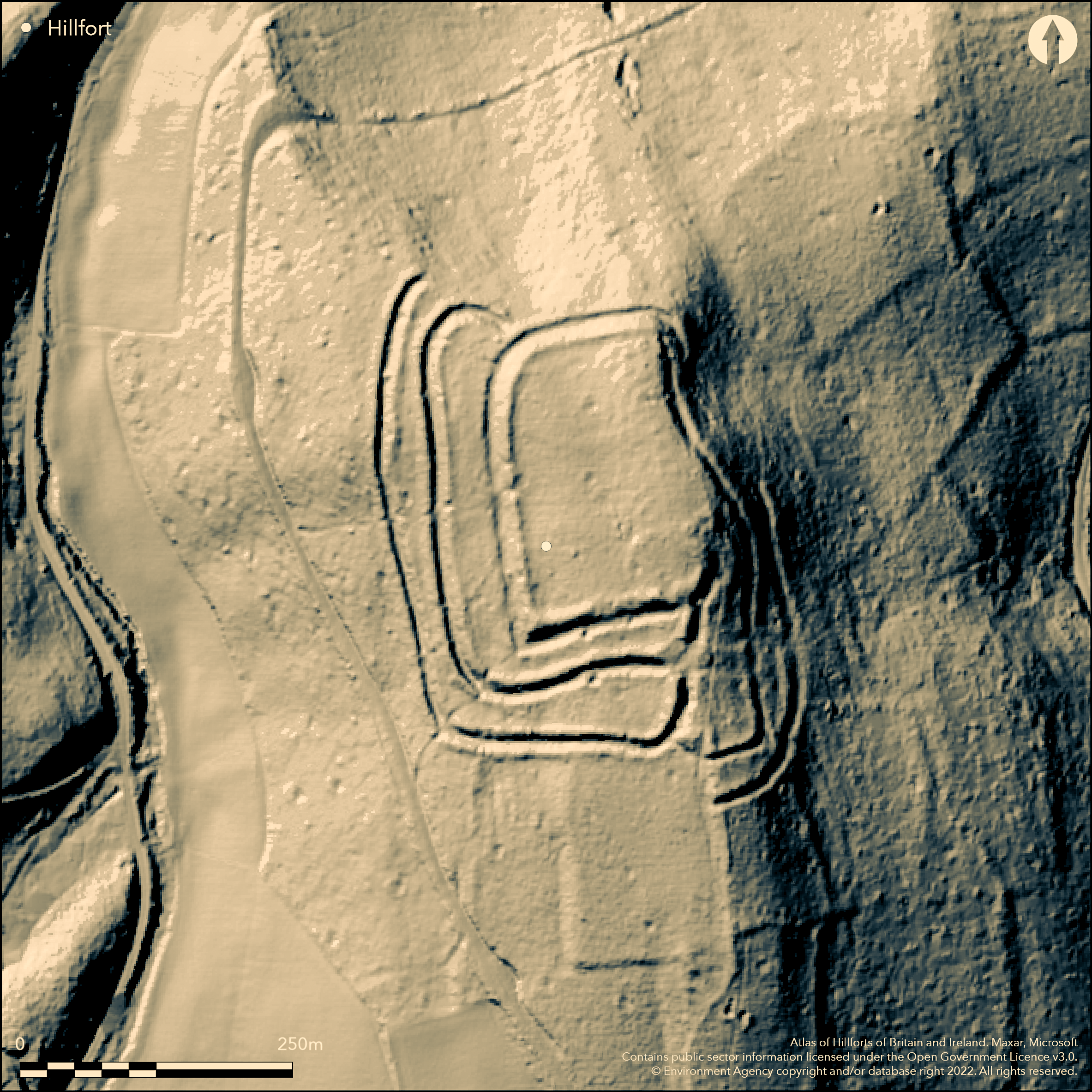
LiDAR 1m DTM Hillshade
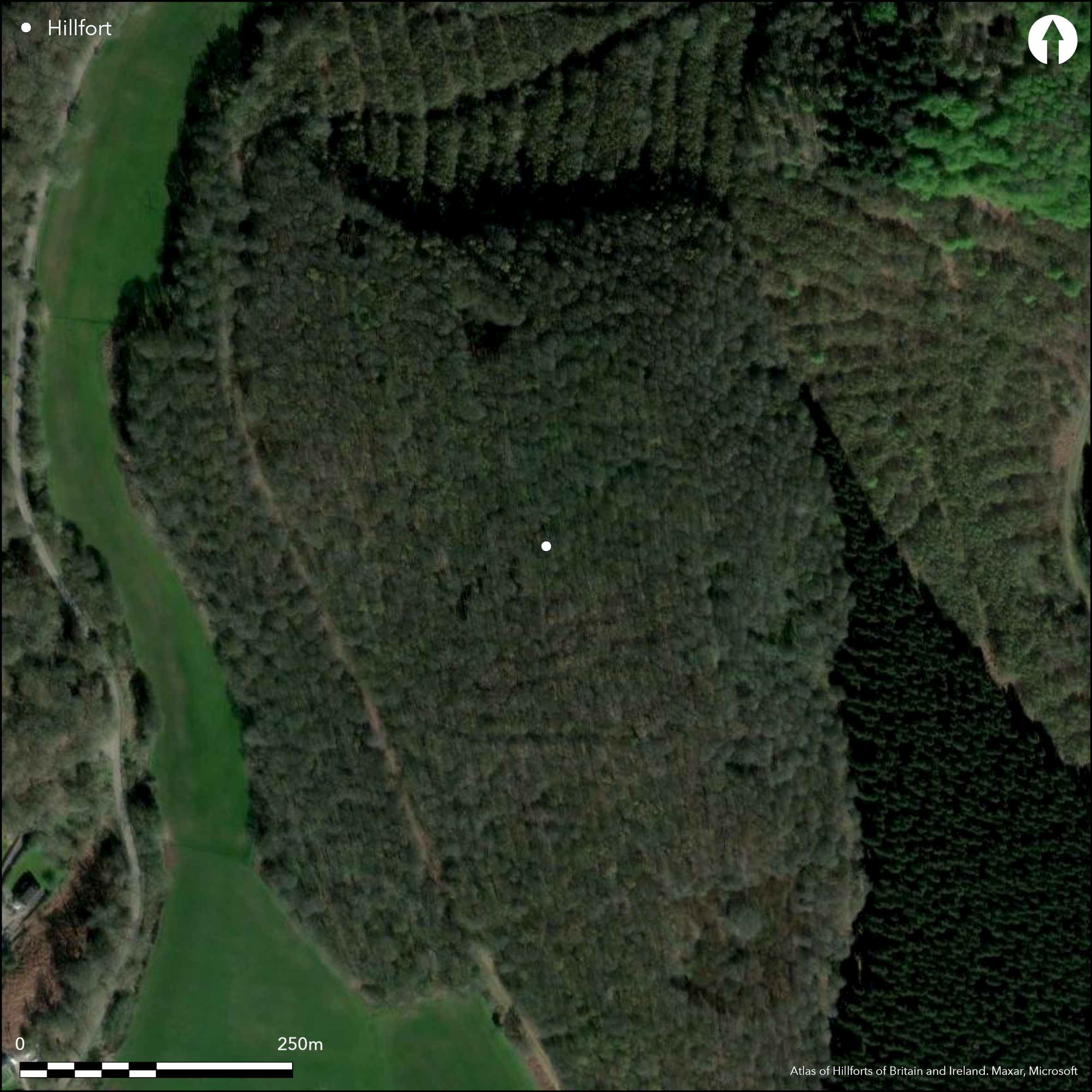
Satellite Imagery
LiDAR 1m DTM Hillshade
Satellite Imagery
Scroll left/right to view further images.
HER: Gloucestershire 5161 (None)
NMR: SO 61 NE 7 (111723)
SM: 1018158
NGR: SO677155
X: 367750 Y: 215550 (OSGB36)
Complex, partial contour hillfort located astride N part of a narrow N-S Old Red Sandstone ridge overlooking Flaxley Valley on E edge of Forest of Dean where few hillforts. Trapezoidal-shaped defensive circuit encloses 2.5ha at its fullest extent. Surrounding slopes very steep on N, E, W sides, steep on S. Extensive and commanding views. Interior measures c. 152m by 91m. Steepness of surrounding slopes on N and E forms a natural defence. Only single line of defence on N and mutilated double line on SE. N defences single ledge or terrace 3-5m in height, with intermittent traces of slight external ditch 2-4m wide and to 1m deep with counterscarp. Elsewhere triple ramparts on SW and NW quadrants separated by wide berms. Ramparts to S to 5m high above bottom of ditch, those to W less substantial and dumps of rubble with inner rampart to 4m high above ditch bottom. Defences do not follow contours, especially on S. Counterscarp banks are present apart from E-facing sides. Two extra lines of earthwork in a loop around SE angle creating annexe thought later than main defences since inner arm cuts into outer ditch. Outer line defined by ledge 2-4m wide, extends for 180m to N before terminating abruptly. Inner line (good for much of course as ledge), has truncated line of original inner rampart, intersection marked by change in direction of the outworks. Original entrance near SE corner. Evidence of refortification as dry-stone walling techniques in existing banks uperceded by dumps of angular, coarse stonework. Important in its siting towards Welsh border where hillforts are few and possible Silures site. Often ignored. To E of site remains of deep hollow way or lynchet extends down E flank of the hillside. Not clear if associated with hillfort. On 1st Ed. OS map (1881). No dating. Small-scale watching brief and geophysics (Dean 2005).
Citizen Science: ✓
Reliability of Data: Confirmed
Reliability of Interpretation: Confirmed
X: -274903 Y: 6770810 (EPSG: 3857)
Longitude: -2.469495054648695 Latitude: 51.83757710218734 (EPSG:4326)
Country: England
Current County or Unitary Authority: Gloucestershire
Historic County: Gloucestershire
Current Parish/Community/Council/Townland: Blaisdon
Quarrying damage N of the inturned entrance. Here much of outer rampart, which inturns along this line, destroyed. 19th century summerhouse in interior.
| Extant | ✓ |
| Cropmark | ✗ |
| Likely Destroyed | ✓ |
Dense woodland. Quarrying.
| Woodland | ✓ |
| Commercial Forestry Plantation | ✗ |
| Parkland | ✗ |
| Pasture (Grazing) | ✗ |
| Arable | ✗ |
| Scrub/Bracken | ✗ |
| Bare Outcrop | ✗ |
| Heather/Moorland | ✗ |
| Heath | ✗ |
| Built-up | ✗ |
| Coastal Grassland | ✗ |
| Other | ✓ |
Complex, multivallate, partial contour hillfort located on N part of a narrow spur overlooking Flaxley Valley on E edge of Forest of Dean where few hillforts.
| Contour Fort | ✗ |
| Partial Contour Fort | ✓ |
| Promontory Fort | ✗ |
| Hillslope Fort | ✗ |
| Level Terrain Fort | ✗ |
| Marsh Fort | ✗ |
| Multiple Enclosure Fort | ✗ |
Located on a narrow spur overlooking the Flaxley Valley on the eastern edge of the Forest of Dean where few hillforts are located. The site is very steep on the east and northern sides, gentler on the south and west
| Hilltop | ✗ |
| Coastal Promontory | ✗ |
| Inland Promontory | ✗ |
| Valley Bottom | ✗ |
| Knoll/Hillock/Outcrop | ✗ |
| Ridge | ✗ |
| Cliff/Plateau-edge/Scarp | ✗ |
| Hillslope | ✗ |
| Lowland | ✗ |
| Spur | ✓ |
Dominant Topographic Feature: Spur
| North | ✗ |
| Northeast | ✗ |
| East | ✗ |
| Southeast | ✗ |
| South | ✗ |
| Southwest | ✗ |
| West | ✗ |
| Northwest | ✗ |
| Level | ✓ |
Altitude: 167.0m
N/A
None
Reliability: D - None
| Pre 1200BC | ✗ |
| 1200BC - 800BC | ✗ |
| 800BC - 400BC | ✗ |
| 400BC - AD50 | ✗ |
| AD50 - AD400 | ✗ |
| AD400 - AD 800 | ✗ |
| Post AD800 | ✗ |
| Unknown | ✓ |
| Pre Hillfort: | None |
| Post Hillfort: | None |
On 1st Ed. OS map (1881). Watching Brief, Gloucestershire County Council, 1993. 1995 RCHME earthwork survey, ref. no. 1065802. Management survey by Gloucestershire County Council, 1996. Aerial photograph interpretation, English Heritage: Gloucestershire NMP (N Cotswold and Forest of Dean), 2002-2006. Gradiometer survey, R. Dean, Substrata Ltd, 2005.
| 1st Identified Map Depiction (1881): | OS map. |
| Other (1993): | Watching Brief. |
| Earthwork Survey (1995): | Measured earthwork survey, RCHME. |
| Other (1996): | Management survey by Gloucestershire County Council, 1996. |
| Geophysical Survey (2005): | Gradiometer survey, R. Dean, Substrata Ltd, 2005. |
| Other (None): | Aerial photograph interpretation, English Heritage. |
Charcoal burning sites in interior. Possible quarry hollows along bottom of ditch.
None
| None | ✓ |
| Spring | ✗ |
| Stream | ✗ |
| Pool | ✗ |
| Flush | ✗ |
| Well | ✗ |
| Other | ✗ |
Charcoal burning sites in interior. Possible quarry hollows as undulations along bottom of ditch.
| No Known Features | ✗ |
| Round Stone Structures | ✗ |
| Rectangular Stone Structures | ✗ |
| Curvilinear Platforms | ✗ |
| Other Roundhouse Evidence | ✗ |
| Pits | ✗ |
| Quarry Hollows | ✓ |
| Other | ✓ |
None
| No Known Excavation | ✓ |
| Pits | ✗ |
| Postholes | ✗ |
| Roundhouses | ✗ |
| Rectangular Structures | ✗ |
| Roads/Tracks | ✗ |
| Quarry Hollows | ✗ |
| Other | ✗ |
| Nothing Found | ✗ |
2005 survey - no details.
| No Known Geophysics | ✗ |
| Pits | ✗ |
| Roundhouses | ✗ |
| Rectangular Structures | ✗ |
| Roads/Tracks | ✗ |
| Quarry Hollows | ✗ |
| Other | ✓ |
| Nothing Found | ✗ |
None
| No Known Finds | ✓ |
| Pottery | ✗ |
| Metal | ✗ |
| Metalworking | ✗ |
| Human Bones | ✗ |
| Animal Bones | ✗ |
| Lithics | ✗ |
| Environmental | ✗ |
| Other | ✗ |
None
| APs Not Checked | ✓ |
| None | ✗ |
| Roundhouses | ✗ |
| Rectangular Structures | ✗ |
| Pits | ✗ |
| Postholes | ✗ |
| Roads/Tracks | ✗ |
| Other | ✗ |
Possible entrance near SE corner, 3.0m wide with one inturned bank and one clubbed bank. Route visible from valley below and approaching the entrance from S is mutilated bank and scarp, averaging 1.7m high. However, all of this is not certain and has been challenged.
| 1: | None |
| 2: | None |
Guard Chambers: ✗
Chevaux de Frise: ✗
| 1. In-turned (South east): | One inturned bank and one clubbed bank. |
Only single line of defence on N and mutilated double line on SE. N defences single ledge or terrace 3-5m in height, with intermittent traces of slight external ditch 2-4m wide and to 1m deep with counterscarp. Elsewhere triple ramparts on SW and NW quadrants separated by wide berms. Ramparts to S to 5m high above bottom of ditch, those to W less substantial and dumps of rubble with inner rampart to 4m high above ditch bottom. Defences do not follow contours, especially on S. Counterscarp banks are present apart from E-facing sides. Two extra lines of earthwork in a loop around SE angle creating annexe. Stone and earth banks. Traces of stone revetting in ditch sides.
| Area 1: | 2.5ha. |
| Total: | 2.5ha. |
Total Footprint Area: Noneha.
None
| ✗ | None |
| ✓ | None |
| NE Quadrant: | 1 |
| SE Quadrant: | 2 |
| SW Quadrant: | 3 |
| NW Quadrant: | 3 |
| Total: | 3 |
| Partial Univallate | ✓ |
| Univallate | ✗ |
| Partial Bivallate | ✓ |
| Bivallate | ✗ |
| Partial Multivallate | ✓ |
| Multivallate | ✗ |
| Unknown | ✗ |
| Partial Univallate | ✗ |
| Univallate | ✗ |
| Partial Bivallate | ✗ |
| Bivallate | ✗ |
| Partial Multivallate | ✗ |
| Multivallate | ✗ |
Earth and stone banks. Traces of stone revetting in ditch sides.
| None | ✗ |
| Earthen Bank | ✓ |
| Stone Wall | ✓ |
| Rubble | ✓ |
| Wall-walk | ✗ |
| Evidence of Timber | ✗ |
| Vitrification | ✗ |
| Other Burning | ✗ |
| Palisade | ✗ |
| Counter Scarp Bank | ✓ |
| Berm | ✓ |
| Unfinished | ✗ |
| Other | ✗ |
None
| None | ✗ |
| Earthen Bank | ✗ |
| Stone Wall | ✗ |
| Murus Duplex | ✗ |
| Timber-framed | ✗ |
| Timber-laced | ✗ |
| Vitrification | ✗ |
| Other Burning | ✗ |
| Palisade | ✗ |
| Counter Scarp Bank | ✗ |
| Berm | ✗ |
| Unfinished | ✗ |
| No Known Excavation | ✓ |
| Other | ✗ |
| ✗ | None |
| ✓ | Ditches variable throughout circuit. Traces of stone revetting in ditch sides. |
Number of Ditches: 3
| ✓ | Two extra lines of earthwork in a loop around SE angle creating annexe thought later than main defences since inner arm cuts into outer ditch. Outer line defined by ledge 2-4m wide, extends for 180m to N before terminating abruptly. Inner line (good for much of course as ledge), has truncated line of original inner rampart, intersection marked by change in direction of the outworks. |
Dean R. 2005. Gradiometer Survey at Welshbury Hillfort, Gloucestershire, Unpublished report Substrata Ltd.
Erskine, J.G.P. 1994, Note, Trans Bristol Gloucestershire Archaeol Soc, 112, 196.
Stoertz C. 2012. The North Cotswolds: a highlight report for the National Mapping Programme, Report No 17-2012, Centre for Archaeology.
Atlas of Hillforts:
Wikidata:
This work is licensed under CC BY-SA 4.0

 and should be cited as:
Lock, Gary and Ralston, Ian. 2024. Atlas of Hillforts of Britain and Ireland. Available at: https://hillforts.arch.ox.ac.uk
Document Version 1.1