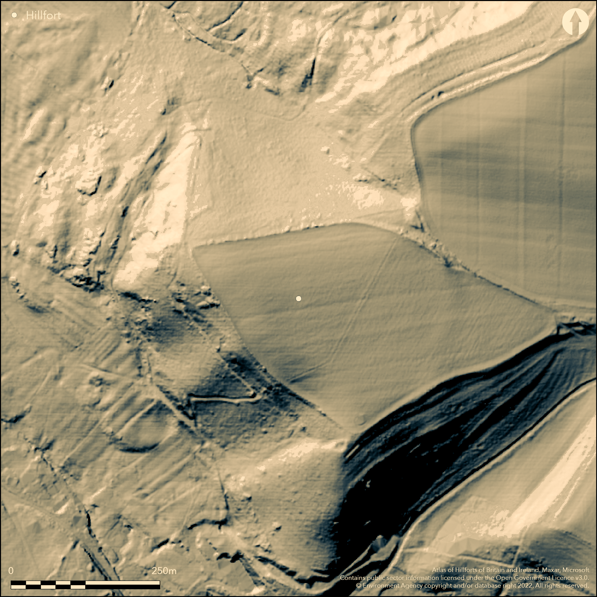
LiDAR 1m DTM Hillshade
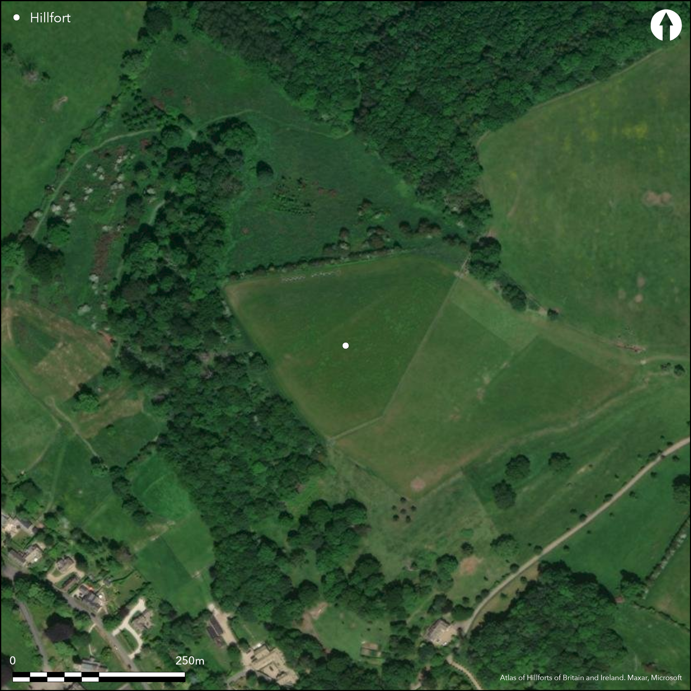
Satellite Imagery
LiDAR 1m DTM Hillshade
Satellite Imagery
Scroll left/right to view further images.
HER: Gloucestershire 2329 (None)
NMR: SP 03 NE 14 (328049)
SM: None
NGR: SP084363
X: 408400 Y: 236300 (OSGB36)
Univallate promontory fort located on W-facing spur of Cotswold escarpment overlooking the Vale of Evesham. Steep surrounding slopes to N, S and W, moderate to ridge on E. Found only in 1960 by L.V. Grinsell. Enclosing 4.8ha. Almost destroyed by farming and bank now extends only half way across neck of spur, but survives to NE to 125m with no evidence of a circuit. All interior and defences ploughed in past. On NE bank to c. 8m wide and 1.5m high has outer ditch 9m wide and nearly 1m deep, the other sides defended by steep natural slopes. Site overlooked to E.To NE an outer bank forms an overlapping entrance. Small sherds of early and middle Iron Age sherds as surface finds (Marshall 1989).
Citizen Science: ✓
Reliability of Data: Confirmed
Reliability of Interpretation: Confirmed
X: -209169 Y: 6804650 (EPSG: 3857)
Longitude: -1.878999448429363 Latitude: 52.02501483413831 (EPSG:4326)
Country: England
Current County or Unitary Authority: Gloucestershire
Historic County: Gloucestershire
Current Parish/Community/Council/Townland: Buckland
Much disturbed and ploughed and nearly gone.
| Extant | ✓ |
| Cropmark | ✗ |
| Likely Destroyed | ✓ |
None
| Woodland | ✗ |
| Commercial Forestry Plantation | ✗ |
| Parkland | ✗ |
| Pasture (Grazing) | ✓ |
| Arable | ✗ |
| Scrub/Bracken | ✗ |
| Bare Outcrop | ✗ |
| Heather/Moorland | ✗ |
| Heath | ✗ |
| Built-up | ✗ |
| Coastal Grassland | ✗ |
| Other | ✗ |
Univallate promontory fort located on W-facing spur of Cotswold escarpment overlooking the Vale of Evesham.
| Contour Fort | ✗ |
| Partial Contour Fort | ✗ |
| Promontory Fort | ✓ |
| Hillslope Fort | ✗ |
| Level Terrain Fort | ✗ |
| Marsh Fort | ✗ |
| Multiple Enclosure Fort | ✗ |
Located on a spur of the Cotwold escarpment
| Hilltop | ✗ |
| Coastal Promontory | ✗ |
| Inland Promontory | ✓ |
| Valley Bottom | ✗ |
| Knoll/Hillock/Outcrop | ✗ |
| Ridge | ✗ |
| Cliff/Plateau-edge/Scarp | ✗ |
| Hillslope | ✗ |
| Lowland | ✗ |
| Spur | ✗ |
Dominant Topographic Feature: Spur
| North | ✗ |
| Northeast | ✗ |
| East | ✗ |
| Southeast | ✗ |
| South | ✗ |
| Southwest | ✗ |
| West | ✓ |
| Northwest | ✗ |
| Level | ✗ |
Altitude: 167.0m
N/A
Early to middle Iron age pottery chance finds in ploughed surface.
Reliability: C - Low
| Pre 1200BC | ✗ |
| 1200BC - 800BC | ✗ |
| 800BC - 400BC | ✓ |
| 400BC - AD50 | ✗ |
| AD50 - AD400 | ✗ |
| AD400 - AD 800 | ✗ |
| Post AD800 | ✗ |
| Unknown | ✗ |
| Pre Hillfort: | None |
| Post Hillfort: | None |
| Artefactual: | None |
Aerial photograph interpretation English Heritage: Gloucestershire NMP (N Cotswolds and Forest of Dean). 2002-2006.
| Other (None): | Aerial Photograph interpretation, English Heritage. |
Pillow mound built into slope on S side of the fort. Small sherds of undecorated hand-made pottery, found along inner edge bank (in Gloucester City Museum). Some abraded sherds of early and middle Iron Age in ploughed surface of interior (in Cheltenham and Gloucester Museums). Single decorated rim with finger tip and finger nail indentations found. Saddle quern from interior.
None
| None | ✓ |
| Spring | ✗ |
| Stream | ✗ |
| Pool | ✗ |
| Flush | ✗ |
| Well | ✗ |
| Other | ✗ |
Pillow mound built into slope on S side of the fort.
| No Known Features | ✗ |
| Round Stone Structures | ✗ |
| Rectangular Stone Structures | ✗ |
| Curvilinear Platforms | ✗ |
| Other Roundhouse Evidence | ✗ |
| Pits | ✗ |
| Quarry Hollows | ✗ |
| Other | ✓ |
None
| No Known Excavation | ✓ |
| Pits | ✗ |
| Postholes | ✗ |
| Roundhouses | ✗ |
| Rectangular Structures | ✗ |
| Roads/Tracks | ✗ |
| Quarry Hollows | ✗ |
| Other | ✗ |
| Nothing Found | ✗ |
None
| No Known Geophysics | ✓ |
| Pits | ✗ |
| Roundhouses | ✗ |
| Rectangular Structures | ✗ |
| Roads/Tracks | ✗ |
| Quarry Hollows | ✗ |
| Other | ✗ |
| Nothing Found | ✗ |
Small sherds of undecorated hand-made pottery, found along inner edge bank (in Gloucester City Museum). Some abraded sherds of early and middle Iron Age in ploughed surface of interior (in Cheltenham and Gloucester Museums). Single decorated rim with finger tip and finger nail indentations found. Saddle quern from interior.
| No Known Finds | ✗ |
| Pottery | ✓ |
| Metal | ✗ |
| Metalworking | ✗ |
| Human Bones | ✗ |
| Animal Bones | ✗ |
| Lithics | ✗ |
| Environmental | ✗ |
| Other | ✗ |
None
| APs Not Checked | ✓ |
| None | ✗ |
| Roundhouses | ✗ |
| Rectangular Structures | ✗ |
| Pits | ✗ |
| Postholes | ✗ |
| Roads/Tracks | ✗ |
| Other | ✗ |
To NE an outer bank forms an overlapping entrance.
| 1: | Much of site lost. |
| 2: | None |
Guard Chambers: ✗
Chevaux de Frise: ✗
| 1. Over-lapping (North east): | None |
Almost destroyed by farming and bank now extends only half way across neck of spur, but survives to NE to 125m with no evidence of a circuit. All interior and defences ploughed in past. On NE bank to c. 8m wide and 1.5m high has outer ditch 9m wide and nearly 1m deep, the other sides defended by steep natural slopes.
| Area 1: | 4.8ha. |
| Total: | 4.8ha. |
Total Footprint Area: Noneha.
None
| ✗ | None |
| ✗ | None |
| NE Quadrant: | 1 |
| SE Quadrant: | 0 |
| SW Quadrant: | 0 |
| NW Quadrant: | 0 |
| Total: | 1 |
| Partial Univallate | ✓ |
| Univallate | ✗ |
| Partial Bivallate | ✗ |
| Bivallate | ✗ |
| Partial Multivallate | ✗ |
| Multivallate | ✗ |
| Unknown | ✗ |
| Partial Univallate | ✗ |
| Univallate | ✗ |
| Partial Bivallate | ✗ |
| Bivallate | ✗ |
| Partial Multivallate | ✗ |
| Multivallate | ✗ |
None
| None | ✗ |
| Earthen Bank | ✓ |
| Stone Wall | ✗ |
| Rubble | ✗ |
| Wall-walk | ✗ |
| Evidence of Timber | ✗ |
| Vitrification | ✗ |
| Other Burning | ✗ |
| Palisade | ✗ |
| Counter Scarp Bank | ✗ |
| Berm | ✗ |
| Unfinished | ✗ |
| Other | ✗ |
None
| None | ✗ |
| Earthen Bank | ✗ |
| Stone Wall | ✗ |
| Murus Duplex | ✗ |
| Timber-framed | ✗ |
| Timber-laced | ✗ |
| Vitrification | ✗ |
| Other Burning | ✗ |
| Palisade | ✗ |
| Counter Scarp Bank | ✗ |
| Berm | ✗ |
| Unfinished | ✗ |
| No Known Excavation | ✓ |
| Other | ✗ |
| ✗ | None |
| ✓ | None |
Number of Ditches: 1
| ✗ | None |
Marshall, A. 1989. The hillfort at Burhill, Gloucestershire: evidence of occupation during the earliest phases of the Iron Age, Trans Bristol Gloucestershire Archaeol Soc, 107, 197-202.
RCHME 1976. Ancient and historical monuments in the County of Gloucestershire, Vol. I: Iron Age and Romano- British monuments in Gloucestershire Cotswolds, London: HMSO, 22-3.
Stoertz, C. 2012. The North Cotswolds: a highlight report for the National Mapping Programme, Report No 17-2012.Centre for Archaeology.
Saville, A. ed 1984. Archaeology in Gloucestershire from earliest hunters to the industrial age: essays dedicated to Helen O'Neil and the late Elsie Clifford, 154, 158, 170.
Atlas of Hillforts:
Wikidata:
This work is licensed under CC BY-SA 4.0

 and should be cited as:
Lock, Gary and Ralston, Ian. 2024. Atlas of Hillforts of Britain and Ireland. Available at: https://hillforts.arch.ox.ac.uk
Document Version 1.1